Download Free Ohio Maps
<-- Free Maps
<-- Free U.S. State Maps
<-- Free World Country Maps
See Also:
Topographic Maps
ArcGIS Shapefile Map Layers
Download or link to these maps for your reports, websites, research, projects, presentations...
Note that maps may not appear on the webpage in their full size and resolution. To save the maps to your computer, right-click on the link.
State Maps
Ohio (base map)
JPEG format (459K) County boundaries and names, county seats, rivers.
Original scale 1:2,500,000 U.S. Geological Survey, 1972 limited update
1990 Ohio (outline map) JPEG format (71K) County boundaries and names. U.S. Bureau of the Census, 1990
Ohio (reference map)
JPEG format (272K) Shaded relief map with state boundaries, forest
cover, place names, major highways. Portion of "The National Atlas of
the United States of America. General Reference", compiled by U.S.
Geological Survey 2001, printed 2002
Ohio (reference map)
PDF format (200K) Shaded relief map with state boundaries, forest
cover, place names, major highways. Portion of "The National Atlas of
the United States of America. General Reference", compiled by U.S.
Geological Survey 2001, printed 2002
Ohio - Federal Lands and Indian Reservations PDF format (502K) The National Atlas of the United States of America, U.S. Geological Survey, 2003
City Maps
Ada (topographic) original scale 1:24,000 U.S.G.S. 1961, photorevised 1987 (536K)
Alliance (topographic) original scale 1:24,000 U.S.G.S. 1966, photorevised 1971 ,1978 and 1994 (978K)
Athens (topographic) original scale 1:24,000 U.S.G.S. 1961, revised 1995 (842K)
Bellefontaine (topographic) original scale 1:24,000 U.S.G.S. 1960, photorevised 1972, photoinspected 1988 (638K)
Bellevue (topographic) original scale 1:24,000 U.S.G.S. 1969, photorevised 1979 (604K)
Bethel (topographic) original scale 1:24,000 U.S.G.S. 1968, revised 1992 (833K)
Bluffton (topographic) original scale 1:24,000 U.S.G.S. 1960, photorevised 1972, photoinspected 1988 (561K)
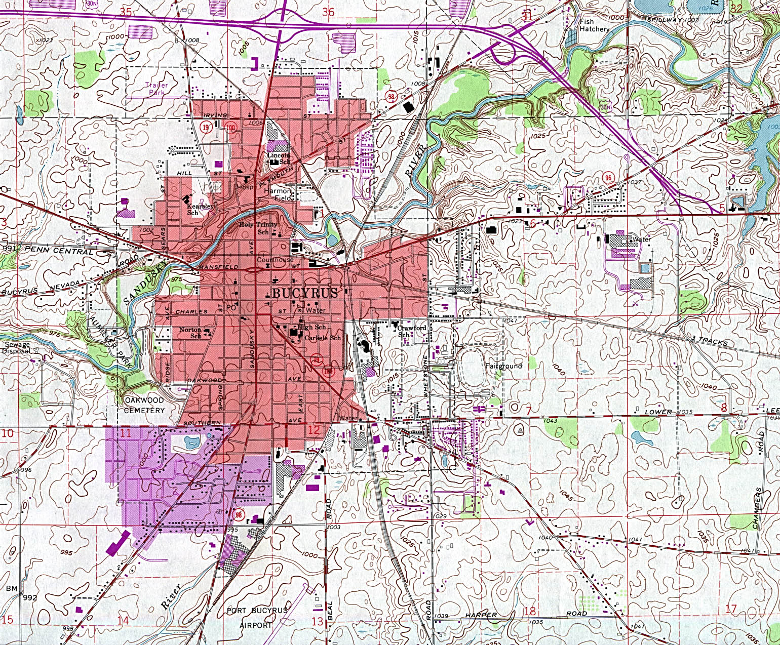
Bucyrus (topographic) original scale 1:24,000 U.S.G.S. 1960, photorevised 1973, photoinspected 1981 (774K)
Celina (topographic) original scale 1:24,000 U.S.G.S. 1960, photorevised 1983 (774K)
Chagrin Falls (topographic) original scale 1:24,000 U.S.G.S. 1963, photorevised 1984 (978K)
Chillicothe (topographic) original scale 1:24,000 U.S.G.S. 1961, photorevised 1985, minor revision 1994 (833K)
Circleville (topographic) original scale 1:24,000 U.S.G.S. 1961, revised 1995 (910K)
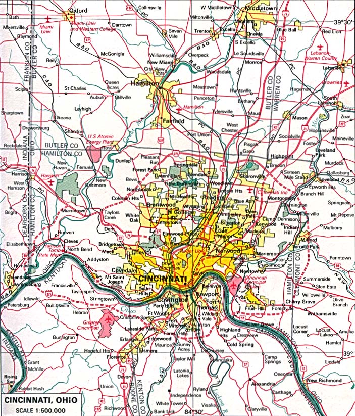
Cincinnati original scale 1:500,000 U.S. National Atlas 1970 (227K)
Cleveland original scale 1:500,000 U.S. National Atlas 1970 (362K)
Conneaut (topographic) original scale 1:24,000 U.S.G.S. 1996 (638K)
Crestline (topographic) original scale 1:24,000 U.S.G.S. 1960, photorevised 1982 (527K)
Defiance (topographic) original scale 1:24,000 U.S.G.S. 1959, photorevised 1979 (731K)
Delaware (topographic) original scale 1:24,000 U.S.G.S. 1960, photorevised 1983 (748K)
Delphos (topographic) original scale 1:24,000 U.S.G.S. 1960, photorevised 1982 (604K)
Deshler (topographic) original scale 1:24,000 U.S.G.S. 1960, photorevised 1973, photinspected 1977 (383K)
East Palestine (topographic) original scale 1:24,000 U.S.G.S. 1960, photorevised 1990 (791K)
Kent (topographic) original scale 1:24,000 U.S.G.S. 1960, photorevised 1984 (1,080K)
London (topographic) original scale 1:24,000 U.S.G.S. 1961, revised 1995 (689K)
Historical Maps
Cincinnati, Ohio 1815
From Report on the Social Statistics of Cities, Compiled by George E.
Waring, Jr., United States. Census Office, Part II, 1887. (286K)
Cincinnati, Ohio 1880
From Report on the Social Statistics of Cities, Compiled by George E.
Waring, Jr., United States. Census Office, Part II, 1887. (642K) and
Cincinnati, Ohio 1880 - Sewerage System
From Report on the Social Statistics of Cities, Compiled by George E.
Waring, Jr., United States. Census Office, Part II, 1887. (286K)
Cincinnati 1914 U.S. Geological Survey (1,454K)
Cleveland 1904 U.S. Geological Survey (893K)
Cleveland 1917 Automobile Blue Book 1917, Volume 8 (267K)
Toledo 1917 Automobile Blue Book 1917, Volume 8 (152K)
Steubenville 1920 Automobile Blue Book (156K)
Youngstown 1920 Automobile Blue Book (176K)
Maps of National Parks, Monuments, and Historic Sites
The following maps were produced by the U.S. National Park Service unless otherwise noted.
Cuyahoga Valley National Recreation Area (Area Map) 1995 (65K) (PDF Format)
Cuyahoga Valley National Recreation Area (Park Map) 1995 (323K) (PDF Format)
Hopewell Culture National Historical Park (Park Map) 1999 (129K) (PDF Format)
Hopewell Culture National Historical Park (Trade Map) 1999 (258K) (PDF Format)
See Also:
Topographic Maps
ArcGIS Shapefile Map Layers
<-- Free Maps
<-- Free U.S. State Maps
<-- Free World Country Maps
Didn't find what you are looking for? We've been online since 1996 and have created 1000's of pages. Search below and you may find just what you are looking for.
Michael R. Meuser
Data Research & GIS Specialist
MapCruzin.com is an independent firm
specializing in GIS project development and data research.
We created the first U.S. based
interactive toxic chemical facility
maps on the internet in 1996 and we
have been online ever since. Learn more about us and our services.
Have a project in mind? If you have data, GIS project or custom shapefile needs contact Mike.
Contact Us
Report Broken Links
Subscribe for Updates


