|
<- Return to Toxics & Pollution with Google Earth and Google Maps
EPA Criteria Pollutants with Google Earth
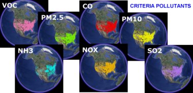
Data accompanying the maps include facility name and address, tons of pollutants released into the air, percent a particular facilities emissions account for total emissions and more. More information can be obtained from the EPA AirData website.
CO( carbon monoxide)
NH3 (ammonia)
NOX (nitrogen oxides)
PM10 Particulate (size < 10 micrometers)
PM2.5 Particulate (size < 2.5 micrometers)
SO2 (Sulfur Dioxide)
VOC (volatile organic compounds
Sponsors
Links to relevant information about the data is available when the map is viewed in Google Earth.
Return often as I will be adding more Google Earth maps freguently.
Sponsors
Thanks,
Didn't find what you are looking for? We've been online since 1996 and have created 1000's of pages. Search below and you may find just what you are looking for.
Michael R. Meuser
Data Research & GIS Specialist
MapCruzin.com is an independent firm
specializing in GIS project development and data research.
We created the first U.S. based
interactive toxic chemical facility
maps on the internet in 1996 and we
have been online ever since. Learn more about us and our services.
Have a project in mind? If you have data, GIS project or custom shapefile needs contact Mike.
Contact Us
Report Broken Links
Subscribe for Updates
| 


