|
|

|
SVTC
Toxic Chemical Point Sources Interactive Web Maps showing the locations and providing information for hundreds of toxic chemical sources in seven categories. Geographic coverage includes Santa Cruz and Santa Clara counties and portions of San Mateo and Alameda counties. |

|
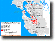
Cumulative Exposure Project (CEP) A series of maps demonstrating concentrations of toxic chemicals in Santa Clara County hundreds of times more than the Clean Air Act (1990) goal of one additional cancer case in one million. The data indicates that an individual living in Santa Clara County has a cancer risk ranging from 47.67 to 1543.75 in one million (Note the goal above). |

|
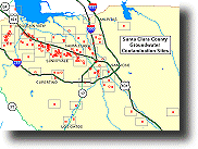
Contaminated Groundwater Sites Interactive maps that provide the location and information about contaminated groundwater sites in Santa Clara County. Includes county-wide demographic maps and charts comparing the demographics near a site with the county-wide values. |