Created by the
North Coast Geography Network

Note that as of November, 2007 we have yet to complete this project. We have done some preliminary work mapping toxics in Humboldt County with the aid of Google Earth. Click here to see this project. Please also visit the project we completed for the Silicon Valley Toxics Coalition. This is a good example of a more comprehensive mapping of toxics in the county that we would like to accomplish, given the funds and time. If you are interested in helping complete such a project, please contact me at [email protected] - Thanks.

redwood coast toxic discoveries
Welcome!

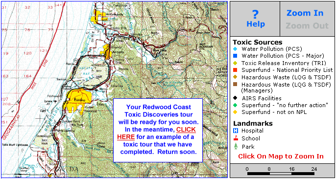
We are working to complete our Redwood Coast Toxic Discoveries maps. This is an interactive web map project. You will be able to zoom-in and out, pan around and click on over 200 facilities in our communities that pollute the air, water or land or handle hazardous materials in some way.

Over a decade ago, we created the first online interactive pollution maps in the U.S. - our Santa Cruz Toxics Release Inventory. This small local project led to our work on Environmental Defense's Chemical Scorecard - a national mapping of toxic facilities. The Redwood Coast Toxic Discoveries interactive pollution maps will be much like a project we did in the Bay Area. Click here to visit that project and get an idea of what you will soon find here.

Below is a list of the sorts of facilities that will be listed in Humboldt County. We are considering doing a similar project focused on wireless towers and facilities in the county. Contact me at [email protected] with any questions, comments or if you would like to discuss joining with us in our efforts.

This is a project of our North Coast Geography Network. There you will find free maps of the North Coast and a tutorial here. We also have many GIS related resources at MapCruzin.com.

Thanks and Best Regards,

Didn't find what you are looking for? We've been online since 1996 and have created 1000's of pages. Search below and you may find just what you are looking for.


Michael R. Meuser
Data Research & GIS Specialist

MapCruzin.com is an independent firm specializing in GIS project development and data research. We created the first U.S. based interactive toxic chemical facility maps on the internet in 1996 and we have been online ever since. Learn more about us and our services.

Have a project in mind? If you have data, GIS project or custom shapefile needs contact Mike.

Contact Us

Report Broken Links

Subscribe for Updates

Water Pollution (PCS)
The EPA PCS is a national computerized management information system that automates entry, updating, and retrieval of National Pollutant Discharge Elimination System (NPDES) data and tracks permit issuance, permit limits and monitoring data, and other data pertaining to facilities regulated under NPDES. The NPDES permit program regulates direct discharges from municipal and industrial wastewater treatment facilities that discharge into the navigable waters of the United States. Wastewater treatment facilities (also called "point sources") are issued NPDES permits regulating their discharge. Reports for those facilities identified by EPA as "Major" include the names and amounts of chemicals and other substances that are discharged.

Toxic Release Inventory (TRI)
The TRI System (TRIS) contains data submitted to EPA by regulated facilities concerning chemicals and chemical categories listed by the Agency under Section 313 of the Emergency Planning and Community Right-to-Know Act. Data contained in the system include chemicals present, amount of on-site use, releases and off-site transfers (including Publicly-Owned Treatment Works, POTWs), on-site treatment, and minimization/prevention actions. TRIS contains information about releases and transfers of more than 600 toxic chemicals and compounds to the environment. We have included data for TRI facilities that reported their 1997 releases and transfers. Further data and information about the facility and chemicals released and transferred are provided through links to RTK Net.

Superfund Sites NPL
Information on Superfund sites was obtained from the Comprehensive Environmental Response, Compensation and Liability Information System (CERCLIS), which is the official repository for site and non-site specific Superfund data in support of the Comprehensive Environmental Response, Compensation, and Liability Act (CERCLA, or Superfund). Sites are placed on the National Priorities List (NPL) by EPA if they have uncontrolled releases of hazardous substances that are priorities for long-term remediation and response.

Hazardous Waste Facilities
Information contained in the Hazardous Waste information is taken from the EPA Biennial Reporting System (BRS). It contains information on facilities that treat, store, or dispose (TSD) of RCRA hazardous wastes or are classified as Large Quantity Generators (LQGs) under RCRA. A RCRA hazardous waste is a waste that is both (a) described by one or more federal RCRA waste codes, and (b) is not exempted from RCRA regulations. RCRA classifies as LQG a facility that either (a) generated 1,000 kg or more of RCRA hazardous waste in a single month; (b) generated in a single month or accumulated at any time 1 kg of RCRA acute hazardous waste; or (c) generated or accumulated at any time more than 100 kg of spill clean up material contaminated with a RCRA acute hazardous waste. Reports for those facilities identified by EPA as "Waste Managers" list amount and type of disposal.

AIRS Facilities
EPA�s Office of Air and Radiation stores information on air quality, point source emissions, and area/mobile source data required by federal regulation from the 50 states in its Aerometric Information Retrieval System (AIRS). States are required by the Code of Federal Regulations (CFR) to report to EPA annual emissions estimates for point sources emitting greater than or equal to 100 tons per year of volatile organic compounds (VOCs), nitrogen dioxide (NO2), sulfur dioxide (SO2), particulate matter less than 10 microns in size (PM-10); 1000 tons per year of carbon monoxide (CO); or 5 tons per year of lead (Pb). The Clean Air Act Amendments also require states to report emissions data for point sources in areas where air pollution exceeds Federal standards (nonattainment areas).

Superfund Sites "No Further Action"
There are approximately 24,000 sites that have been included in CERCLIS in the past, but for which EPA requires no further action under the Federal Superfund program.

Superfund Sites NOT on NPL
These are Superfund sites where there is ongoing Federal interest or potential Federal activity, but where the hazard posed is not sufficiently significant or time-critical for the site to be placed on the NPL.

Source: EPA

About MapCruzin - Cookies, Privacy, Fair Use and Disclaimer - Advertise on MapCruzin.com

Developed and Maintained by Michael R. Meuser, [email protected]
Questions, Comments or Suggestions? Send A Message

Programming, Web and Graphic Design by Aran C. Deltac, portfolio.arandeltac.com,
Contact Aran at: [email protected],

Managed hosting & custom programming provided on our dedicated server, SilentForest.net

Copyright © 1996 - 2004 Michael R. Meuser, All Rights Reserved
MapCruzin is a Cookie and Pop-Up Free Website -- Best Viewed With ANY Browser