reimagining relationships
Home   Store   Free GIS   Education   Free Shapefiles   Census   Weather   Energy   Climate Change   News   Maps   TOPO   Aerial   GPS   Learn GIS

DOWNLOAD SHAPEFILES: Canada FSA Postal - Zip Code - U.S. Waterbodies & Wetlands - Geographic Names - School Districts - Indian Federal Lands
Zip Code/Demographics - Climate Change - U.S. Streams, Rivers & Waterways - Tornadoes - Nuclear Facilities - Dams & Risk - 2013 Toxic Release Inventory TRI

<-- Return to Do It Yourself GIS Maps

Toxic Release Inventory (TRI) GIS Shapefiles Based on the Latest 100% Complete 2013 EPA Data Finalized October 2014


These ArcGIS shapefiles work with the free ArcExplorer GIS viewer, ArcView GIS, ArcGIS, Maptitude, Mapinfo, Manifold, TatukGIS and many other commercial GIS and mapping programs and many free GIS programs as well and they're much less costly than most others. Use our free Learn2Map GIS Tutorial and Atlas to add streets, highways, census information and much more to your maps for free. We have included free national level base maps with each map archive listed below. Also, check our free GIS software and free GIS ArcGIS shapefiles pages for more information and free ArcGIS shapefiles. If you are new to GIS, check out our free Learn2Map GIS Tutorial and Atlas.

Note - Your download will include various documents associated with this 2013 release of the TRI data and the shapefiles we have created.

Each year more than 20,000 industrial facilities release over 4,000,000,000 pounds of toxics into our environment. Wondering about the chemicals that are released to the air, water and land where you work, live and play? The Toxic Release Inventory can help answer these questions. Here's just one example of what we have done with them. Exploring the proximity of toxic chemical releases to schools in the U.S. We have also used the TRI for environmental justice research and for the maps we created for EDF's Scorecard project.

Shapefile Description

We have created GIS shapefiles based on state boundaries. Entire regions as well as federal facilities and tribal subsets are available below.

TRI is a database containing data on disposal or other releases of over 650 toxic chemicals from tens of thousands of U.S. facilities and information about how facilities manage those chemicals through recycling, energy recovery, and treatment. One of TRI's primary purposes is to inform communities about toxic chemical releases to the environment. Check here for more about the Toxic Release Inventory.

We based our shapefiles on the 2013 Toxic Release Inventory dataset. The 2013 TRI preliminary dataset is considered 100% complete as of October 2014 and will form the basis of the 2013 TRI National Analysis, Click here for more about the 2013 TRI dataset. Here is a list of data fields included with each shapefile.

Immediate Download

States and territories are in alphabetical order. Please note that in a few instances the required locational information - longitude and latitude - of the facilities were not provided. In these cases we geocoded the addresses to obtain the longitude and latitude required for the shapefile creation. We have included a spreadsheet of these geocoded facilities in each shapefile package that you download.

Save! The cost for each shapefile is $67. If you are purchasing more than a few of these shapefiles, consider purchasing an entire region for $197.

Click next to the shapefile you wish and you will have immediate access to it using our secure merchant account provider, ClickBank/Keynetics or PayPal, whichever you prefer.

Subsets - Each state includes both federal facilities and TRI facilities on tribal lands. These subsets include all of these facilities in the U.S.

Federal Facilities 2013 TRI GIS Shapefile Download Now

Tribal (TRI facilities on tribal lands) 2013 TRI GIS Shapefile Download Now

States

Alaska 2013 TRI GIS Shapefile Download Now

Alabama 2013 TRI GIS Shapefile Download Now

Arkansas 2013 TRI GIS Shapefile Download Now

Arizona 2013 TRI GIS Shapefile Download Now

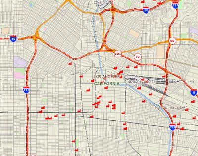
California 2013 TRI GIS Shapefile Download Now

Colorado 2013 TRI GIS Shapefile Download Now

Connecticut 2013 TRI GIS Shapefile Download Now

District of Columbia 2013 TRI GIS Shapefile Download Now

Delaware 2013 TRI GIS Shapefile Download Now

Florida 2013 TRI GIS Shapefile Download Now

Georgia 2013 TRI GIS Shapefile Download Now

Guam 2013 TRI GIS Shapefile Download Now

Hawaii 2013 TRI GIS Shapefile Download Now

Iowa 2013 TRI GIS Shapefile Download Now

Idaho 2013 TRI GIS Shapefile Download Now

Illinois 2013 TRI GIS Shapefile Download Now

Indiana 2013 TRI GIS Shapefile Download Now

Kansas 2013 TRI GIS Shapefile Download Now

Kentucky 2013 TRI GIS Shapefile Download Now

Louisiana 2013 TRI GIS Shapefile Download Now

Massachusetts 2013 TRI GIS Shapefile Download Now

Maryland 2013 TRI GIS Shapefile Download Now

Maine 2013 TRI GIS Shapefile Download Now

Michigan 2013 TRI GIS Shapefile Download Now

Minnesota 2013 TRI GIS Shapefile Download Now

Missouri 2013 TRI GIS Shapefile Download Now

Mississippi 2013 TRI GIS Shapefile Download Now

Montana 2013 TRI GIS Shapefile Download Now

North Carolina 2013 TRI GIS Shapefile Download Now

North Dakota 2013 TRI GIS Shapefile Download Now

Nebraska 2013 TRI GIS Shapefile Download Now

New Hampshire 2013 TRI GIS Shapefile Download Now

New Jersey 2013 TRI GIS Shapefile Download Now

New Mexico 2013 TRI GIS Shapefile Download Now

Nevada 2013 TRI GIS Shapefile Download Now

New York 2013 TRI GIS Shapefile Download Now

Ohio 2013 TRI GIS Shapefile Download Now

Oklahoma 2013 TRI GIS Shapefile Download Now

Oregon 2013 TRI GIS Shapefile Download Now

Pennsylvania 2013 TRI GIS Shapefile Download Now

Puerto Rico 2013 TRI GIS Shapefile Download Now

Rhode Island 2013 TRI GIS Shapefile Download Now

South Carolina 2013 TRI GIS Shapefile Download Now

South Dakota 2013 TRI GIS Shapefile Download Now

Tennessee 2013 TRI GIS Shapefile Download Now

Texas 2013 TRI GIS Shapefile Download Now

Utah 2013 TRI GIS Shapefile Download Now

Virginia 2013 TRI GIS Shapefile Download Now

Virgin Islands 2013 TRI GIS Shapefile Download Now

Vermont 2013 TRI GIS Shapefile Download Now

Washington 2013 TRI GIS Shapefile Download Now

Wisconsin 2013 TRI GIS Shapefile Download Now

West Virginia 2013 TRI GIS Shapefile Download Now

Wyoming 2013 TRI GIS Shapefile Download Now
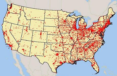
Save! Purchase an entire region for $197.

Region 1 2013 TRI GIS Shapefile includes Connecticut, Massachusetts, Maine, New Hampshire, Rhode Island and Vermont
Download Region 1 Now

Region 2 2013 TRI GIS Shapefile includes New Jersey, New York, Puerto Rico, US Virgin Islands
Download Region 2 Now

Region 3 2013 TRI GIS Shapefile includes Delaware, District of Columbia, Maryland, Pennsylvania, Virginia and West Virginia
Download Region 3 Now

Region 4 2013 TRI GIS Shapefile includes Alabama, Florida, Georgia, Kentucky, Mississippi, North Carolina, South Carolina and Tennessee
Download Region 4 Now

Region 5 2013 TRI GIS Shapefile includes Illinois, Indiana, Michigan, Minnesota, Ohio and Wisconsin
Download Region 5 Now

Region 6 2013 TRI GIS Shapefile includes Arkansas, Louisiana, New Mexico, Oklahoma and Texas
Download Region 6 Now

Region 7 2013 TRI GIS Shapefile includes Iowa, Kansas, Missouri and Nebraska
Download Region 7 Now

Region 8 2013 TRI GIS Shapefile includes Colorado, Montana, North Dakota, South Dakota, Utah and Wyoming
Download Region 8 Now

Region 9 2013 TRI GIS Shapefile includes Arizona, California, Hawaii, Nevada and Guam
Download Region 9 Now

Region 10 2013 TRI GIS Shapefile includes Alaska, Idaho, Oregon and Washington
Download Region 10 Now

Data Fields Included Download Shapefiles

Data associated with the shapefiles include the following (note that each field is fully explained in the Toxic Release Inventory Basic Data File Format Documentation v13 (pdf)):

YEAR
TRI_FACILITY_ID
FACILITY_NAME
STREET_ADDRESS
CITY
COUNTY
ST
ZIP
BIA_CODE
TRIBE
LATITUDE
LONGITUDE
FEDERAL_FACILITY
PRIMARY_SIC
SIC_2
SIC_3
SIC_4
SIC_5
SIC_6
PRIMARY_NAICS
NAICS_2
NAICS_3
NAICS_4
NAICS_5
NAICS_6
DOC_CTRL_NUM
CHEMICAL
CAS_#/COMPOUND_ID
CLEAN_AIR_ACT_CHEMICAL
CLASSIFICATION
METAL
METAL_CATEGORY
CARCINOGEN
FORM_TYPE
UNIT_OF_MEASURE
5.1_FUGITIVE_AIR
5.2_STACK_AIR
5.3_WATER
5.4.1_UNDERGROUND_CLASS_I
5.4.2_UNDERGROUND_CLASS_II-V
5.5.1A_RCRA_C_LANDFILLS
5.5.1B_OTHER_LANDFILLS
5.5.2_LAND_TREATMENT
5.5.3_SURFACE_IMPOUNDMENT
5.5.3A_RCRA_C_SURFACE_IMP.
5.5.3B_Other_SURFACE_IMP.
5.5.4_OTHER_DISPOSAL
ON-SITE_RELEASE_TOTAL
6.1_POTW-TRANSFERS_FOR_RELEASE
6.1_POTW-TRANSFERS_FOR_TREATM.
6.1_POTW-TOTAL_TRANSFERS
6.2_M10
6.2_M41
6.2_M62
6.2_M71
6.2_M81
6.2_M82
6.2_M72
6.2_M63
6.2_M66
6.2_M67
6.2_M64
6.2_M65
6.2_M73
6.2_M79
6.2_M90
6.2_M94
6.2_M99
OFF-SITE_RELEASE_TOTAL
6.2_M20
6.2_M24
6.2_M26
6.2_M28
6.2_M93
OFF-SITE_RECYCLED_TOTAL
6.2_M56
6.2_M92
OFF-SITE_RECOVERY_TOTAL
6.2_M40
6.2_M50
6.2_M54
6.2_M61
6.2_M69
6.2_M95
OFF-SITE_TREATED_TOTAL
TOTAL_RELEASES
8.1_RELEASES
8.1A_ON-SITE_CONTAINED_REL.
8.1B_ON-SITE_OTHER_RELEASES
8.1C_OFF-SITE_CONTAINED_REL.
8.1D_OFF-SITE_OTHER_RELEASES
8.2_ENERGY_RECOVERY_ON-SITE
8.3_ENERGY_RECOVERY_OFF-SITE
8.4_RECYCLING_ON-SITE
8.5_RECYCLING_OFF-SITE
8.6_TREATMENT_ON-SITE
8.7_TREATMENT_OFF-SITE
PROD._WASTE_(8.1_THRU_8.7)
8.8_ONE-TIME_RELEASE
8.9_PRODUCTION_RATIO
PARENT_COMPANY_NAME
PARENT_COMPANY_DB_NUMBER

Download Shapefiles

Note that each field is fully explained in the Toxic Release Inventory Basic Data File Format Documentation v13 (pdf)

A Note About How Your GIS Maps Will Look

The image on this page is an example of how these shapefiles may look when loaded into a GIS program. Your GIS maps may not look exactly like this. Each GIS program is different. Shapefiles themselves are a collection of points, lines or polygons. They have no attributes. It is up to you, the user, to define colors, line width, symbols and other attributes within the limits and capabilities of the GIS programs you are using.

Copyright and Use of Shapefiles

The shapefiles on this page are copyrighted as follows. Copyright © 2014 Mapcruzin.com, All Rights Reserved. You may use these shapefiles in any GIS project or to make maps. You may not create copies of the shapefiles for the use of others whether for personal or commercial use. You may not resell the shapefiles. If you require multiple copies of the same shapefile, please contact Mike at [email protected]. Thank You.

About Quality, Accuracy and Suitability

The TRI data is self-reported by the polluting facility. Therefore neither EPA nor we at MapCruzin.com can guarantee the accuracy of the data or the location of the facilities. The TRI data is made public so that we, the citizens who live, work, attend schools and play near these facilities, can determine if locations and other data are accurate and/or make sense.

Generally, the geodata and shapefiles found at MapCruzin.com may come from a variety of government, non-governmental and self-reporting private sources. While we try to assure the accuracy of this material, we cannot promise that it is absolutely accurate. We do promise that using the map layer will be fun, entertaining or educational - possibly even frustrating. Beyond this, we make no guarantee as to its suitability for any purpose. We assume no liability or responsibility for errors or inaccuracies. Please understand that you download and use these map layers and data at your own risk.

<-- Return to Do It Yourself GIS Maps

Didn't find what you are looking for? We've been online since 1996 and have created 1000's of pages. Search below and you may find just what you are looking for.


Michael R. Meuser
Data Research & GIS Specialist

MapCruzin.com is an independent firm specializing in GIS project development and data research. We created the first U.S. based interactive toxic chemical facility maps on the internet in 1996 and we have been online ever since. Learn more about us and our services.

Have a project in mind? If you have data, GIS project or custom shapefile needs contact Mike.

Contact Us

Report Broken Links

Subscribe for Updates

About MapCruzin - Cookies, Privacy, Fair Use and Disclaimer - Advertise on MapCruzin.com

Copyright © 1996 - 2019 Michael Meuser, All Rights Reserved
MapCruzin is a Pop-Up Free Website -- Best Viewed With ANY Browser