Download Free Croatia Maps
<-- Free Map Downloads
<-- Free World Country Map Downloads
Sponsors
Note that maps may not appear on the webpage in their full size and resolution. To save the maps to your computer, right-click on the link.
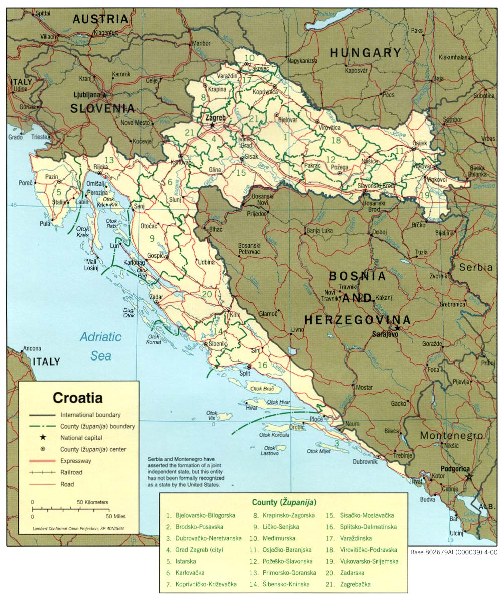
Croatia (Political) 2001 (313K) and
pdf format (332K)
Croatia (Political) 2000 (264K) and pdf format (284K)
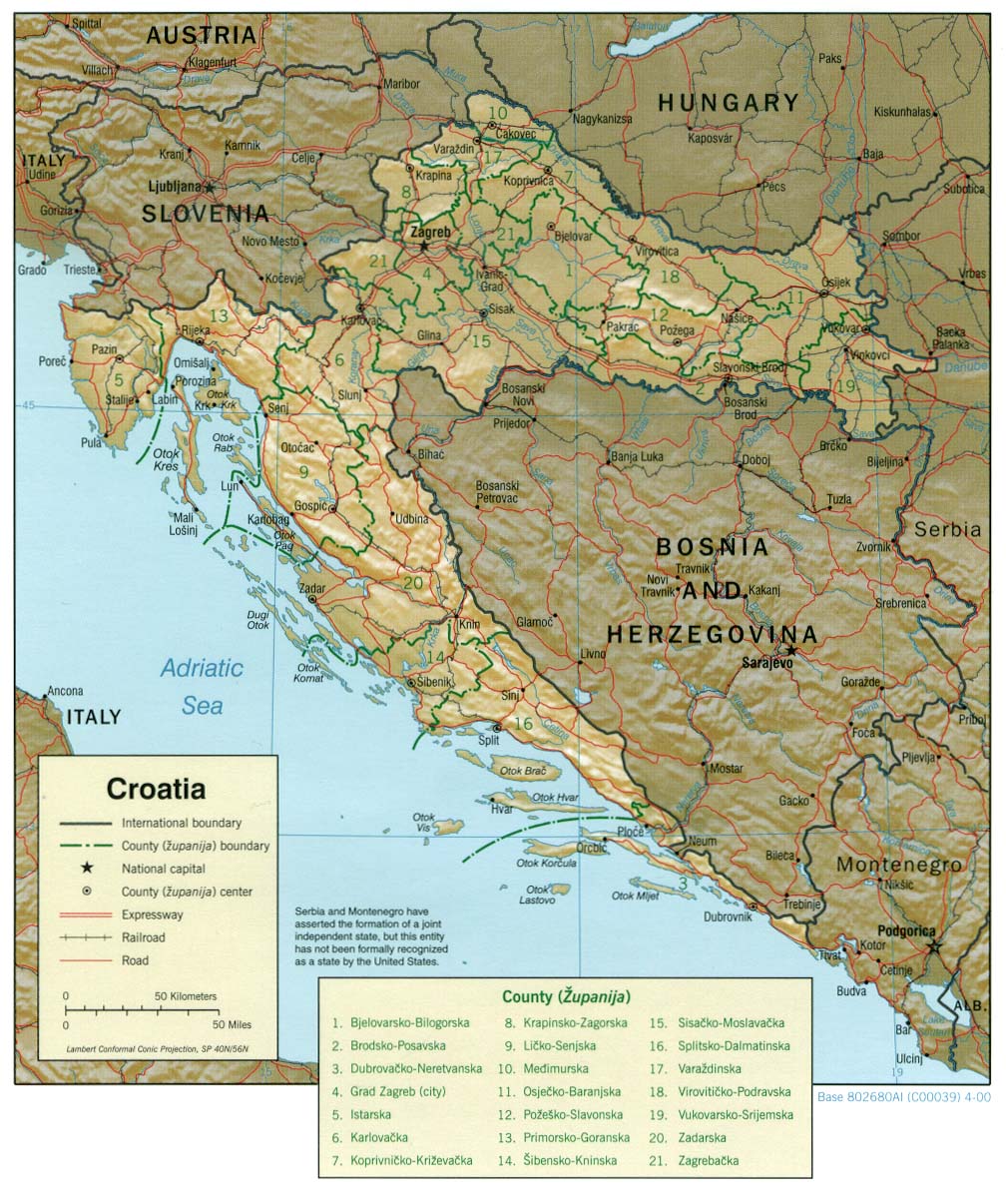
Croatia (Shaded Relief) 2001 (355K) and
pdf format (353K)
Croatia (Shaded Relief) 2000 (259K) and pdf format (267K)
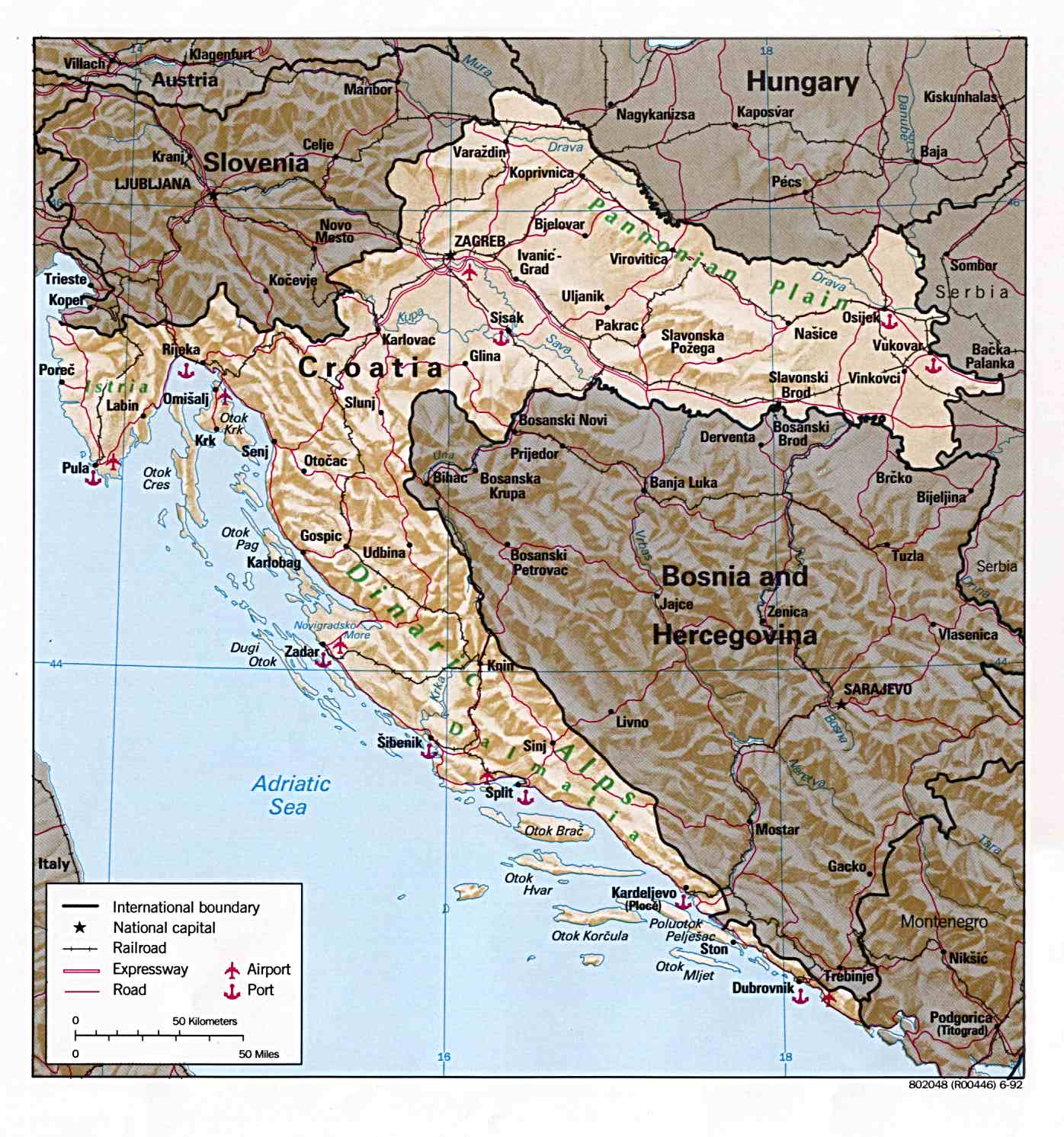
Croatia (Shaded Relief) 1992 (224K) and pdf format (227K)
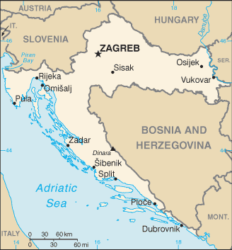
Croatia (Small Map) 2008 (16K)
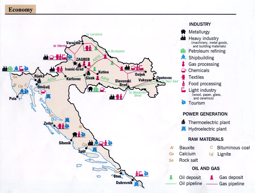
Croatia - Economy From Former Yugoslavia: A Map Folio 1992 (145K)
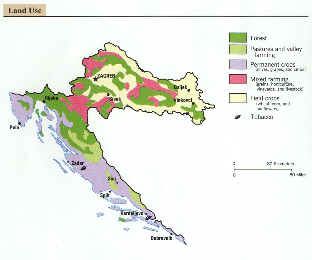
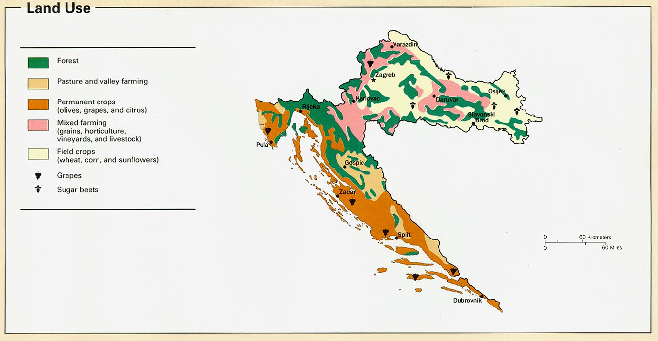
Croatia - Land Use From Former Yugoslavia: A Map Folio 1992 (92K)
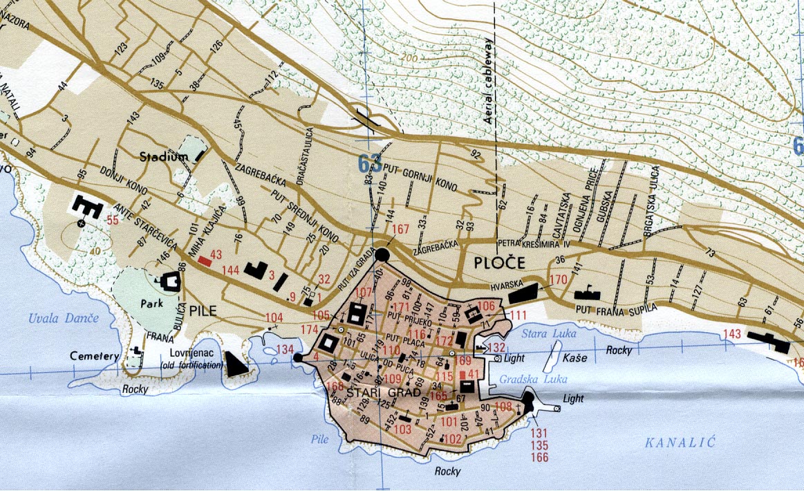
Dubrovnik Portion of Dubrovnik Croatia City Graphic 1:12,500.
Edition 3-DMA, Series M903, U.S. Defense Mapping Agency, 1995. (292K) "Map information as of 1993"
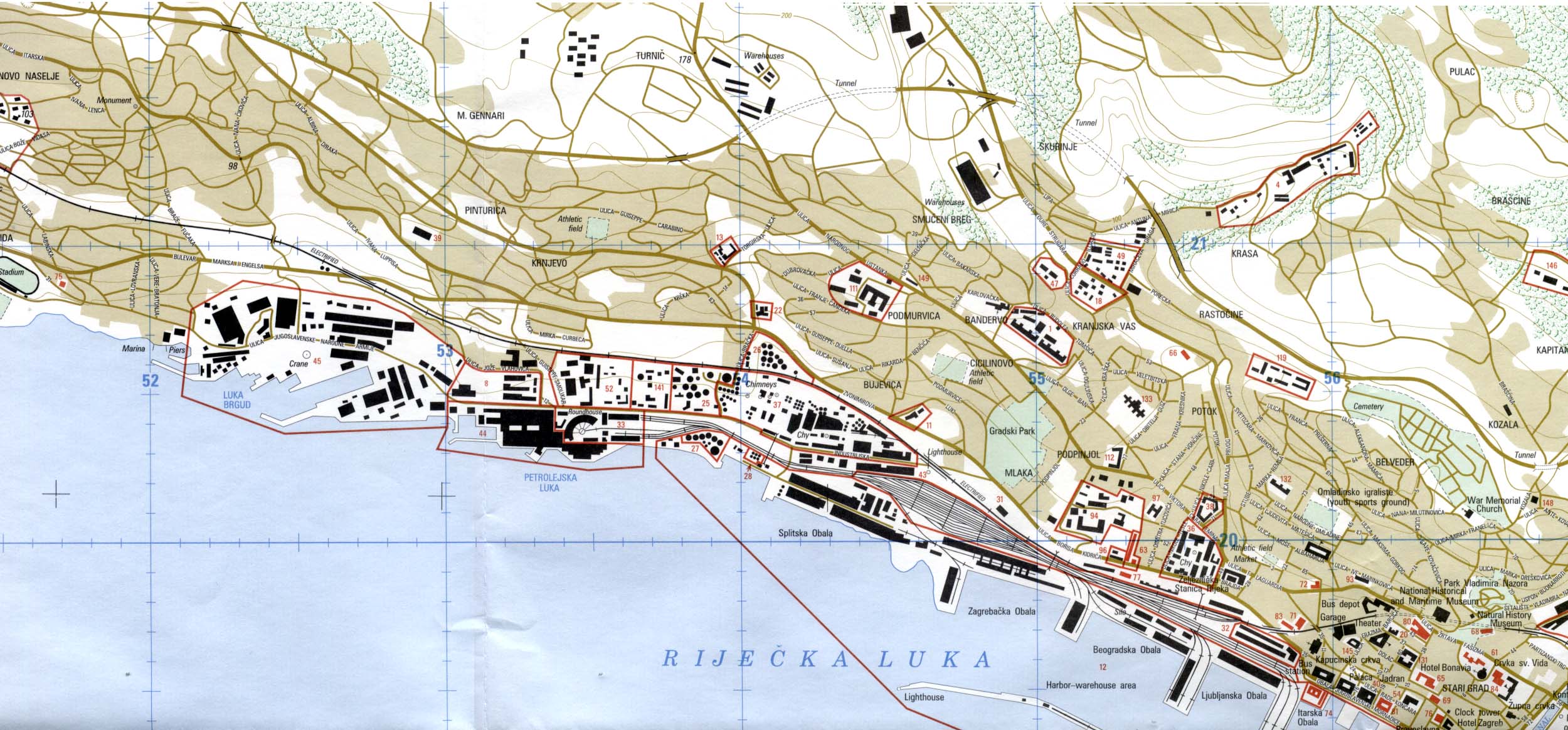
Rijeka Portion of Rijeka Croatia City Graphic 1:12,500. Edition 3-DMA, Series M903, U.S. National Imagery and Mapping Agency, 1997. (449K) "Map information as of 1993"
Zagreb Portion of Zagreb Croatia city graphic 1:25,000, Edition 4-DMA, Series M903. U.S. Defense Mapping Agency, 1995. "Map information as of 1995. (1MB) Compiled in 1995 from best available sources"
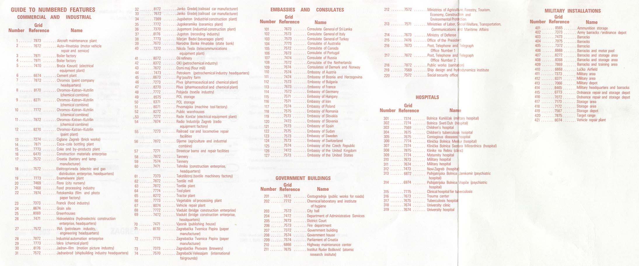
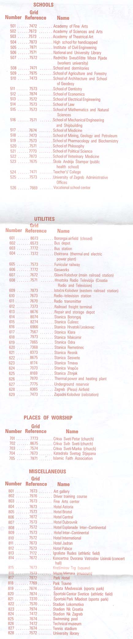
Guide to Numbered Features on Zagreb map: Commercial and Industrial, Embassies and Consulates, Government Buildings, Hospitals, Military Installations and Guide to Numbered Features on Zagreb map: Schools, Utilities, Places of Worship, Miscellaneous
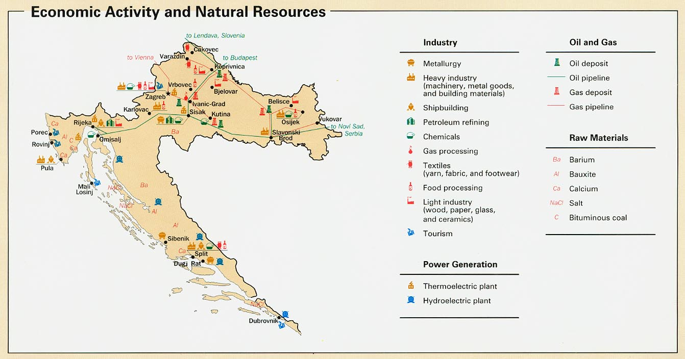
Croatia - Economic Activity from Map No. 802345 1996 (134K)
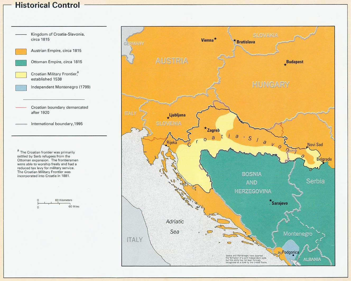
Croatia - Historical Control from Map No. 802345 1996 (261K)
Croatia - Land Use from Map No. 802345 1996 (107K)
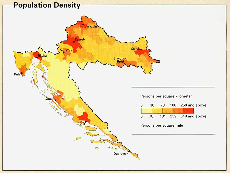
Croatia - Population Density from Map No. 802345 1996 (107K)
Croatia - Population Structure [chart] from Map No. 802345 1996 (47K)
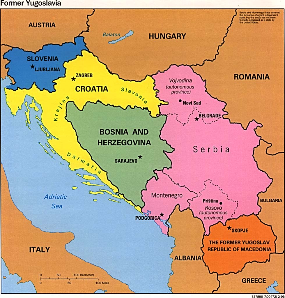
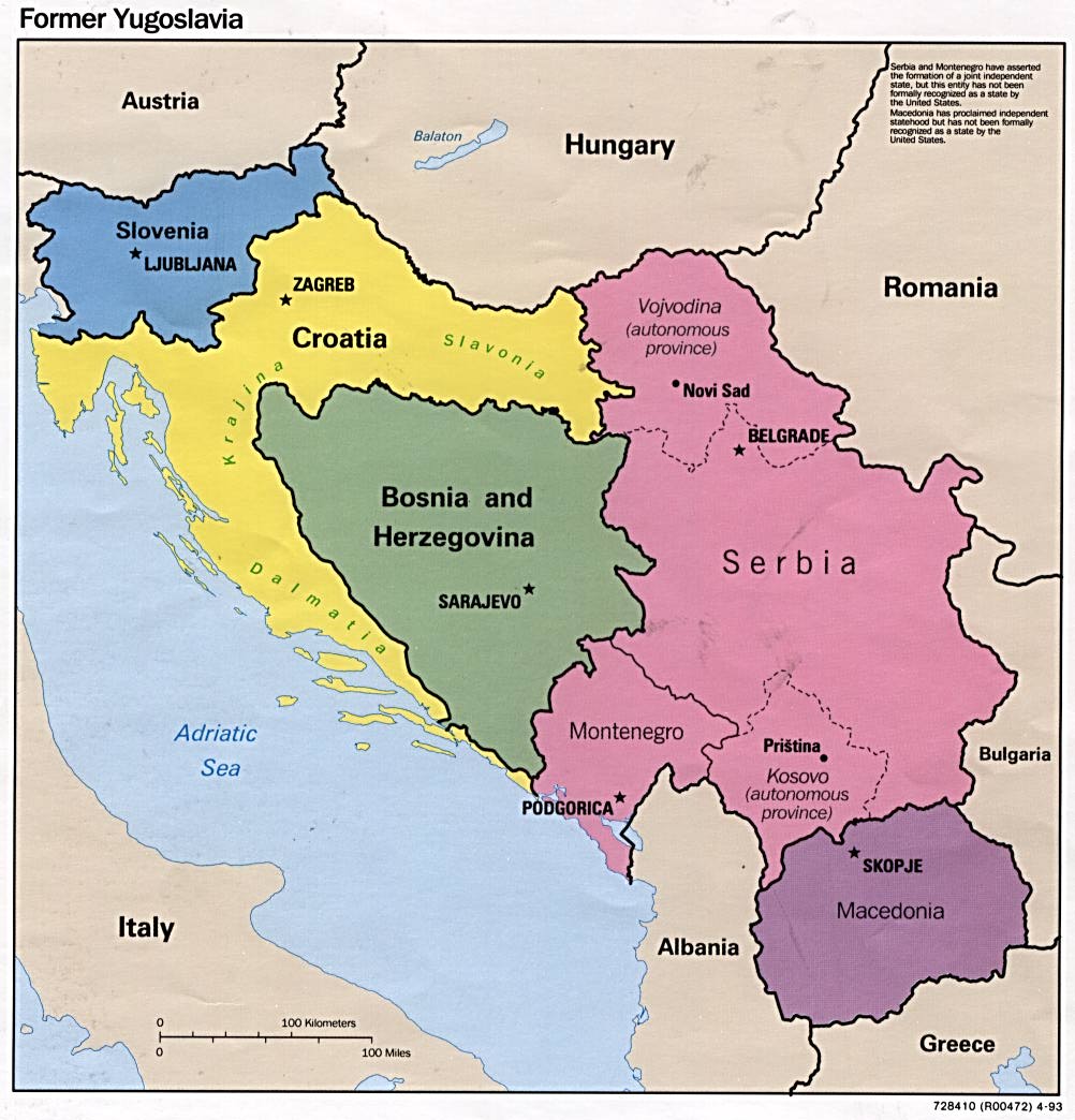
Former Yugoslavia (Political) 1996 (162K)
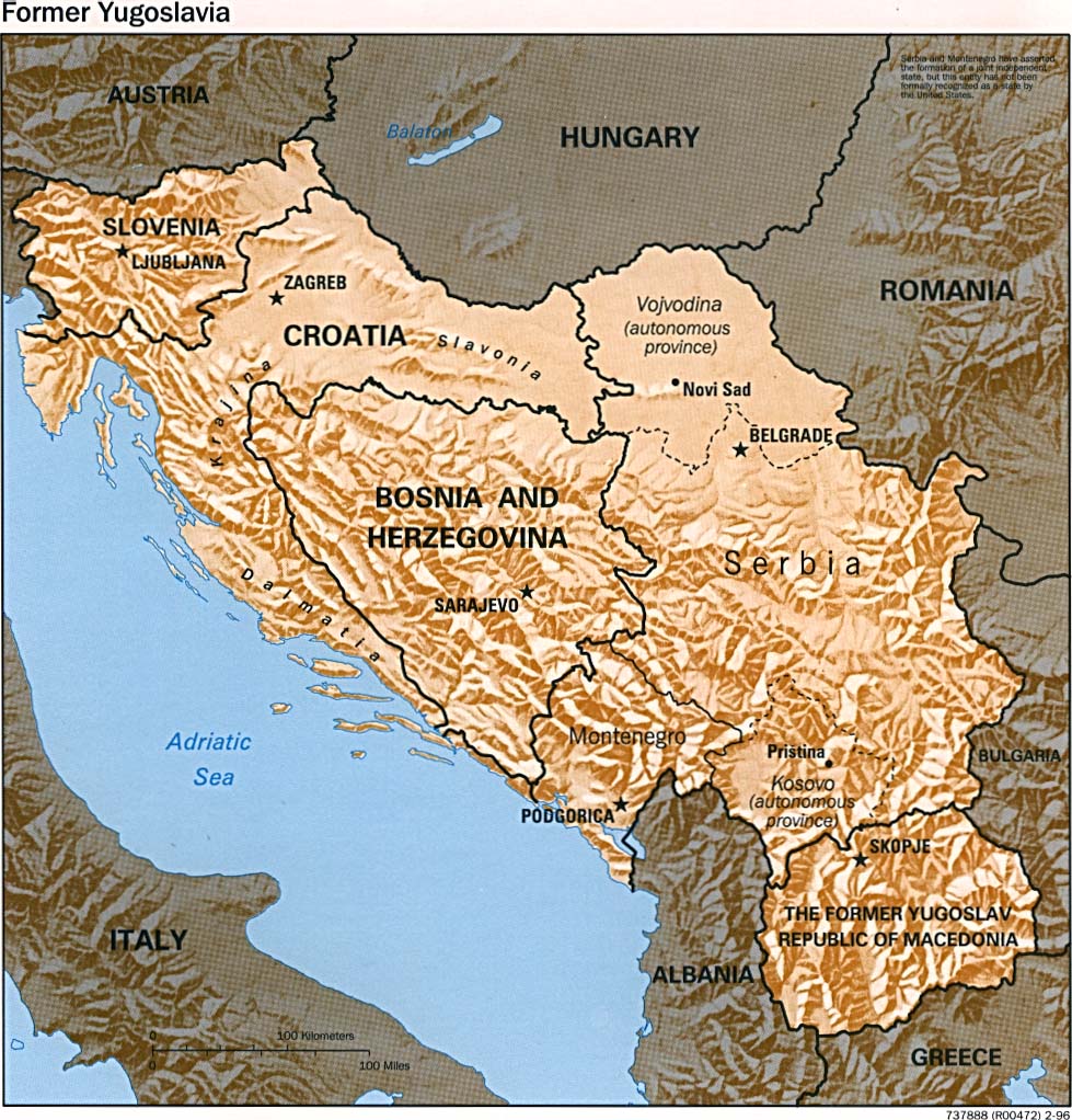
Former Yugoslavia (Shaded Relief) 1996 (1237K)
Former Yugoslavia (Political) 1995 (131K)
Former Yugoslavia (Political) 1993 (146K)
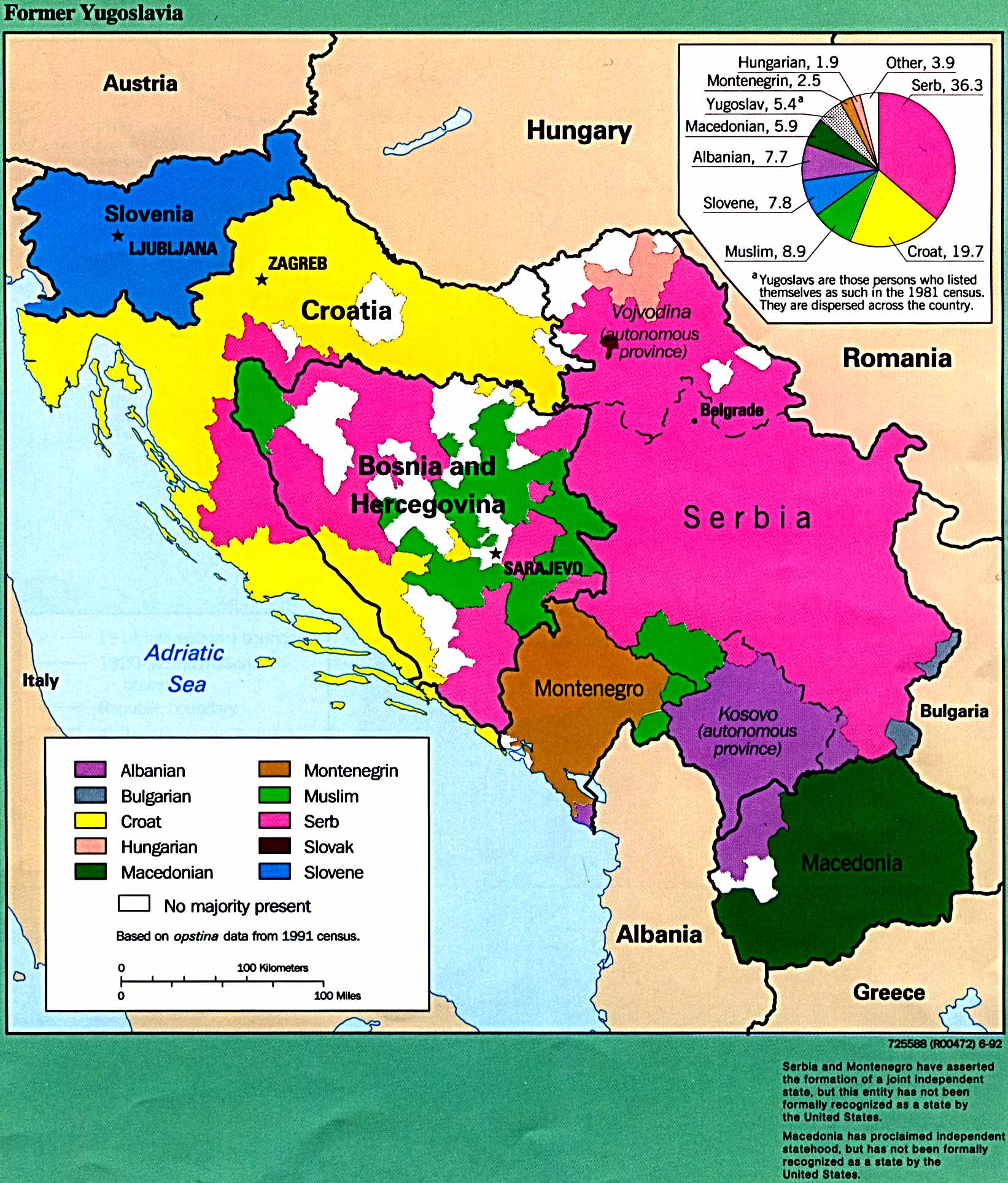
Former Yugoslavia - Ethnic Majorities From Former Yugoslavia: A Map Folio, 1992 (412K)
Former Yugoslavia - Military Geography 1998 (581K)
Sources: These maps were provided by the University of Texas Library and/or
the U.S. Central Intelligence Agency (CIA) unless otherwise noted.
Sponsors
Maps on other websites:
Croatia (GRID-Arendal)
Croatia (United Nations) [PDF]
Croatia - Eastern (United Nations) [PDF]
Croatia - Interactive Map (Cromaps)
Croatia - Interactive Map (VIP Navigator)
Sources: Many of these maps were provided by the University of Texas Library.
<-- Free Map Downloads
<-- Free World Country Map Downloads
Didn't find what you are looking for? We've been online since 1996 and have created 1000's of pages. Search below and you may find just what you are looking for.
Michael R. Meuser
Data Research & GIS Specialist
MapCruzin.com is an independent firm
specializing in GIS project development and data research.
We created the first U.S. based
interactive toxic chemical facility
maps on the internet in 1996 and we
have been online ever since. Learn more about us and our services.
Have a project in mind? If you have data, GIS project or custom shapefile needs contact Mike.
Contact Us
Report Broken Links
Subscribe for Updates


