Download Free Cuba Maps
<-- Free Map Downloads
<-- Free World Country Map Downloads
Sponsors
Note that maps may not appear on the webpage in their full size and resolution. To save the maps to your computer, right-click on the link.
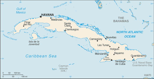
Cuba (Political) 1994 (532K) and
pdf format (518K)
Cuba (Shaded Relief) 1994 (236K) and
pdf format (231K)
Cuba (Small Map) 2008 (16K)
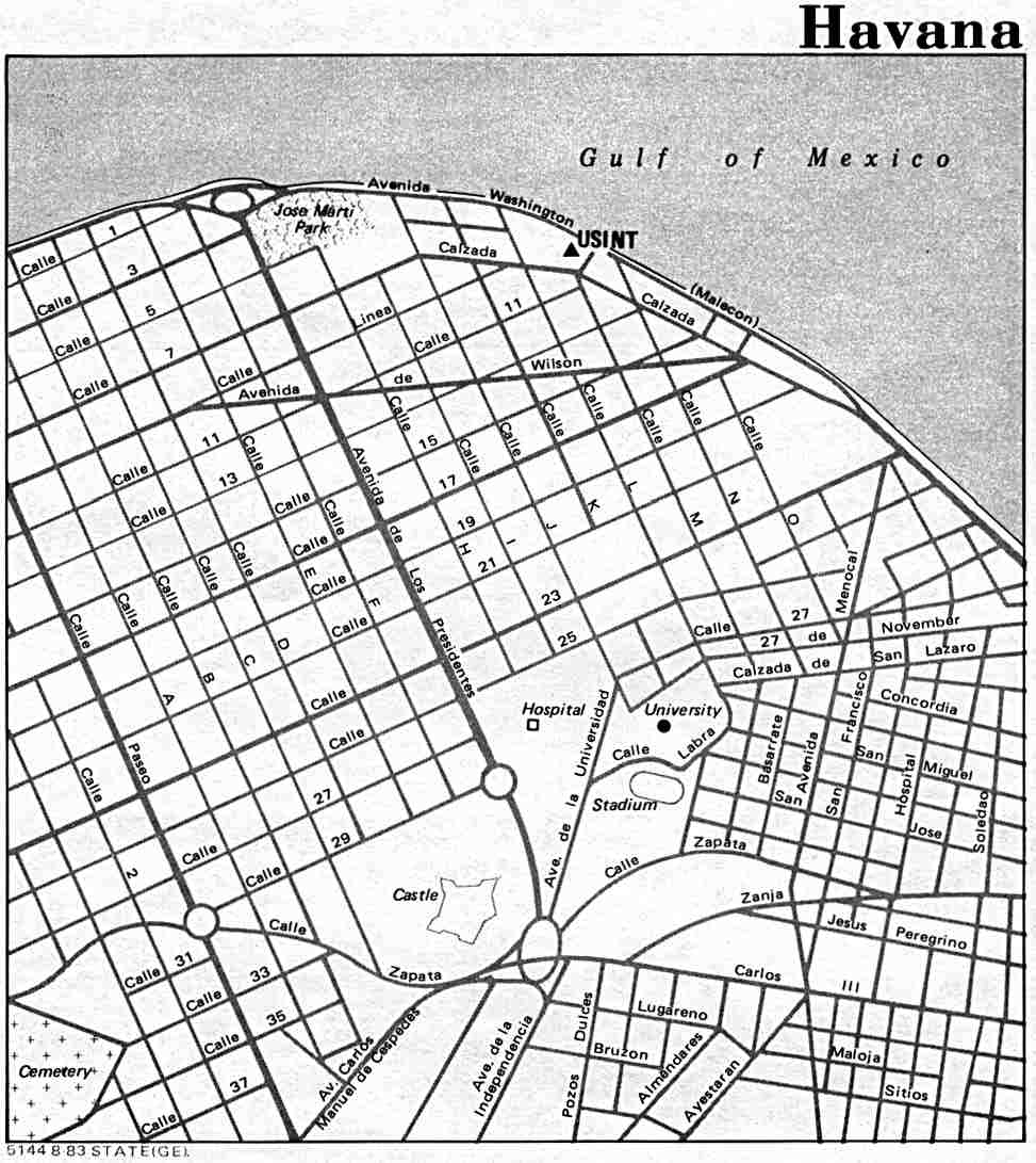
Havana U.S. Dept. of State 1983 (99K)
Havana CIA (447K)
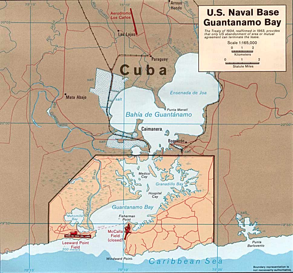
Guantanamo Bay 1985 (120K)
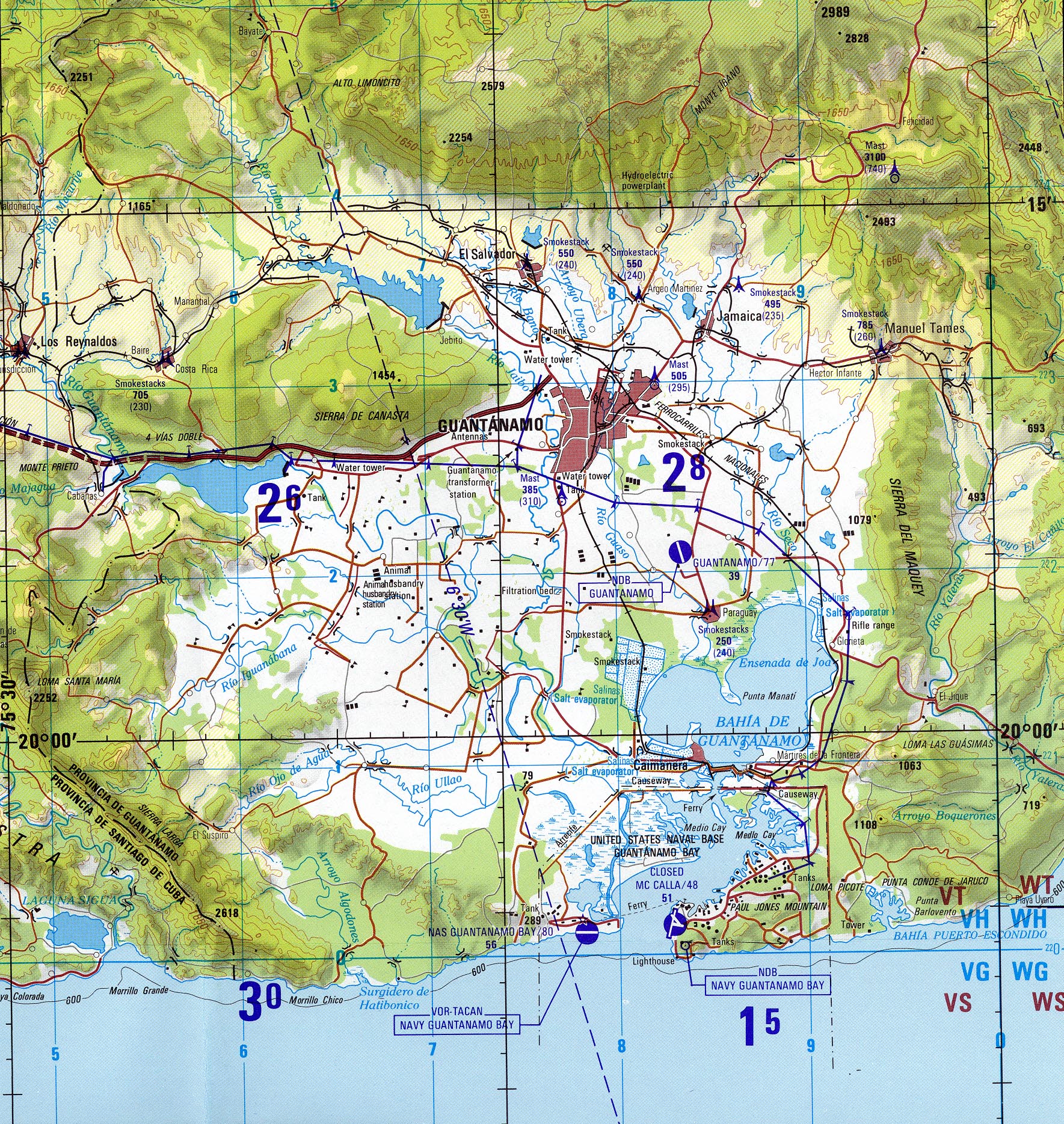
Guantanamo (Joint Operations Graphic) 1996 (1.6MB) Portion of Santiago De Cuba, Cuba, Joint Operations Graphic (AIR), Series 1501 AIR, Sheet NF 18-14, Edition 5. Original scale 1:250,000. U.S. National Imagery and Mapping Agency, compiled April 1988, revised July 1995, air information current through 27 July 1996. Not for navigational use
Camp Delta [Guantanamo] From "Camp Delta Standard Operating Procedures", U.S. Department of Defense, Joint Task Force-Guantanamo, March 28, 2003 (402K)
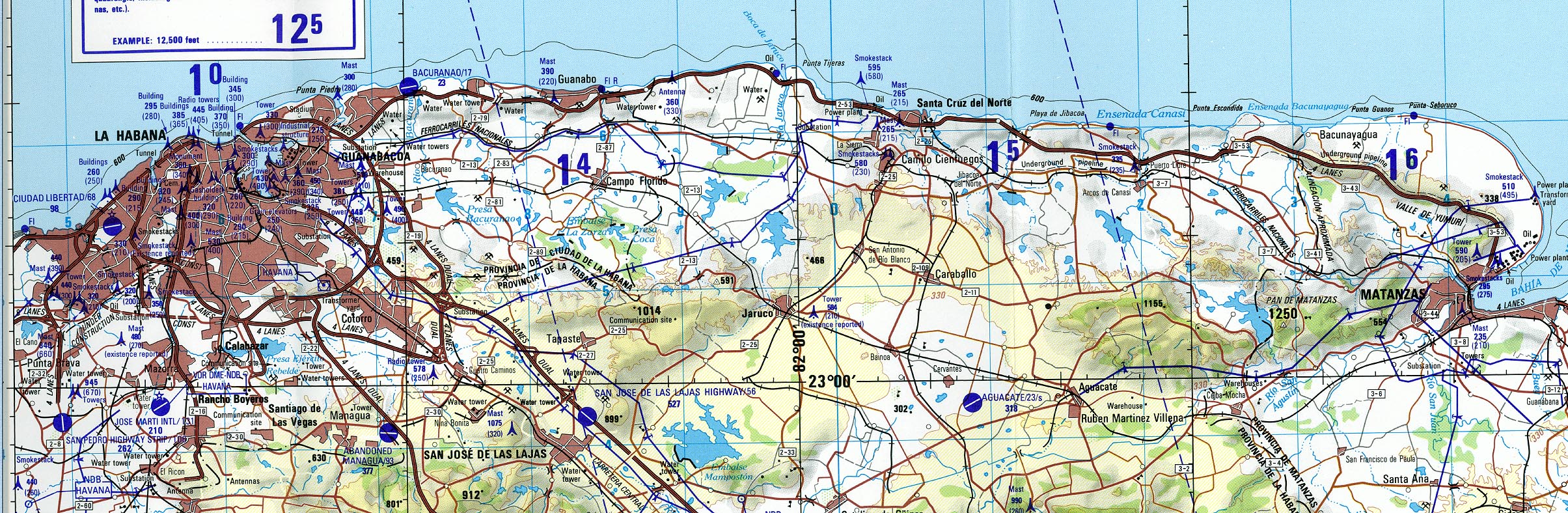
Havana (Joint Operations Graphic) 1997 (869K) Portion of La Habana (Havana), Cuba, Joint Operations Graphic (AIR), Series 1501 AIR, Sheet NF 17-6, Edition 6. Original scale 1:250,000. U.S. National Imagery and Mapping Agency, compiled 1978, revised July 1995, air information current through 30 July 1997. Not for navigational use
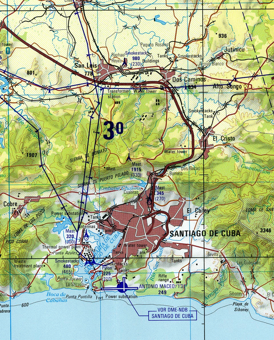
Santiago De Cuba (Joint Operations Graphic) 1996 (705K) Portion of Santiago De Cuba, Cuba, Joint Operations Graphic (AIR), Series 1501 AIR, Sheet NF 18-14, Edition 5. Original scale 1:250,000. U.S. National Imagery and Mapping Agency, compiled April 1988, revised July 1995, air information current through 27 July 1996. Not for navigational use
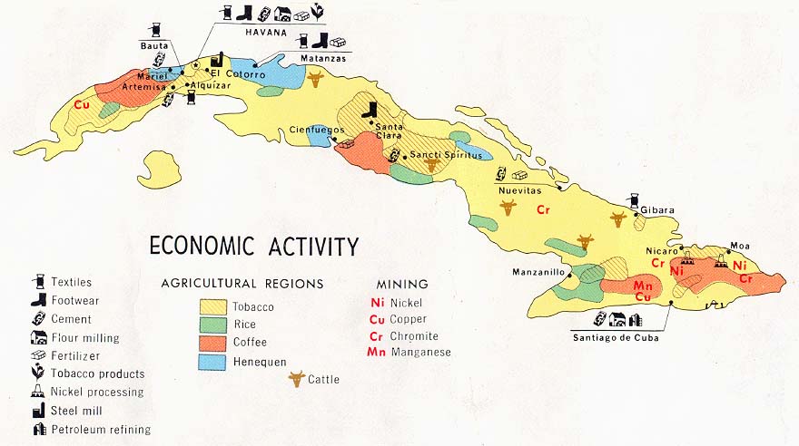
Cuba - Economic Activity from Map No. 502988 1977 (84K)
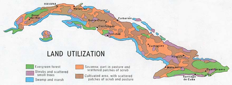
Cuba - Land Utilization from Map No. 502988 1977 (70K)
Cuba - Population from Map No. 502988 1977 (63K)
Cuba - Sugar from Map No. 502988 1977 (72K)
Cuba, 1919 Automobile Blue Book, Volume Six, 1919 (323K)
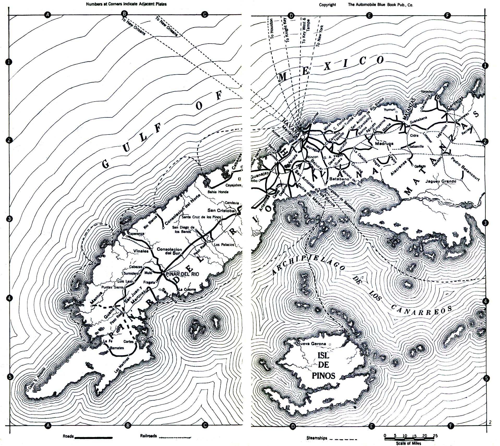
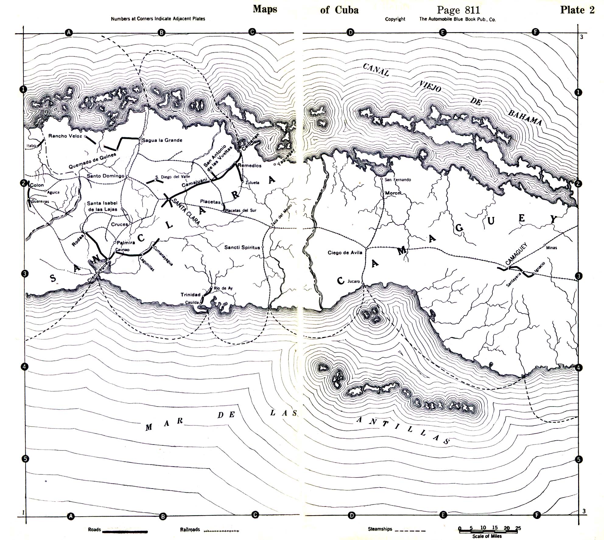
Cuba - Central Cuba 1919 Automobile Blue Book, Volume Six, 1919 (645K)
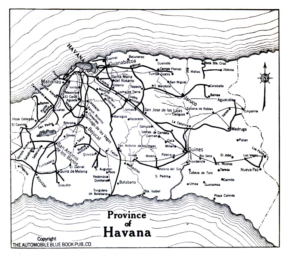
Cuba - Province of Havana 1919 Automobile Blue Book, Volume Six, 1919. (323K)
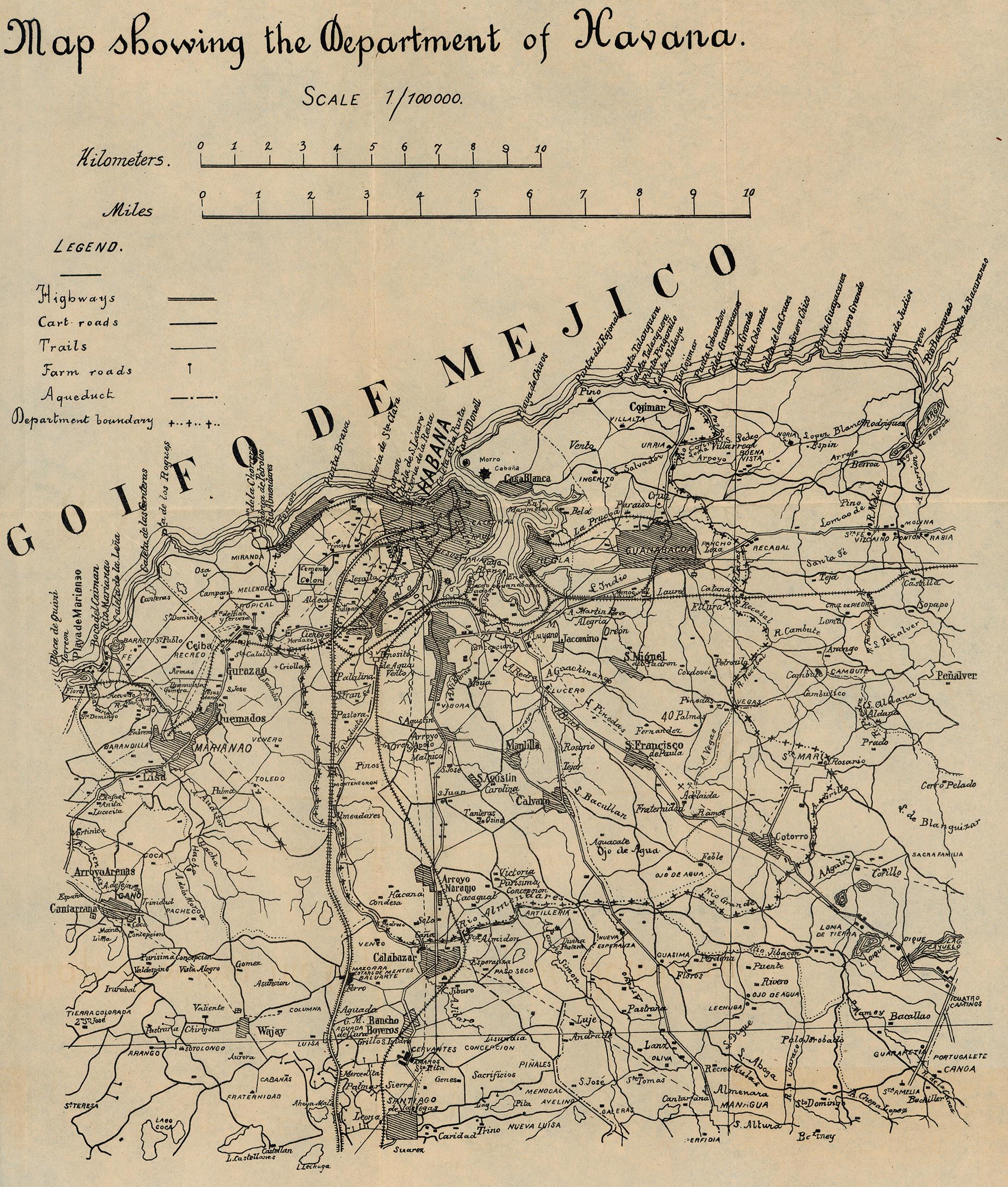
Havana - Map Showing the Department of Havana 1899 (940K) From 56th Congress, 1st Session. House of Representatives. Document No. 2. Annual Reports of the War Department for the Fiscal Year Ended June 30, 1899. Washington: Government Printing Office. 1899.
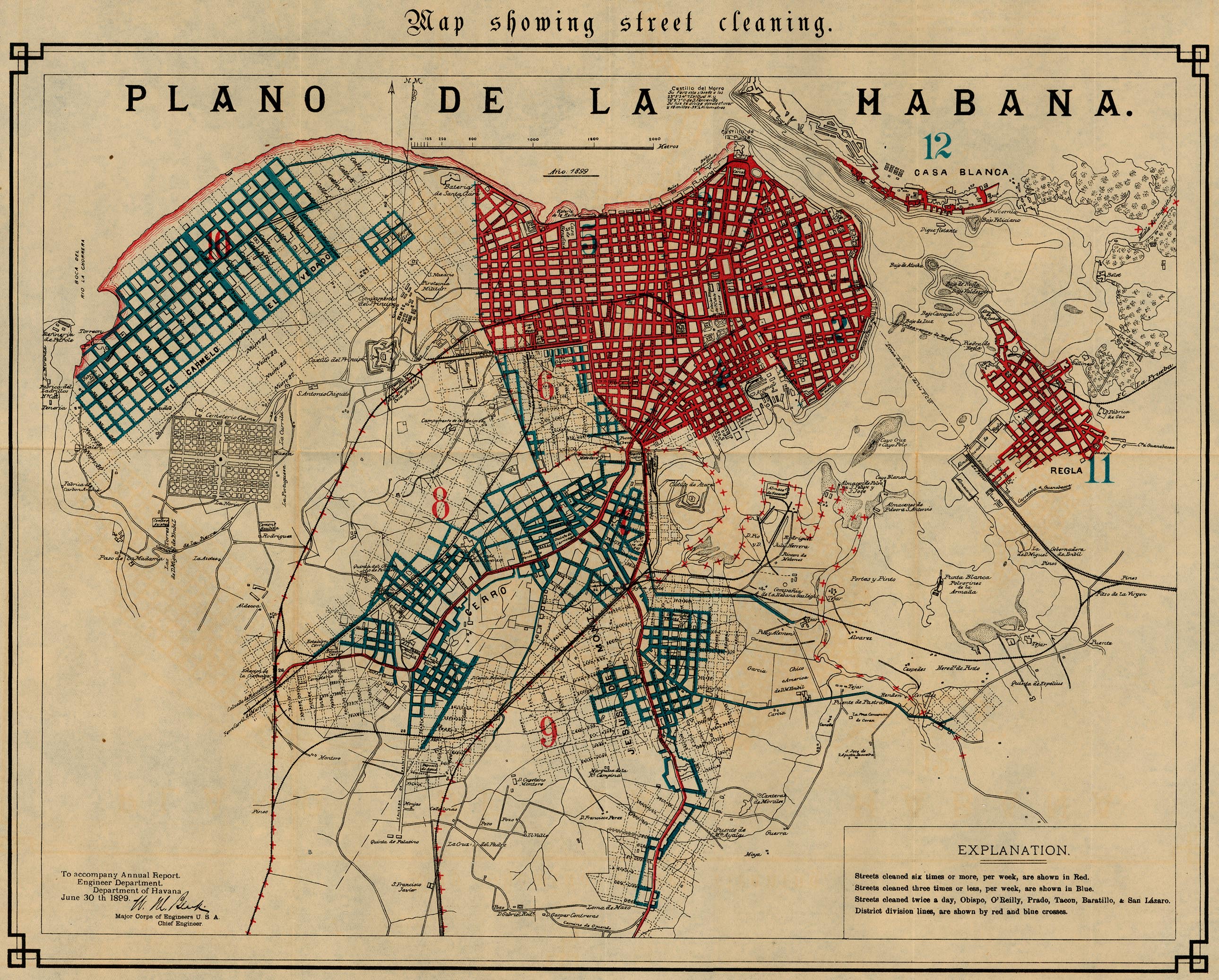
Havana - Map Showing Street Cleaning 1899 (1,382K) From 56th Congress, 1st Session. House of Representatives. Document No. 2. Annual Reports of the War Department for the Fiscal Year Ended June 30, 1899. Washington: Government Printing Office. 1899.
Havana - Map Showing Street Pavements 1899 (1,372K) From 56th Congress, 1st Session. House of Representatives. Document No. 2. Annual Reports of the War Department for the Fiscal Year Ended June 30, 1899. Washington: Government Printing Office. 1899.
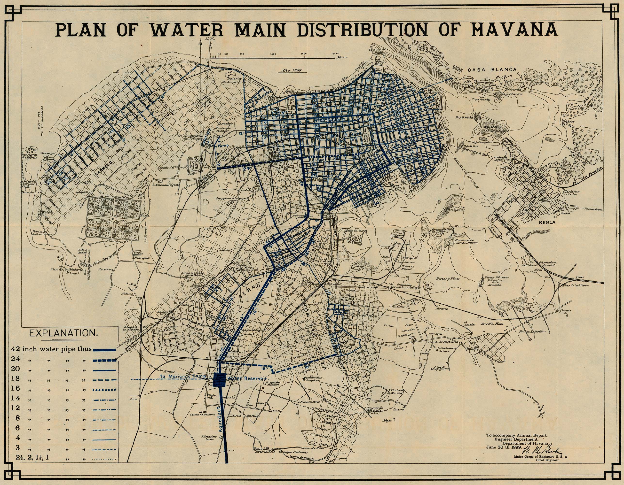
Havana - Plan of Water Main Distribution 1899 (1,124K) From 56th Congress, 1st Session. House of Representatives. Document No. 2. Annual Reports of the War Department for the Fiscal Year Ended June 30, 1899. Washington: Government Printing Office. 1899.
Sources: These maps were provided by the University of Texas Library and/or
the U.S. Central Intelligence Agency (CIA) unless otherwise noted.
Maps on other websites
Cuba (Guides Ulyssee)
Cuba (Lonely Planet)
Cuba (WorldAtlas.com)
Cuba - Maps (UniMaps)
Sources: Many of these maps were provided by the University of Texas Library.
<-- Free Map Downloads
<-- Free World Country Map Downloads
Sponsors
Didn't find what you are looking for? We've been online since 1996 and have created 1000's of pages. Search below and you may find just what you are looking for.
Michael R. Meuser
Data Research & GIS Specialist
MapCruzin.com is an independent firm
specializing in GIS project development and data research.
We created the first U.S. based
interactive toxic chemical facility
maps on the internet in 1996 and we
have been online ever since. Learn more about us and our services.
Have a project in mind? If you have data, GIS project or custom shapefile needs contact Mike.
Contact Us
Report Broken Links
Subscribe for Updates


![Camp Delta [Guantanamo]](/free-maps-cuba/camp_delta_assembly_areas_2003.jpg)