Download Free Europe Maps
<-- Free Map Downloads
<-- Free World Country Map Downloads
Sponsors
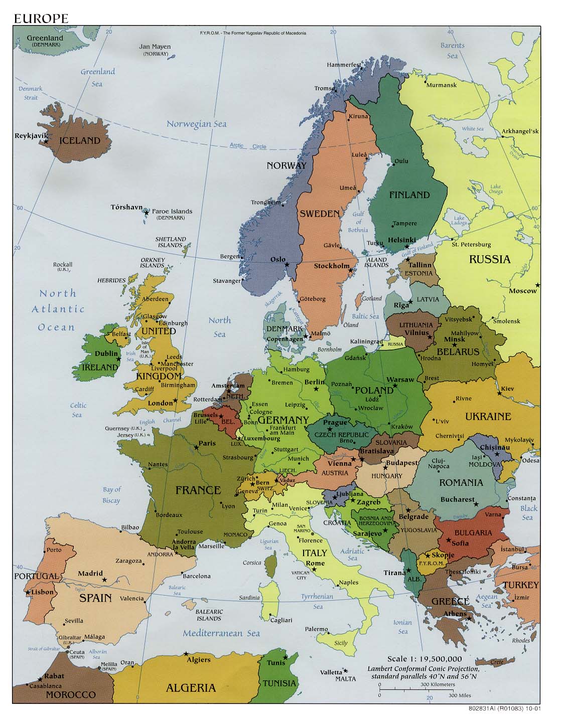
Europe (Political) 2008 (940KB)
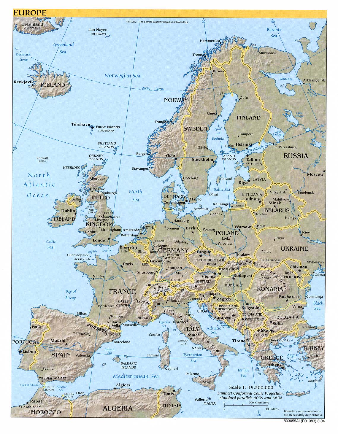
Europe (Reference Map) 2008 (1 MB) [pdf] and
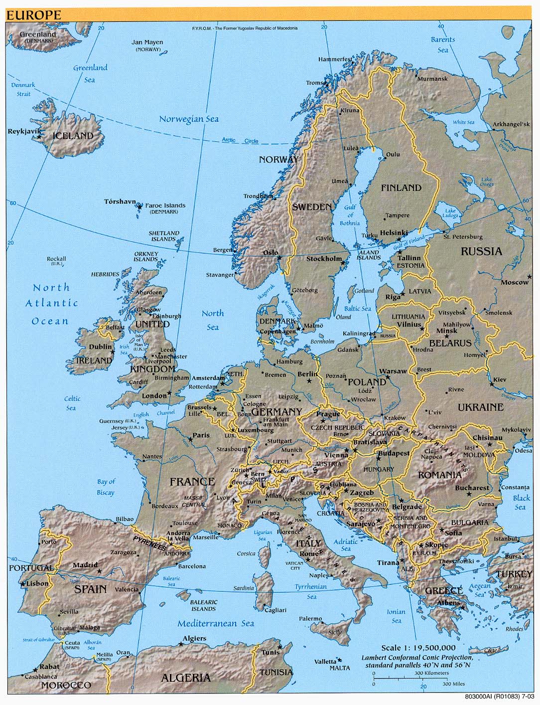
Europe (Reference Map) 2007 (897K) [jpeg]
Andorra (Political) U.S. Department of State 1986 (174K)
Andorra (Small Map) 2008 (7K)
Azores (Shaded Relief) 1975 (146K)
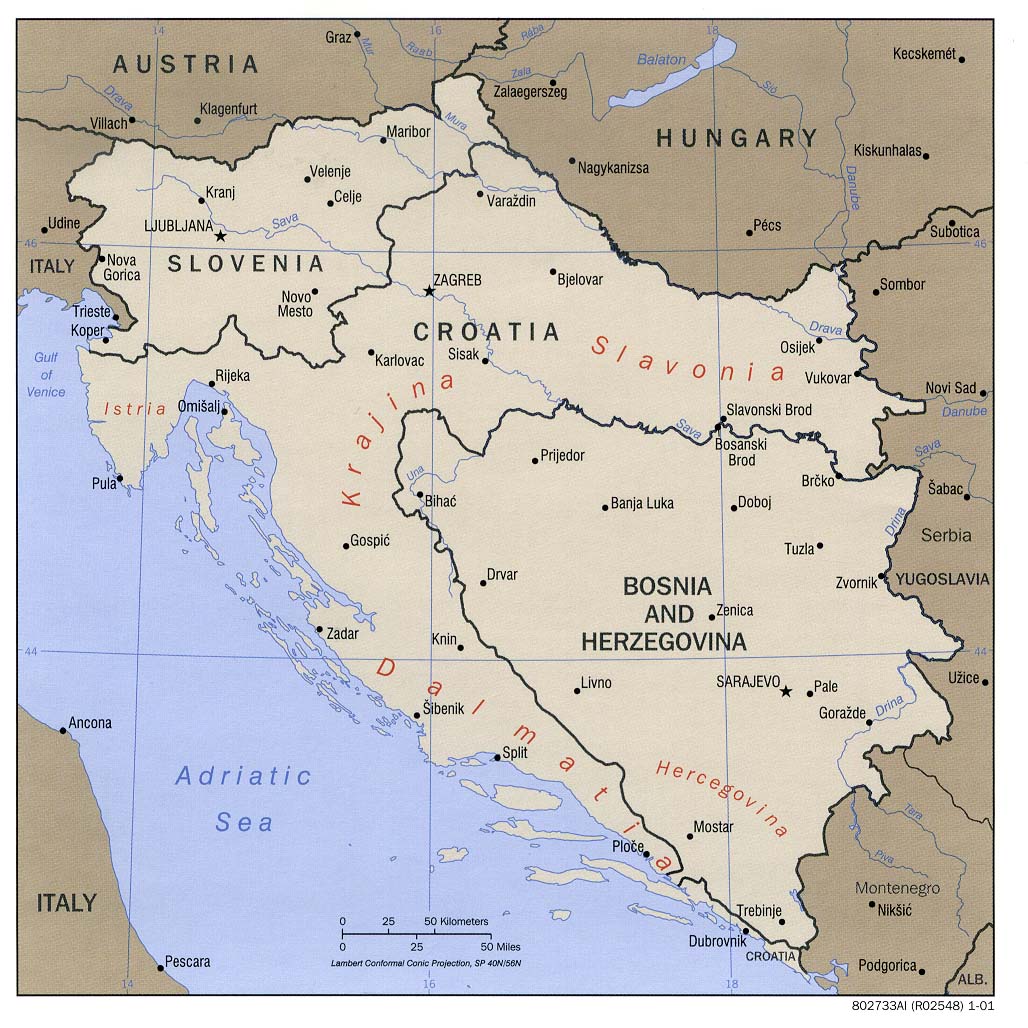
Balkan States - West (Bosnia, Croatia, Slovenia) (Political) CIA 2001 (189K)
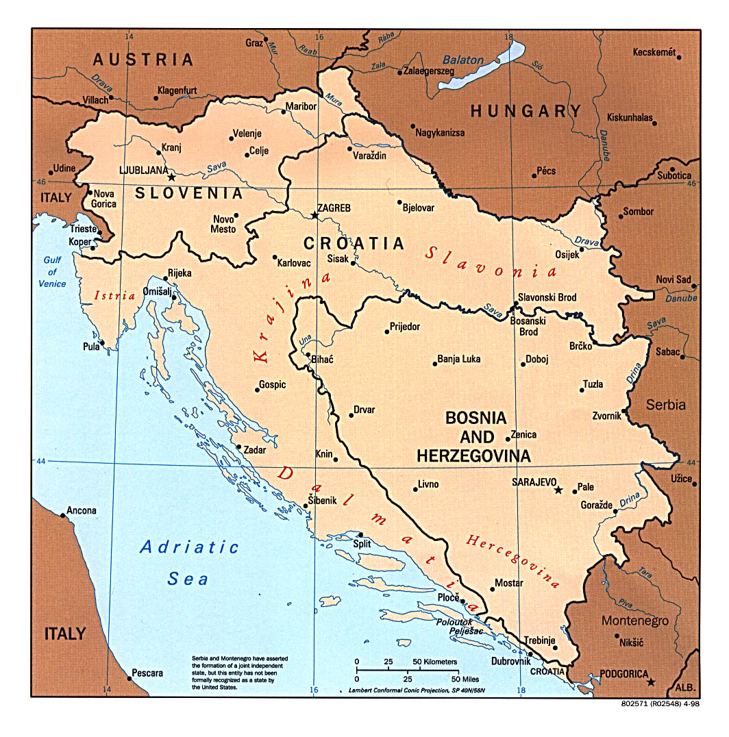
Balkan States - West (Bosnia, Croatia and Slovenia) (Political) CIA 1997 (340K)
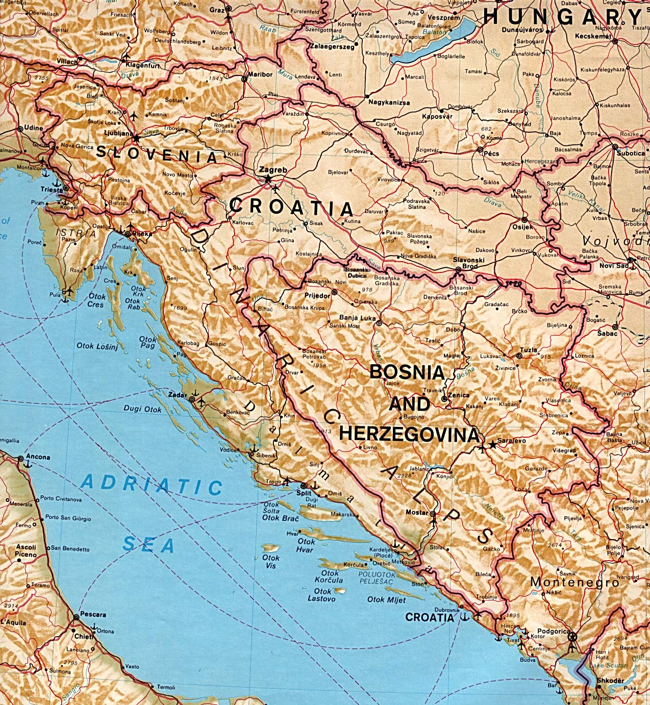
Balkan States - West (Bosnia, Croatia and Slovenia) Portion of The Balkans (Shaded Relief) CIA 1993 (556K)
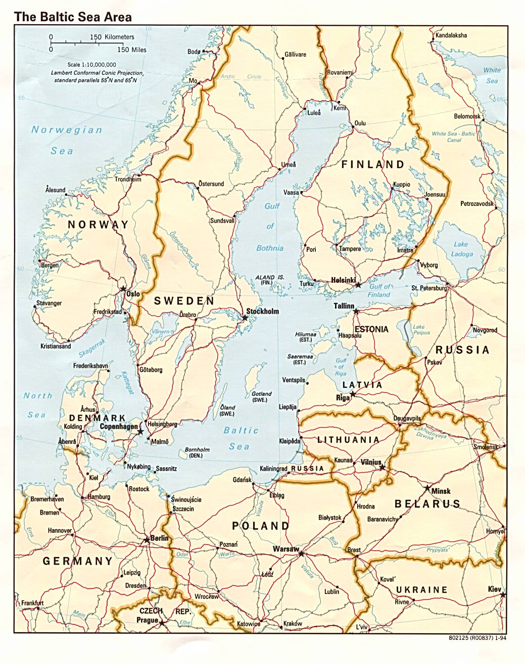
Baltic Sea Area (Political) 1994 (276K)
Baltic States (Political) 1994 (200K)
Baltic States: Major Defense Industries 1993 (196K) from The Defense Industries of the Newly Independent States of Eurasia (CIA)
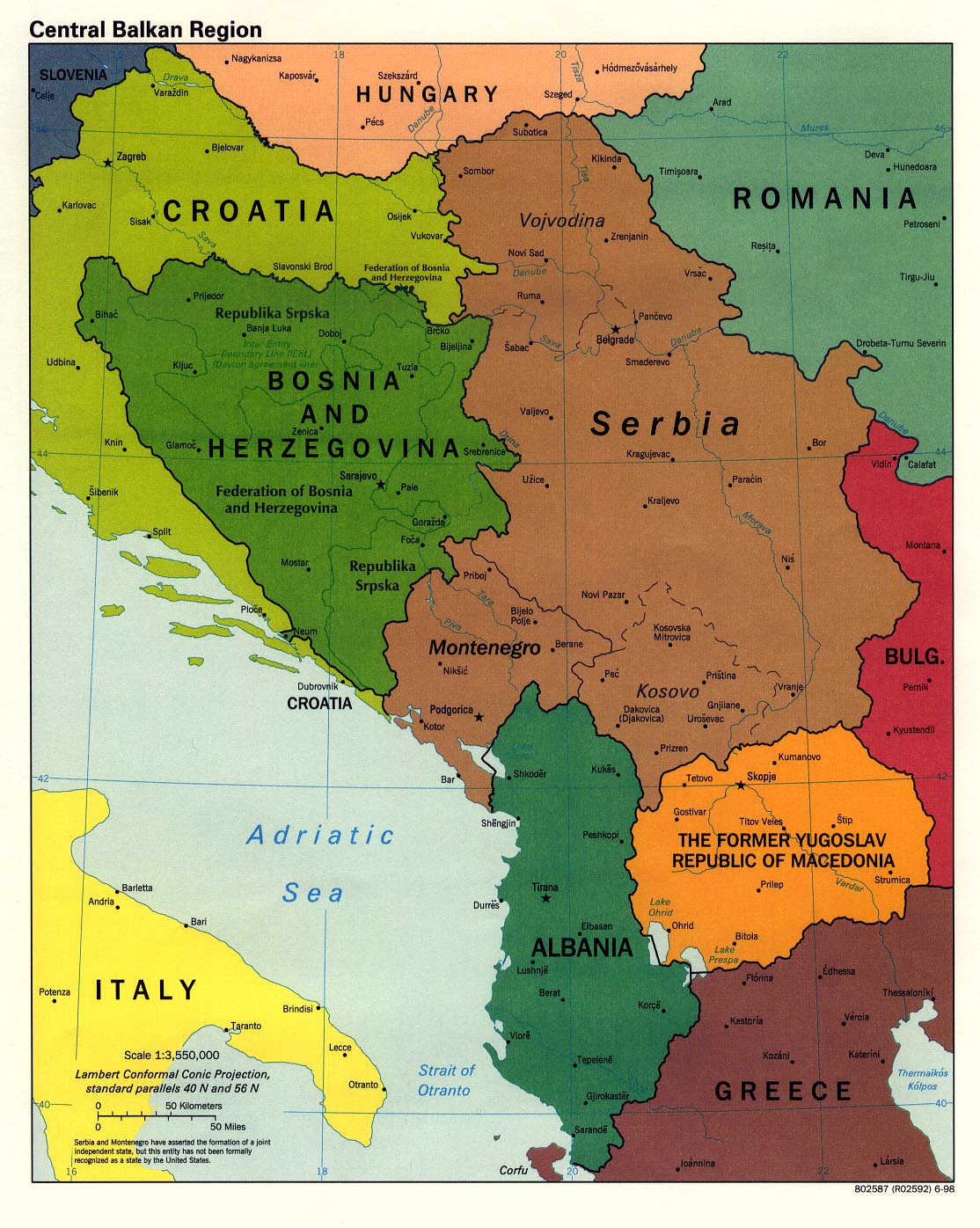
Central Balkan Region (Political) 2008 (976K)
Central Balkan Region (Political) 2003 (247K) and
Central Balkan Region (Political) 2003 (244K) [pdf format]
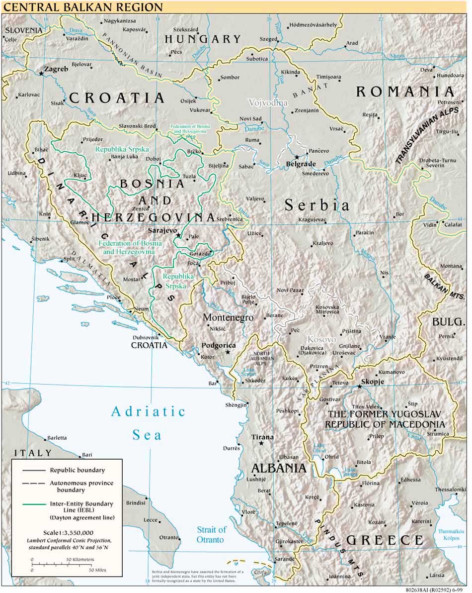
Central Balkan Region (Political) 1998 (387K)
Central Balkan Region (Reference Map) 2007 (866K) [jpeg format] and
Central Balkan Region (Reference Map) 2007 (560K) [pdf format]
Central Balkan Region (Reference Map) 2001 (226K)
Central Balkan Region (Reference Map) 2000 (275K)
Central Balkan Region (Reference Map) 1999 (211K)
Central Balkan Region (Reference Map) 2001 (1MB) [pdf format]
Central Balkan Region (Reference Map) 2000 (774K) [pdf format]
Central Balkan Region (Reference Map) 1999 (560K) [pdf format]
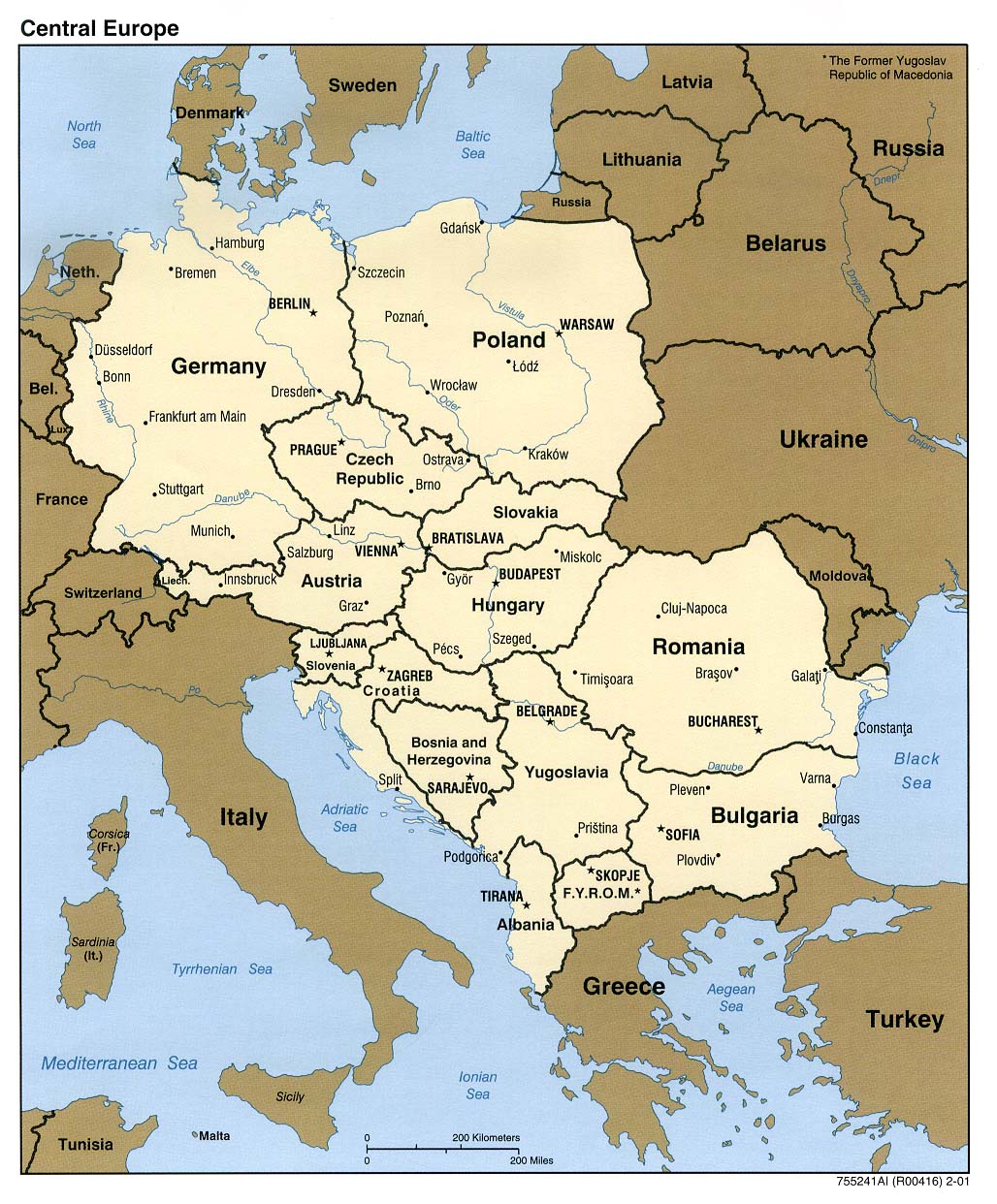
Central Europe (Political) 2001 (248K)
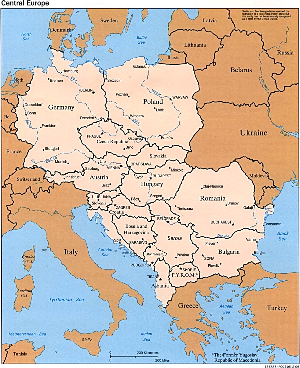
Central Europe (Political) 1996 (241K)
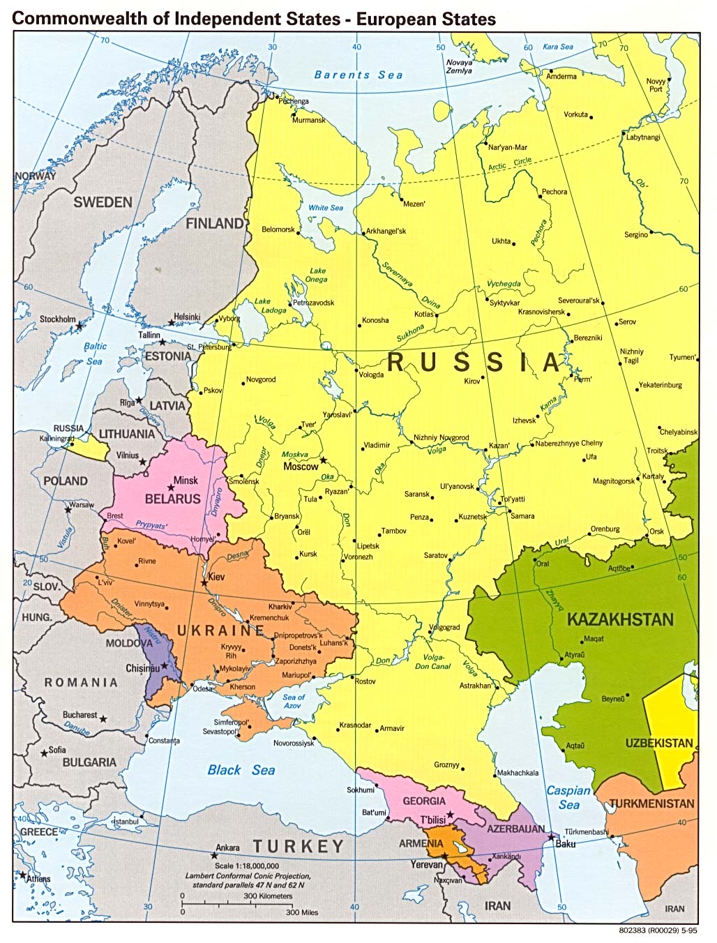
Commonwealth of Independent States - European States (Political) 1995 (286K)
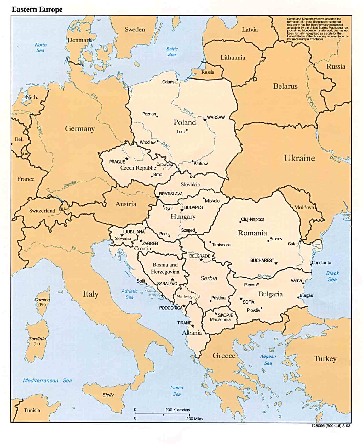
Eastern Europe (Political) 1993 (151K)
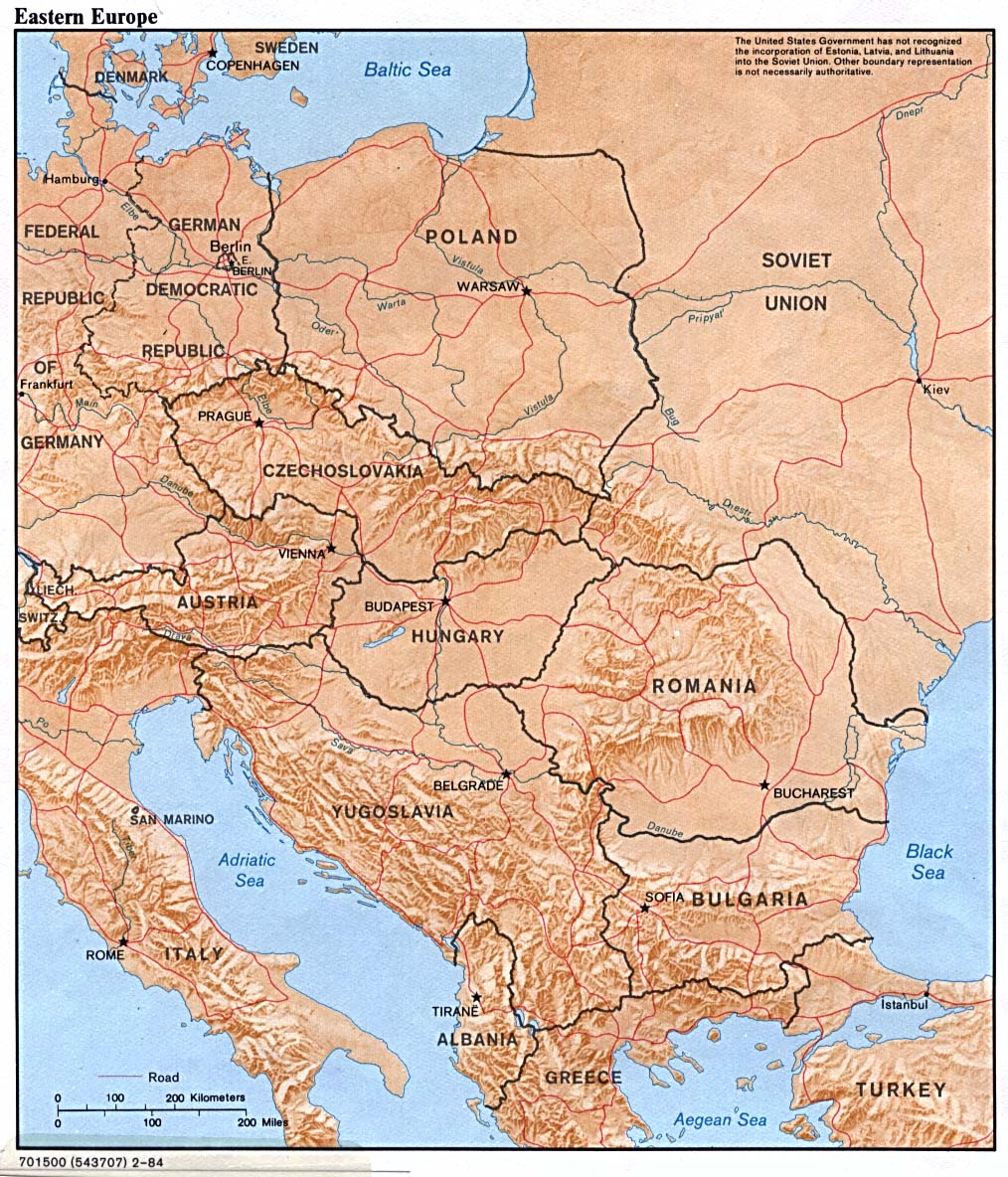
Eastern Europe (Shaded Relief) 1984 (316K)
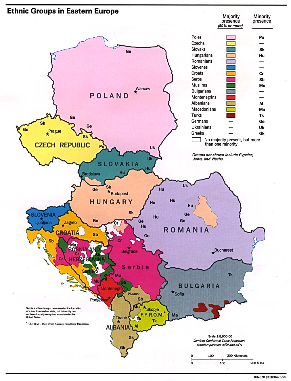
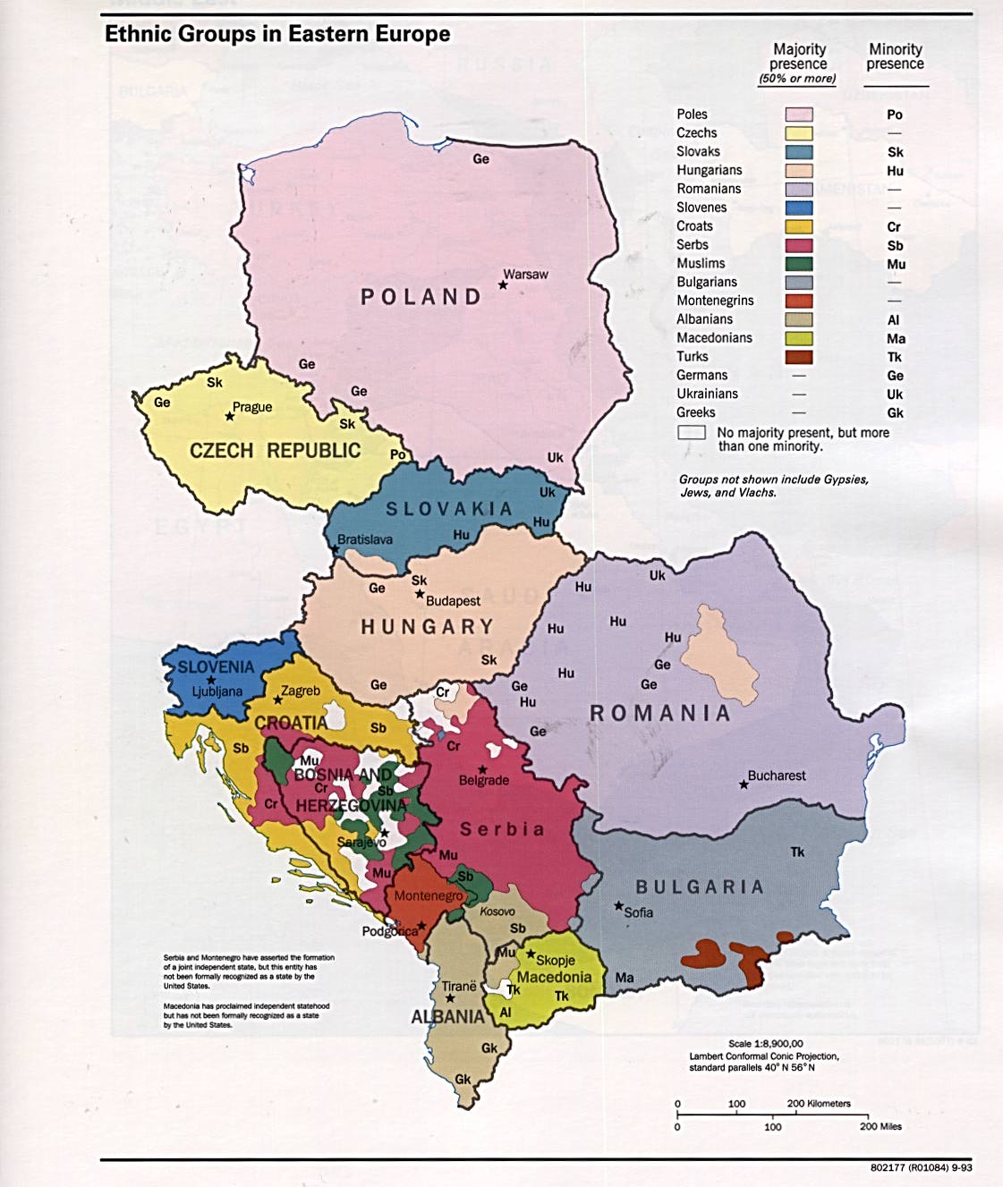
Eastern Europe: Ethnic Groups 1995 (176K)
Eastern Europe: Ethnic Groups 1993 (169K)
Eastern Europe: Ethnic Groups 1993 (173K)
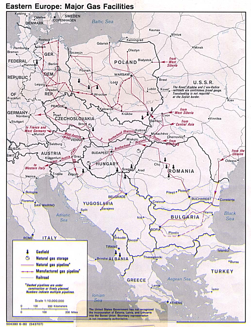
Eastern Europe: Major Gas Facilities 1980 (353K)
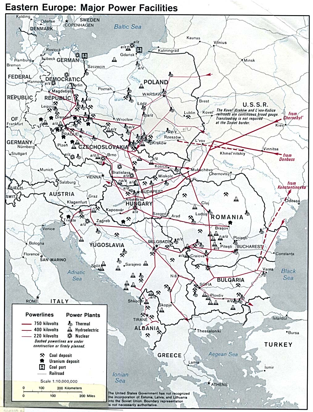
Eastern Europe: Major Power Facilities 1980 (359K)
Europe (Political) 2004 (487K) [jpeg format]
Europe (Political) 2001 (241K) [jpeg format]
Europe (Political) 1998 (452K) [jpeg format]
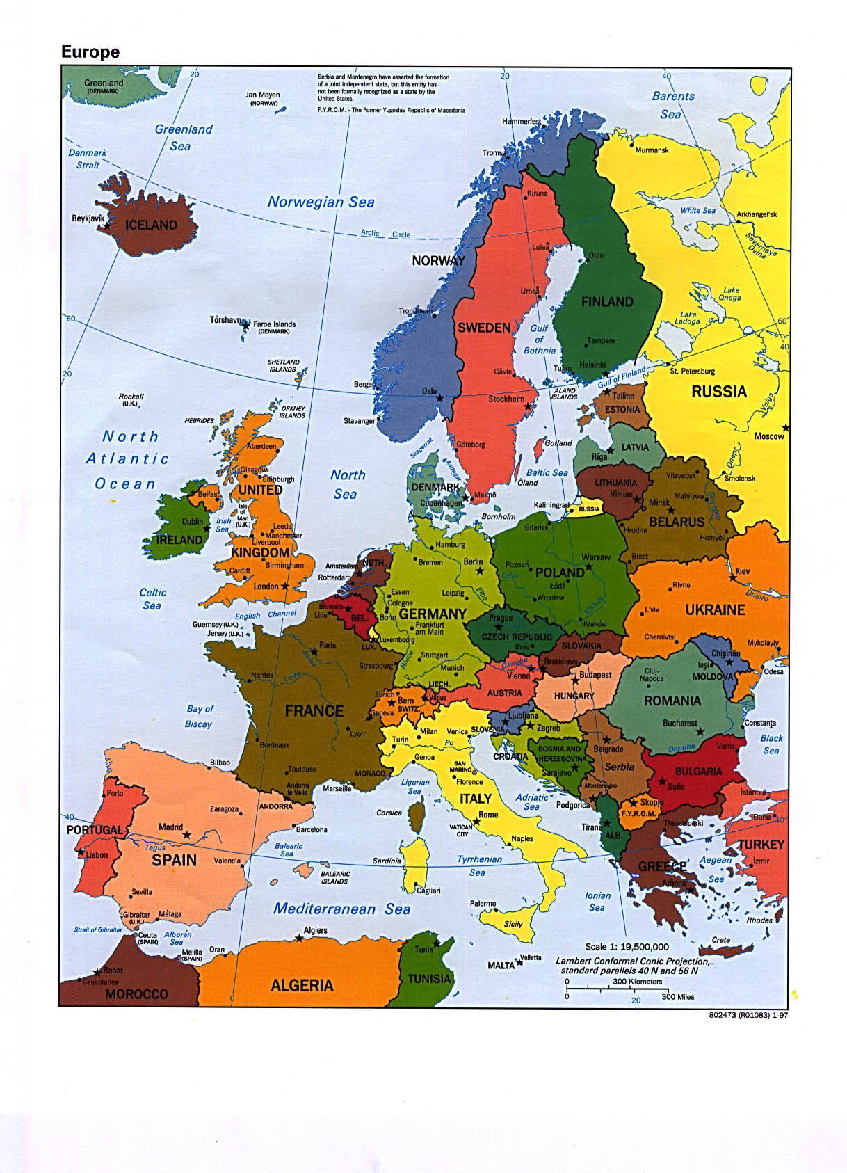
Europe (Political) 1997 (383K) [jpeg format] and
Europe (Political) 1997 (1.7MB) [pdf format]
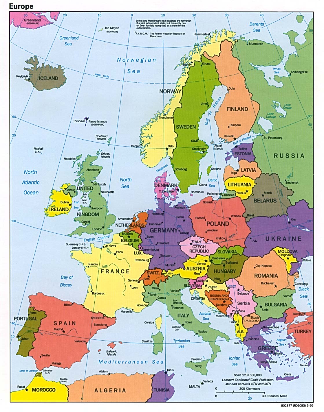
Europe (Political) 1995 (302K) [jpeg format]
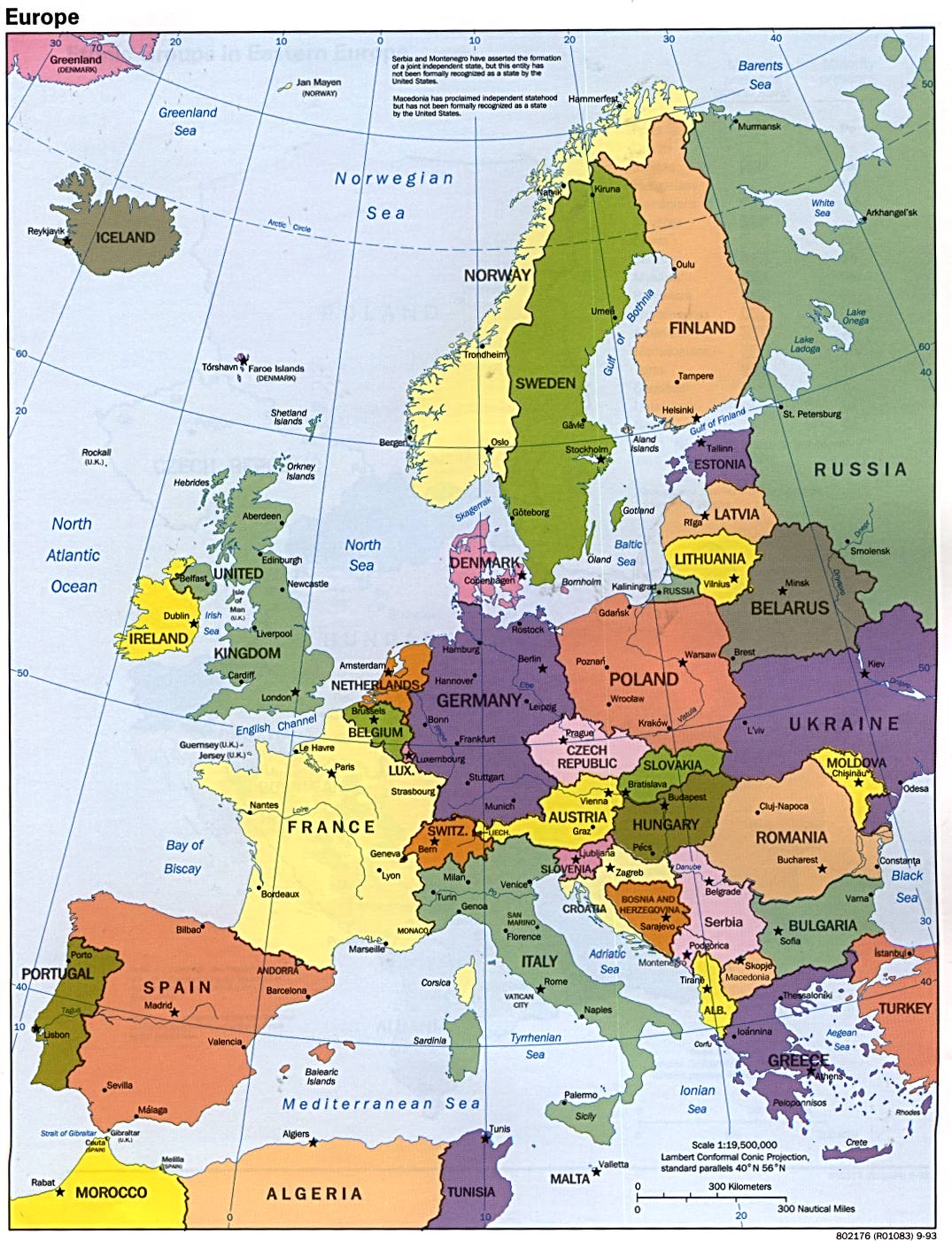
Europe (Political) 1993 (286K) [jpeg format]
Europe (Reference Map) 2008 (1 MB) [pdf format]
Europe (Reference Map) 2007 (897K) [jpeg format] and
Europe (Reference Map) 2007 (1 MB) [pdf format]
Europe (Reference Map) 2006 (1.38MB) [pdf format]
Europe (Reference Map) 2005 (467K) [pdf format]
Europe (Reference Map) 2004 (392K) [jpeg format] and
Europe (Reference Map) 2004 (467MB) [pdf format]
Europe (Reference Map) 2003 (389K) [jpeg format] and
Europe (Reference Map) 2003 (392K) [pdf format]
Europe (Reference Map) 2002 (306K) [jpeg format] and
Europe (Reference Map) 2002 (307K) [pdf format]
Europe (Reference Map) 2001 (249K) [jpeg format] and
Europe (Reference Map) 2001 (1MB) [pdf format]
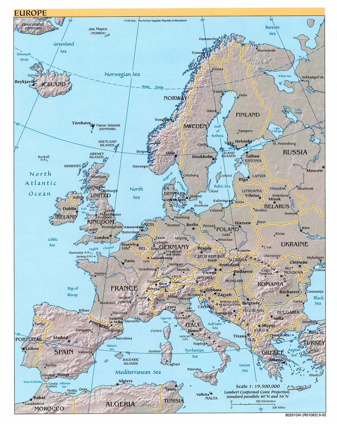
Europe (Reference Map) 2000 (305K) [jpeg format] and
Europe (Reference Map) 2000 (839K) [pdf format]
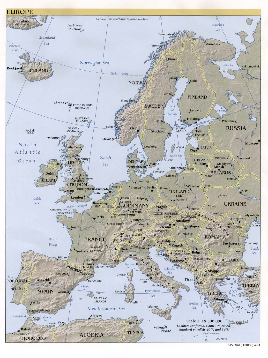
Europe (Reference Map) 1999 (202K) [jpeg format] and
Europe (Reference Map) 1999 (318K) [larger jpeg] and
Europe (Reference Map) 1999 (645K) [pdf format]
Sponsors
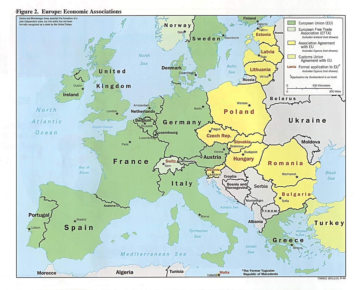
Europe: Economic Associations from Handbook of International Economic Statistics (CIA) 1996 (293K)
European Union (Small Map) 2008 (33K)
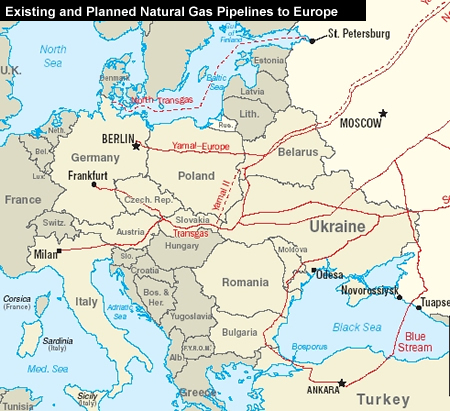
Existing and Planned Natural Gas Pipelines to Europe from U.S. Energy Information Administration, Country Analysis Briefs,
Major Russian Oil and Natural Gas Pipeline Projects, March 2005 (183K)
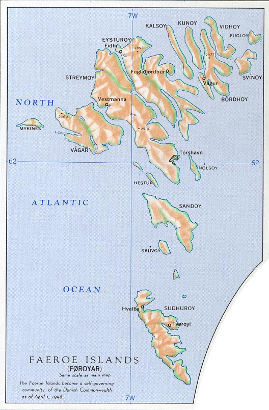
Faroe Islands (Denmark) (Small Map) 2008 (11K)
Faroe Islands (Denmark) from Nuclear Weapons and NATO: Analytical Survey of Literature, United States. Department of the Army, 1970 (167K)
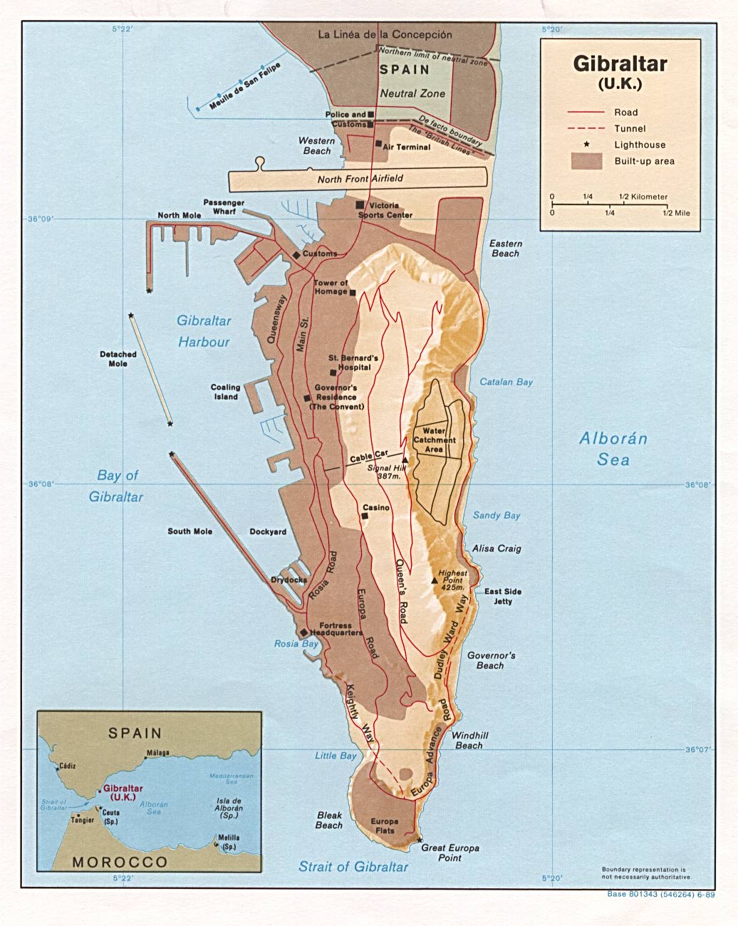
Gibraltar (Shaded Relief) 1989 (200K)
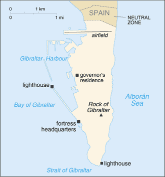
Gibraltar (Small Map) 2008 (9K)
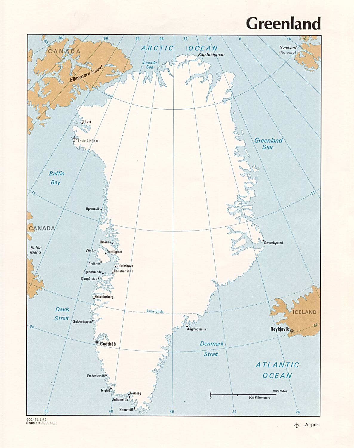
Greenland (Political) 1976 (182K) and pdf format (185K)
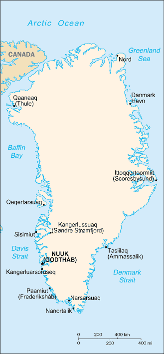
Greenland (Small Map) 2008 (19K)
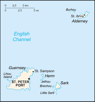
Guernsey (Small Map) 2008 (6K)
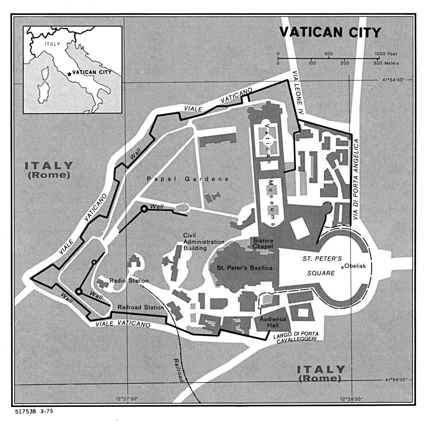
Holy See (Vatican City) (Political) U.S. Department of State 1975 (167K)
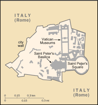
Holy See (Vatican City) (Small Map) 2008 (10K)
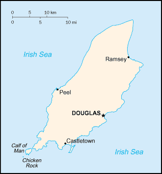
Isle of Man (Small Map) 2008 (5K)
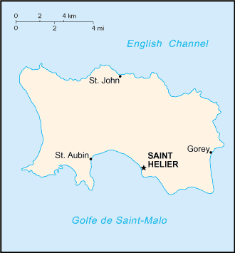
Jersey (Small Map) 2008 (5K)
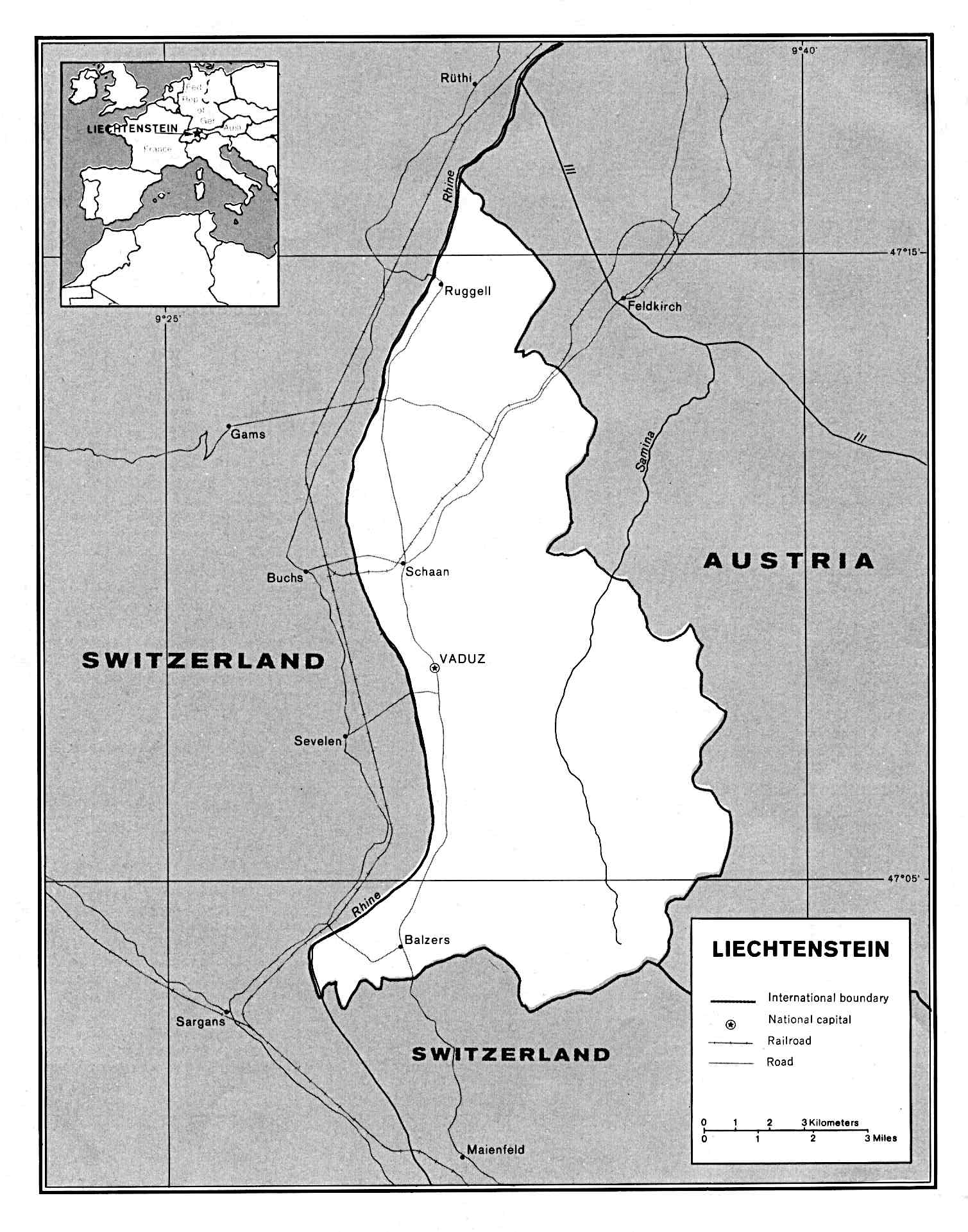
Liechtenstein (Political) U.S. Department of State 1989 (287K)
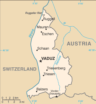
Liechtenstein (Small Map) 2008 (9K)
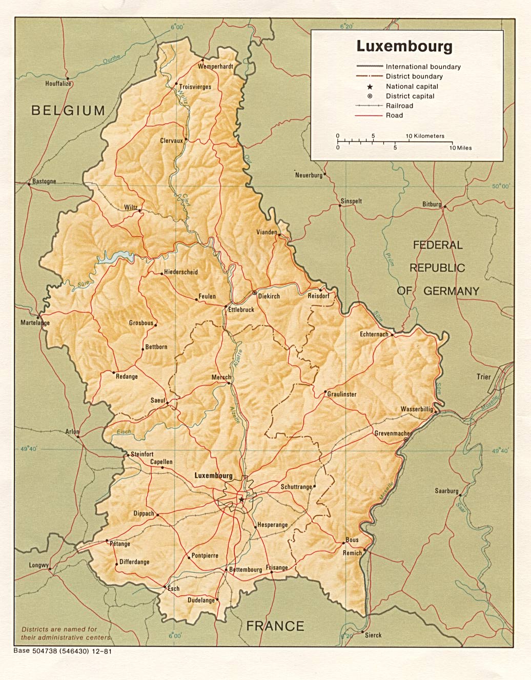
Luxembourg (Shaded Relief) 1981 (243K)
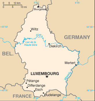
Luxembourg (Small Map) 2008 (10K)
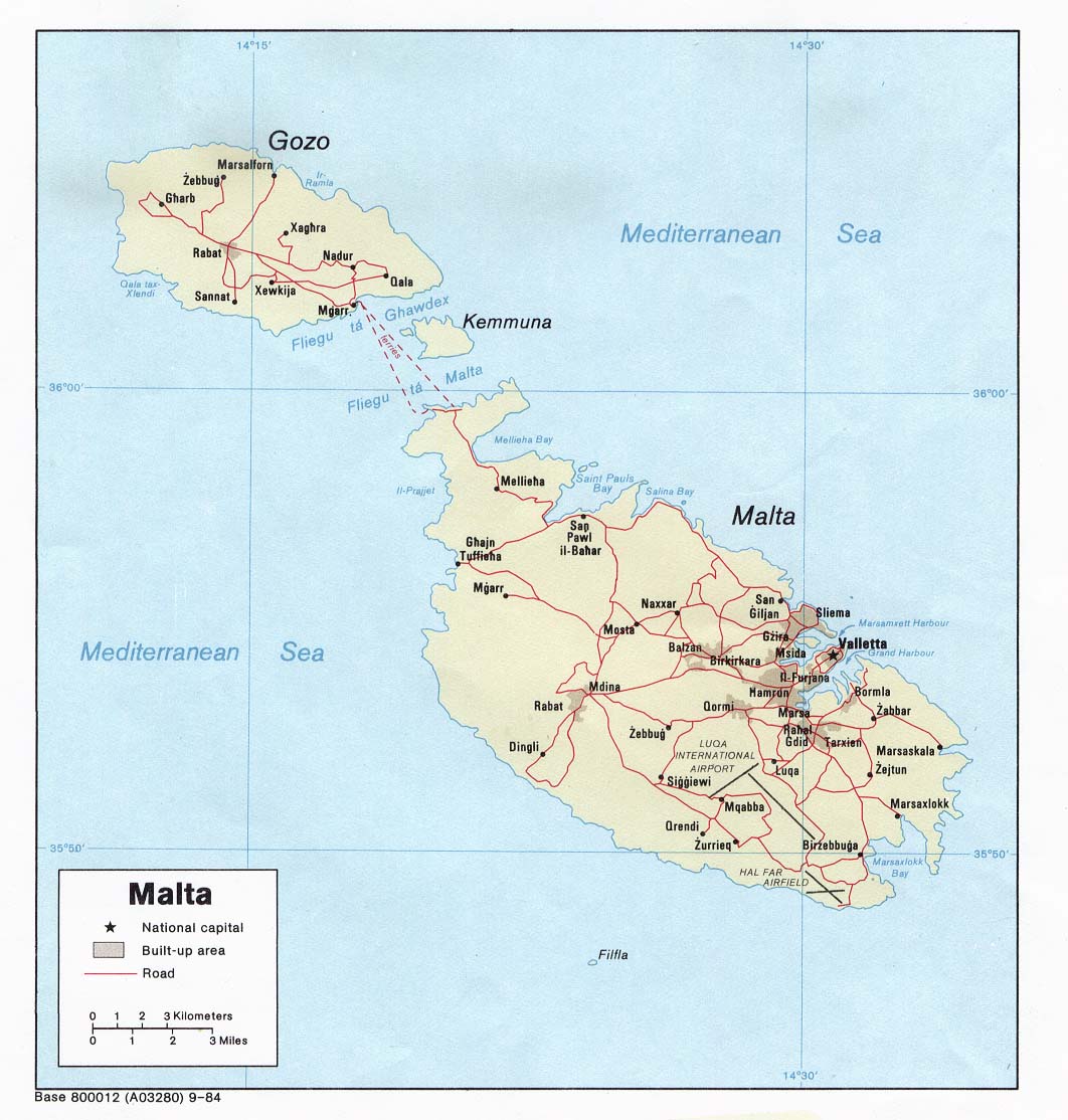
Malta (Political) 1984 (147K) and pdf format (153K)
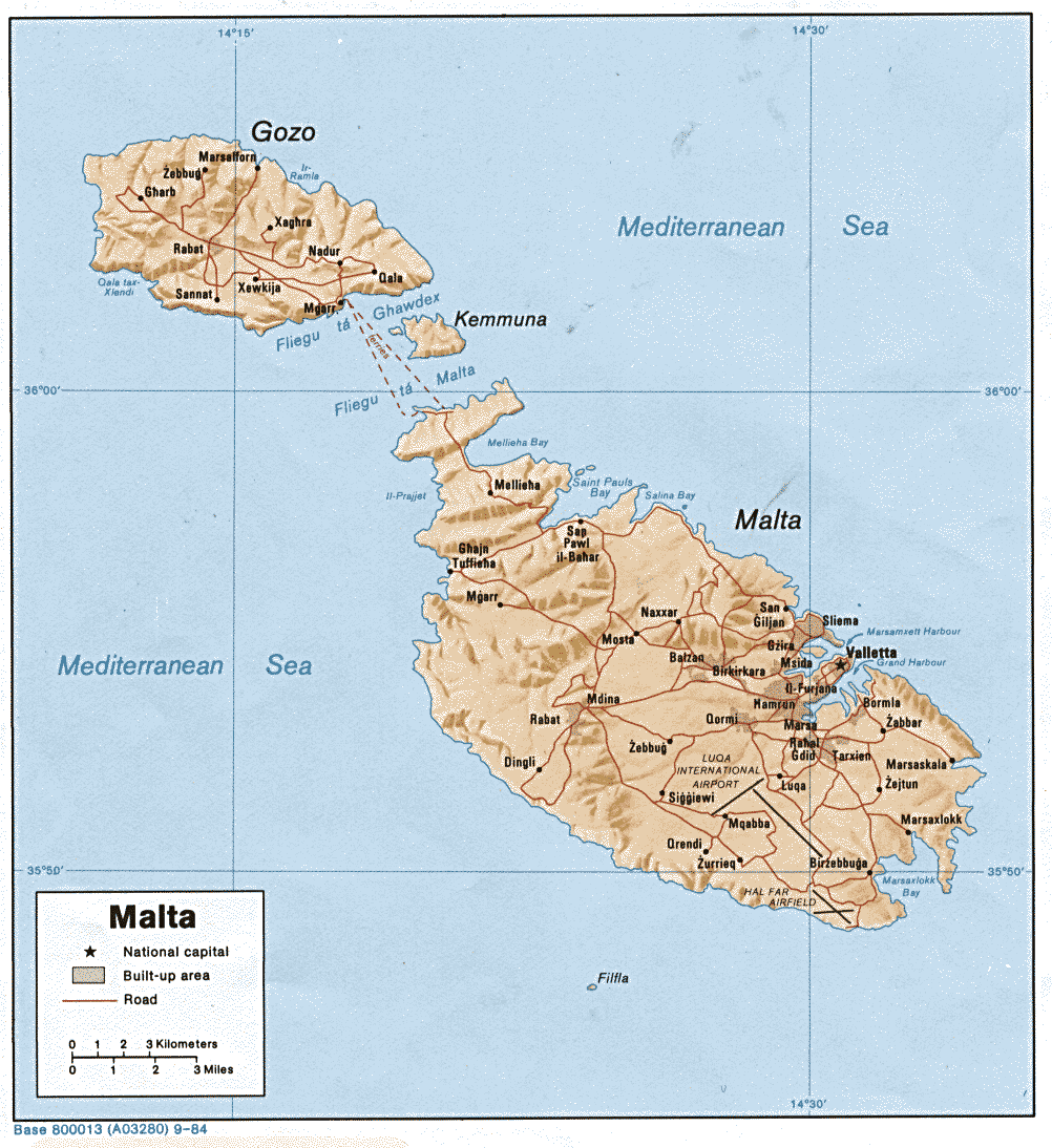
Malta (Shaded Relief) 1984 (211K) and pdf format (232K)
Malta (Small Map) 2008 (7K)
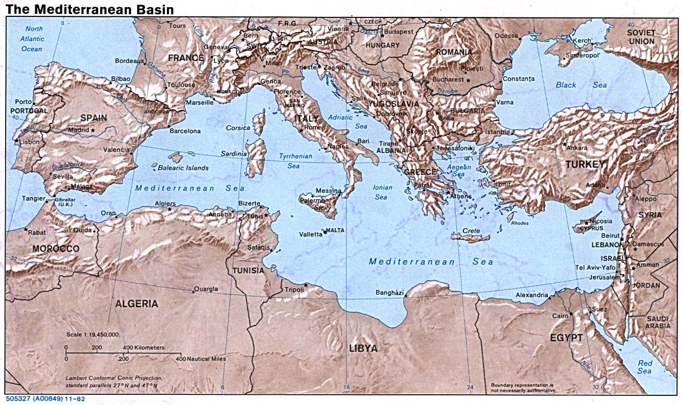
Mediterranean Basin (Shaded Relief) 1982 (310K)
Monaco (Political) 1982 (189K) and
pdf format (192K)
Monaco (Small Map) 2008 (8K)
Northern Ireland (U.K) (Political) 1987 (274K)
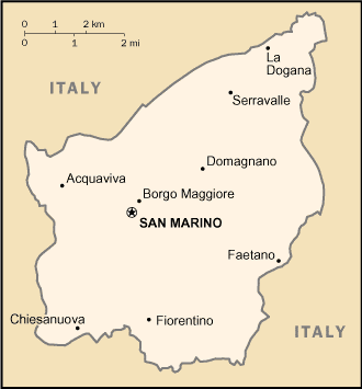
San Marino (Political) U.S. Department of State 1987 (82K)
San Marino (Small Map) 2008 (8K)
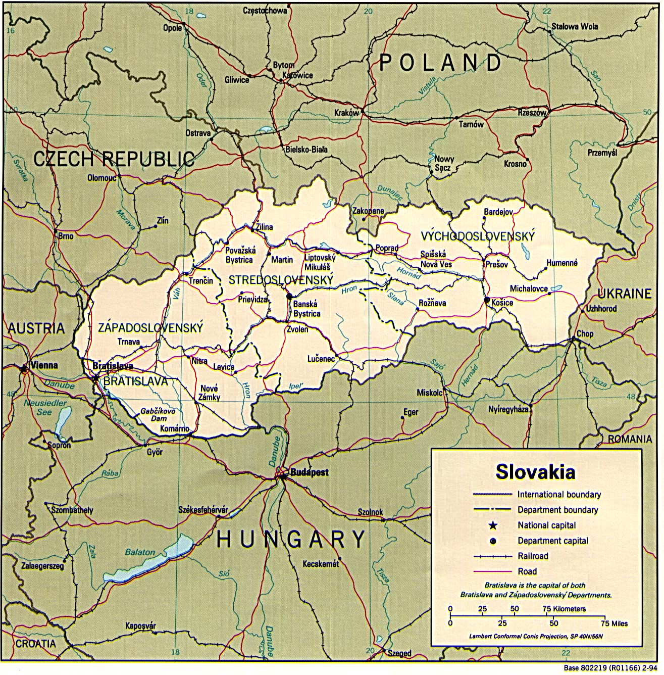
Slovakia (Political) 1994 (453K) and pdf format (467K)
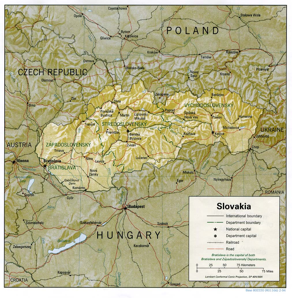
Slovakia (Shaded Relief) 1994 (311K) and pdf format (320K)
Slovakia (Small Map) 2008 (13K)
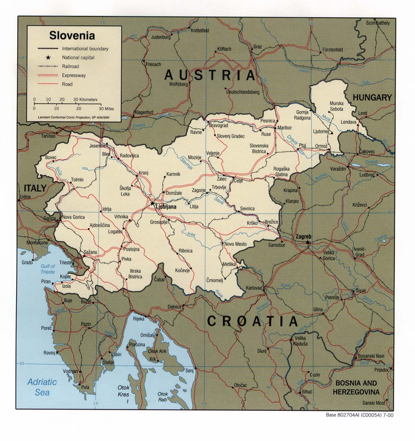
Slovenia (Political) 2000 (275K) and pdf format (283K)
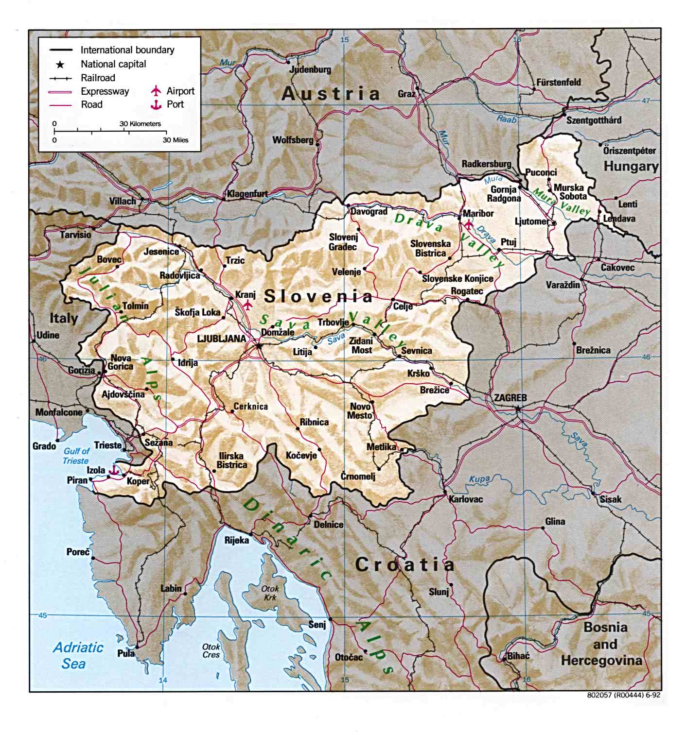
Slovenia (Shaded Relief) 2000 (319K) and pdf format (329K)
Slovenia (Shaded Relief) 1992 (226K)
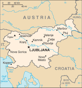
Slovenia (Small Map) 2008 (10K)
Vatican City (Holy See) (Political) U.S. Department of State 1975 (167K) and pdf format (170K)
Vatican City (Holy See) (Small Map) 2008 (10K)
Maps on other websites:
Europe (DK Clip Art)
Europe (Natural Resources Canada)
Europe - Central and Eastern (United Nations) [PDF]
Europe - Culture Maps (Eupedia)
Europe - Economic Commission for Europe (United Nations) [PDF]
Europe - Environmental Impact of Chernobyl (BBC News)
Europe - European Union and Candidate Countries (Ecdel/Eurostat)
Europe - Forest Type and Protected Area Distribution (WCMC)
Europe - Gas Pipelines - From Russia to Europe: Natural Gas Pipelines (NPR)
Europe - Muslim Population (Times Online)
Europe - NATO Countries Map (NATO)
Europe - Political (Graphic Maps)
Europe - Pollution Maps [NO2] (OMI)
Europe - Railways (Railpass.com)
Europe - Railways (Trainspotting B?kkes)
Europe - Regions (Assembly of European Regions)
Europe - Routes of African Immigration to Europe, 2004 (Le Monde)
Europe - Spanish Language Map (HRW World Atlas)
Europe - Vegetation and Plant Distribution Maps (Claire Englander and Philip Hoehn)
Europe - World Heritage Sites[JAVA virtual machine required]
Sources: Many of these maps were provided by the University of Texas Library.
<-- Free Map Downloads
<-- Free World Country Map Downloads
Didn't find what you are looking for? We've been online since 1996 and have created 1000's of pages. Search below and you may find just what you are looking for.
Michael R. Meuser
Data Research & GIS Specialist
MapCruzin.com is an independent firm
specializing in GIS project development and data research.
We created the first U.S. based
interactive toxic chemical facility
maps on the internet in 1996 and we
have been online ever since. Learn more about us and our services.
Have a project in mind? If you have data, GIS project or custom shapefile needs contact Mike.
Contact Us
Report Broken Links
Subscribe for Updates


