Download Free Indian Ocean Maps
<-- Free Map Downloads
<-- Free World Country Map Downloads
Sponsors
Note that maps may not appear on the webpage in their full size and resolution. To save the maps to your computer, right-click on the link.
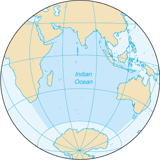
Indian Ocean (Small Map) 2008 (12K)
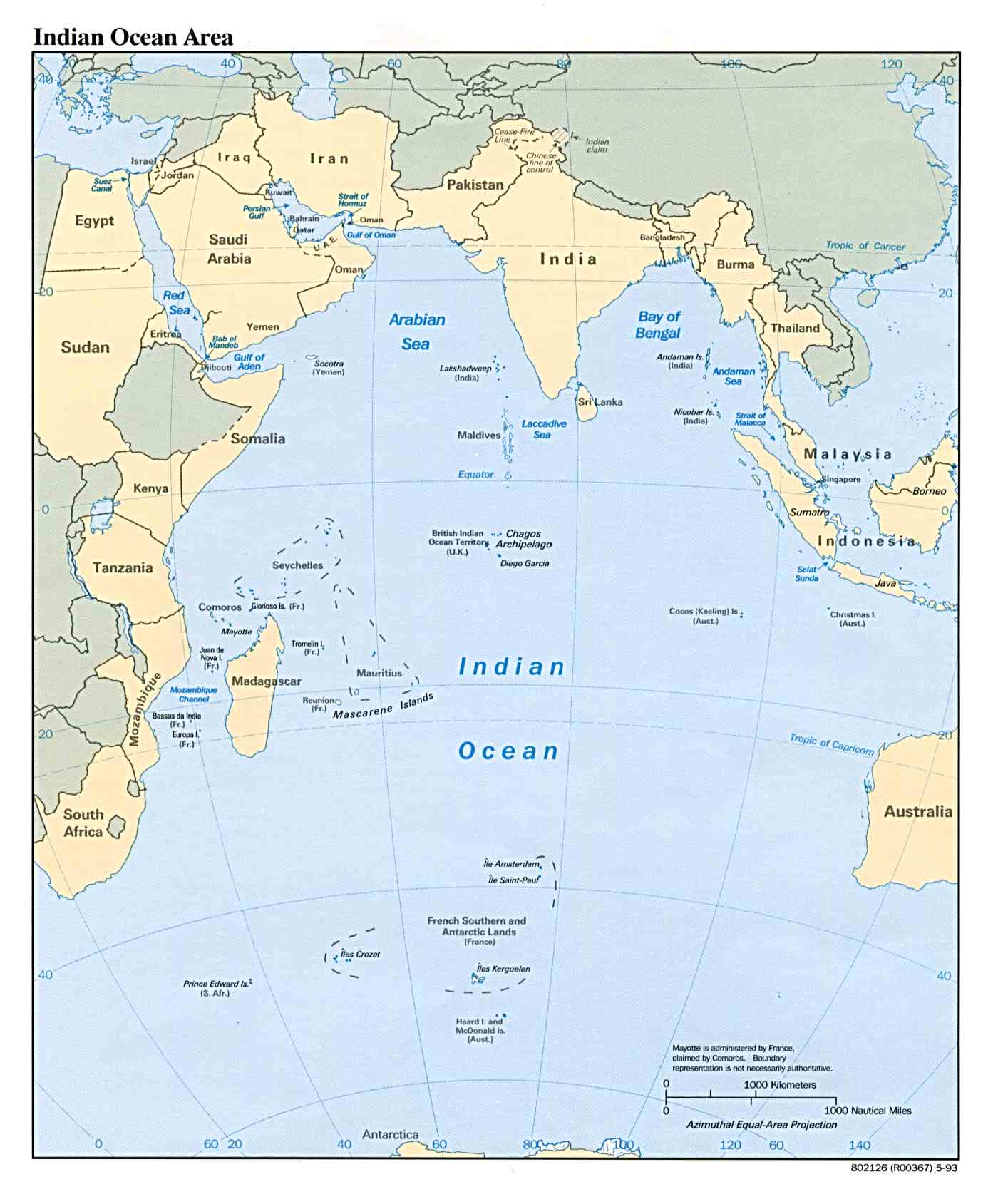
Indian Ocean Area (Political) 1993 (142K) and pdf format (147K)
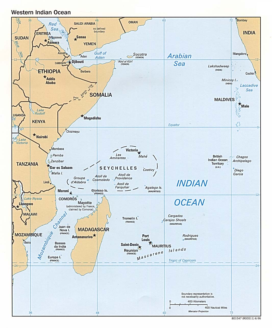
Indian Ocean - West (Political) 1996 (193K) and pdf format (200K)
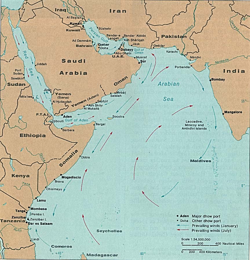
Indian Ocean - Dhow Ports 1976 (167K)
Amsterdam Island and Saint-Paul Island (France) 1976 (141K)
Andaman and Nicobar Islands (Union Territory of India) 1976 (315K)
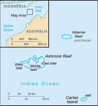
Ashmore and Cartier Islands (Small Map) 2008 (8K)
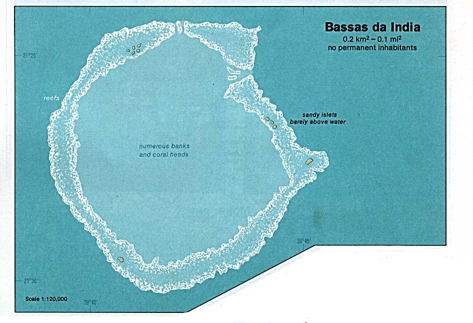
Bassas da India (France) 1976 (116K)
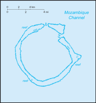
Bassas da India (France) (Small Map) 2006 (6K)
British Indian Ocean Territory (Small Map) 2008 (6K)
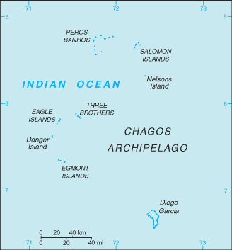
British Indian Ocean Territory - Diego Garcia (British Indian Ocean Territory) 1980 (254K)
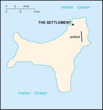
Christmas Island (Australia) 1976 (129K)
Christmas Island (Australia) (Small Map) 2008 (5K)
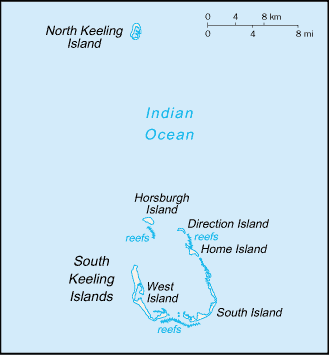
Cocos (Keeling) Islands (Australia) 1976 (142K)
Cocos (Keeling) Islands (Australia) (Small Map) 2008 (6K)
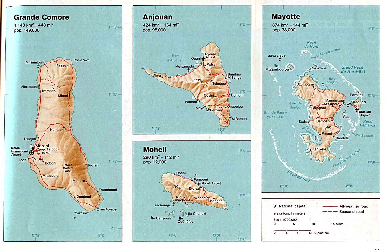
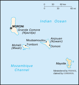
Comoros (Political) 1991 (212K)
Comoros (Shaded Relief) 1987 (123K)
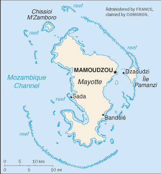
Comoros (Grande Comore, Anjouan, Moheli, Mayotte) 1976 (198K)
Comoros (Small Map) 2008 (7K)
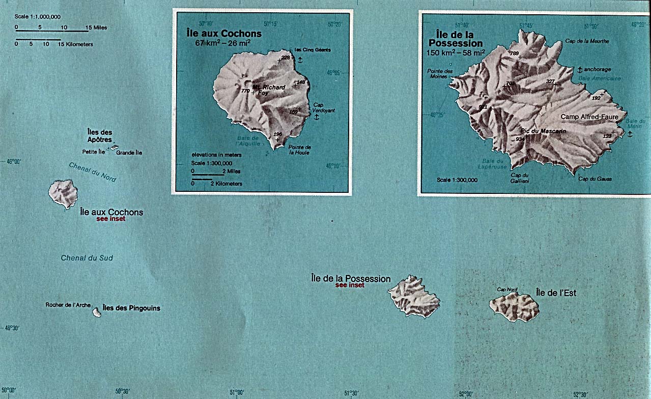
Crozet Islands (France) 1976 (206K)
Diego Garcia (British Indian Ocean Territory) (Political) 1980 (254K)
Diego Garcia (British Indian Ocean Territory) (Small Map) 2008 (6K)
Europa Island (France) 1976 (64K)
Europa Island (France) (Small Map) 2006 (10K)
French Southern and Antarctic Lands (Small Map) 2008 (4K)
French Southern and Antarctic Lands - Amsterdam Island and Saint-Paul Island 1976 (141K)
French Southern and Antarctic Lands - Crozet Islands 1976 (206K)
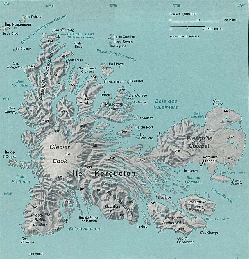
French Southern and Antarctic Lands - Kerguelen Islands 1976 (171K)
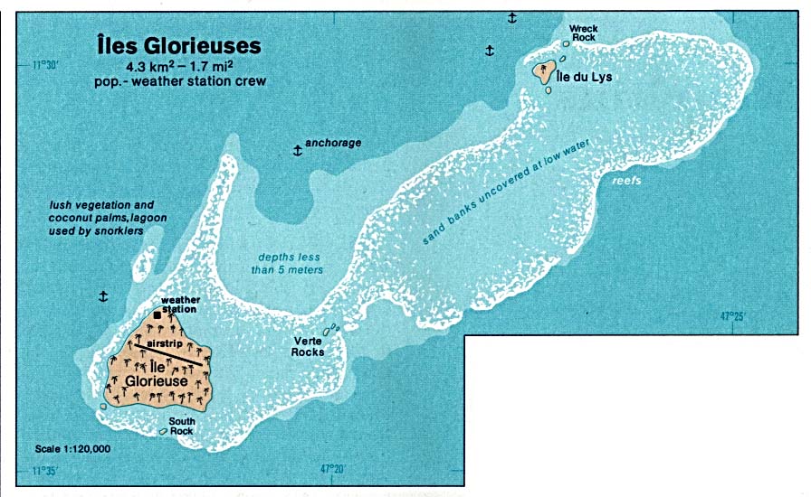
Glorioso Islands (Iles Glorieuses) (France) 1976 (103K)
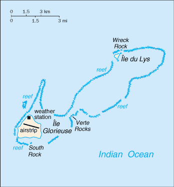
Glorioso Islands (Iles Glorieuses) (France) (Small Map) 2006 (7K)
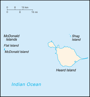
Heard Island and McDonald Islands (Australia) 1976 (64K)
Heard Island and McDonald Islands (Australia) (Small Map) 2008 (5K)
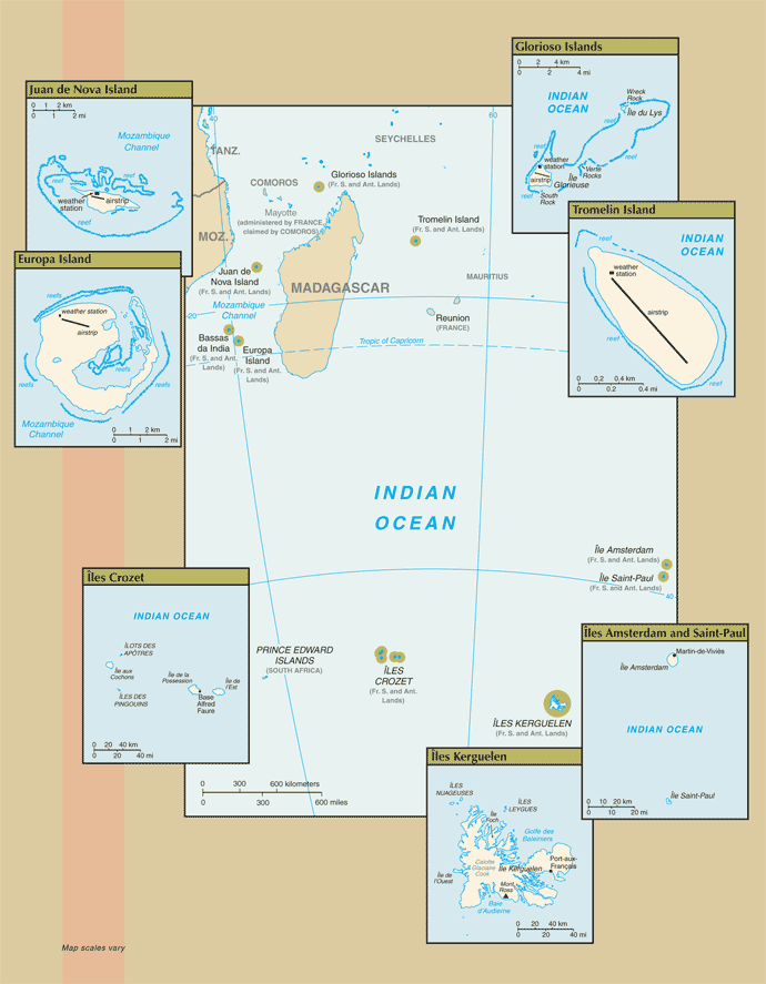
Iles Eparses (France) (Small Map) 2007 (35K) [Bassas da India, Europa Island, Gloriso Islands, Juan de Nova Island, Tromelin Island]
Jaza'ir Khuriya Muriya (Sultanate of Oman) 1976 (32K)
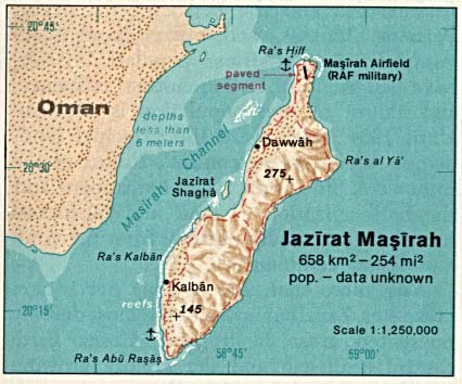
Jazirat Masirah (Sultanate of Oman) 1976 (38K)
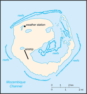
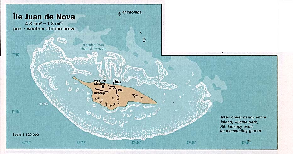
Juan de Nova Island (France) 1976 (80K)
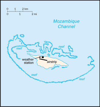
Juan de Nova Island (France) (Small Map) 2006 (7K)
Kerguelen Islands (France) 1976 (171K)
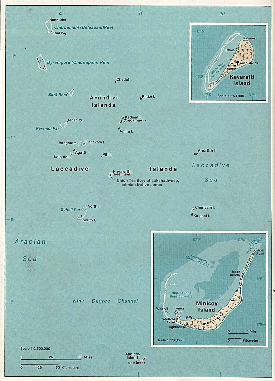
Laccadive, Minicoy and Amindivi Islands (Lakshadweep - Union Territories of the Republic Of India) 1976 (171K)
Mayotte (Small Map) 2008 (17K)
McDonald Islands - Heard Island and McDonald Islands (Australia) (Small Map) 2008 (5K)
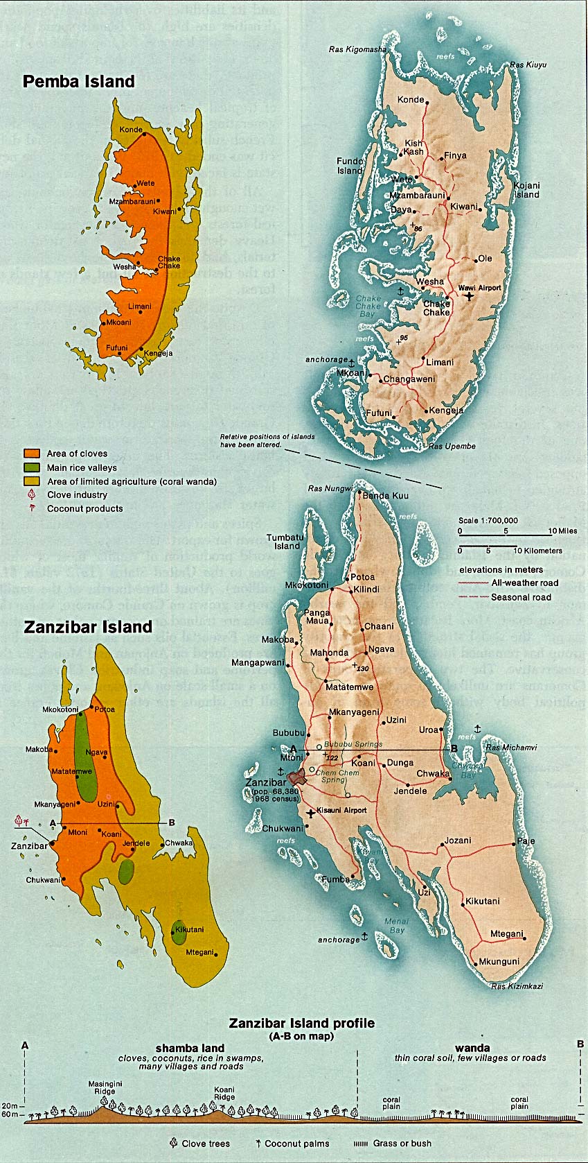
Pemba and Zanzibar Islands (Tanzania) 1976 (322K)
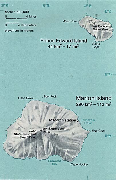
Prince Edward Island (South Africa) 1976 (45K)
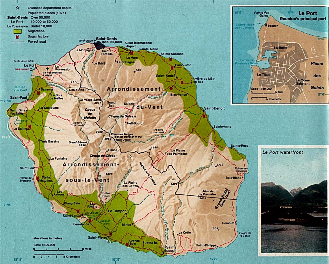
Reunion (French Overseas Department) 1976 (309K)
Reunion (Small Map) 2006 (6K)
Saint-Paul Island and Amsterdam Island (France) 1976 (141K)
Socotra (Peoples Democratic Republic Of Yemen) 1976 (101K)
Tromelin Island (France) 1976 (29K)
Tromelin Island (France) (Small Map) 2006 (7K)
Zanzibar and Pemba Islands (Tanzania) 1976 (322K)
Sources: These maps were provided by the University of Texas Library and/or
the U.S. Central Intelligence Agency (CIA) unless otherwise noted.
Sponsors
Maps on other websites
Indian Ocean (HRW World Atlas)
Indian Ocean Region - Coral Reef Maps (NOAA)
<-- Free Map Downloads
<-- Free World Country Map Downloads
Didn't find what you are looking for? We've been online since 1996 and have created 1000's of pages. Search below and you may find just what you are looking for.
Michael R. Meuser
Data Research & GIS Specialist
MapCruzin.com is an independent firm
specializing in GIS project development and data research.
We created the first U.S. based
interactive toxic chemical facility
maps on the internet in 1996 and we
have been online ever since. Learn more about us and our services.
Have a project in mind? If you have data, GIS project or custom shapefile needs contact Mike.
Contact Us
Report Broken Links
Subscribe for Updates


_76.jpg)