Download Free Indonesia Maps
<-- Free Map Downloads
<-- Free World Country Map Downloads
Sponsors
Note that maps may not appear on the webpage in their full size and resolution. To save the maps to your computer, right-click on the link.
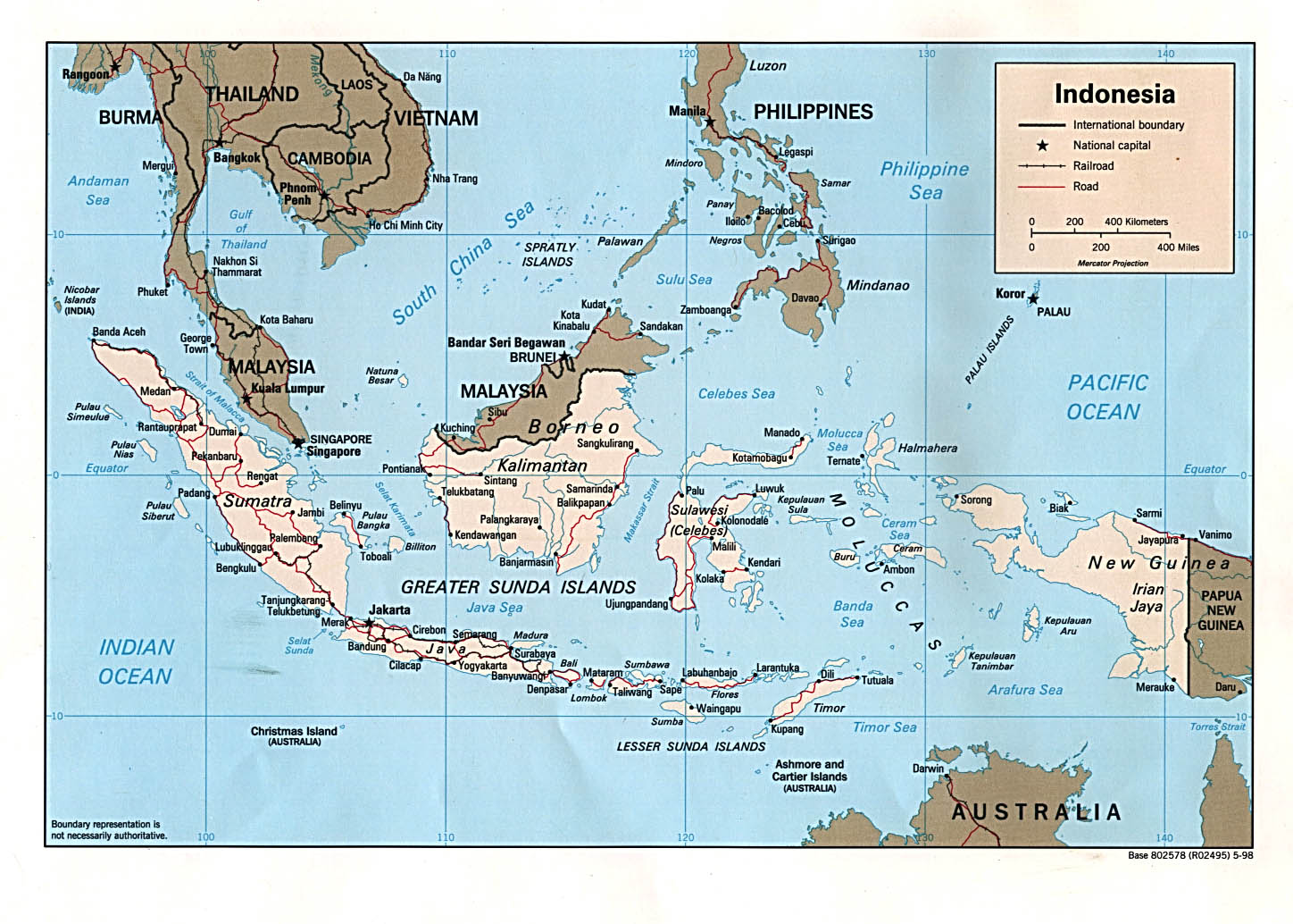
Indonesia (Political) U.S. Central Intelligence Agency 2002 (243K) and
pdf format (241K)
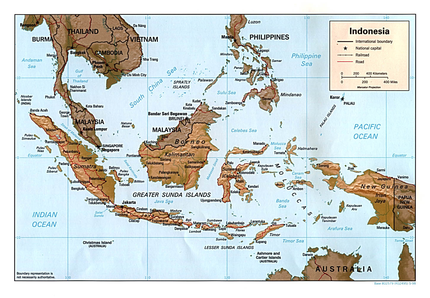
Indonesia (Political) U.S. Central Intelligence Agency 1998 (269K) and pdf format (278K)
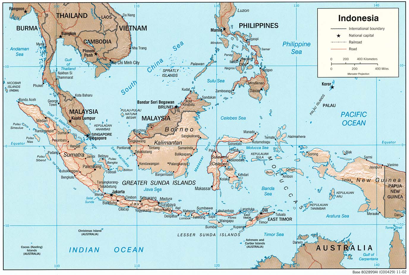
Indonesia (Shaded Relief) U.S. Central Intelligence Agency 2002 (234K) and
pdf format (232K)
Indonesia (Shaded Relief) U.S. Central Intelligence Agency 1998 (274K) and pdf format (283K)
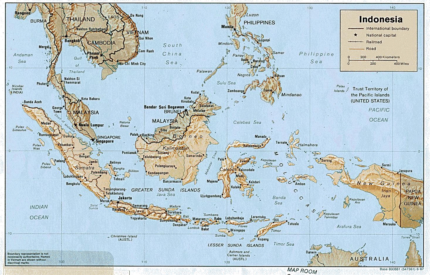
Indonesia (Shaded Relief) U.S. Central Intelligence Agency 1987 (776K) and pdf format (750K)
Indonesia (Small Map) U.S. Central Intelligence Agency 2008 (30K)
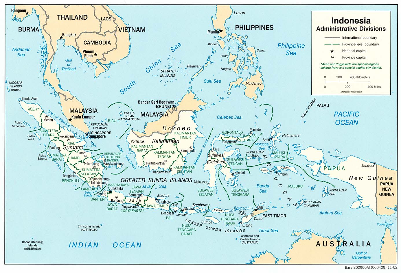
Indonesia: Administrative Divisions (Political) U.S. Central Intelligence Agency 2002 (220K)and pdf format (228K)
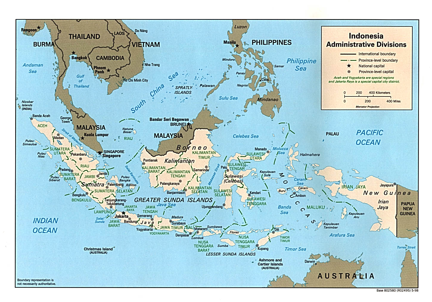
Indonesia: Administrative Divisions (Political) U.S. Central Intelligence Agency 1998 (387K) and pdf format (282K)
Indonesia: Administrative Divisions (Political) U.S. Central Intelligence Agency 1983 (257K) and pdf format (260K)
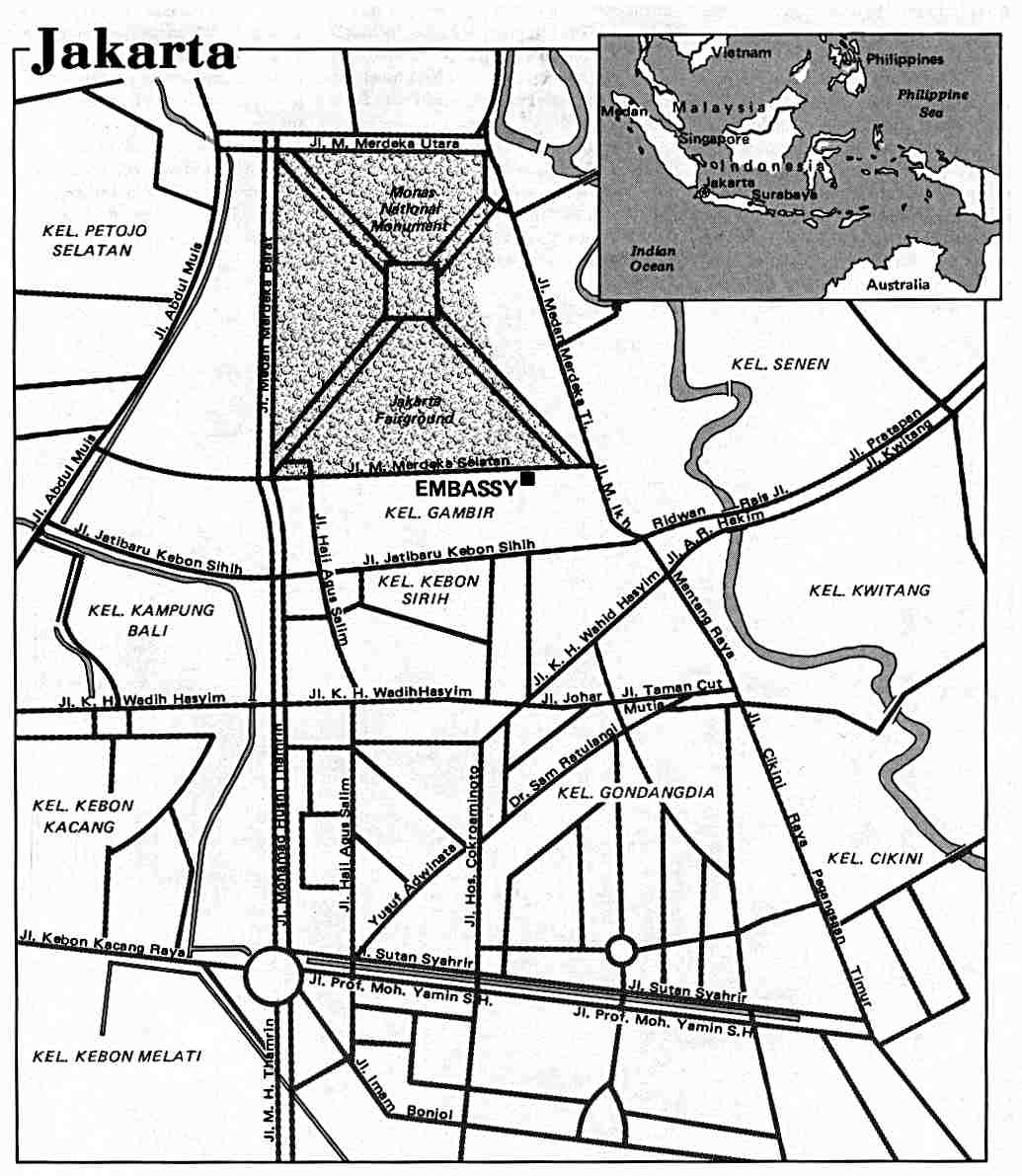
Jakarta U.S. Department of State 1986 (105K)
Medan U.S. Department of State 1981 (96K)
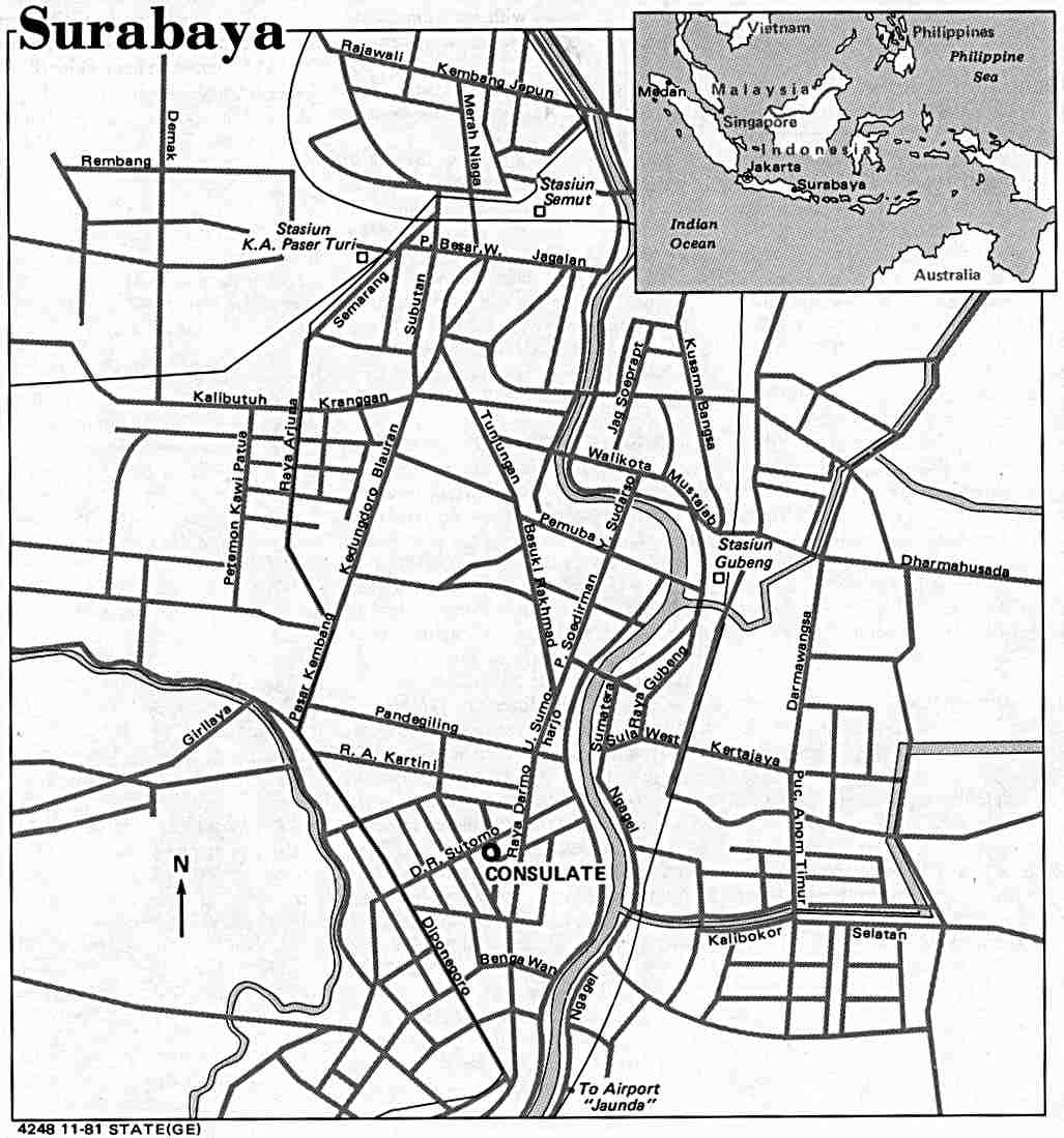
Surabaya U.S. Department of State 1981 (94K)
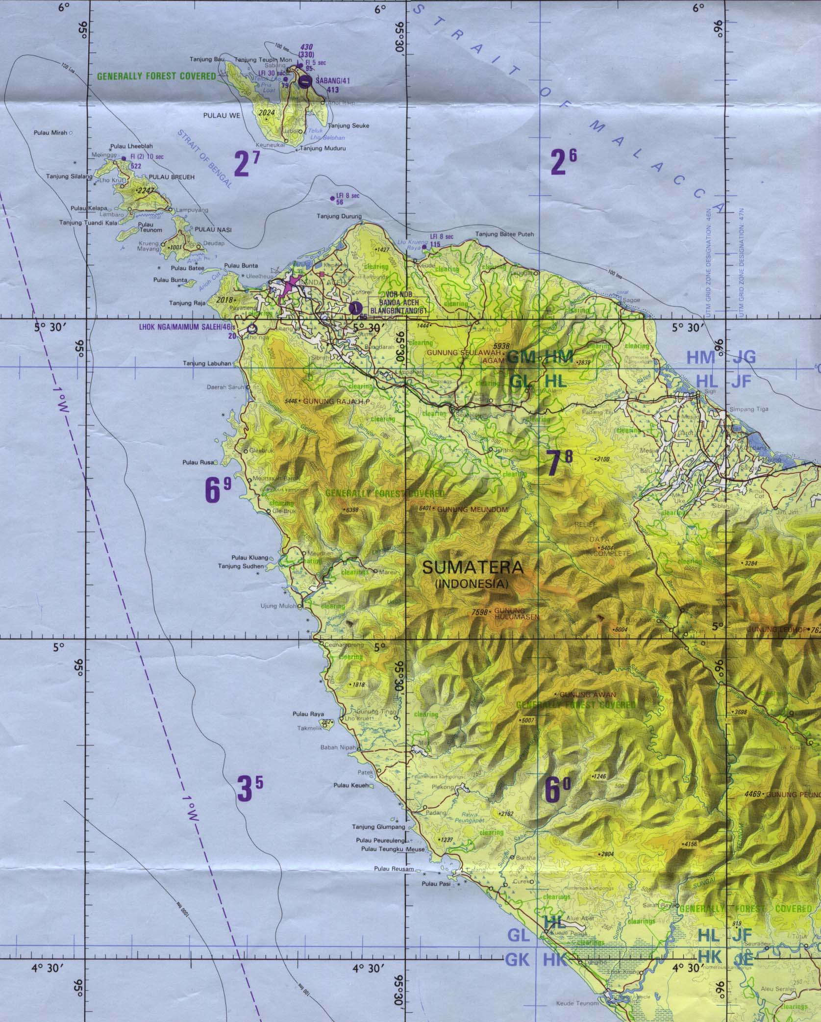
Aceh Region (Tactical Pilotage Chart) original scale 1:500,000. Portion of Defense Mapping Agency TPC L-9B 1990 (419K) Not for navigational use
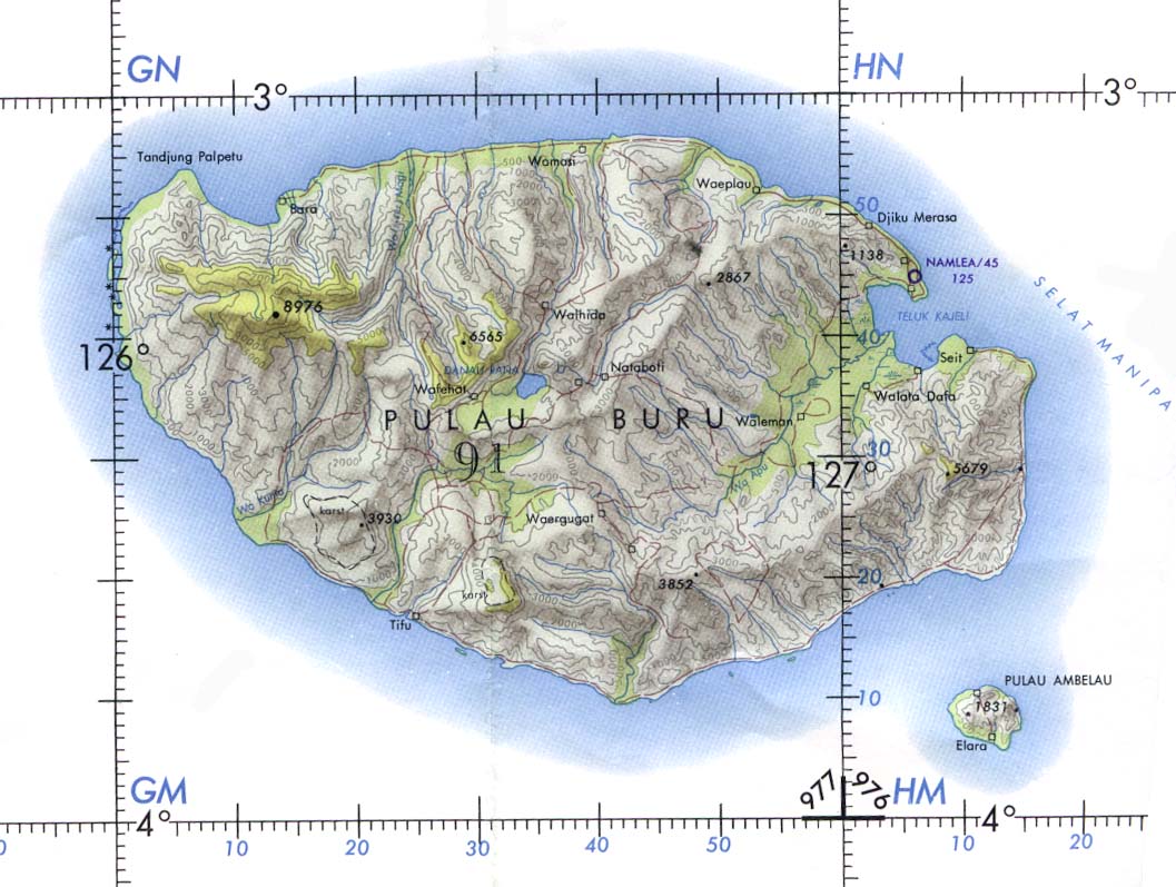
Buru Island (Operational Navigation Chart) original scale 1:1,000,000. Portion of Defense Mapping Agency ONC M-12 1967 (152K) Not for navigational use
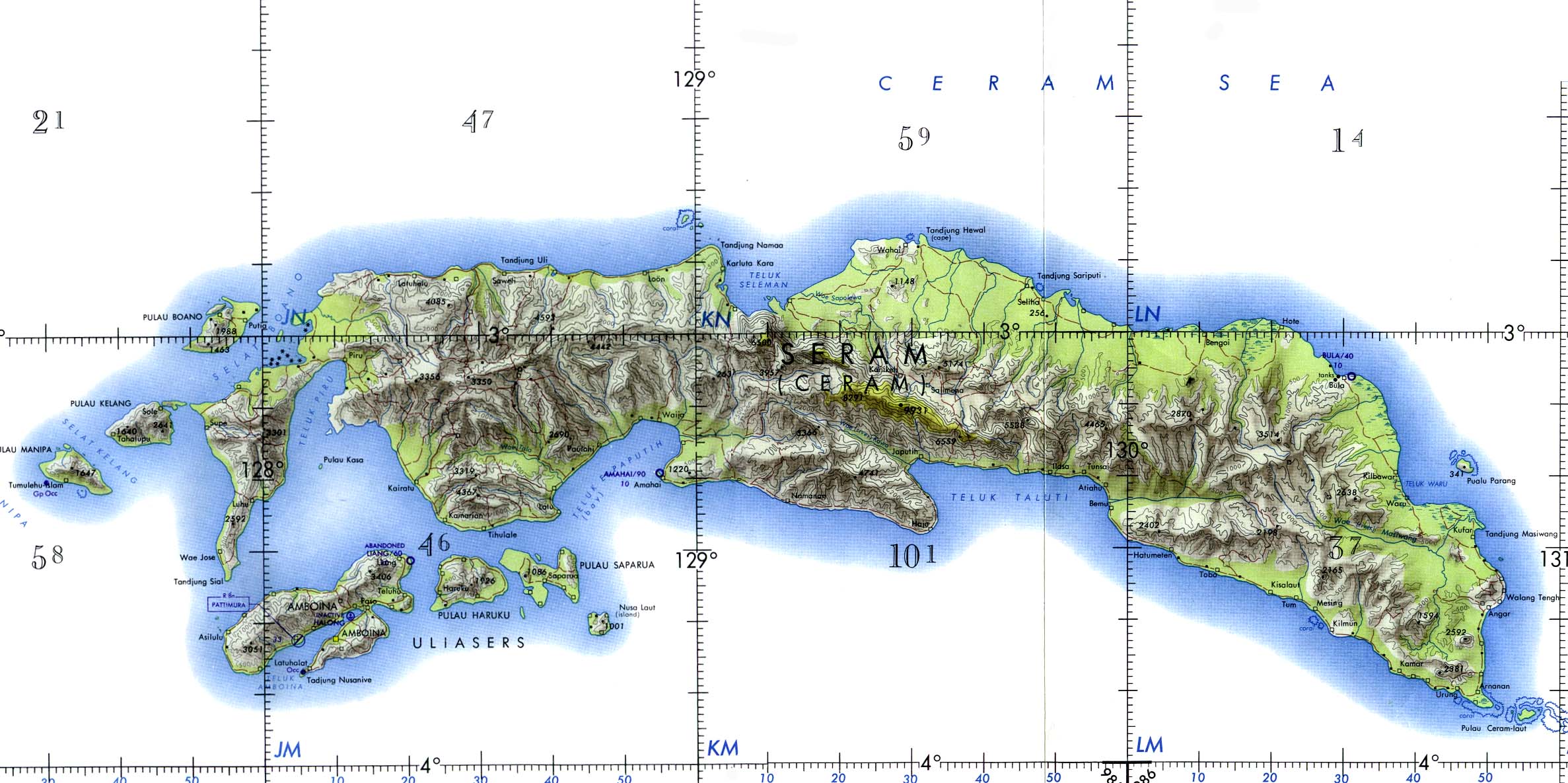
Ceram and Ambon Islands (Operational Navigation Chart) original scale 1:1,000,000. Portion of Defense Mapping Agency ONC M-12 1967 (372K) Not for navigational use
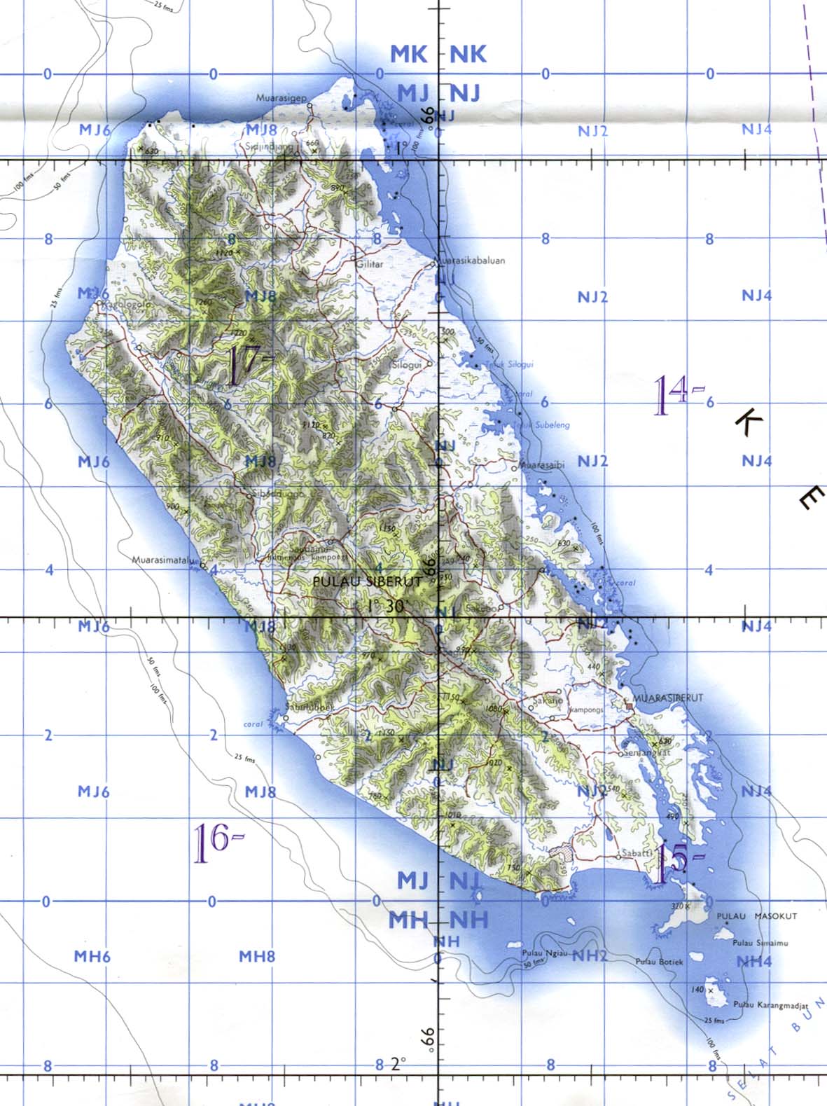
Siberut Island (Tactical Pilotage Chart) original scale 1:500,000. Portion of Defense Mapping Agency TPC M-10A 1970 (224K) Not for navigational use
South Central Kalimantan: Palangkaraja, Sampit, Semuda (Tactical Pilotage Chart) original scale 1:500,000. Portion of Defense Mapping Agency TPC M-11A 1974 (718K) Not for navigational use
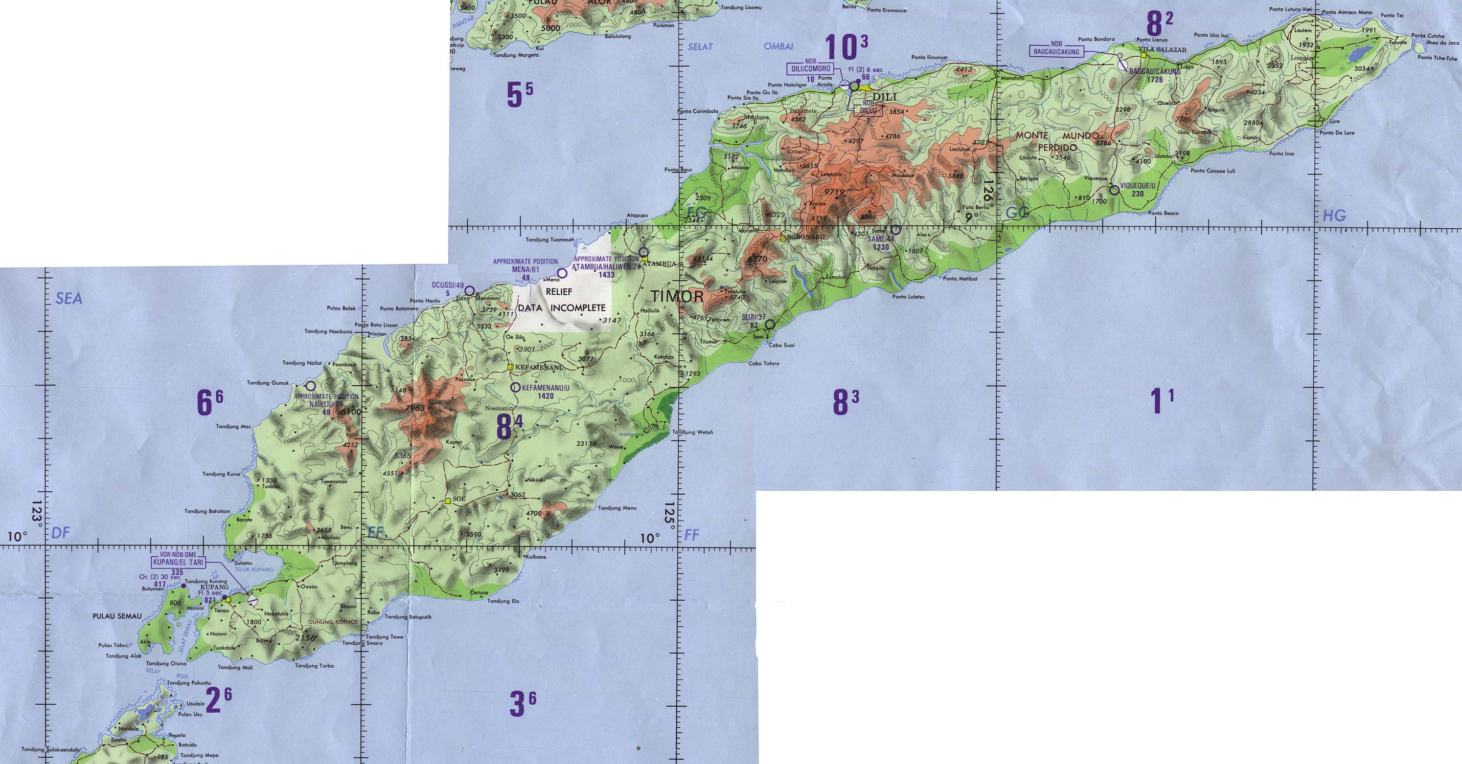
Timor (Operational Navigation Chart) original scale 1:1,000,000. Portion of Defense Mapping Agency ONC N-13 1989 (500K) Not for navigational use
[Ambon, Netherlands East Indies] Tan Toey Prisoners of War Camp 1943 "Sketch Map of Tan Toey Prisoners of War Camp, Amboina Island, Former camp of the Australian troops, built by the Netherlanders,
now used by the Japanese as a prisoner-of-war camp..." from Allied Geographical Section, Southwest Pacific Area. Area Study of Ambon Island, Terrain Study No. 45, Map 13 dated March 13, 1943. (429K)
Batavia [Jakarta] 1897
From Guide to the Dutch East Indies by Dr. J.F. van Bemmelen and G.B. Hoover, Luzac & Co, London 1897. (516K)
Jakarta [Djakarta] Region original scale 1:250,000 Army Map Service, Corps of Engineers. Portion of SB 48-12 1958 (1 MB)
Nederlandisch-Indie [Netherlands Indies] circa 1893
"Kaart van Nederlandisch-Indie naar oorspronkelijke teekening van H. Ph. Th. Witkamp", J.H. deBussy, Amsterdam, ca. 1893. Original scale of main map 1:5,000,000 (3.3 MB)
Soerabaja [Surabaya] 1897
From Guide to the Dutch East Indies by Dr. J.F. van Bemmelen and G.B. Hoover, Luzac & Co, London 1897. (452K)
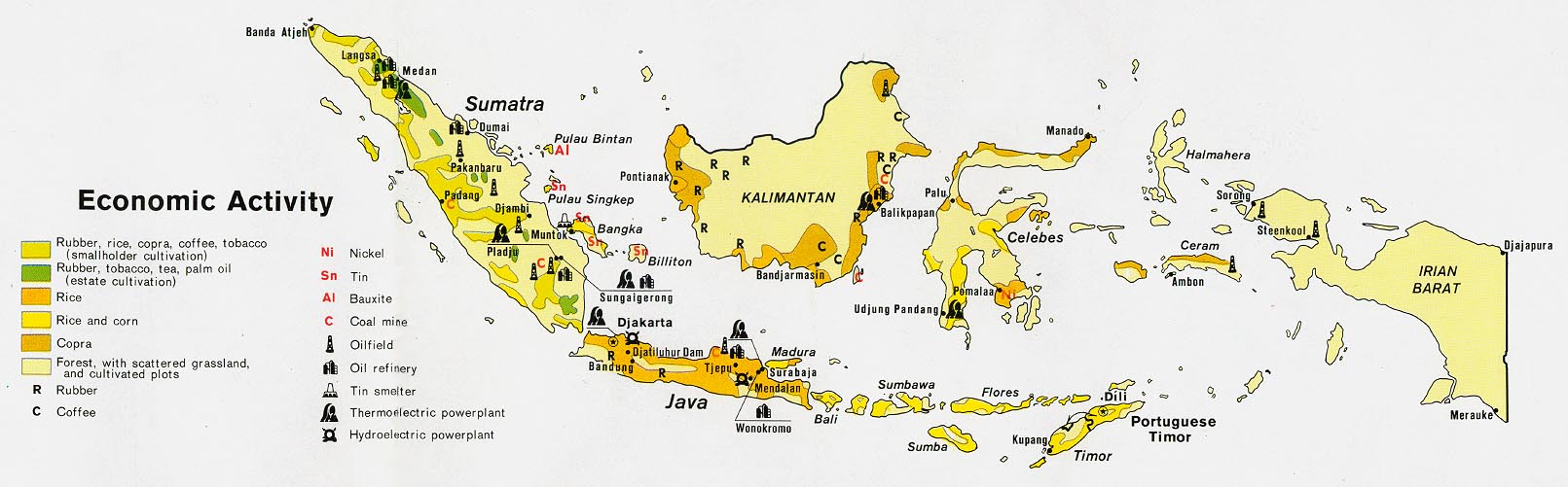
Indonesia - Economic Activity from Map No. 500869 1972 (149K)
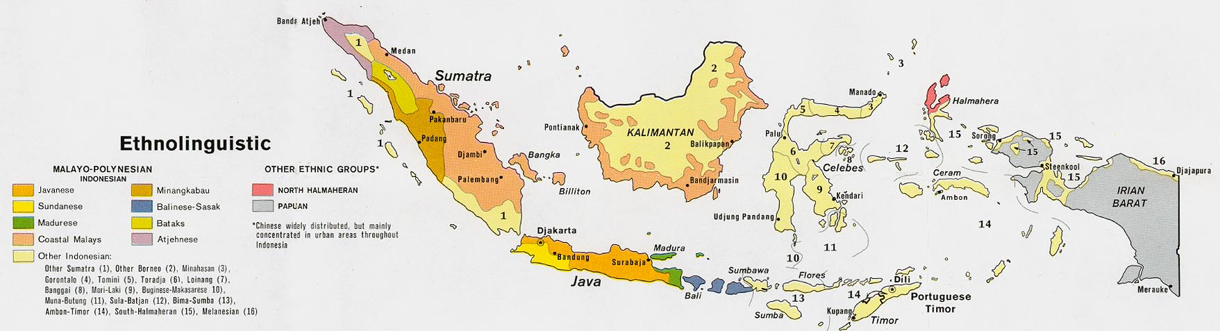
Indonesia - Ethnolinguistic from Map No. 500869 1972 (144K)
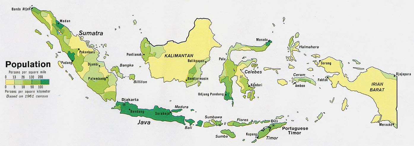
Indonesia - Population from Map No. 500869 1972 (111K)
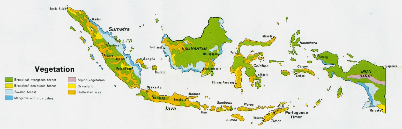
Indonesia - Vegetation from Map No. 500869 1972 (112K)
Sources: These maps were provided by the University of Texas Library and/or
the U.S. Central Intelligence Agency (CIA) unless otherwise noted.
Maps on other websites
Indonesia (Lonely Planet)
Indonesia - Maps (UNOSAT)
<-- Free Map Downloads
<-- Free World Country Map Downloads
Didn't find what you are looking for? We've been online since 1996 and have created 1000's of pages. Search below and you may find just what you are looking for.
Michael R. Meuser
Data Research & GIS Specialist
MapCruzin.com is an independent firm
specializing in GIS project development and data research.
We created the first U.S. based
interactive toxic chemical facility
maps on the internet in 1996 and we
have been online ever since. Learn more about us and our services.
Have a project in mind? If you have data, GIS project or custom shapefile needs contact Mike.
Contact Us
Report Broken Links
Subscribe for Updates
Sponsors


![[Ambon, Netherlands East Indies] Tan Toey Prisoners of War Camp 1943](/free-maps-indonesia/ambon_1943.jpg)
![Batavia [Jakarta] 1897](/free-maps-indonesia/batavia_1897.jpg)
![Jakarta [Djakarta] Region](/free-maps-indonesia/djakarta_58.jpg)
![Nederlandisch-Indie [Netherlands Indies] circa 1893](/free-maps-indonesia/nederlandsch_indie_1893.jpg)
![Soerabaja [Surabaya] 1897](/free-maps-indonesia/soerabaja_1897.jpg)