Download Free Iran Maps
<-- Free Map Downloads
<-- Free World Country Map Downloads
Sponsors
Note that maps may not appear on the webpage in their full size and resolution. To save the maps to your computer, right-click on the link.
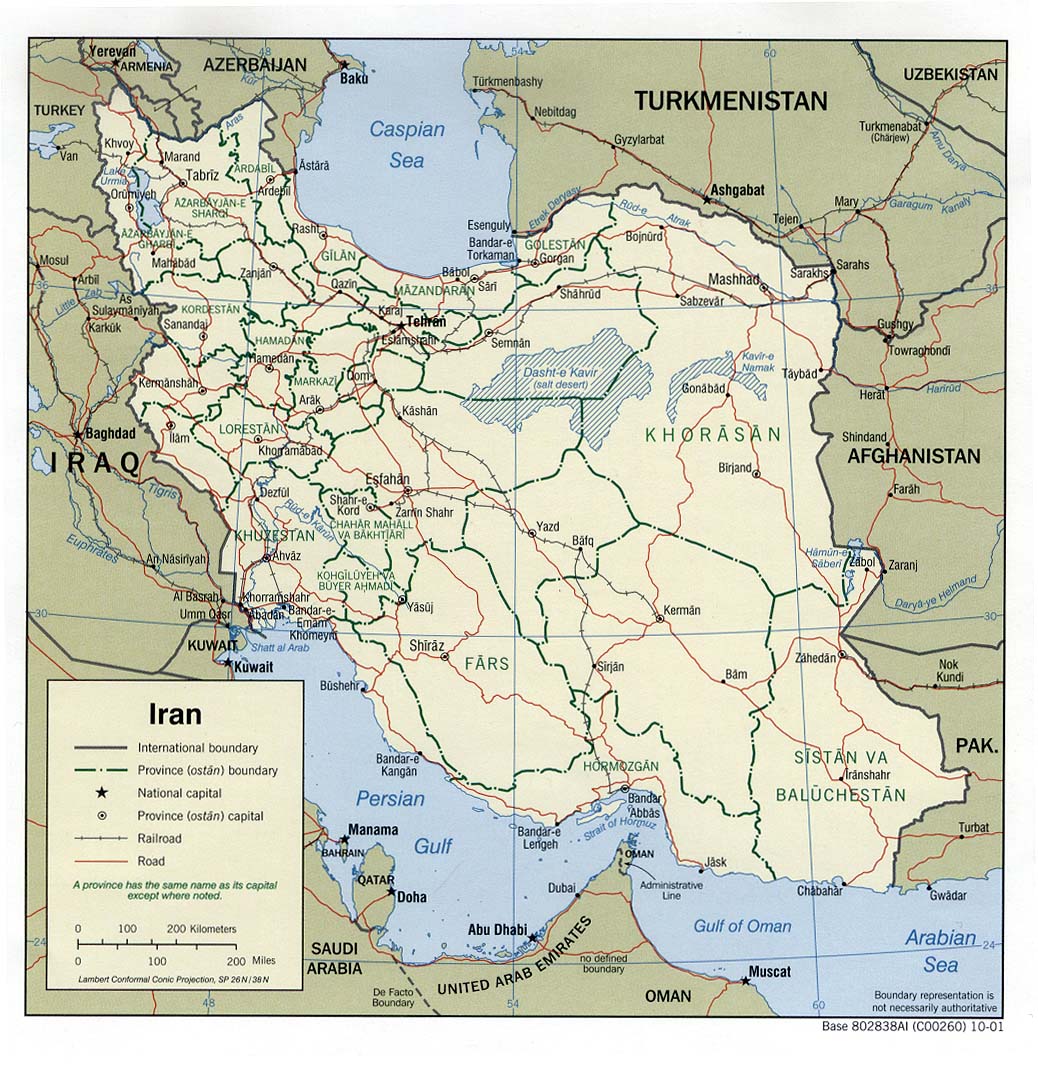
Iran (Political) 2001 (247K) and
pdf format (263K)
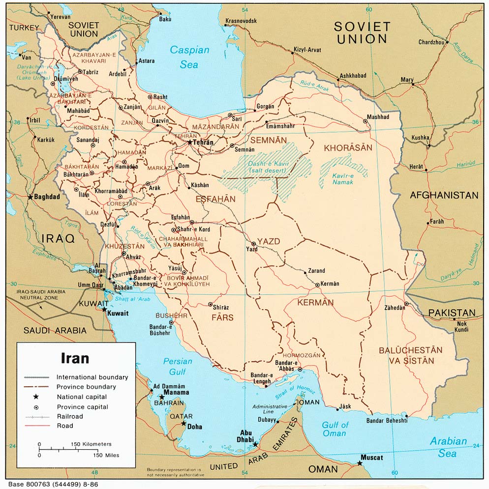
Iran (Political) 1996 (262K) and
pdf format (271K)
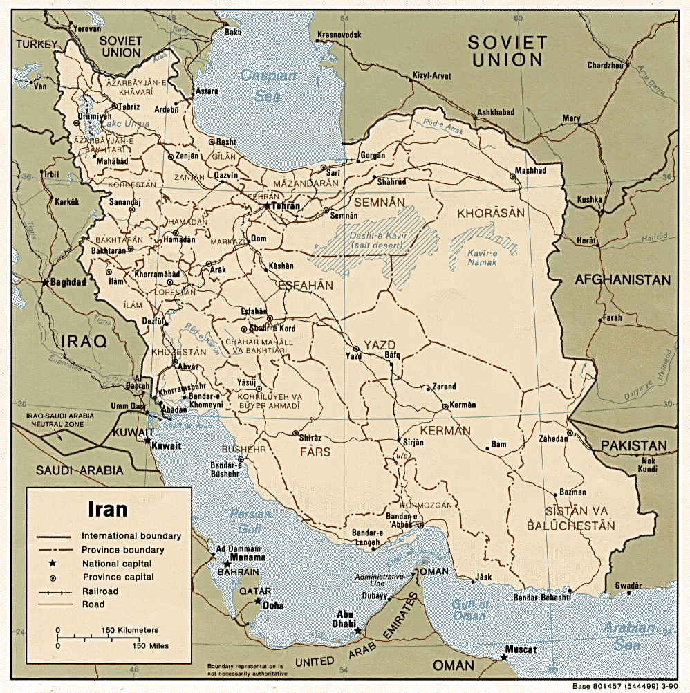
Iran (Political) 1990 (306K) and
pdf format (317K)
Iran (Political) 1986 (228K) and pdf format (236K)
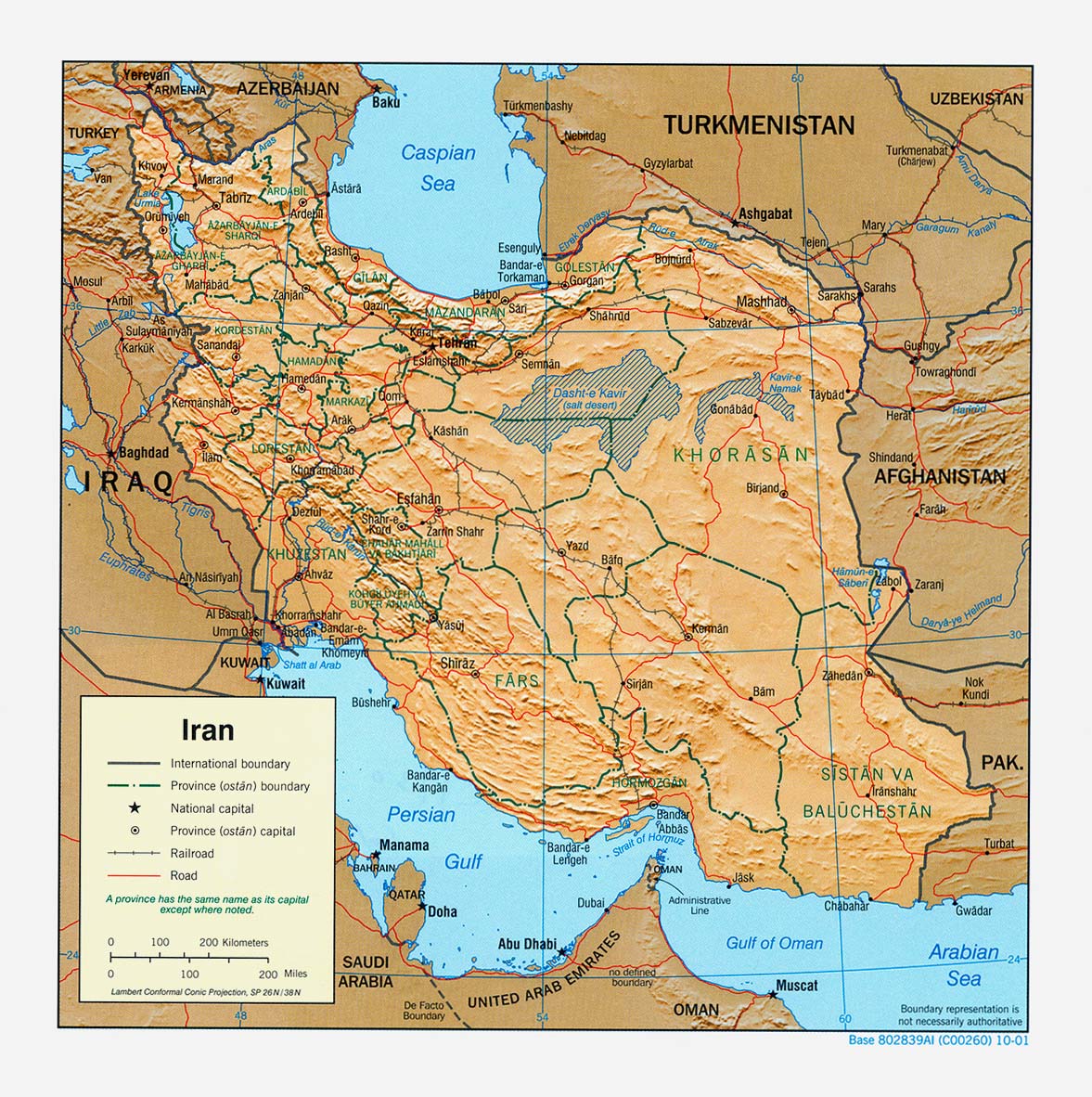
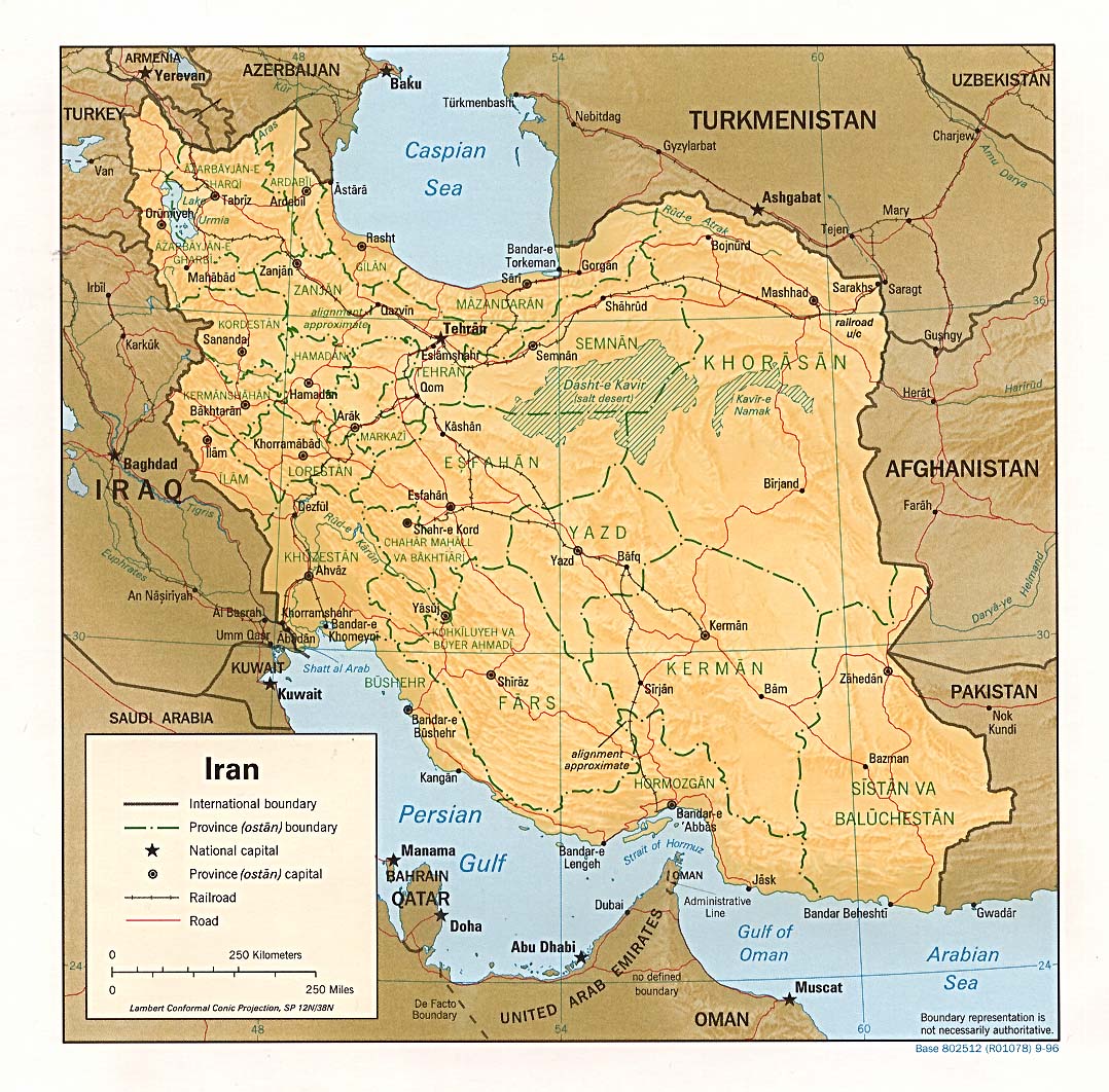
Iran (Shaded Relief) 2001 (321K) and pdf format (294K)
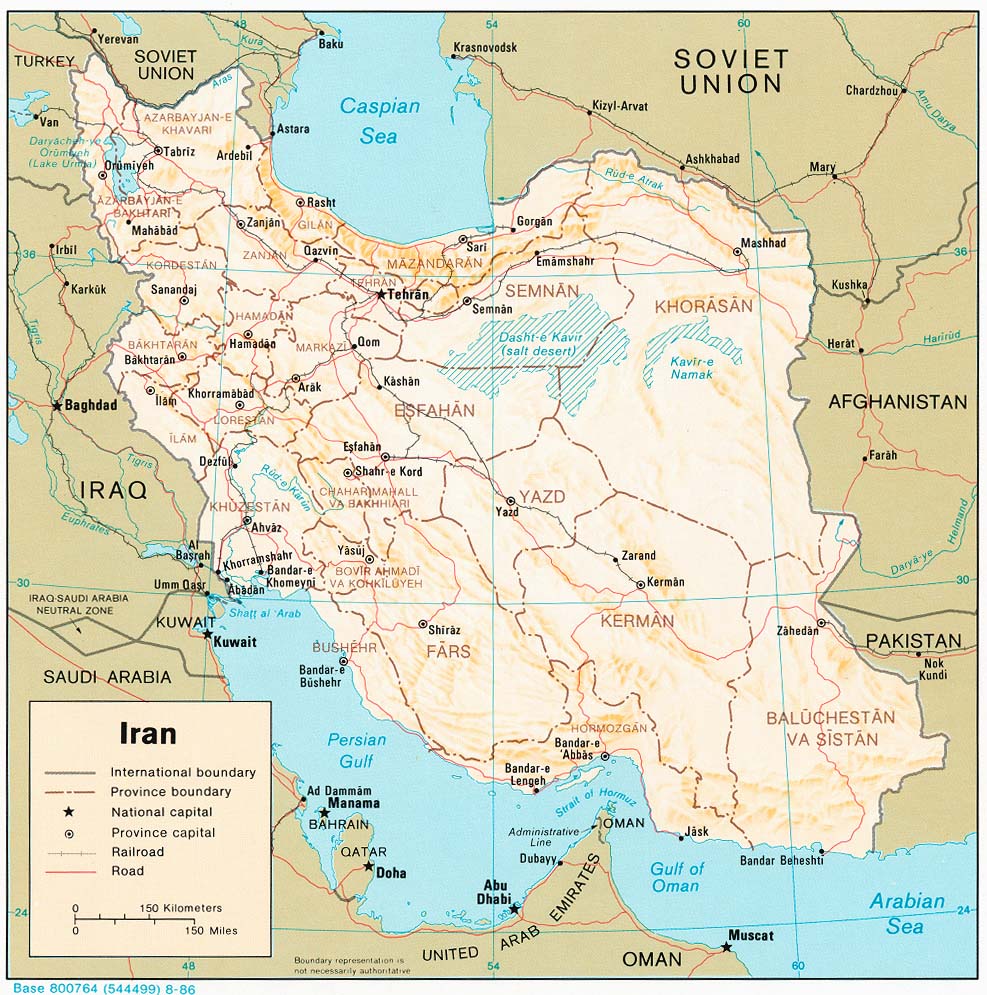
Iran (Shaded Relief) 1996 (312K) and pdf format (292K)
Iran (Shaded Relief) 1990 (277K) and pdf format (283K)
Iran (Shaded Relief) 1986 (235K) and pdf format (246K)
Iran (Shaded Relief) 1982 (239K) and pdf format (247K)
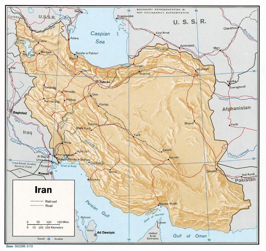
Iran (Shaded Relief) 1973 (398K) and pdf format (410K)
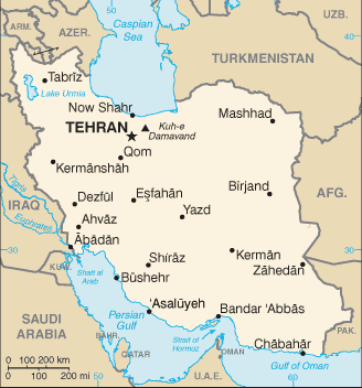
Iran (Small Map) 2008 (17K)
Iran (Wall Map) 2004 "Iran Country Profile" Iran map with insets: Population Density, Ethnoreligious Distribution, Key Petroleum Sector Facilities, Southern Caspian Energy Prospects and Strait Of Hormuz (2.5M)
Mashhad - East (446K) and
Mashhad - West (764K) (topographic maps in Russian) original scale 1:10,000 Portions of Soviet General Staff maps J-40-144 1 and 2 1971
Yazd (topographic map in Russian) original scale 1:25,000 Portion of Soviet General Staff map H-40-1 1978 (1MB)
Iran - Operational Navigation Charts, 1:1,000,000 [Not for Navigational Use] see Index Map
ONC G-4 includes far northwest Iran. Edition 15, 8 January 1997, National Imagery and Mapping Agency (17.1 MB)
ONC G-5 includes most of northern Iran. Edition 11, 4 February 1997, National Imagery and Mapping Agency (18.8 MB)
ONC G-6 includes far northeast Iran. Edition 7, 19 November 1982, Defense Mapping Agency (11.8 MB)
ONC H-6 includes southwest Iran. Edition 4, 21 November 1973, Defense Mapping Agency Aerospace Center (17.2 MB)
ONC H-7 includes southeast Iran. Edition 11, 12 December 1994, Defense Mapping Agency Aerospace Center (17.5 MB)
Persian Gulf Region (Political) 1981 (187K)
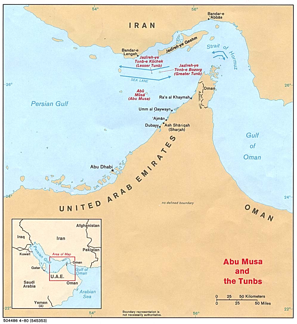
Strait of Hormuz (Political) 1980 (149K)
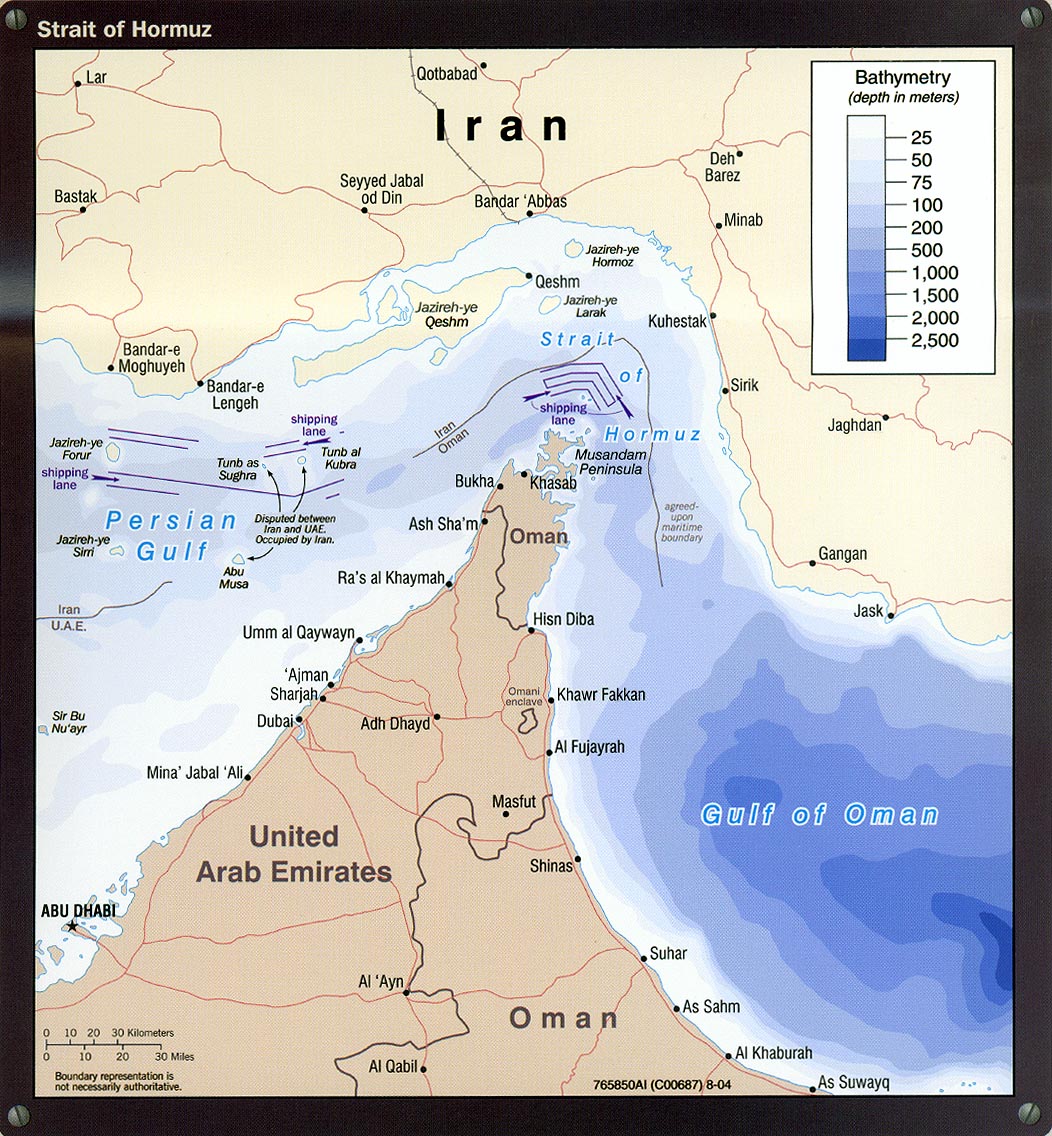
Strait of Hormuz portion of Iran Country Profile 2004 (311K)
Caspian Region Oil Pipelines (633K) April 2002 [pdf format]
[Caspian Region] Oil and Gas Infrastructure in the Caspian Sea Region 2001 (2.5 MB)
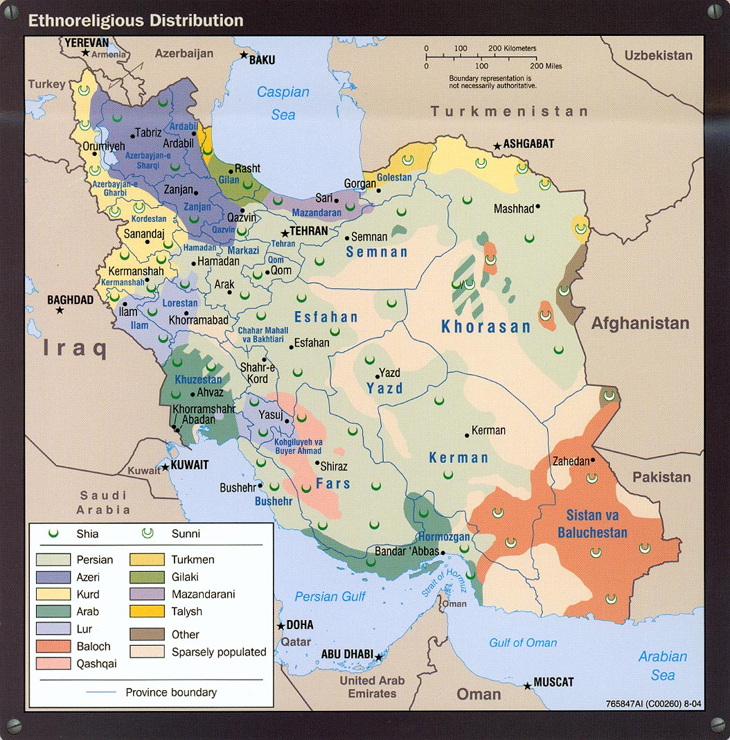
Ethnoreligious Distribution portion of Iran Country Profile 2004 (373K)
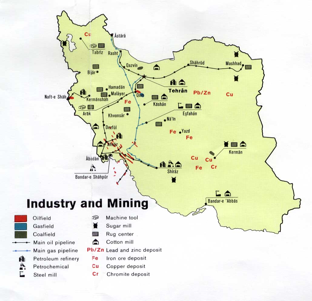
Industry and Mining from U.S. Central Intelligence Agency map of Iran 1978 (108K)
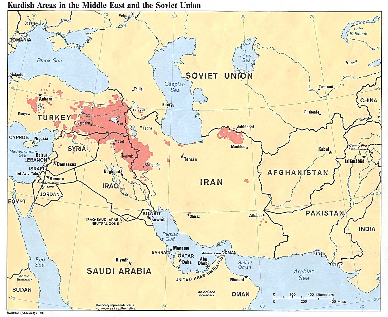
Kurdish Areas in the Middle East and the Soviet Union 1986 (254K)
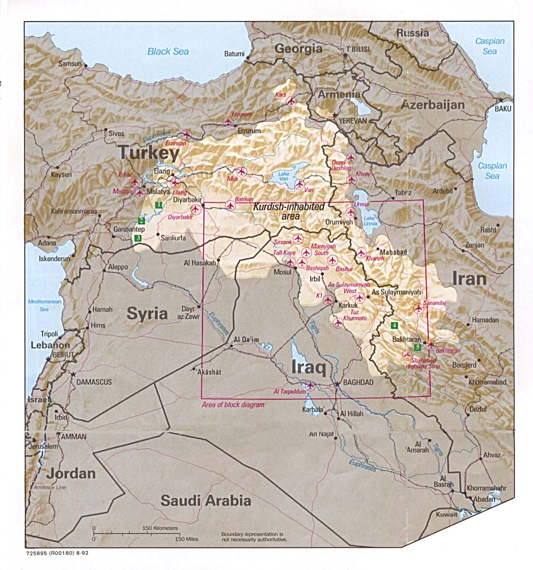
Kurdish Lands (location map) 1992 (235K)
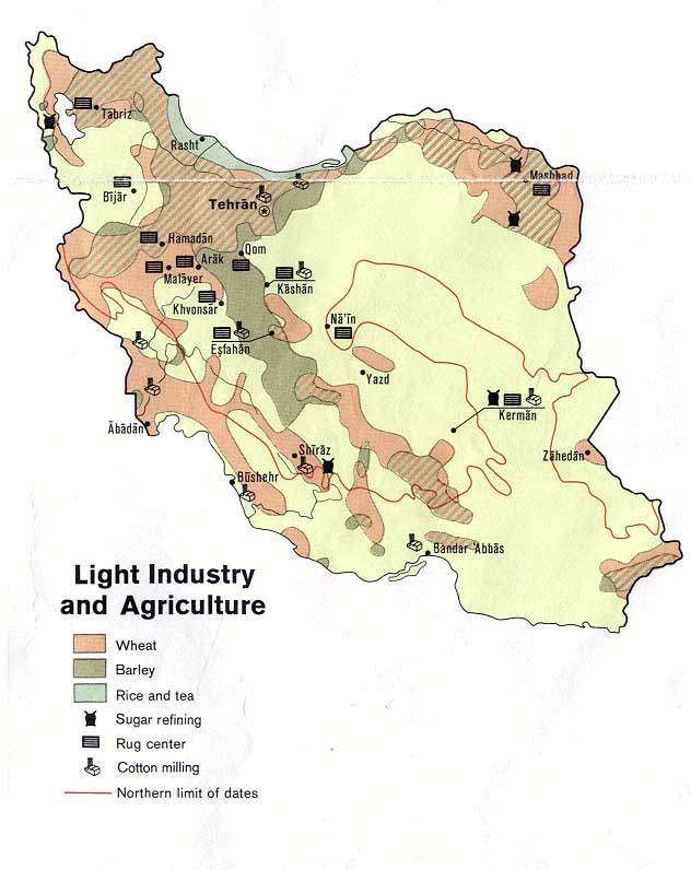
Light Industry and Agriculture from U.S. Central Intelligence Agency map of Iran 1973 (84K)
Major Crops from U.S. Central Intelligence Agency map of Iran 1978 (96K)
Major Muslim Ethnic Groups in Armenia, Iran, and the Islamic Commonwealth States 1992 (203K)
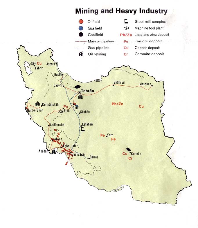
Mining and Heavy Industry from U.S. Central Intelligence Agency map of Iran 1973 (80K)
Peoples of Iran [Ethnolinguistic Groups] 1982 (490K)
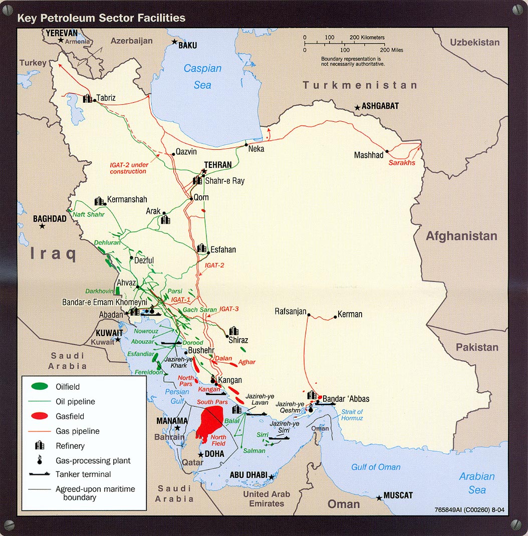
Petroleum - Key Petroleum Sector Facilites portion of Iran Country Profile 2004 (318K)
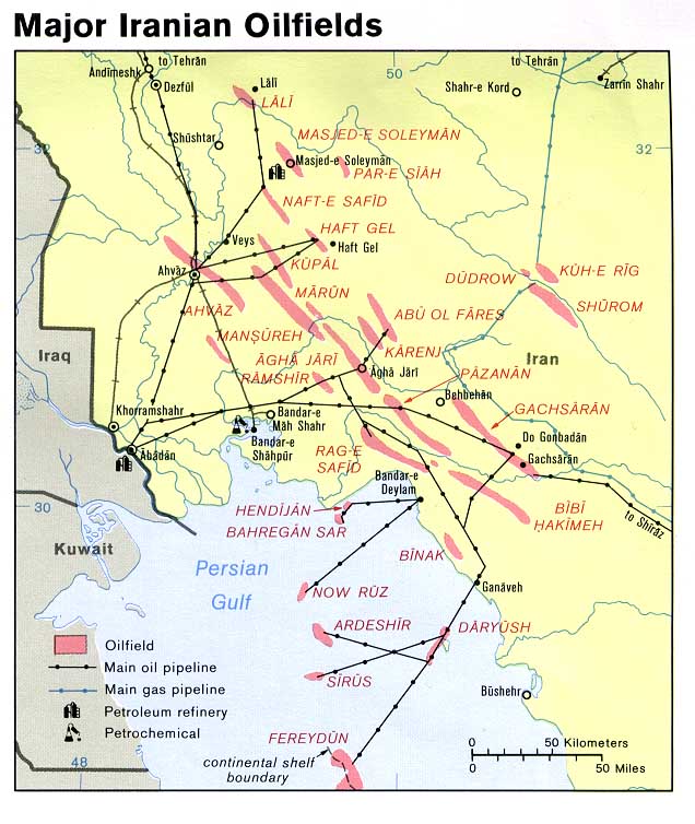
Petroleum - Major Iranian Oilfields from U.S. Central Intelligence Agency map of Iran 1978 (108K)
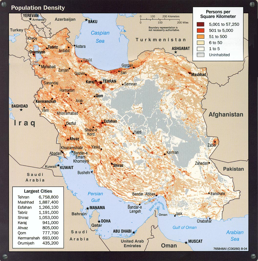
Population Density portion of Iran Country Profile 2004 (413K)
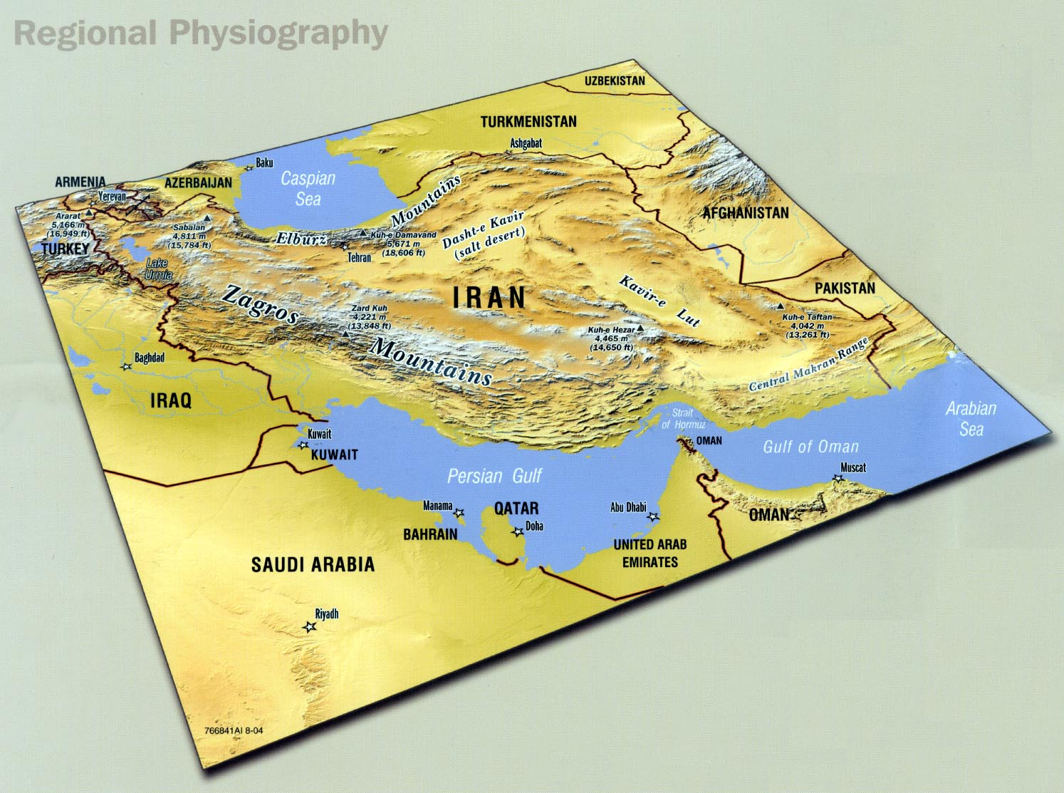
Regional Physiography portion of Iran Country Profile 2004 (285K)
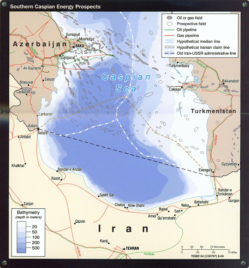
Southern Caspian Energy Prospects portion of Iran Country Profile 2004 (394K)
Strait of Hormuz portion of Iran Country Profile 2004 (311K)
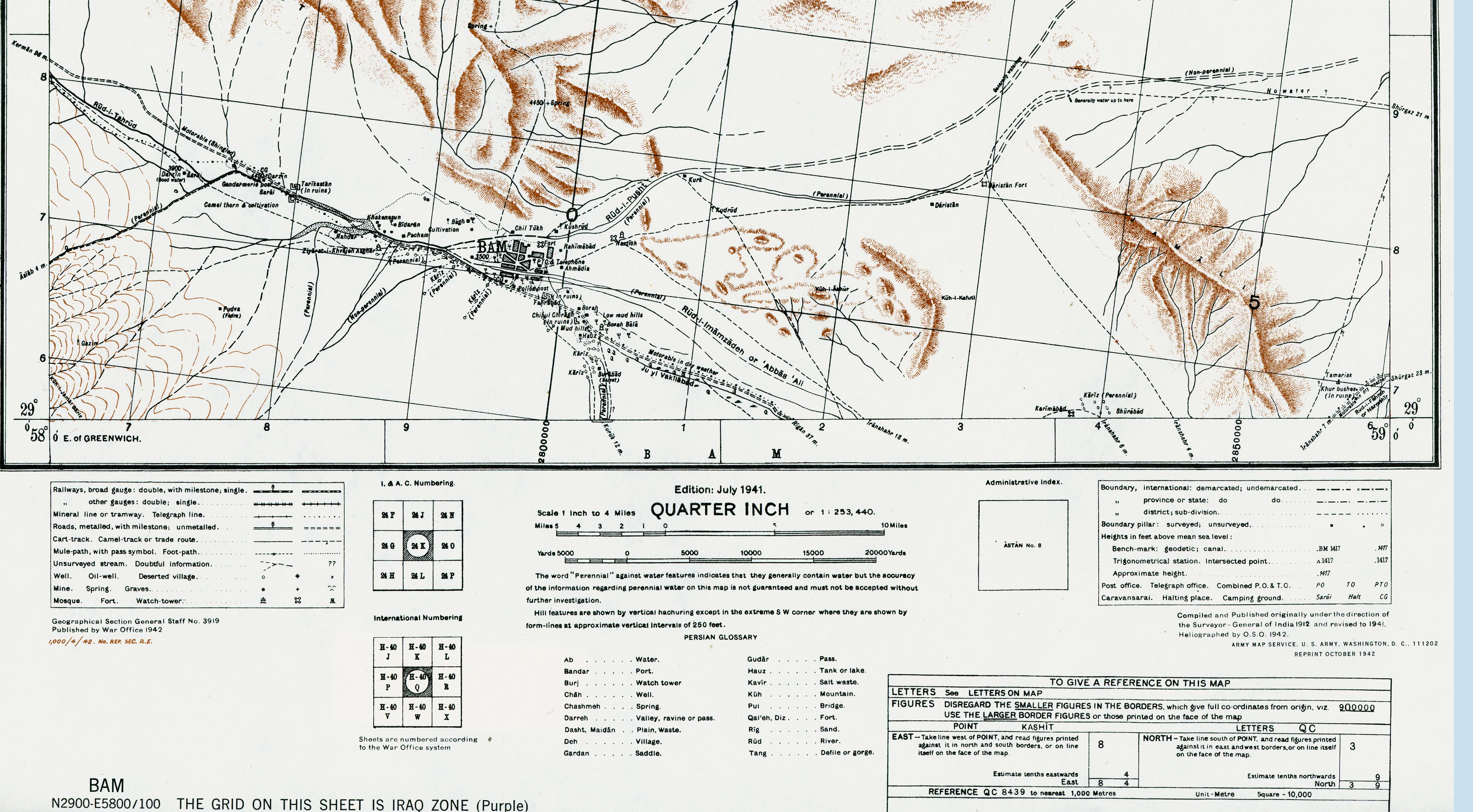
Bam Area (1,520K)
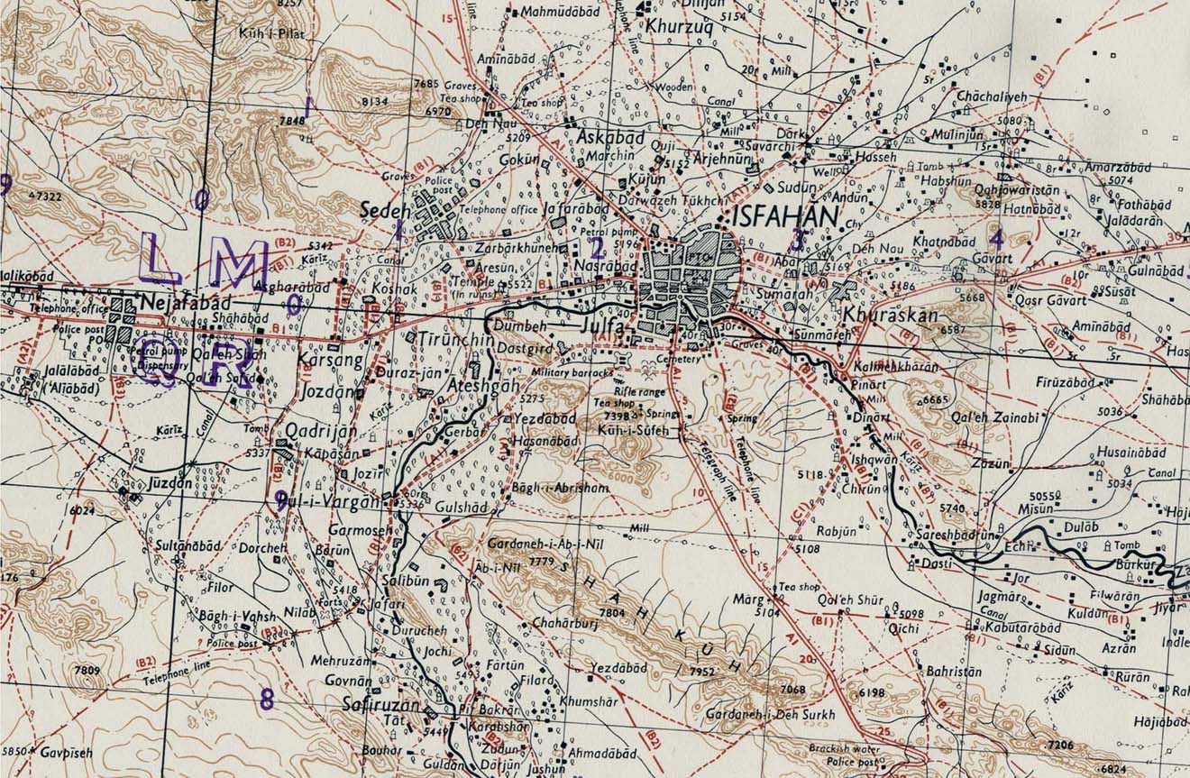
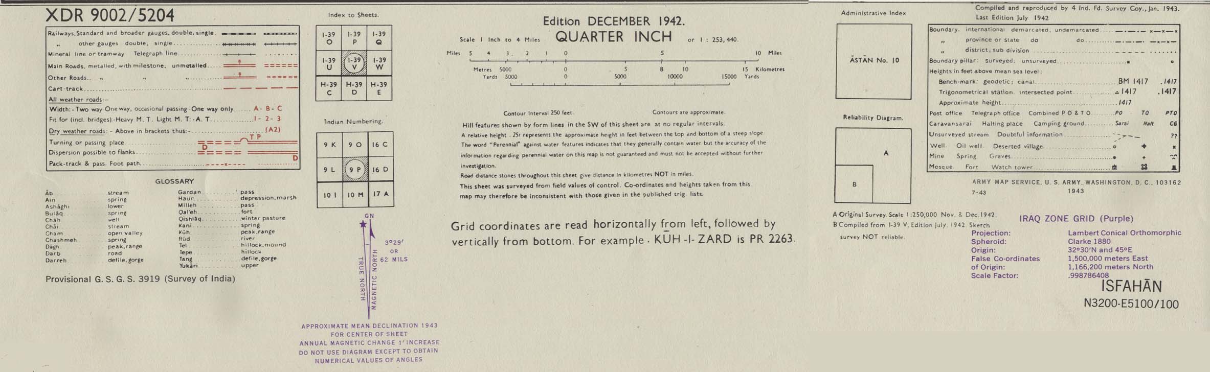
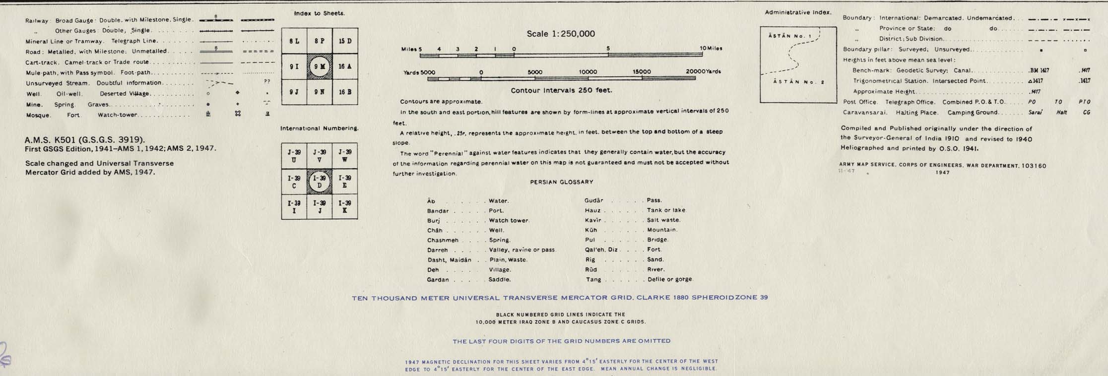
Isfahan Area 1942 (314K) map key and scale (168K) Portion of sheet I-39 V Isfahan. Edition December 1942. Original scale 1:253,440 Compiled and Reproduced by India Field Survey Company, January 1943. Published by the U.S. Army Map Service, July 1943.
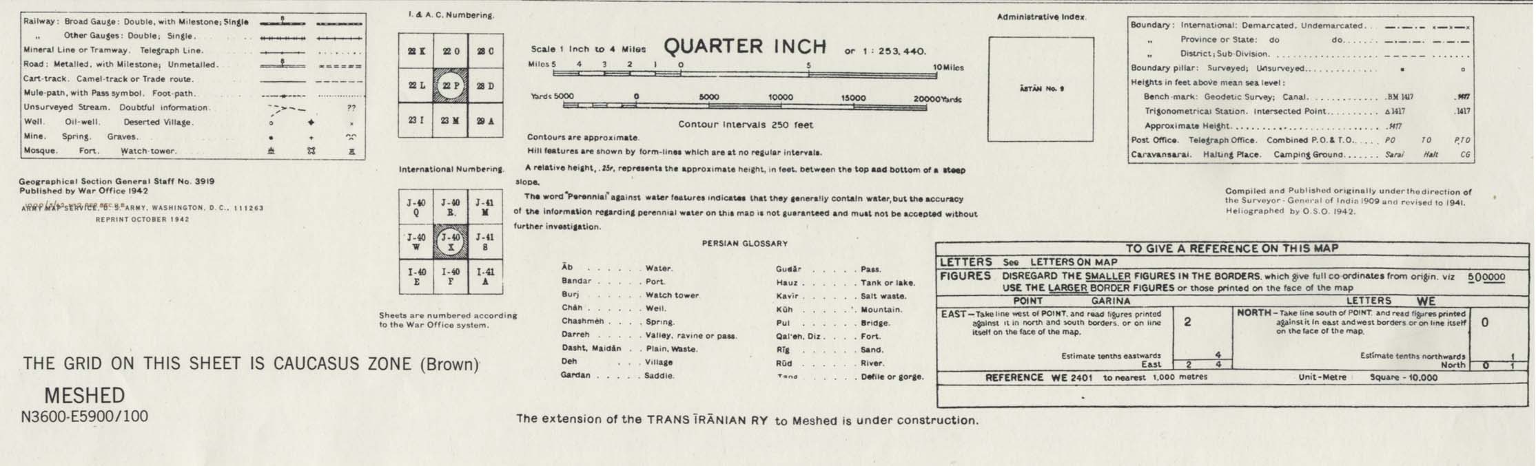
Meshed [Mashhad] Area 1942 (538K) map key and scale (146K)
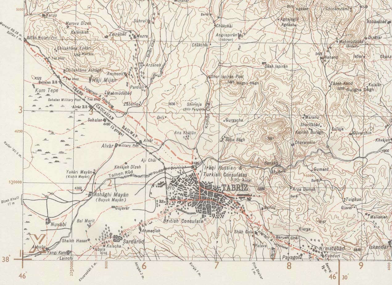
Tabriz Area 1943 (244K) map key and scale (149K)
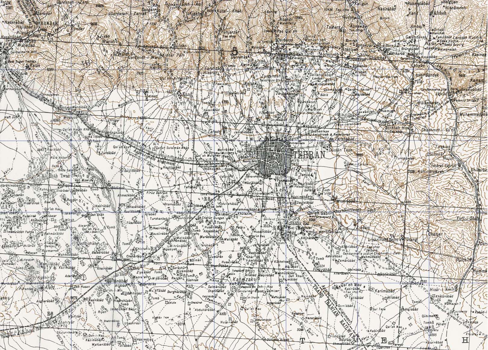
Tehran Area 1947 (538K) map key and scale (146K)
Sources: These maps were provided by the University of Texas Library and/or
the U.S. Central Intelligence Agency (CIA) unless otherwise noted.
Sponsors
Maps on other websites
Iran (Persia.org)
Iran (Lonely Planet)
Iran (United Nations) [pdf format]
Iran - Aeronautical - Series 1501, Joint Operations Graphic (University of Texas at Austin Map Collection)
Iran - Geology (National Geoscience Database of Iran) More than 300 maps
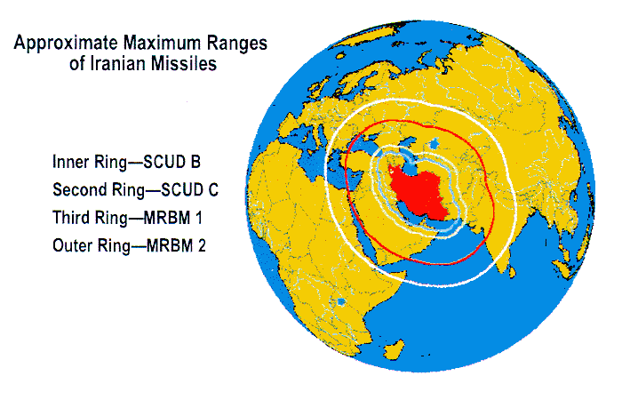
Iran - Iranian Missiles, Ranges (Federation of American Scientists)
Iran in Maps (BBC News)
Iran - Maps (UNOSAT)
Iran - Natanz Uranium Enrichment Complex (ISIS)
Iran - Nuclear Sites (BBC News)
Iran - Provinces (Iransaga)
Iran - Railway Maps (IRIRW)
Iran - Railways (MSEDV)
Iran - Railways Clickable Map (Raja)
Iran - Special Weapons Facilities Maps (Federation of American Scientists)
Iran - Special Weapons Facilities (GlobalSecurity.org)
<-- Free Map Downloads
<-- Free World Country Map Downloads
Didn't find what you are looking for? We've been online since 1996 and have created 1000's of pages. Search below and you may find just what you are looking for.
Michael R. Meuser
Data Research & GIS Specialist
MapCruzin.com is an independent firm
specializing in GIS project development and data research.
We created the first U.S. based
interactive toxic chemical facility
maps on the internet in 1996 and we
have been online ever since. Learn more about us and our services.
Have a project in mind? If you have data, GIS project or custom shapefile needs contact Mike.
Contact Us
Report Broken Links
Subscribe for Updates


![[Caspian Region] Oil and Gas Infrastructure in the Caspian Sea Region](/free-maps-iran/caspian_sea_oil_gas-2001.jpg)
![Peoples of Iran [Ethnolinguistic Groups]](/free-maps-iran/iran_peoples_82.jpg)
![Meshed [Mashhad] Area 1942](/free-maps-iran/meshed_iran_1942.jpg)