Download Free Italy Maps
<-- Free Map Downloads
<-- Free World Country Map Downloads
Sponsors
Note that maps may not appear on the webpage in their full size and resolution. To save the maps to your computer, right-click on the link.
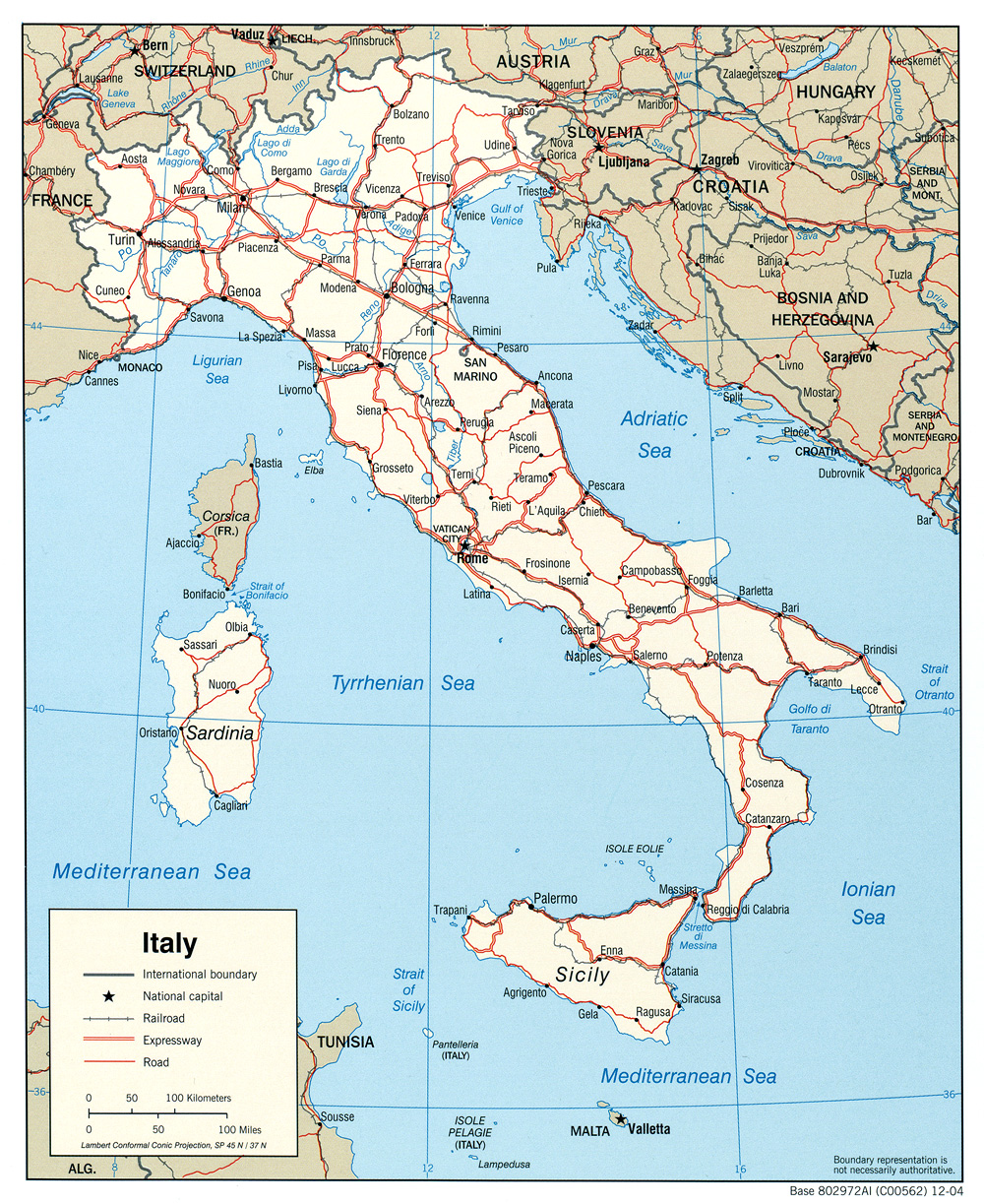
Italy (Political) 2004 (401K) and pdf format (404K)
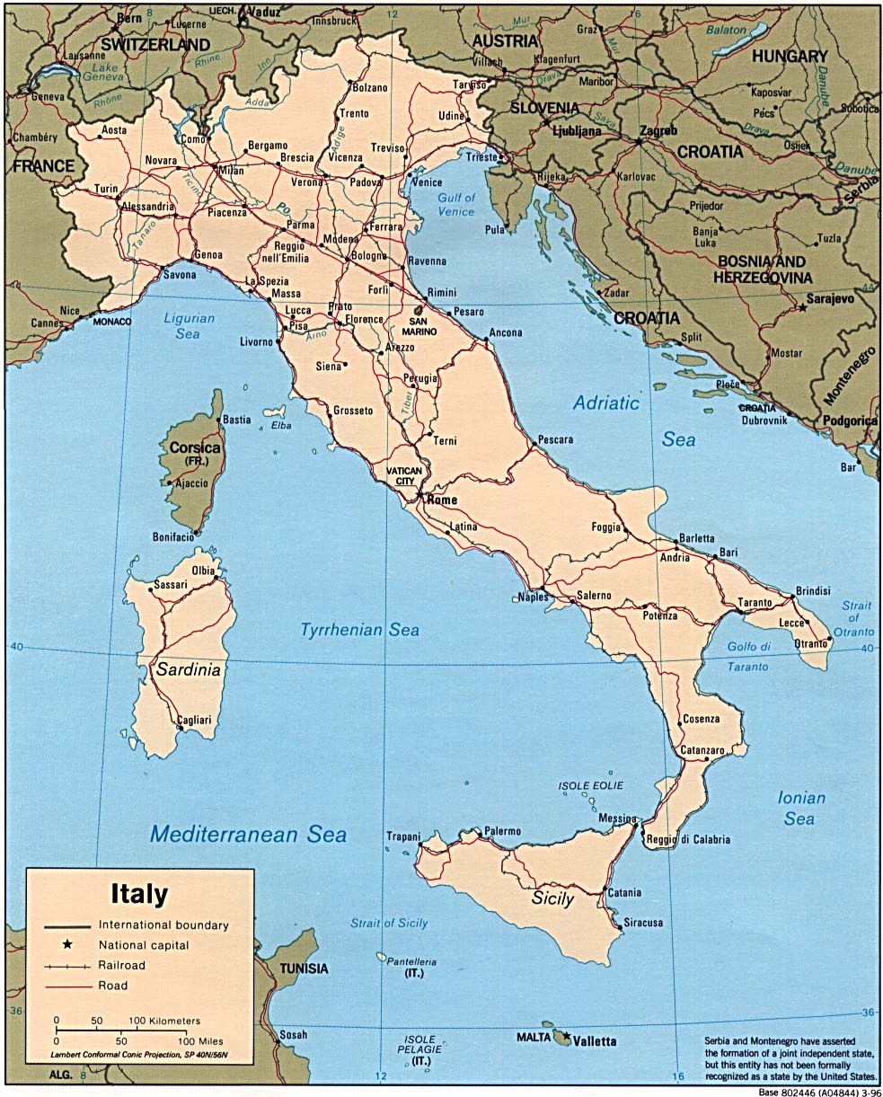
Italy (Political) 1996 (264K) and pdf format (309K)
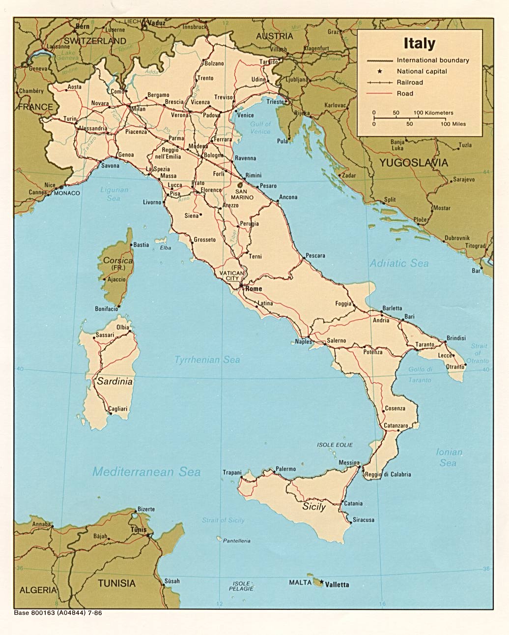
Italy (Political) 1986 (199K) and pdf format (201K)
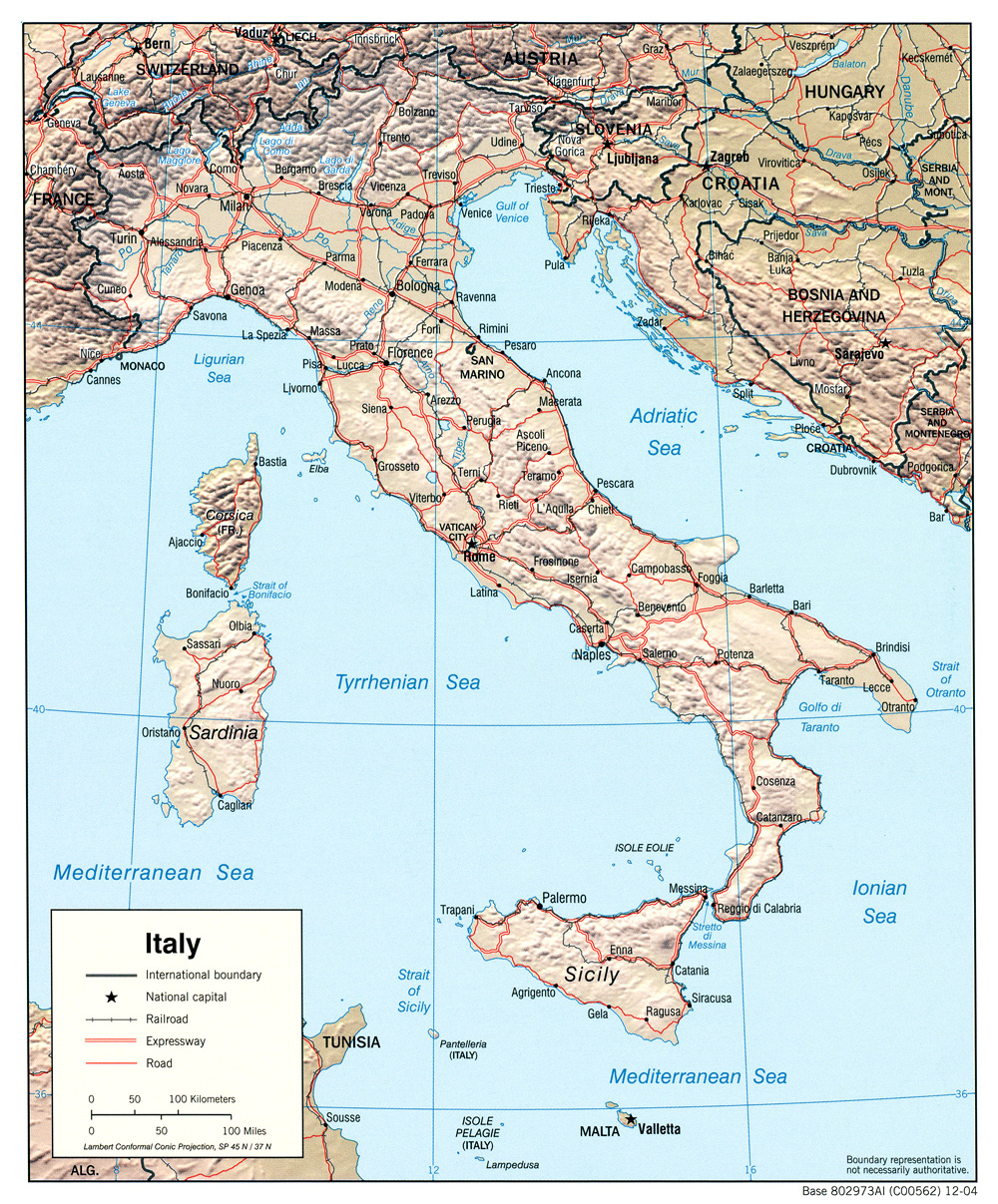
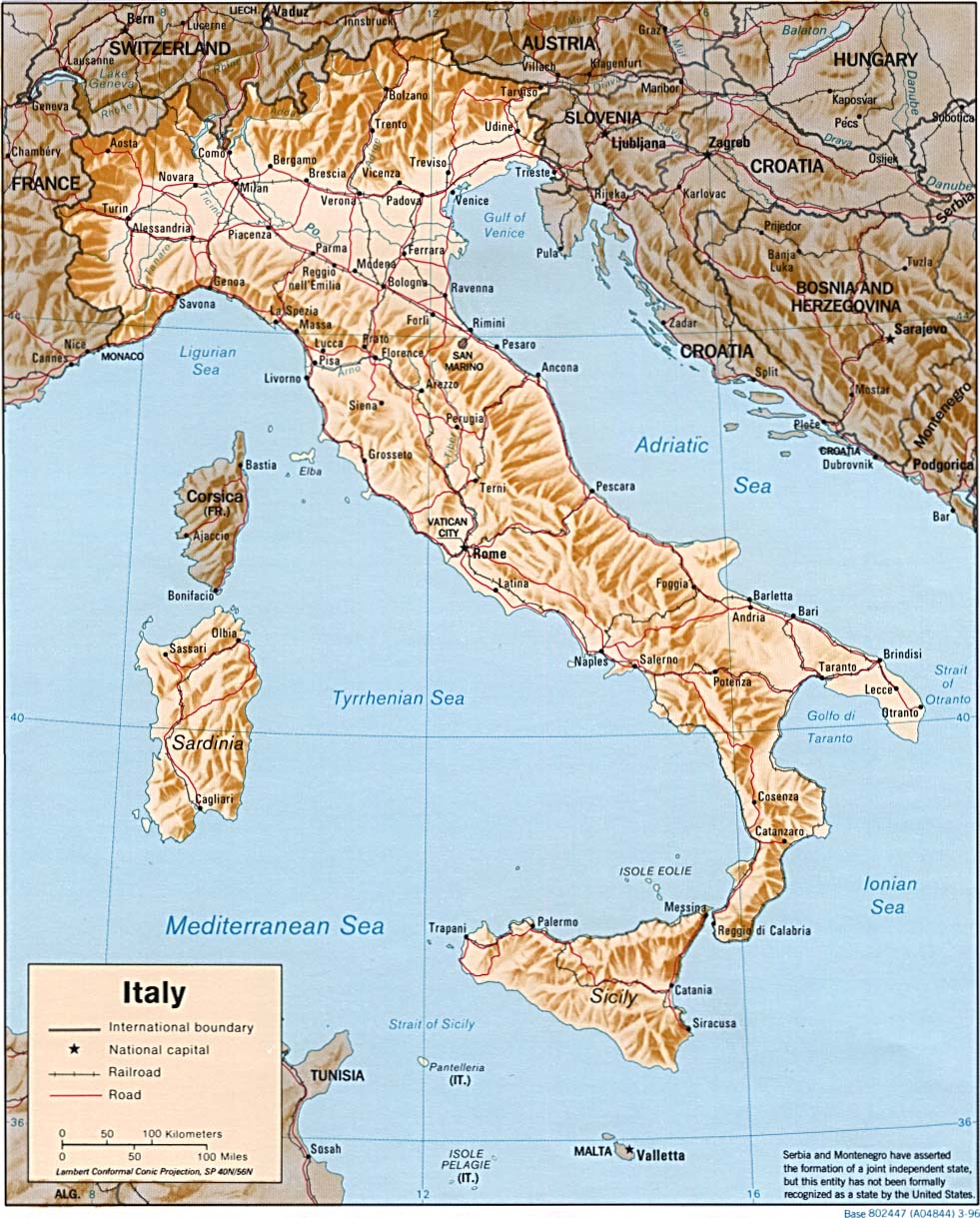
Italy (Shaded Relief) 2004 (428K) and pdf format (430K)
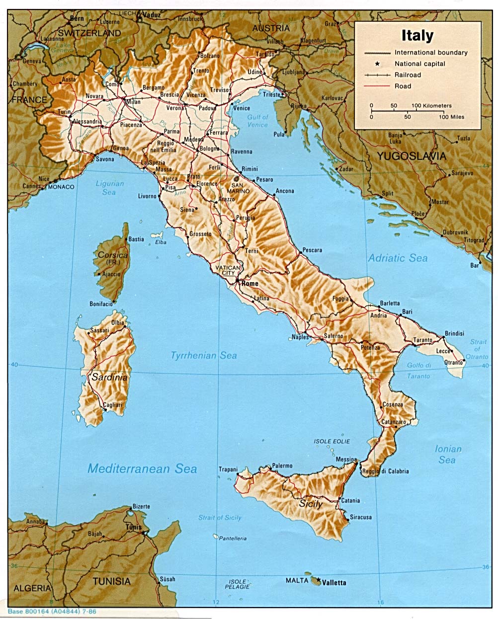
Italy (Shaded Relief) 1996 (248K) and pdf format (293K)
Italy (Shaded Relief) 1986 (253K) and pdf format (256K)
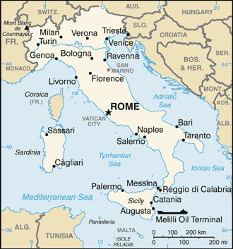
Italy (Small Map) 2008 (20K)
Italy: Administrative Divisions 1996 (155K)
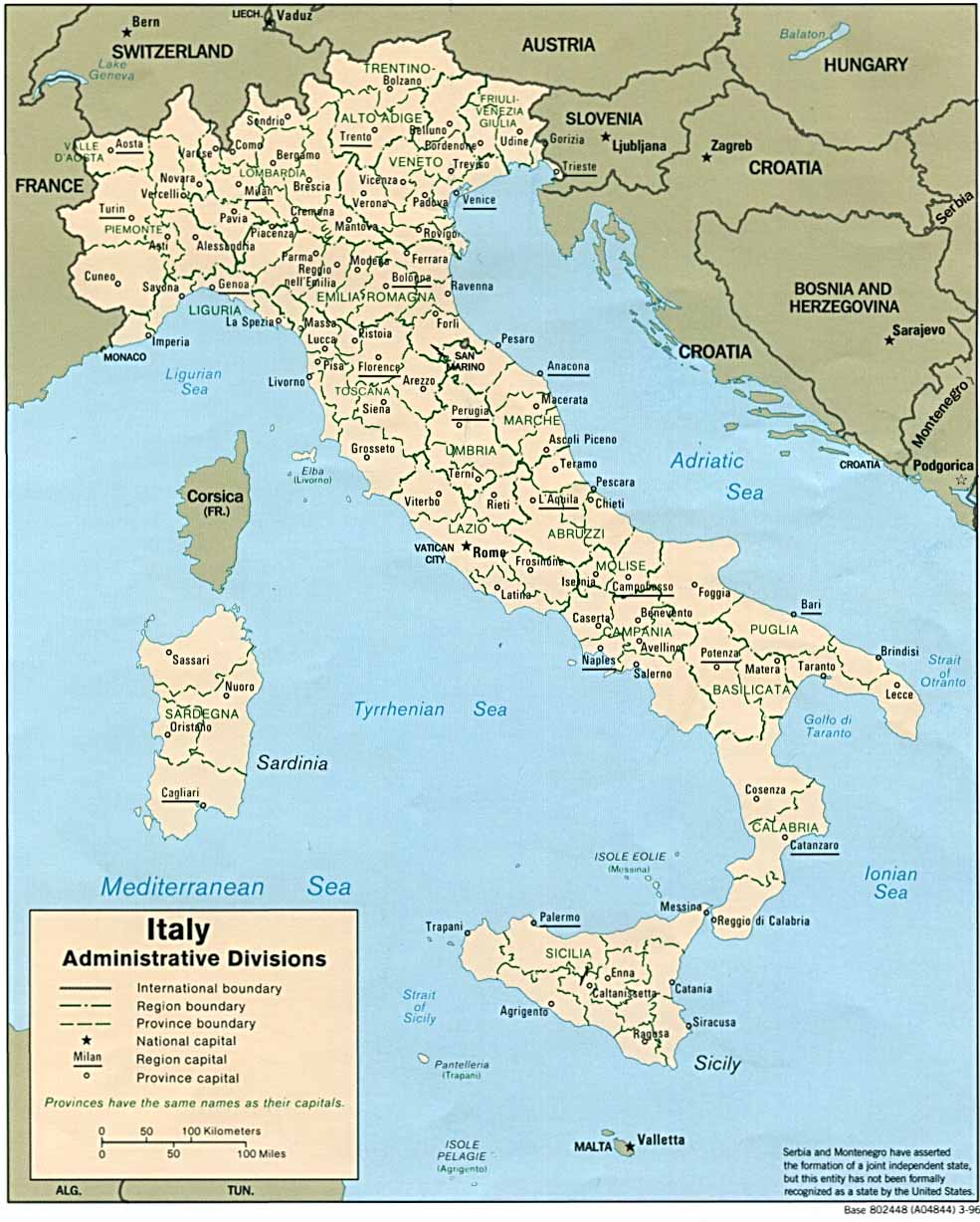
Italy: Administrative Divisions 2006 (580K) and pdf format (683K)
Central Italy, with the adjacent countries, from the Peutingerian Tables constructed about 393 A.D. Classical Atlas by Alexander G. Findlay. New York: Harper and Brothers 1849. (580K)
Firenze [Florence] 1913 Baedeker's Northern Italy Handbook For Travellers , Fourteenth Remodelled Edition 1913 (1,037K)
Genova [Genoa] 1913 Baedeker's Northern Italy Handbook For Travellers , Fourteenth Remodelled Edition 1913 (1,267K)
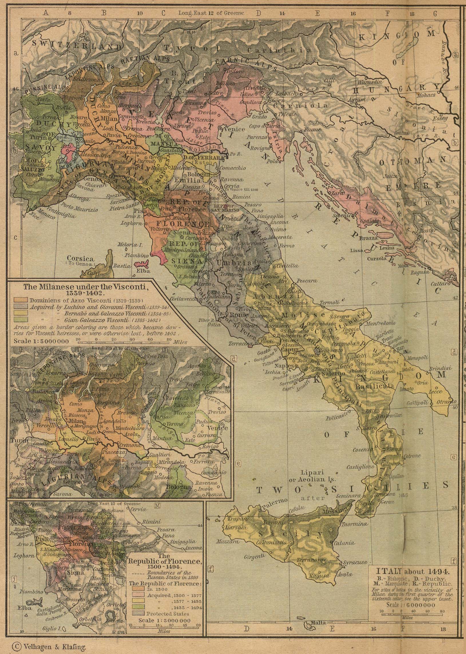
Italy about 1494 Insets: The Milanese under the Visconti, 1339-1402. The Republic of Florence, 1300-1494. From The Historical Atlas by William R. Shepherd, 1923. (774K)
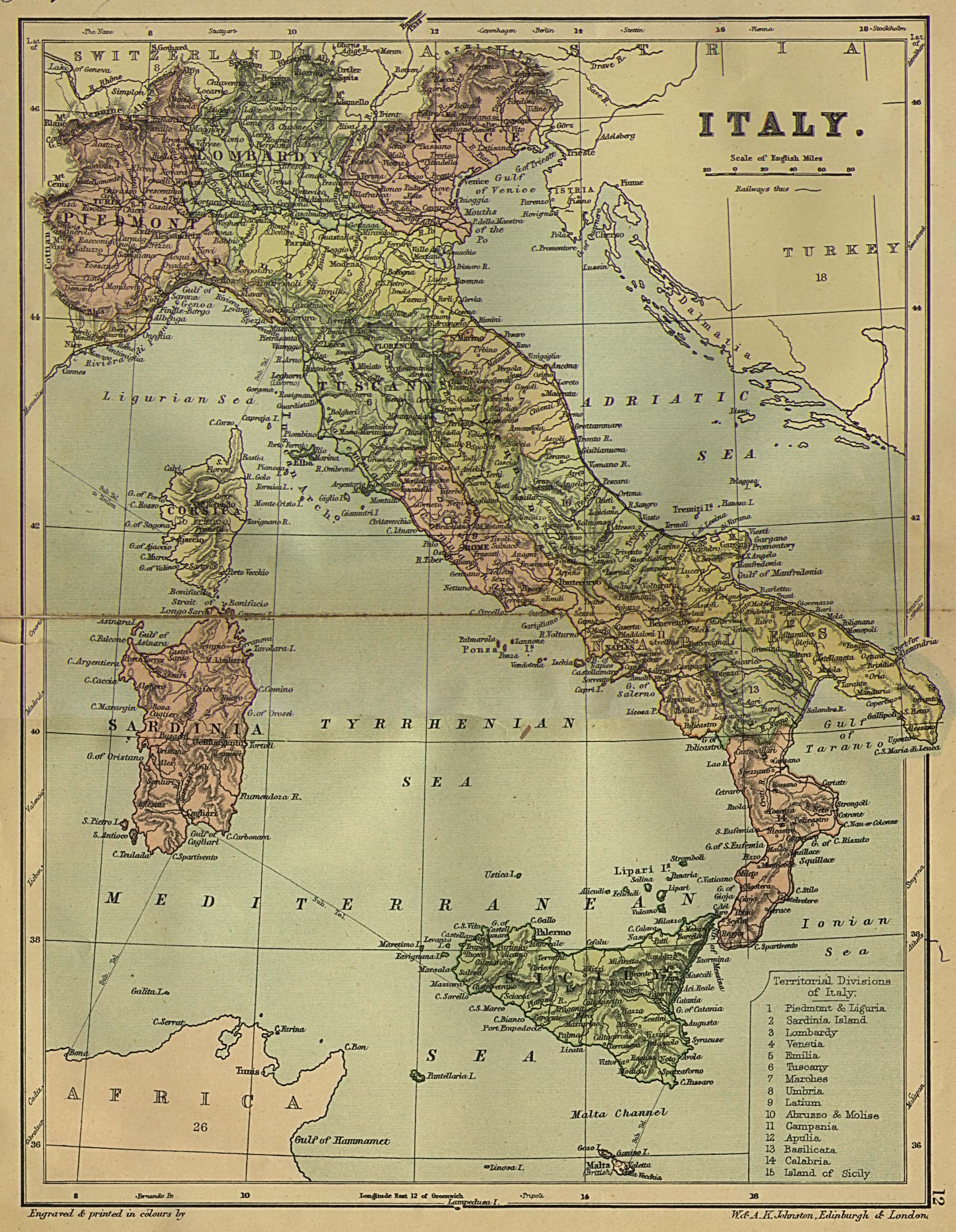
Italy 1882 From W. & A.K. Johnston's "The World an Atlas" 1882. (968K)
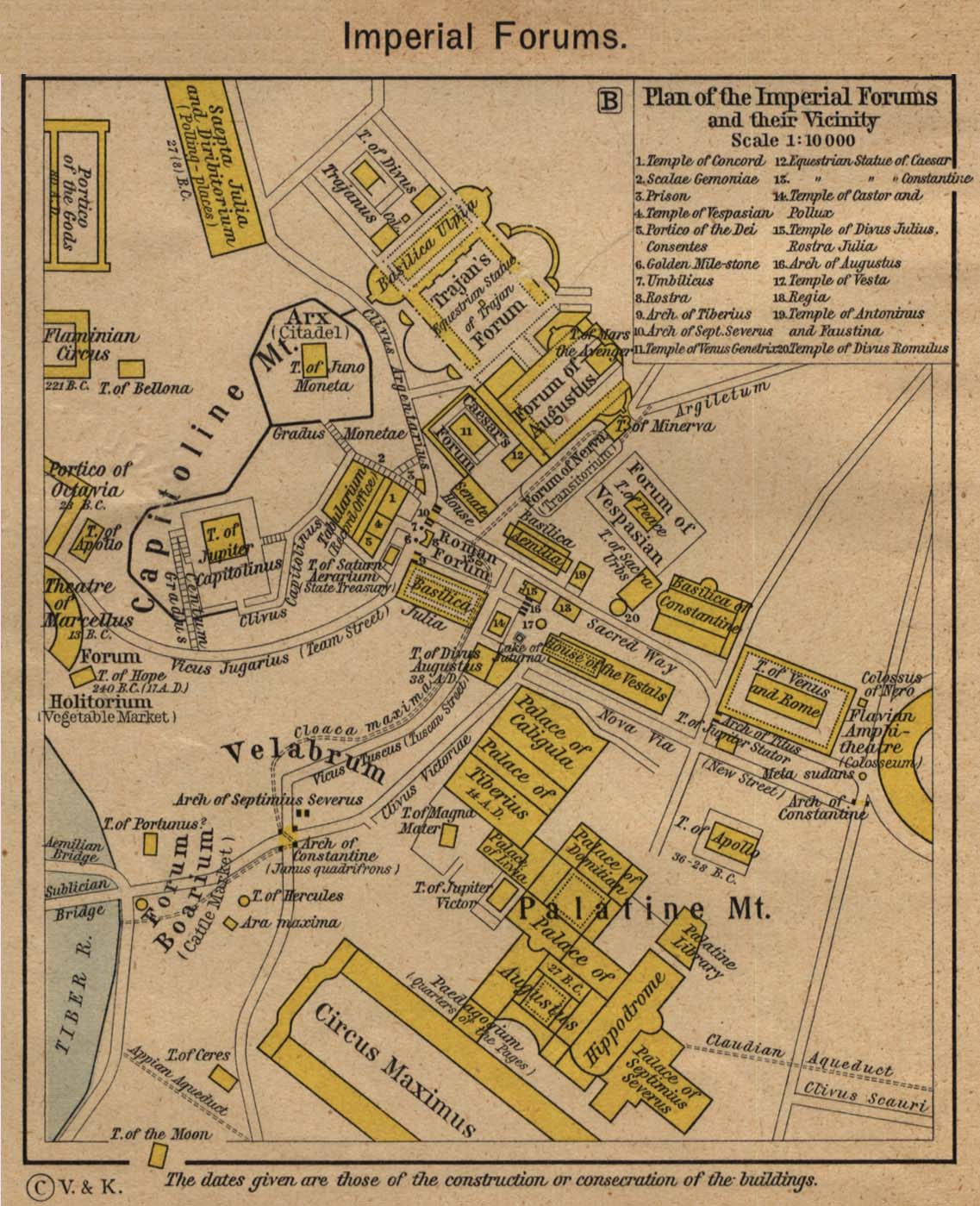
Imperial Forums and their Vicinity From The Historical Atlas by William R. Shepherd, 1923. (240K)
Milano [Milan] 1913 Baedeker's Northern Italy Handbook For Travellers , Fourteenth Remodelled Edition 1913 (782K)
Rome in the Middle Ages From The Historical Atlas by William R. Shepherd, 1923. (452K)
Roman Forum and its Vicinity at the Time of the Republic From The Historical Atlas by William R. Shepherd, 1923. (208K)
Torino [Turin] 1913 Baedeker's Northern Italy Handbook For Travellers , Fourteenth Remodelled Edition 1913 (765K)
Venezia [Venice] 1913 Baedeker's Northern Italy Handbook For Travellers , Fourteenth Remodelled Edition 1913 (808K)
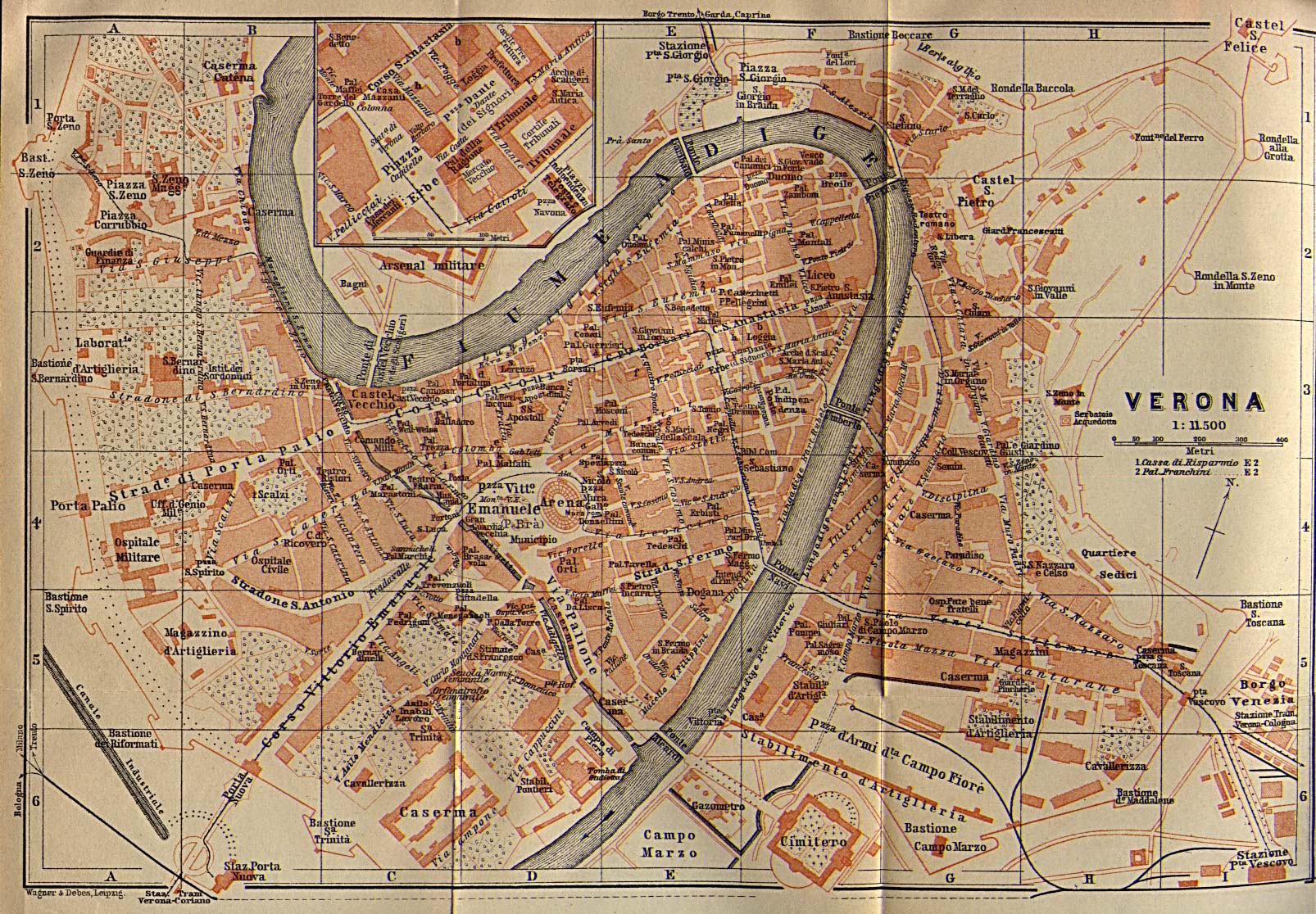
Verona 1913 Baedeker's Northern Italy Handbook For Travellers , Fourteenth Remodelled Edition 1913 (612K)
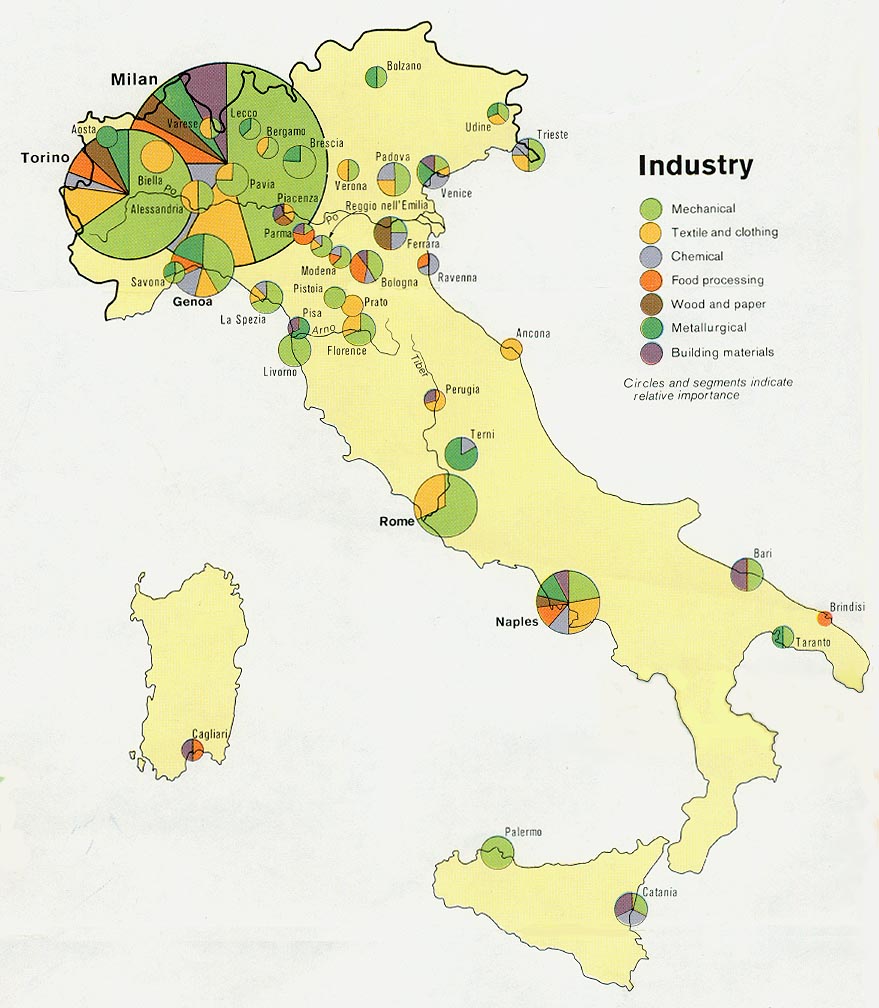
Italy - Industry from Map No. 501445 1972 (145K)
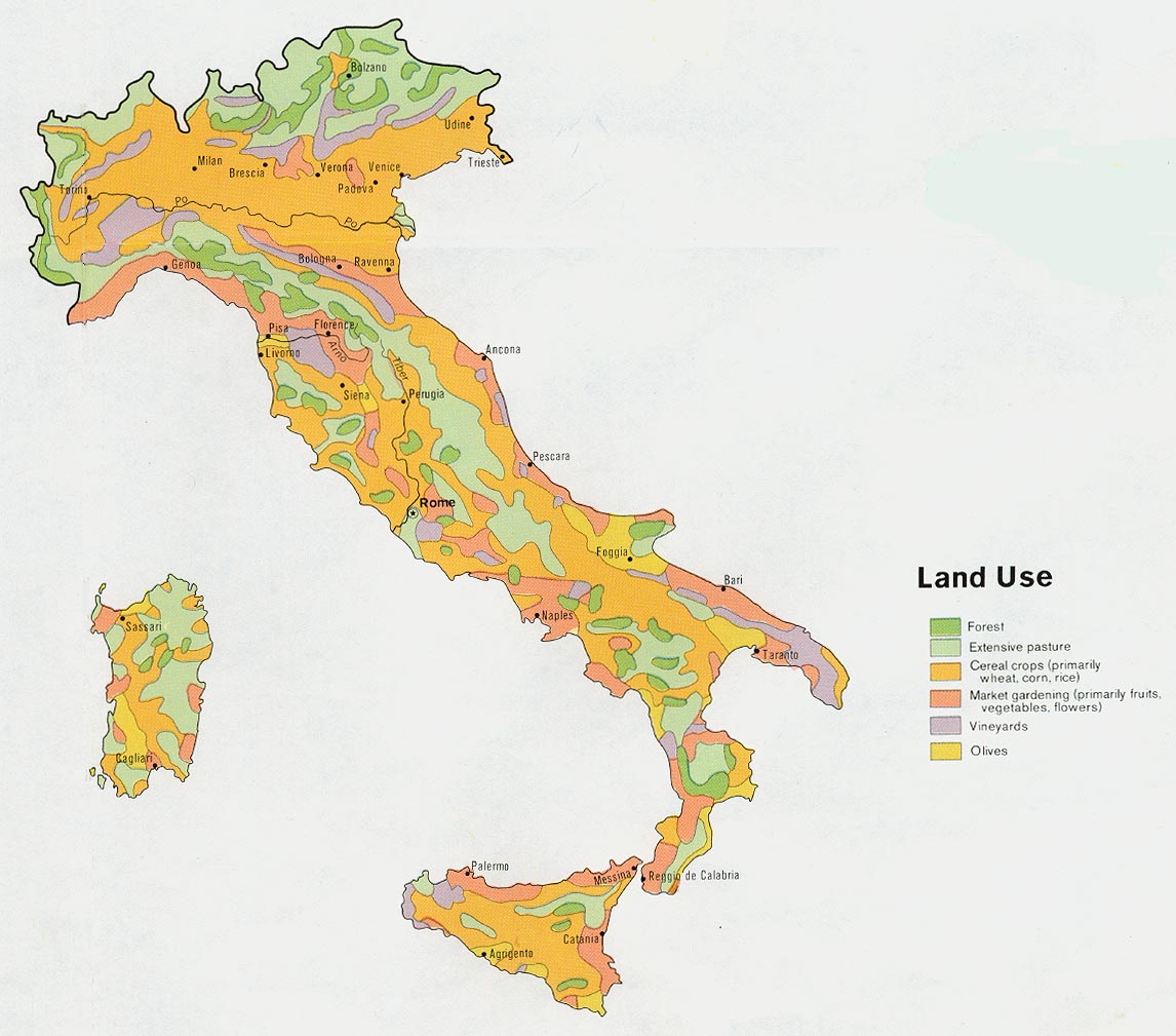
Italy - Land Use from Map No. 501445 1972 (173K)
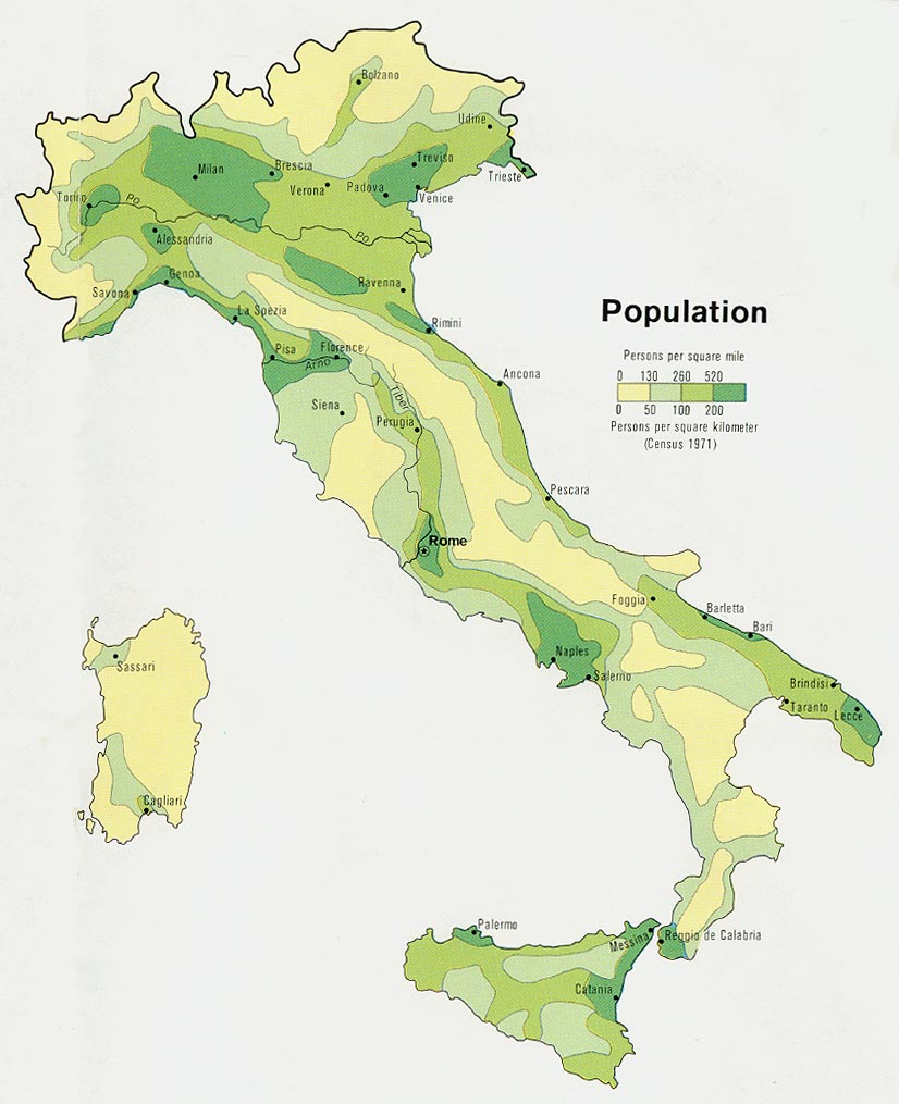
Italy - Population from Map No. 501445 1972 (127K)
Sources: These maps were provided by the University of Texas Library and/or
the U.S. Central Intelligence Agency (CIA) unless otherwise noted.
Maps on other websites
Italy (Lonely Planet)
Italy - Central Italy Maps (toscane.pagina.nl)
Italy -Interactive Atlas (Discover Italia)
Italy - Interactive Atlas (Virgilio Mappe)
Italy - Maps (Geoplan)
Italy - Major Volcanoes (USGS)
Italy - Opera Map (Operabase)
Italy - Railways (Trainspotting B�kkes)
Italy - Road Maps (AGIP)
Italy - Sicily Maps (Ragusa OnLine)
Italy - Sicily Maps (SicilyWeb)
Italy - Tuscany Road Maps (Tuscany.net)
<-- Free Map Downloads
<-- Free World Country Map Downloads
Didn't find what you are looking for? We've been online since 1996 and have created 1000's of pages. Search below and you may find just what you are looking for.
Michael R. Meuser
Data Research & GIS Specialist
MapCruzin.com is an independent firm
specializing in GIS project development and data research.
We created the first U.S. based
interactive toxic chemical facility
maps on the internet in 1996 and we
have been online ever since. Learn more about us and our services.
Have a project in mind? If you have data, GIS project or custom shapefile needs contact Mike.
Contact Us
Report Broken Links
Subscribe for Updates
Sponsors


![Firenze [Florence] 1913](/free-maps-italy/firenze_italy_1913.jpg)
![Genova [Genoa] 1913](/free-maps-italy/genova_italy_1913.jpg)
![Milano [Milan] 1913](/free-maps-italy/milano_1913.jpg)
![Torino [Turin] 1913](/free-maps-italy/torino_1913.jpg)
![Venezia [Venice] 1913](/free-maps-italy/venezia_italy_1913.jpg)