Download Free Lebanon Maps
<-- Free Map Downloads
<-- Free World Country Map Downloads
Lebanon (DiscoverLebanon)
Sponsors
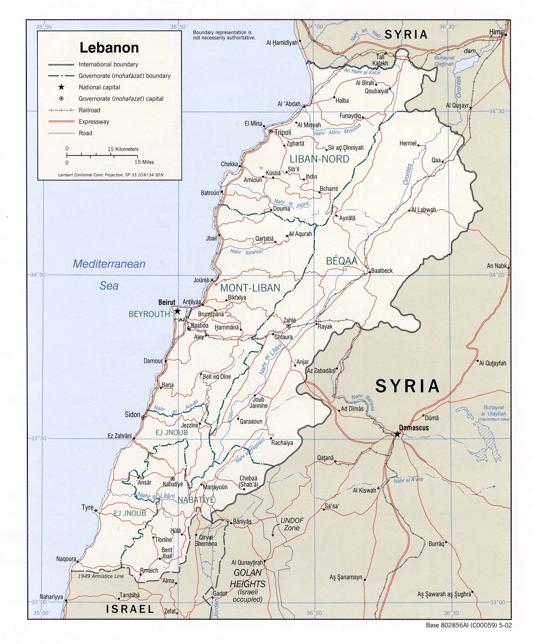
Lebanon (Political) 2002 (208K) and pdf format (258K)
Lebanon (Political) 2000 (235K)
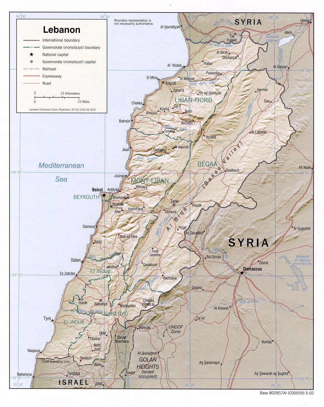
Lebanon (Shaded Relief) 2002 (191K) and pdf format (208K)
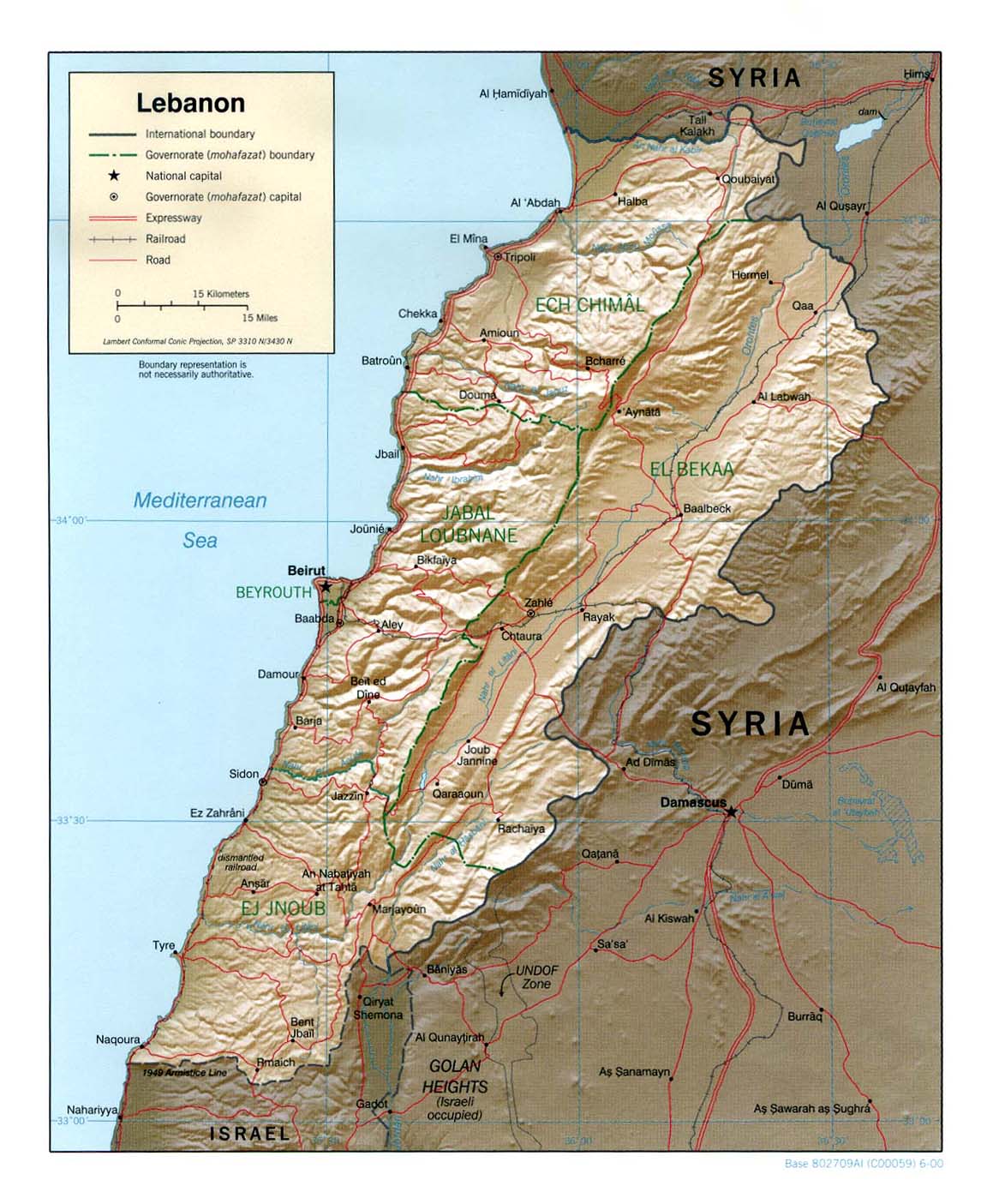
Lebanon (Shaded Relief) 2000 (269K)
Lebanon (Shaded Relief) From Atlas of the Middle East 1993 (604k)
Lebanon (Shaded Relief) 1982 (283K) and
pdf format (412K)
Lebanon (Shaded Relief) 1971 (400K) and
pdf format (412K)
Lebanon (Small Map) 2008 (12K)
Beirut 1980 (249K)
South Lebanon and Vicinity original scale 1:150,000 1976 (5.2 MB)
Southern Lebanon Border Area original scale 1:150,000 1986 (2.9 MB)
Beirut [Beyrout] 1912 (737K) From Palestine and Syria...Handbook for Travellers by Karl Baedeker, 5th Edition, 1912
Beirut Environs 1912 (346K) From Palestine and Syria...Handbook for Travellers by Karl Baedeker, 5th Edition, 1912
Sidon [Saida] Environs 1912 (290K) From Palestine and Syria. Handbook for Travellers by Karl Baedeker, 5th Edition, 1912
Tyre [Sur] Environs 1912 (240K) From Palestine and Syria. Handbook for Travellers by Karl Baedeker, 5th Edition, 1912
Lebanon - Distribution of Religious Groups 1983 (190K)
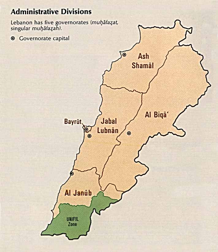
Lebanon - Administrative Divisions From Atlas of the Middle East 1993 (64k)
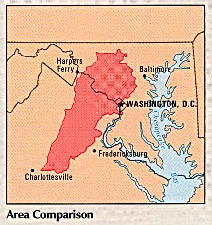
Lebanon - Area Comparison From Atlas of the Middle East 1993 (50k)
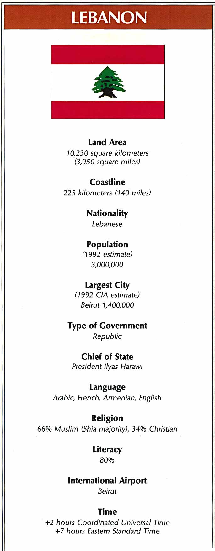
Lebanon - Country Information From Atlas of the Middle East 1993 (93k)
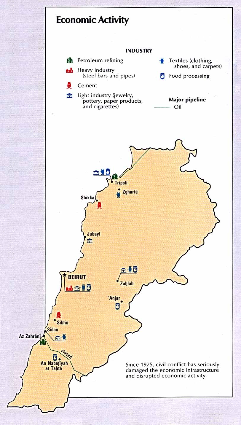
Lebanon - Economic Activity From Atlas of the Middle East 1993 (148k)
Lebanon - Land Use From Atlas of the Middle East 1993 (126k)
Lebanon - Population Density From Atlas of the Middle East 1993 (119k)
Sources: These maps were provided by the University of Texas Library and/or
the U.S. Central Intelligence Agency (CIA) unless otherwise noted.
Maps on other websites
Lebanon (UniMaps)
Lebanon (WorldAtlas.com)
Lebanon - Bekaa Valley Roads (Lebanon.com)
Lebanon - Clickable Maps in Arabic and English (AUB)
Lebanon - [Former] Israeli Occupation Zone 1998 (Al Mashriq)
Lebanon - South - U.N. Interim Force in Lebanon (United Nations) [PDF]
<-- Free Map Downloads
<-- Free World Country Map Downloads
Sponsors
Didn't find what you are looking for? We've been online since 1996 and have created 1000's of pages. Search below and you may find just what you are looking for.
Michael R. Meuser
Data Research & GIS Specialist
MapCruzin.com is an independent firm
specializing in GIS project development and data research.
We created the first U.S. based
interactive toxic chemical facility
maps on the internet in 1996 and we
have been online ever since. Learn more about us and our services.
Have a project in mind? If you have data, GIS project or custom shapefile needs contact Mike.
Contact Us
Report Broken Links
Subscribe for Updates


![Beirut [Beyrout] 1912](/free-maps-lebanon/beirut2_1912.jpg)
![Sidon [Saida] Environs 1912](/free-maps-lebanon/sidon_1912.jpg)
![Tyre [Sur] Environs 1912](/free-maps-lebanon/tyre_1912.jpg)