Download Free Madagascar Maps
<-- Free Map Downloads
<-- Free World Country Map Downloads
Sponsors
Note that maps may not appear on the webpage in their full size and resolution. To save the maps to your computer, right-click on the link.
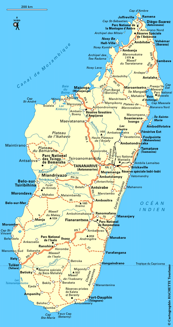
Madagascar (Political) 2003 (223K) and pdf format (217K)
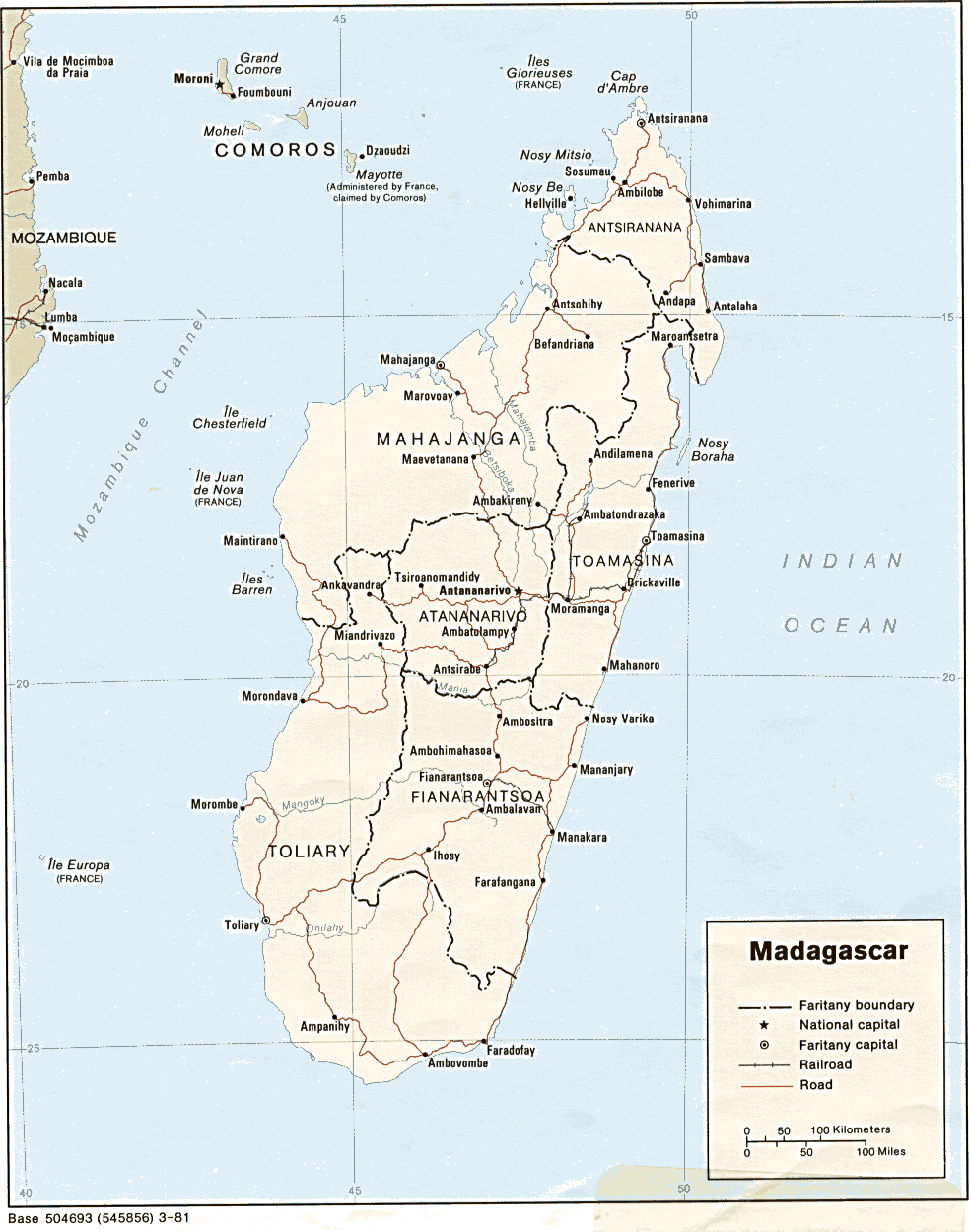
Madagascar (Political) 1981 (174K) and
pdf format (186K)
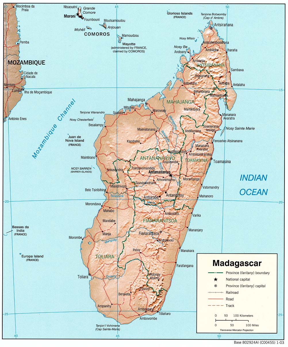
Madagascar (Shaded Relief) 2003 (291K) and pdf format (285K)
Madagascar (Shaded Relief) 1981 (159K) and
pdf format (166K)
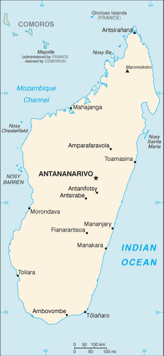
Madagascar (Small Map) 2008 (18K)
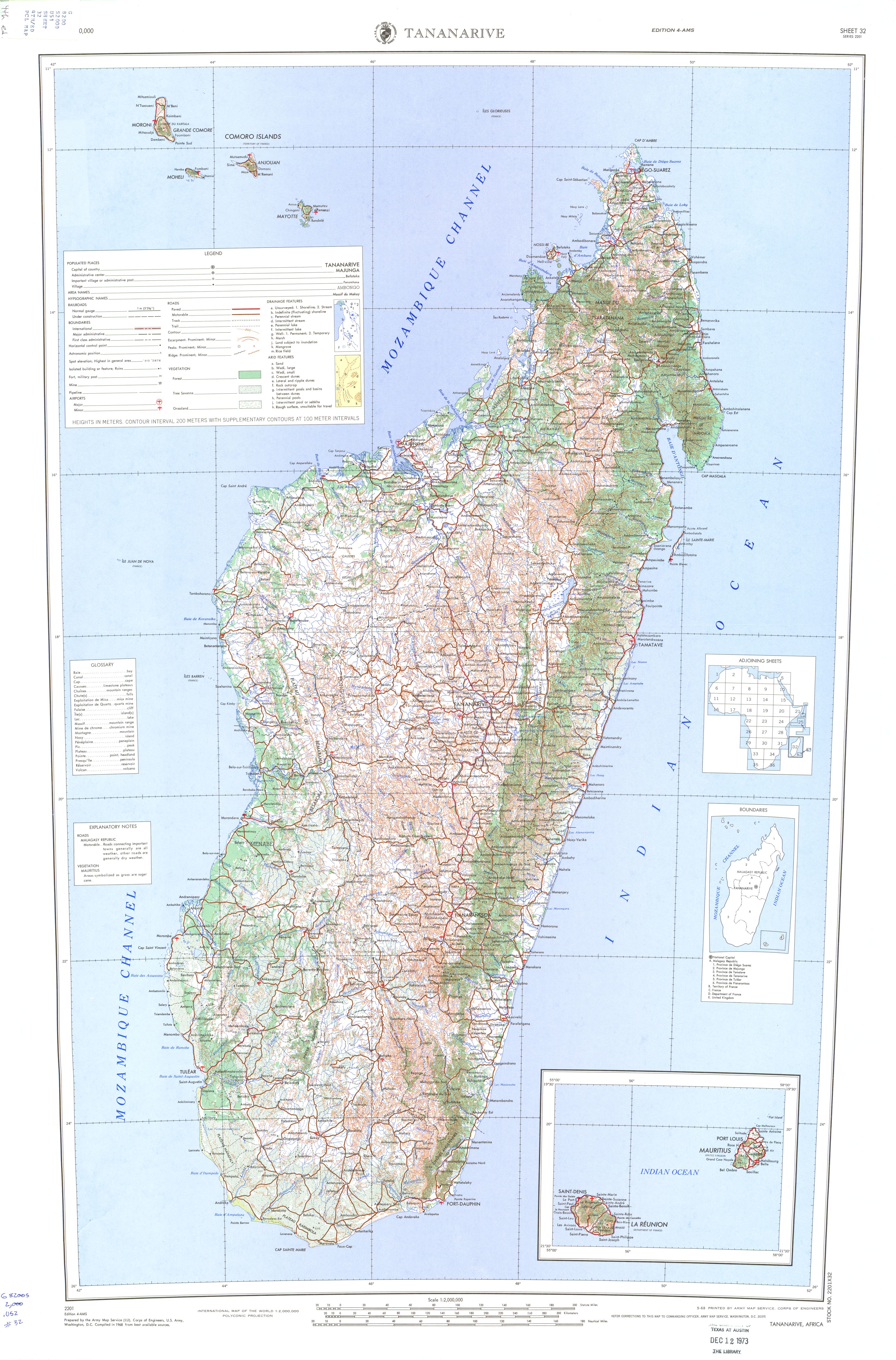
Madagascar (Topographic Map) Sheet 32, Series 2201, Edition 4-AMS. 1:2,000,000. U.S. Army Map Service, 1968 (3.5 MB)
Antananarivo U.S. Dept. of State 1982 (402K)
Diego-Suarez [Antsiranana] 1976 (60K)
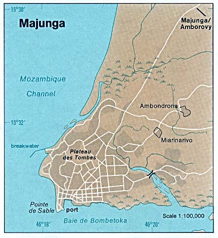
Majunga 1976 (50K)
Tamatave [Taomasina] 1976 (59K)
1:2,000,000 - Africa Topographic Maps U.S. Army Map Service - Tananarive Sheet 32, Edition 4, AMS, 1968 includes all of Madagascar (3.5 MB)
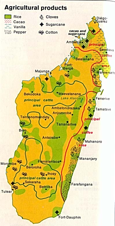
Madagascar - Agricultural Products from The Indian Ocean Atlas, 1976 (68K)
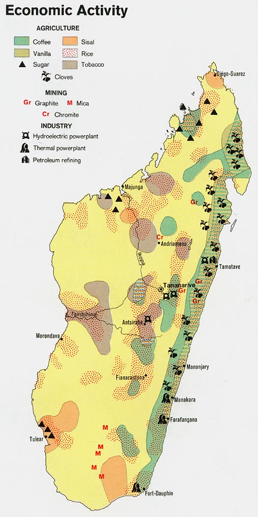
Madagascar - Economic Activity 1973 (134K)
Madagascar - Minerals and Industry from The Indian Ocean Atlas, 1976 (76K)
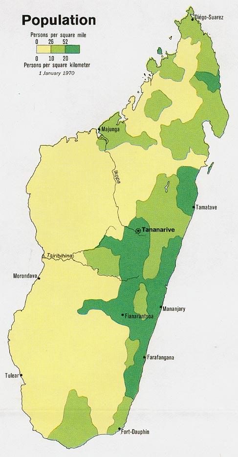
Madagascar - Population 1973 (97K)
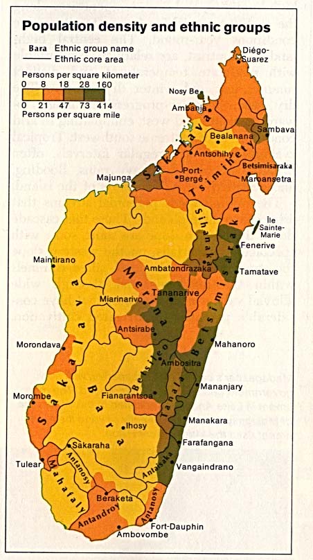
Madagascar - Population Density and Ethnic Groups from The Indian Ocean Atlas, 1976 (80K)
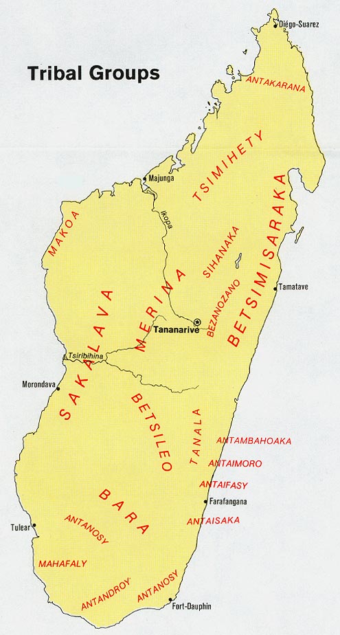
Madagascar - Tribal Groups 1973 (100K)
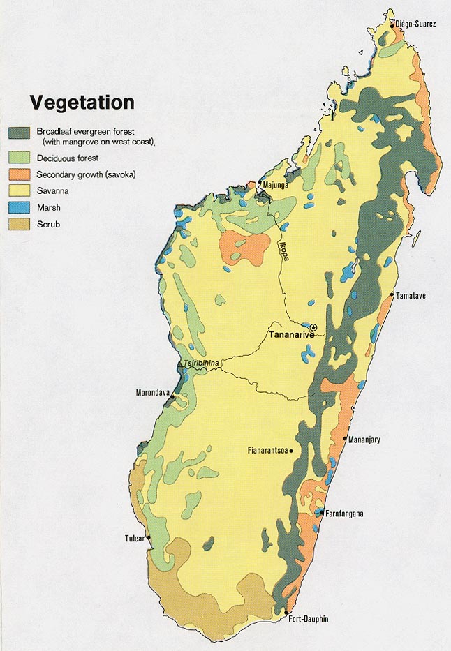
Madagascar - Vegetation 1973 (134K)
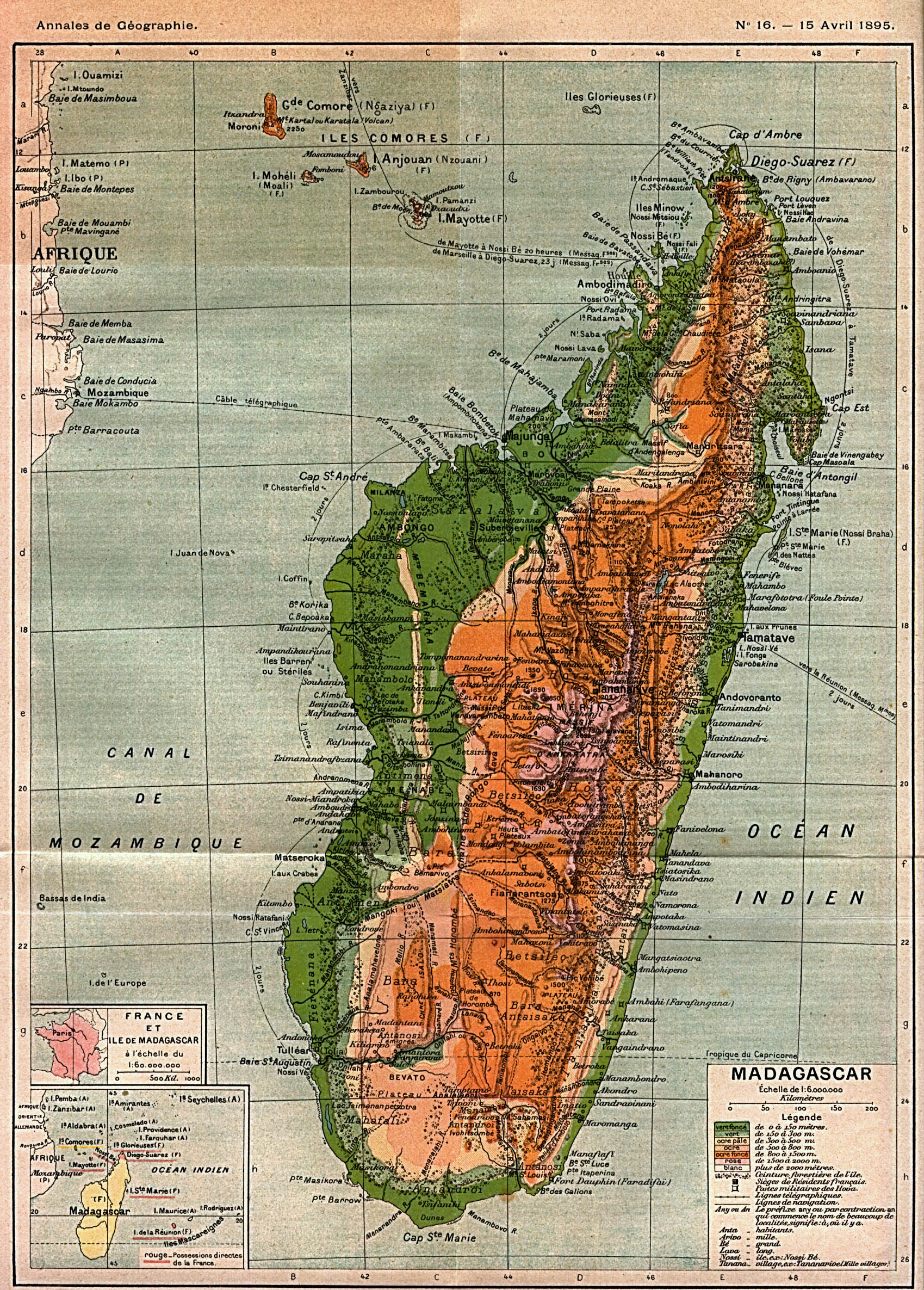
Madagascar 1895 Annales de Geographie, Tome IV 1895 (1.1MB)
Sources: These maps were provided by the University of Texas Library and/or
the U.S. Central Intelligence Agency (CIA) unless otherwise noted.
Maps on other websites
Madagascar (Internethellosa)
Madagascar (Routard.com)
Madagascar (UniMaps)
Madagascar (Visite Virtuelle)
Madagascar - Maps (UNOSAT)
<-- Free Map Downloads
<-- Free World Country Map Downloads
Didn't find what you are looking for? We've been online since 1996 and have created 1000's of pages. Search below and you may find just what you are looking for.
Michael R. Meuser
Data Research & GIS Specialist
MapCruzin.com is an independent firm
specializing in GIS project development and data research.
We created the first U.S. based
interactive toxic chemical facility
maps on the internet in 1996 and we
have been online ever since. Learn more about us and our services.
Have a project in mind? If you have data, GIS project or custom shapefile needs contact Mike.
Contact Us
Report Broken Links
Subscribe for Updates
Sponsors


![Diego-Suarez [Antsiranana]](/free-maps-madagascar/diego-suarez_76.jpg)
![Tamatave [Taomasina]](/free-maps-madagascar/tamatave_76.jpg)