Download Free Colombia Maps
<-- Free Map Downloads
<-- Free World Country Map Downloads
Note that maps may not appear on the webpage in their full size and resolution. To save the maps to your computer, right-click on the link.
Colombia (Political) 2008 (788KB)
Colombia (Political) 2001 (283K) and
pdf format (281K)
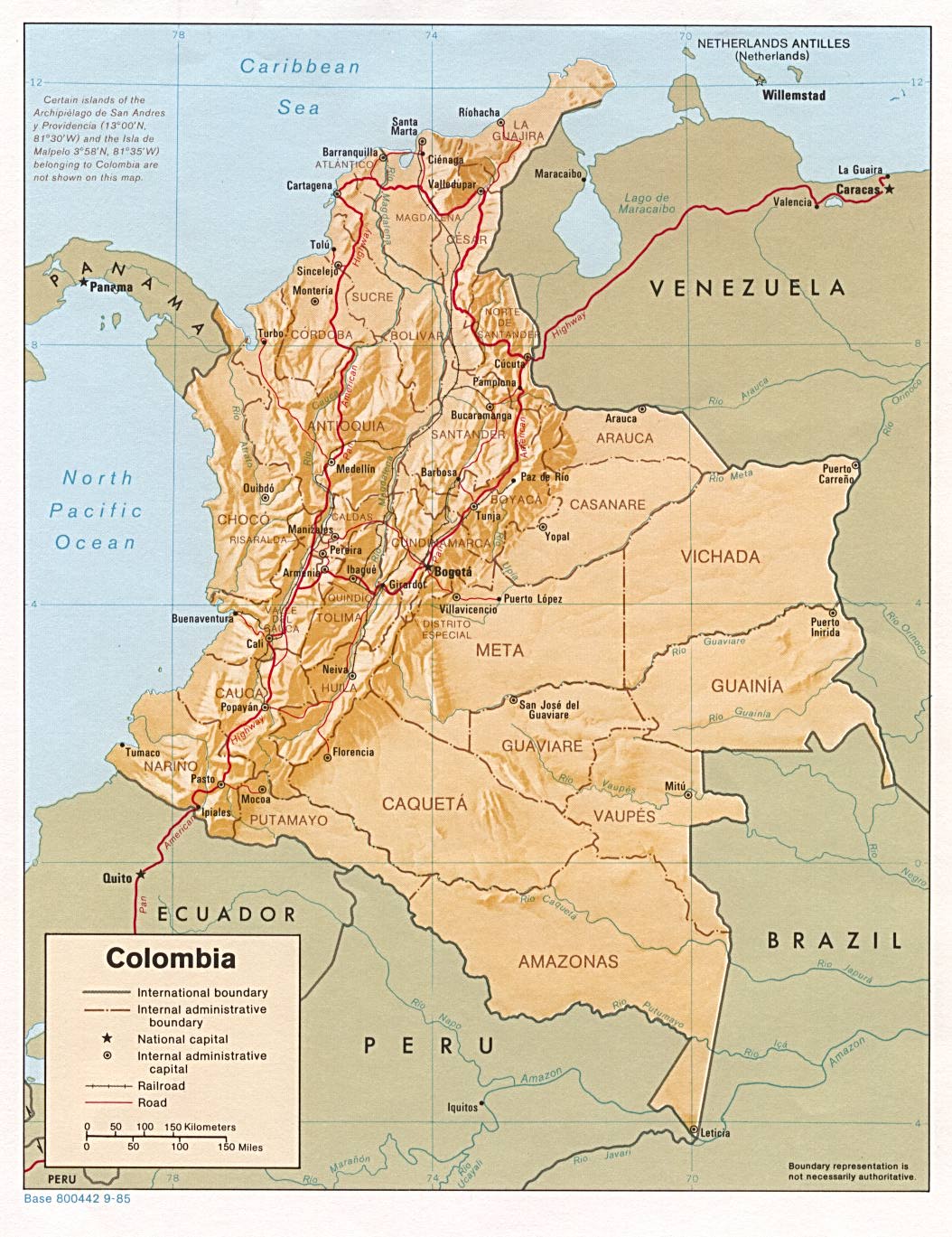
Colombia (Shaded Relief) 2008 (840KB)
Colombia (Shaded Relief) 2001 (276K) and
pdf format (286K)
Colombia (Shaded Relief) 1985 (255K) and pdf format (258K)
Colombia (Small Map) 2008 (14K)
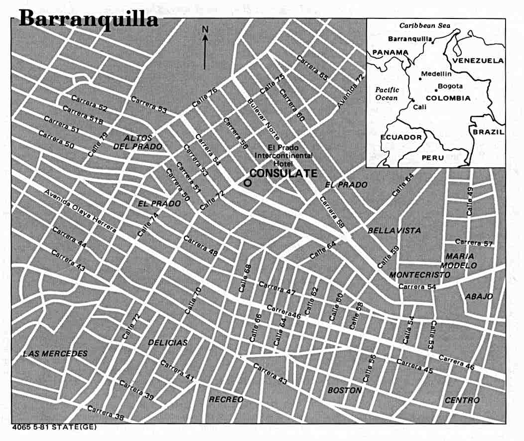
Barranquilla U.S. Dept. of State 1981 (79K)
Barranquilla original scale 1:20,000, Edition 2-NIMA, Series E973. National Imagery and Mapping Agency, 1997 (16.5MB)
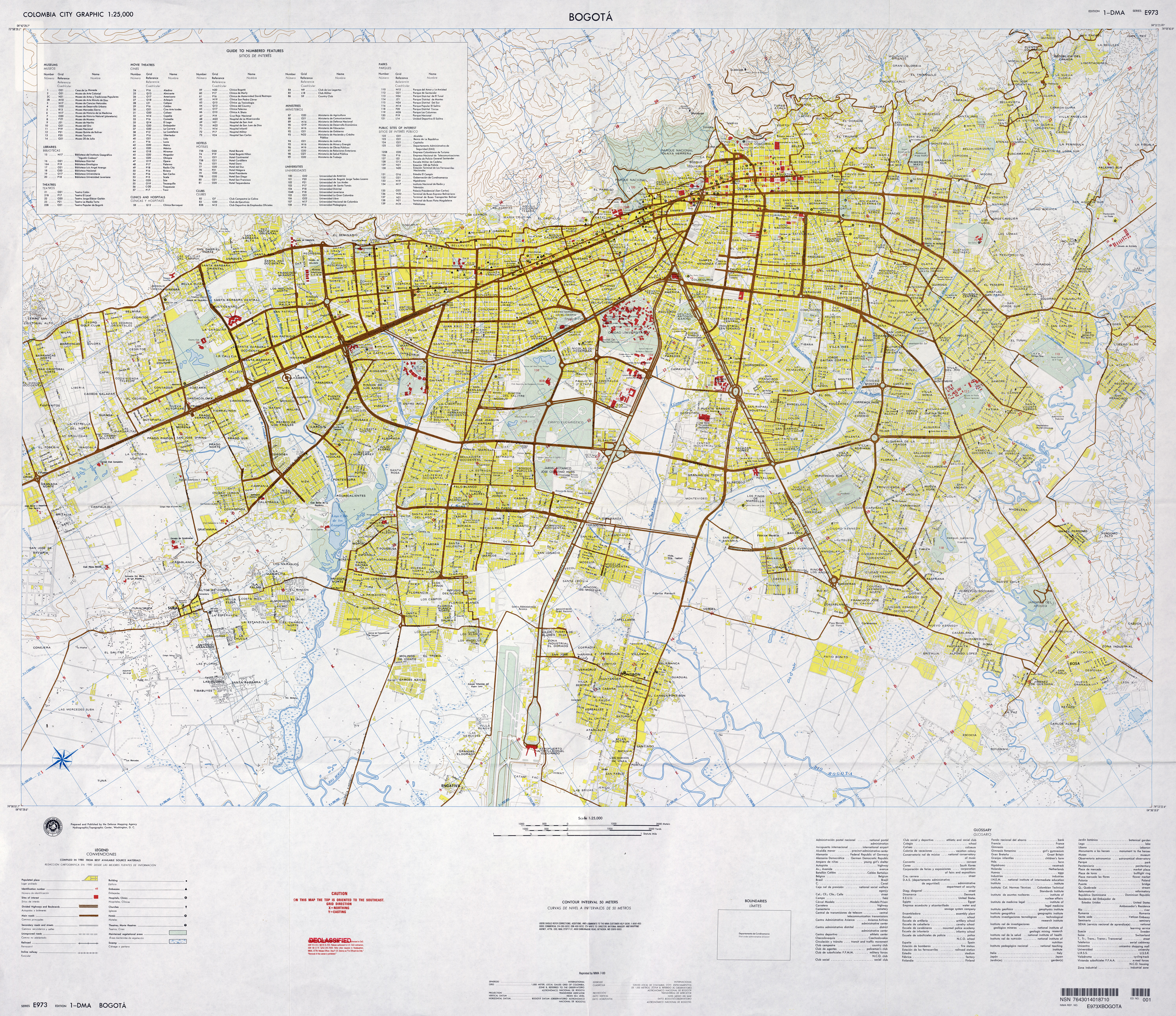
Bogota original scale 1:25,000, Edition 1-DMA, Series E973. U.S. Defense Mapping Agency, 1980 (11.1MB)
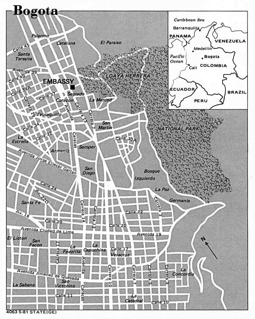
Bogota U.S. Dept. of State 1981 (79K)
Cali U.S. Dept. of State 1981 (73K)
Cali original scale 1:20,000, Edition 1-NIMA, Series E973. National Imagery and Mapping Agency, 1995 (15.9MB)
Cartagena original scale 1:15,000, Edition 2-NIMA, Series E973. National Imagery and Mapping Agency, 1994 (8.2MB)
Leticia [with Tabatinga, Brazil] original scale 1:17,500, Edition 1-NIMA, Series E973. National Imagery and Mapping Agency, 1995 (7.7MB)
Medellin U.S. Dept. of State 1981 (61K)
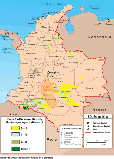
Colombia - Coca Cultivation Density from "The Drug Trade in Colombia: A Threat Assessment", U.S. Drug Enforcement Agency, Intelligence Division, March 2002 (53K)
Colombia - Economic Activity 1970 (148K)
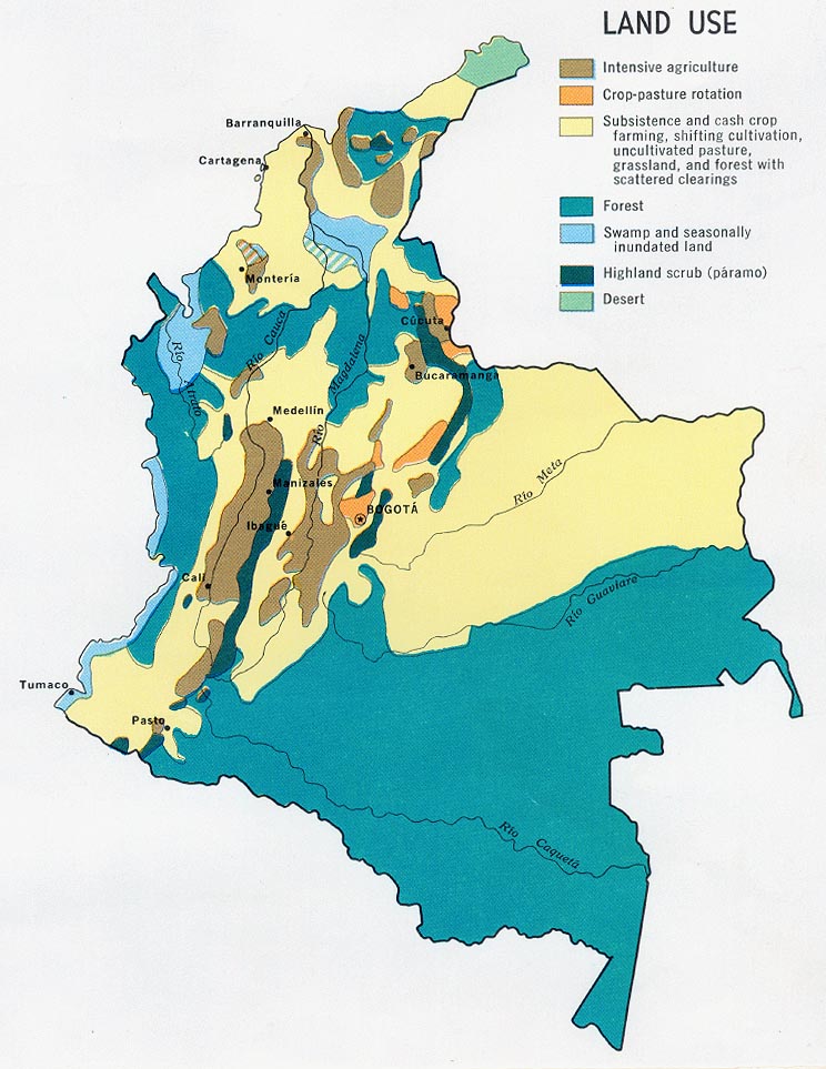
Colombia - Land Use 1970 (153K)
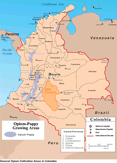
Colombia - Opium-Poppy Growing Areas from "The Drug Trade in Colombia: A Threat Assessment", U.S. Drug Enforcement Agency, Intelligence Division, March 2002 (51K)
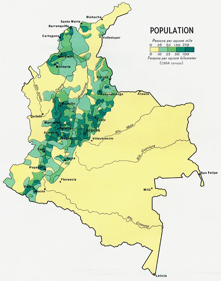
Colombia - Population 1970 (138K)
Sources: These maps were provided by the University of Texas Library and/or
the U.S. Central Intelligence Agency (CIA) unless otherwise noted.
Maps on other websites:
Colombia (HRW)
Colombia - Forests and Protected Areas (UNEP)
Colombia (Lonely Planet)
Colombia - Guerrillas and Paramilitary Forces (Le Monde Diplomatique)
Colombia - Major Volcanoes (USGS)
Colombia - Maps (UNOSAT)
Sources: These maps were provided by the University of Texas Library and/or
the U.S. Central Intelligence Agency (CIA) unless otherwise noted.
<-- Free Map Downloads
<-- Free World Country Map Downloads
Didn't find what you are looking for? We've been online since 1996 and have created 1000's of pages. Search below and you may find just what you are looking for.
Michael R. Meuser
Data Research & GIS Specialist
MapCruzin.com is an independent firm
specializing in GIS project development and data research.
We created the first U.S. based
interactive toxic chemical facility
maps on the internet in 1996 and we
have been online ever since. Learn more about us and our services.
Have a project in mind? If you have data, GIS project or custom shapefile needs contact Mike.
Contact Us
Report Broken Links
Subscribe for Updates


![Leticia [with Tabatinga, Brazil]](/free-maps-colombia/txu-oclc-232610622-leticia-1995.jpg)