Download Free Middle East Country Atlas Maps
<-- Free Map Downloads
<-- Free World Country Map Downloads
Sponsors
Note that maps may not appear on the webpage in their full size and resolution. To save the maps to your computer, right-click on the link.
Bahrain
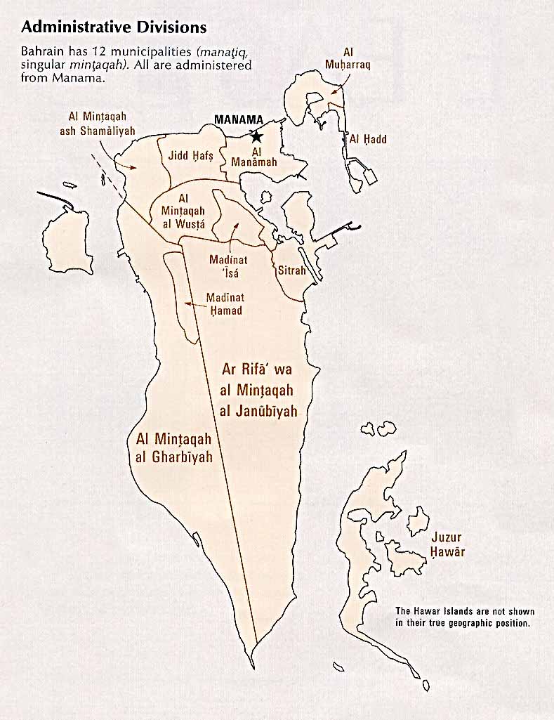
Administrative Divisions (98k)
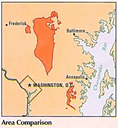
Area Comparison (31k)
Country Information (100k)
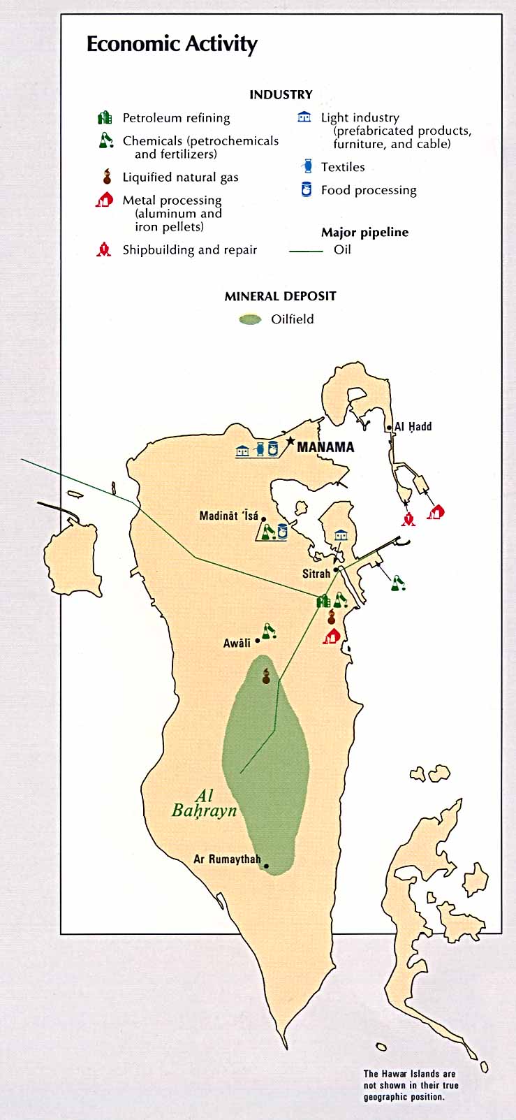
Economic Activity
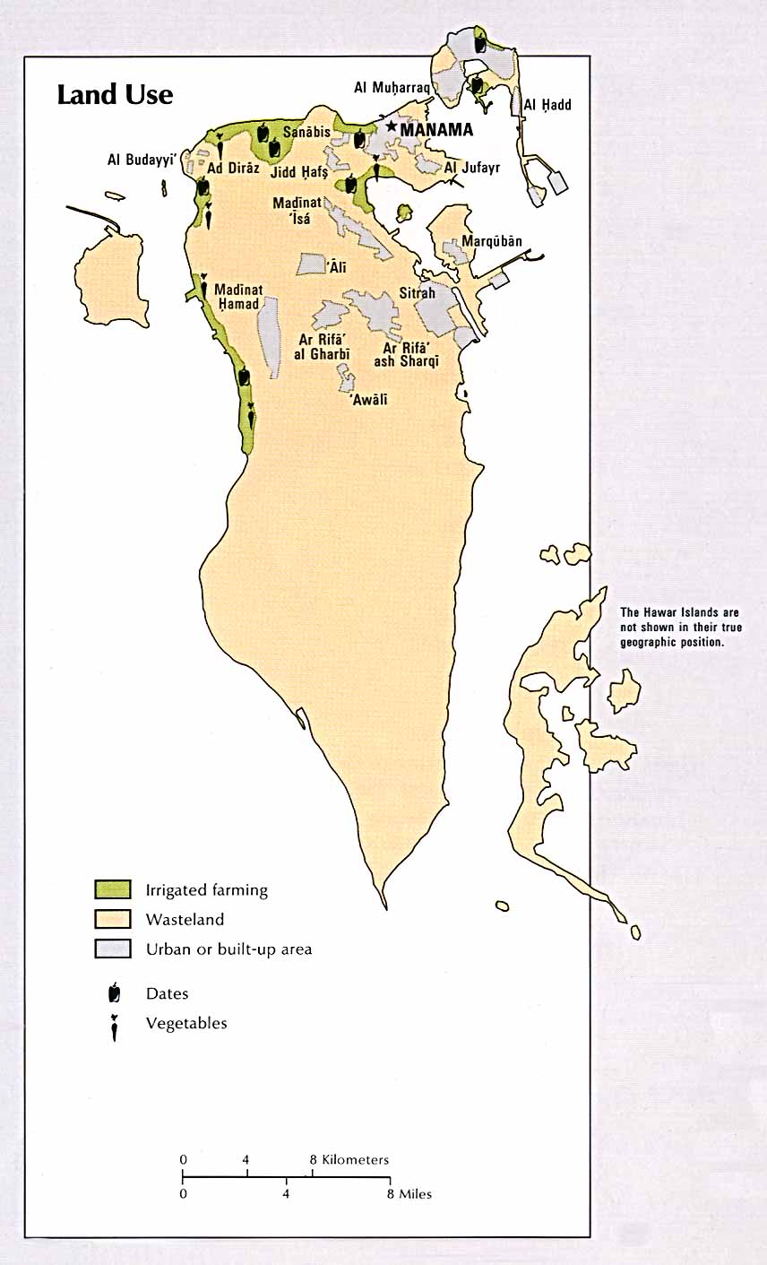
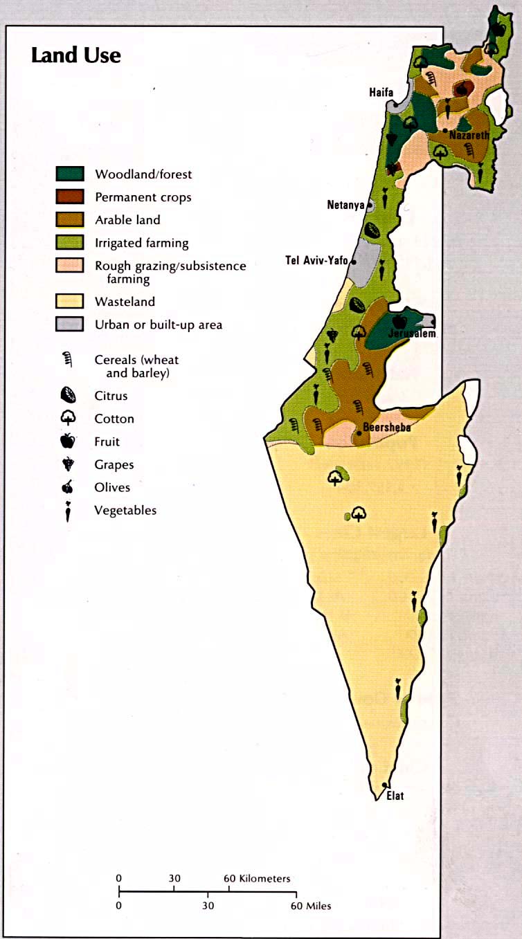
Land Use (94k)
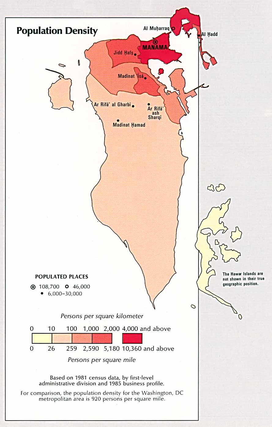
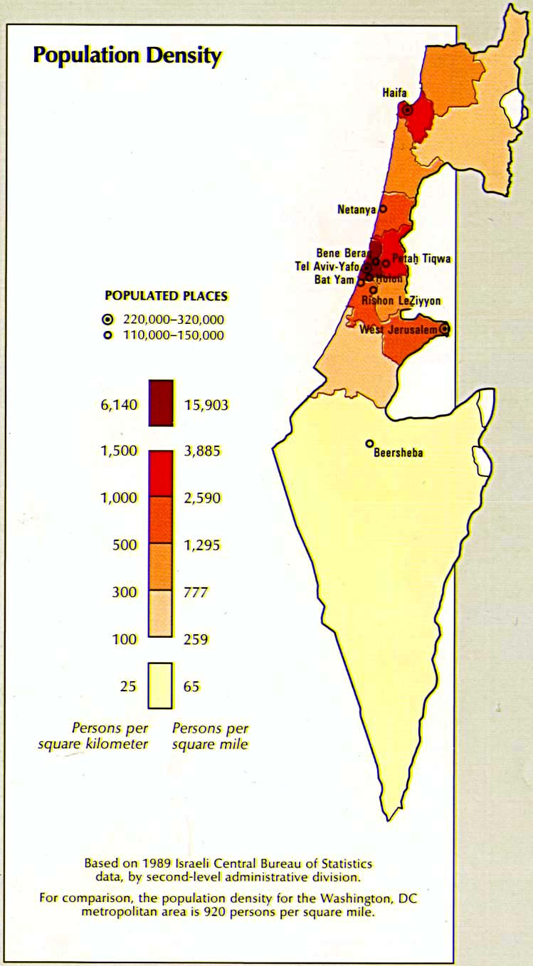
Population Density (110k)
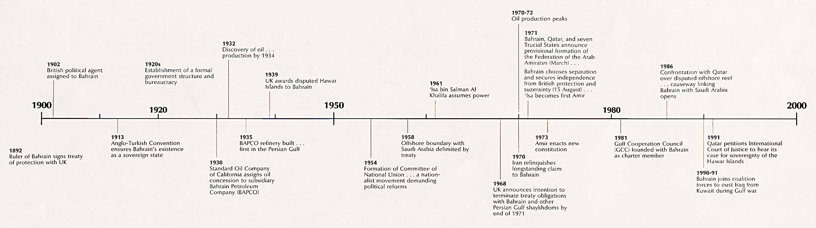
Time Line (160k)
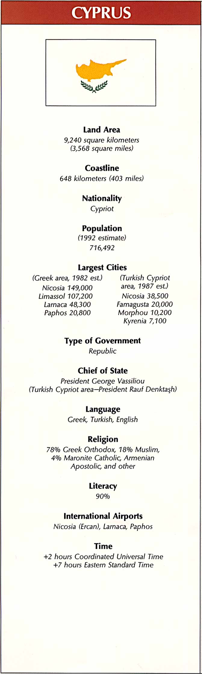
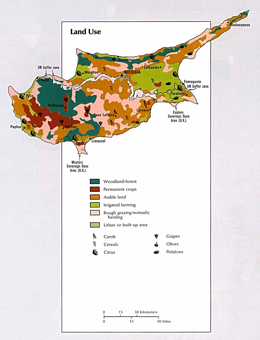
Cyprus
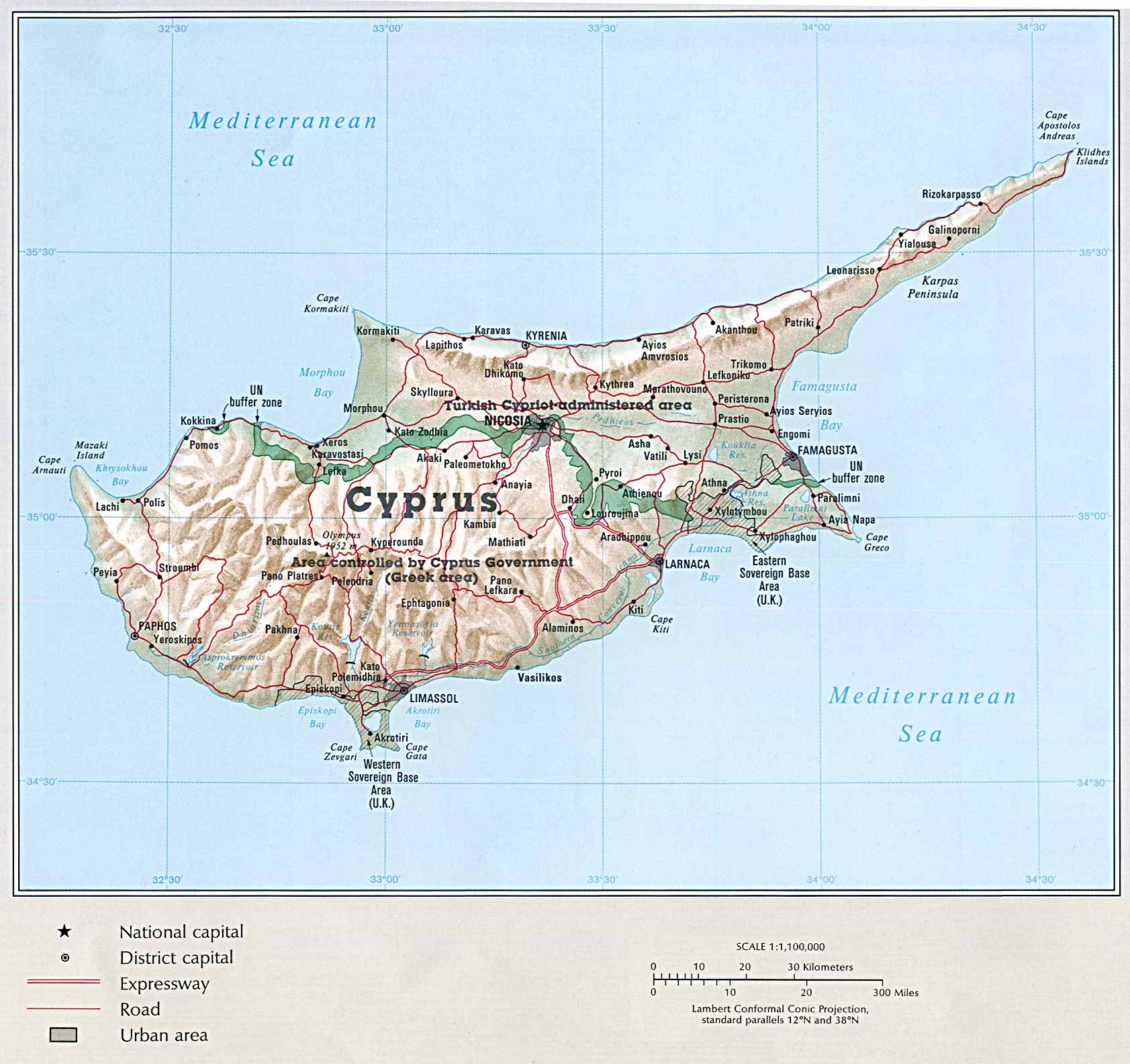
Country Map (282k)
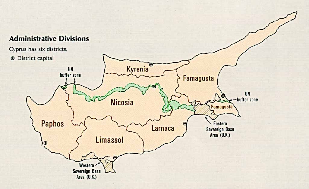
Administrative Divisions (66k)
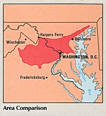
Area Comparison (41k)
Country Information (105k)
Economic Activity (121k)
Land Use (132k)
Time Line (158k)
Egypt
Country Map (518k)
Administrative Divisions (72k)
Area Comparison (40k)
Country Information (130k)
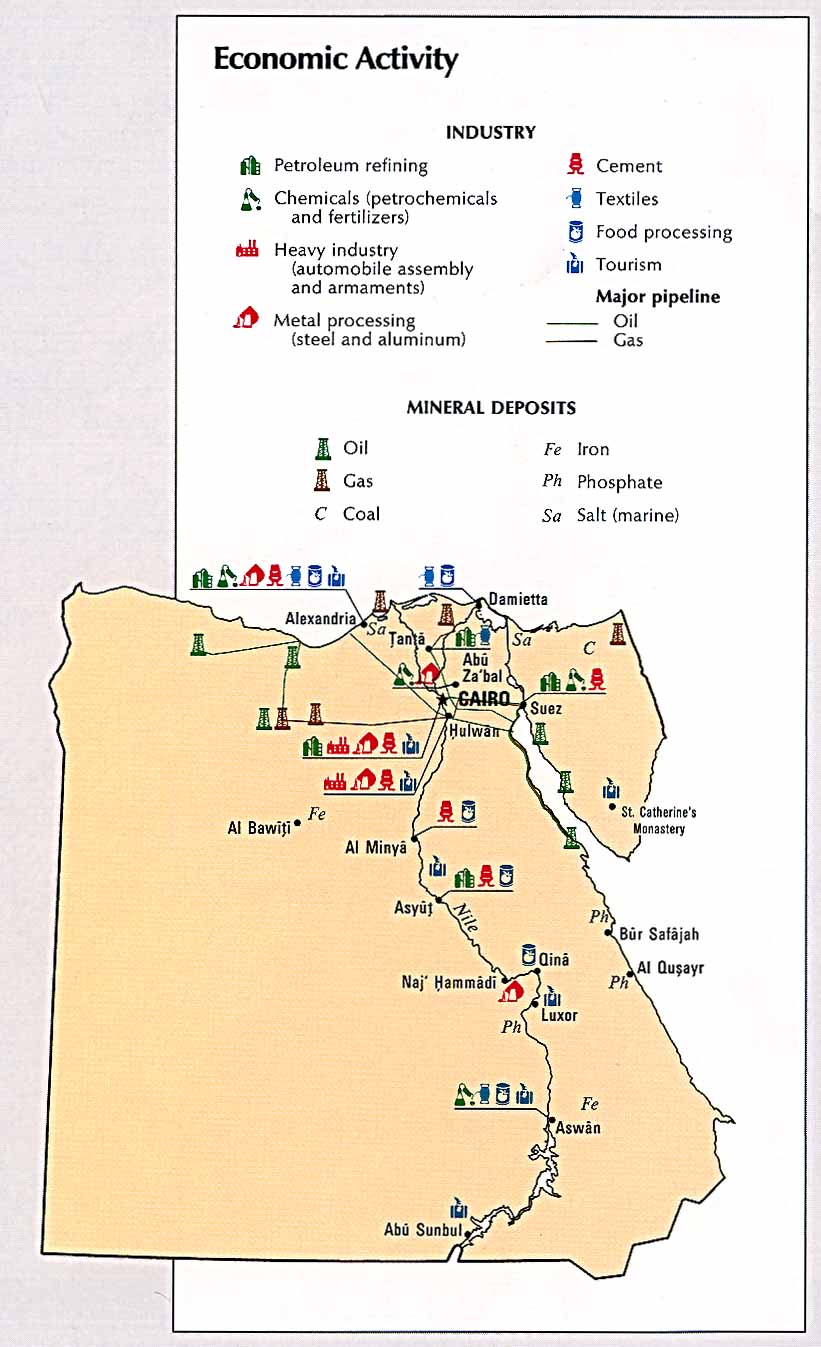
Economic Activity (107k)
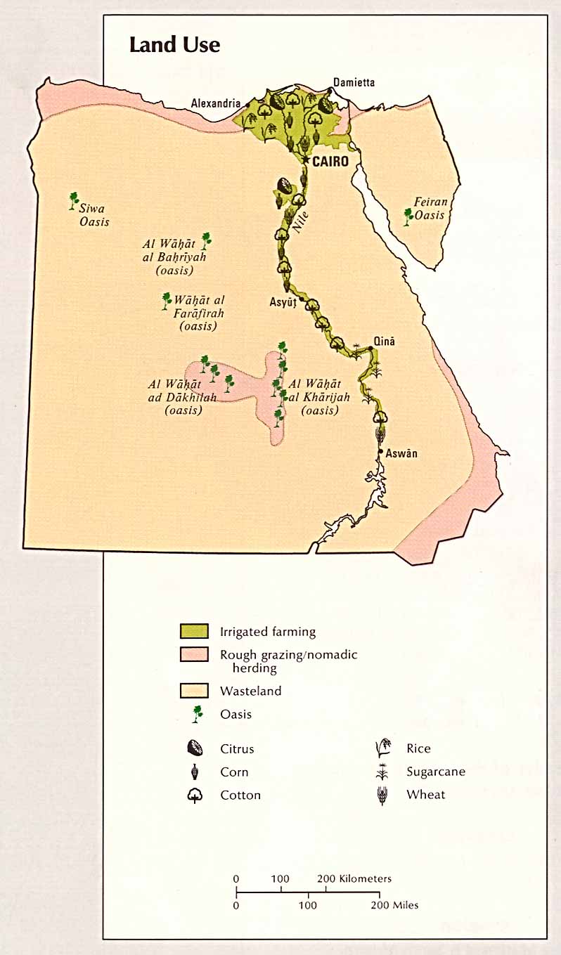
Land Use (83k)
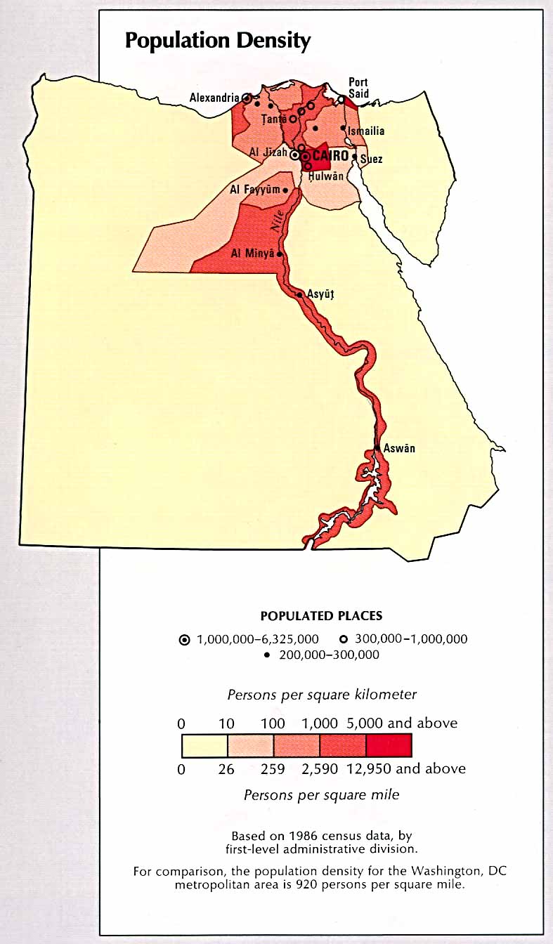
Population Density (98k)
Time Line (189k)
Gaza
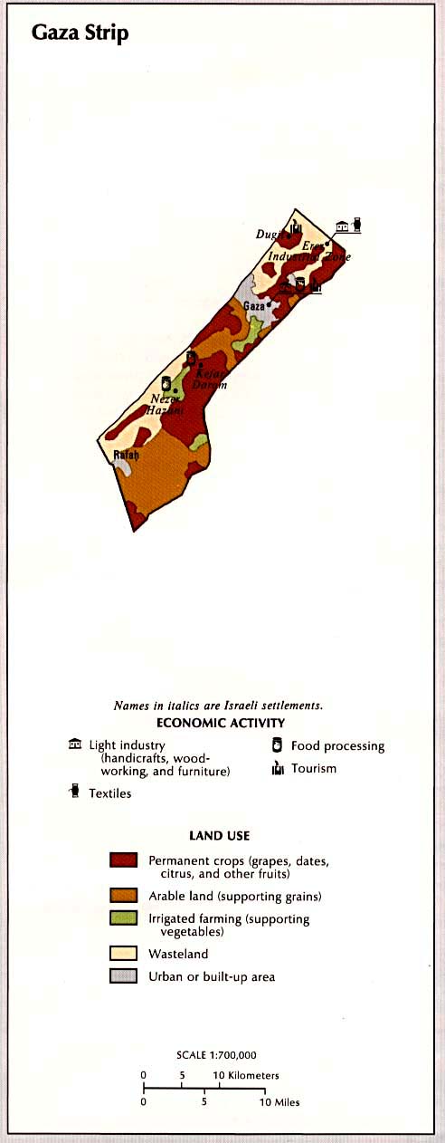
Gaza Strip Map (57k)
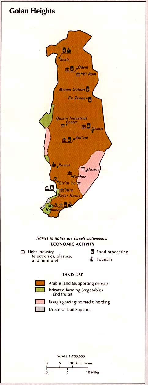
Golan Heights Map (62k)
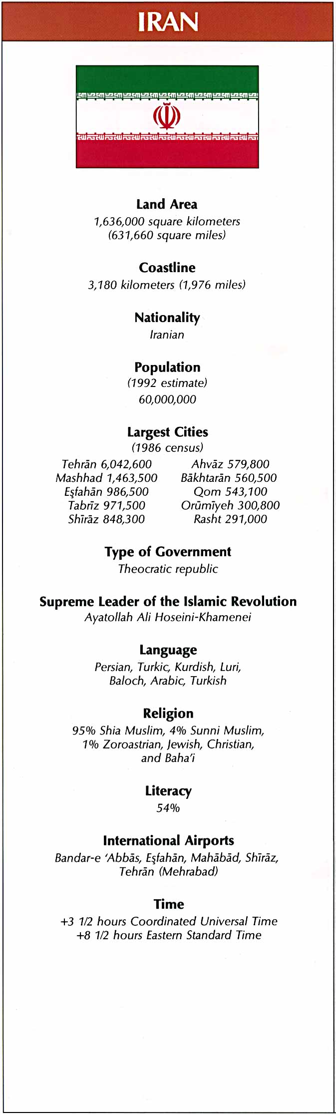
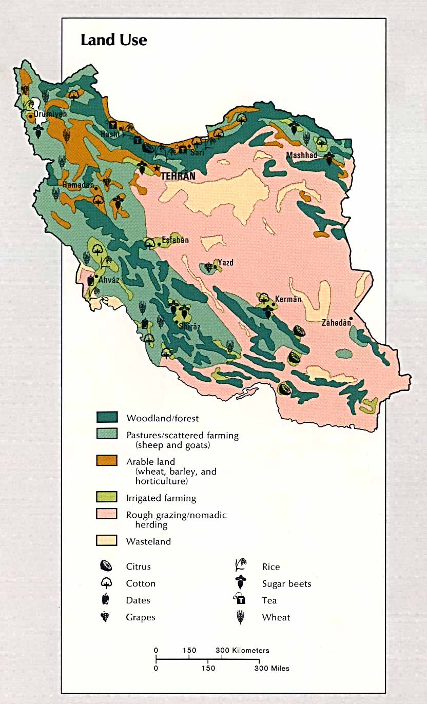
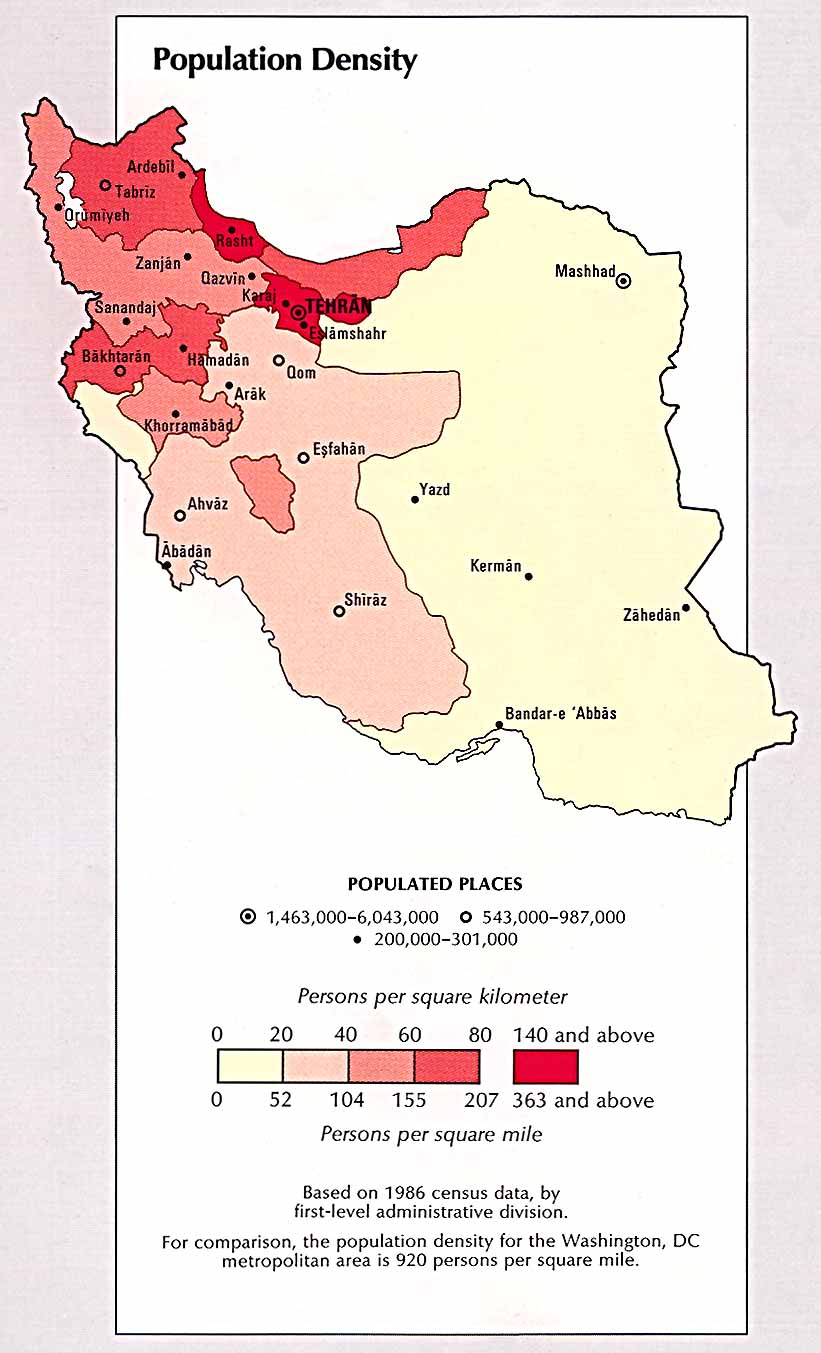
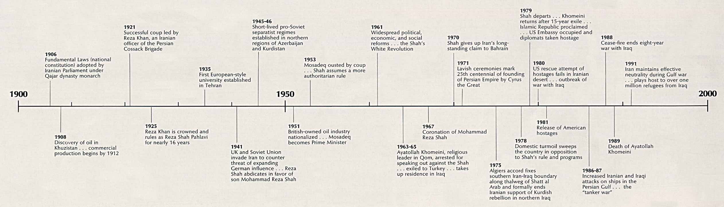
Iran
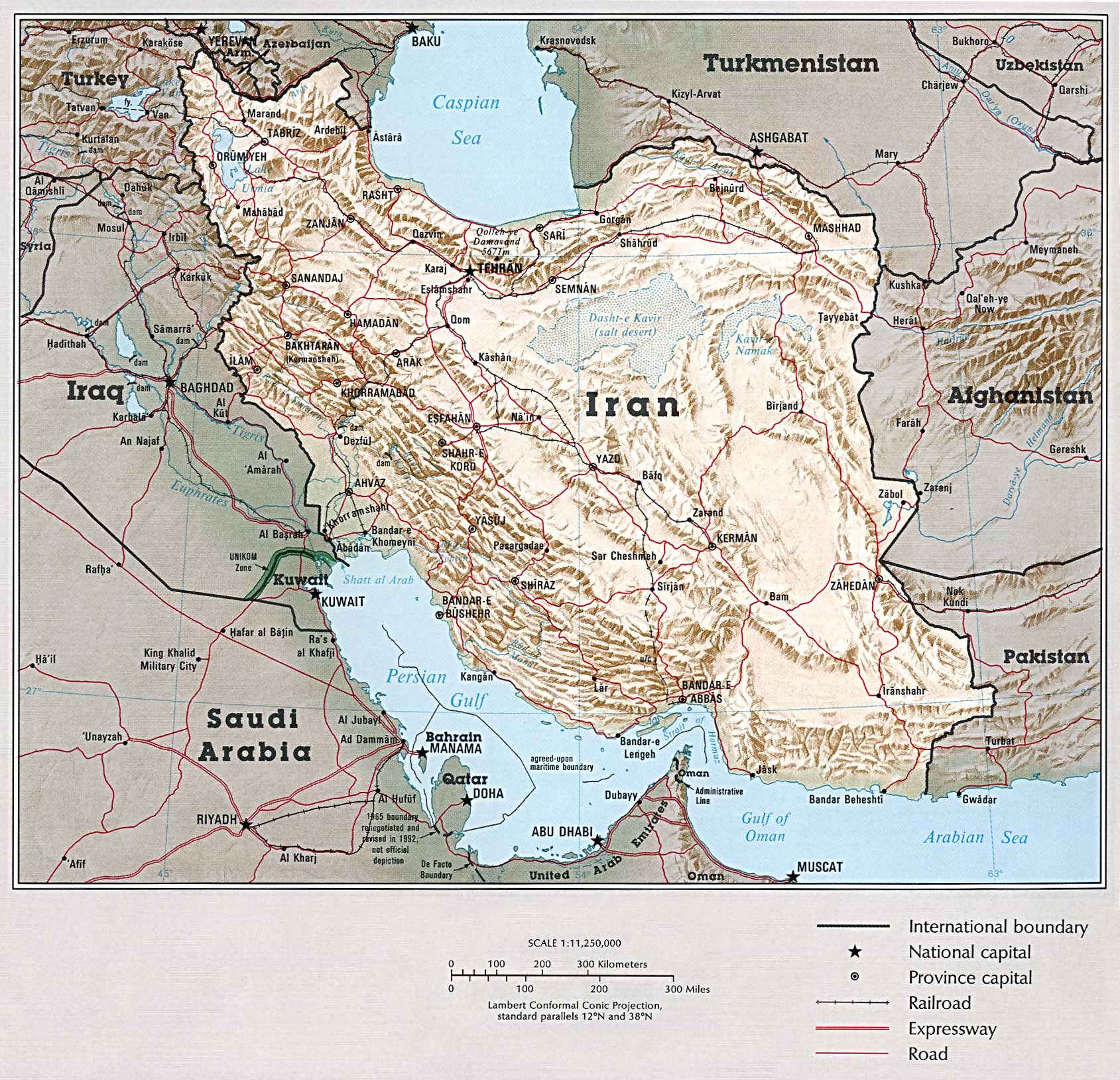
Country Map (558k)
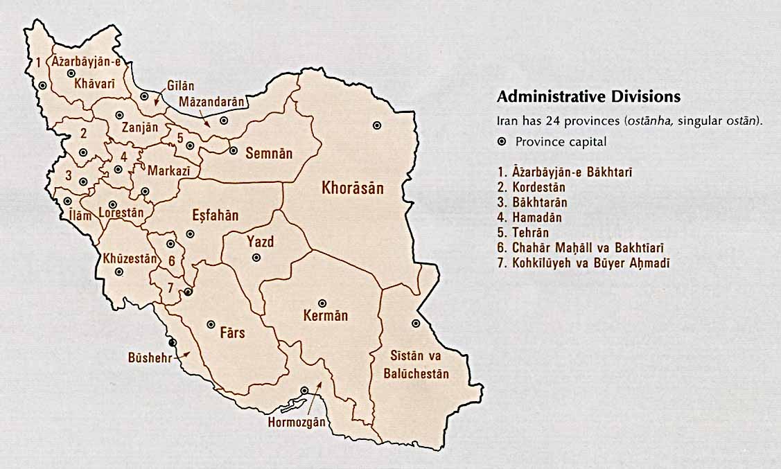
Administrative Divisions (88k)
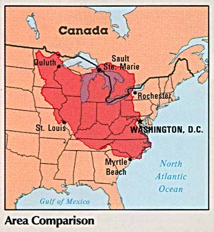
Area Comparison (37k)
Country Information (135k)
Economic Activity (118k)
Land Use (145k)
Population Density (108k)
Time Line (176k)
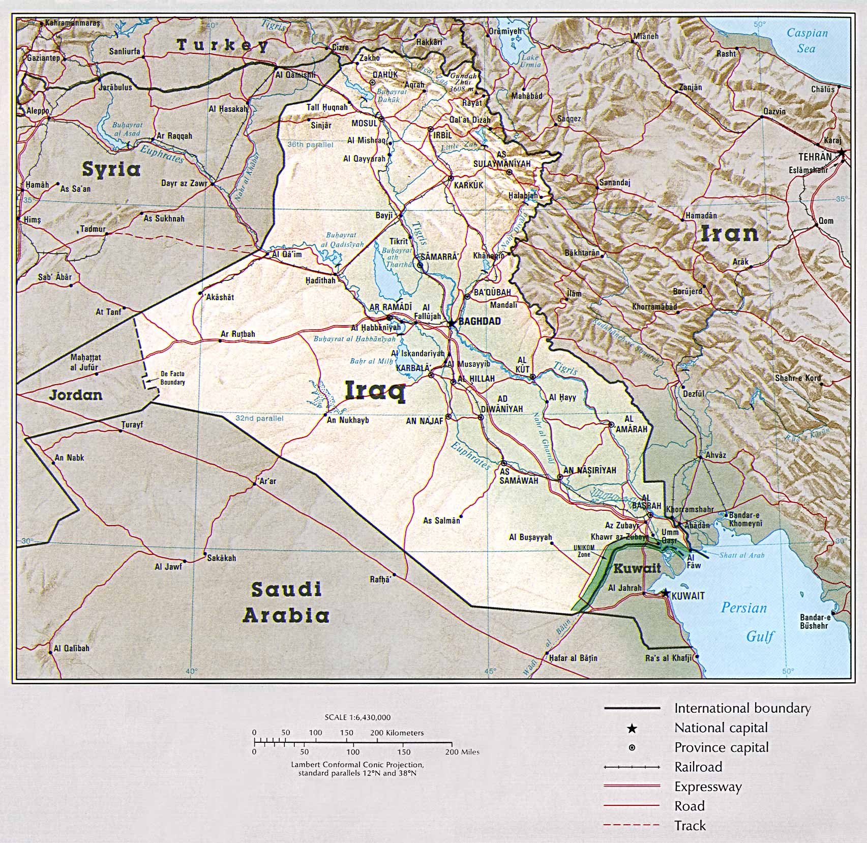
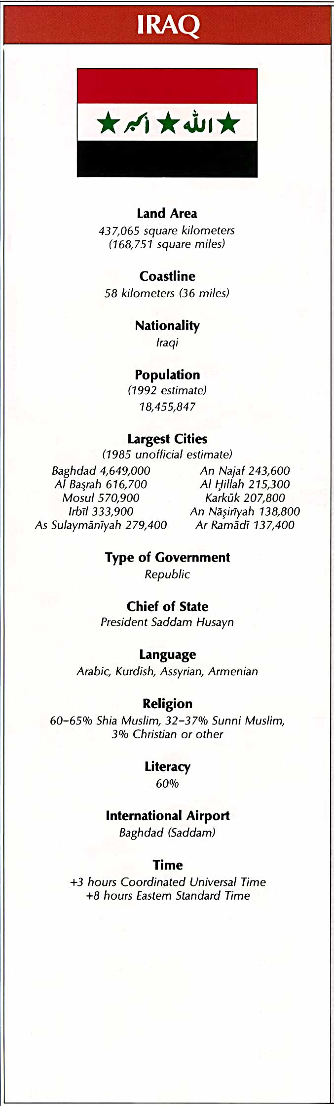
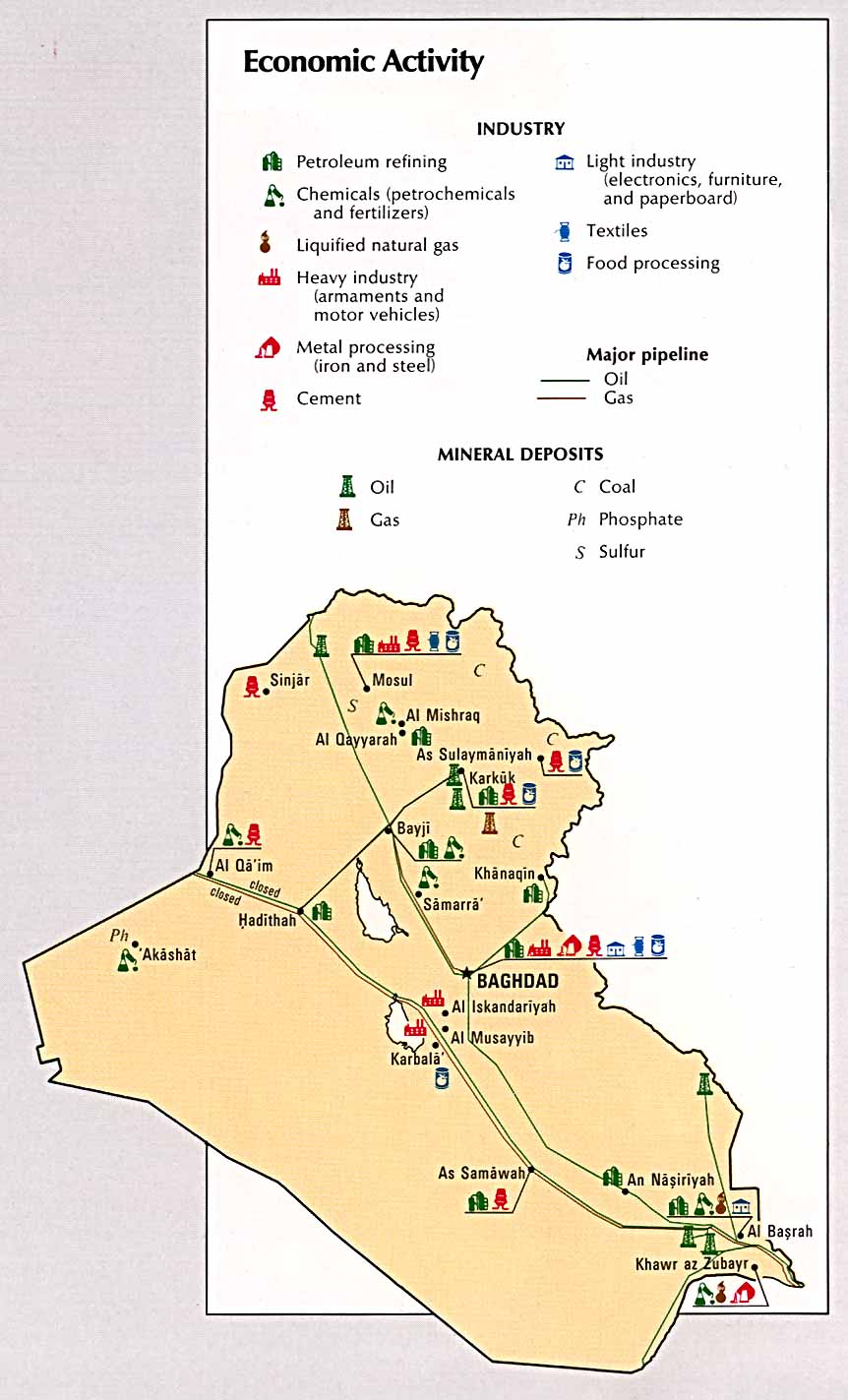
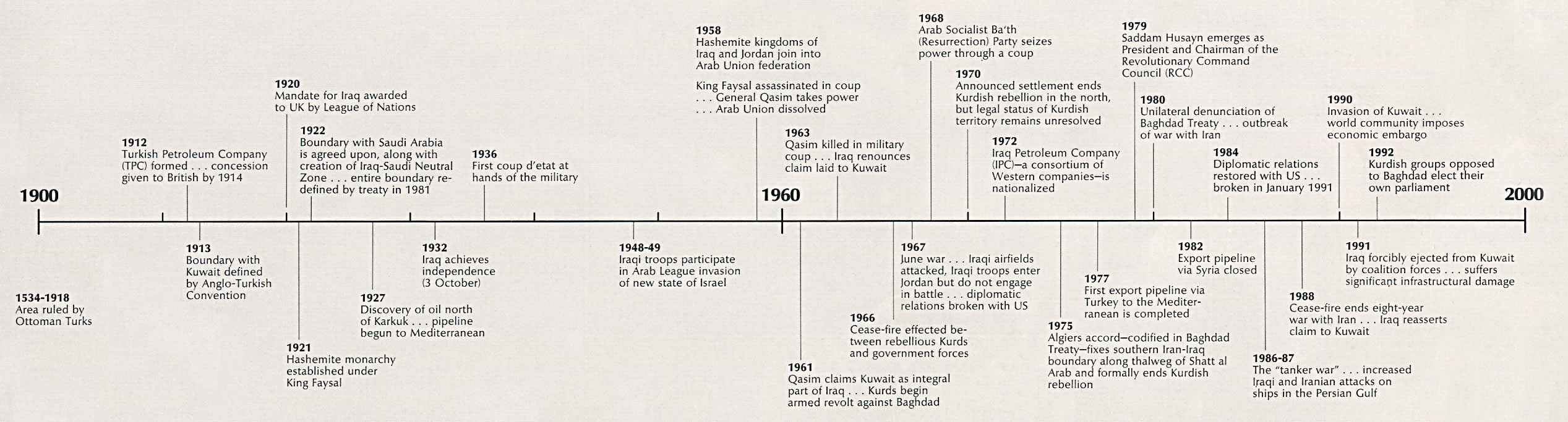
Iraq
Country Map (580k)
Administrative Divisions (69k)
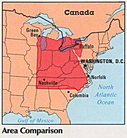
Area Comparison (38k)
Country Information (128k)
Economic Activity (115k)
Land Use (111k)
Population Density (99k)
Time Line (210k)
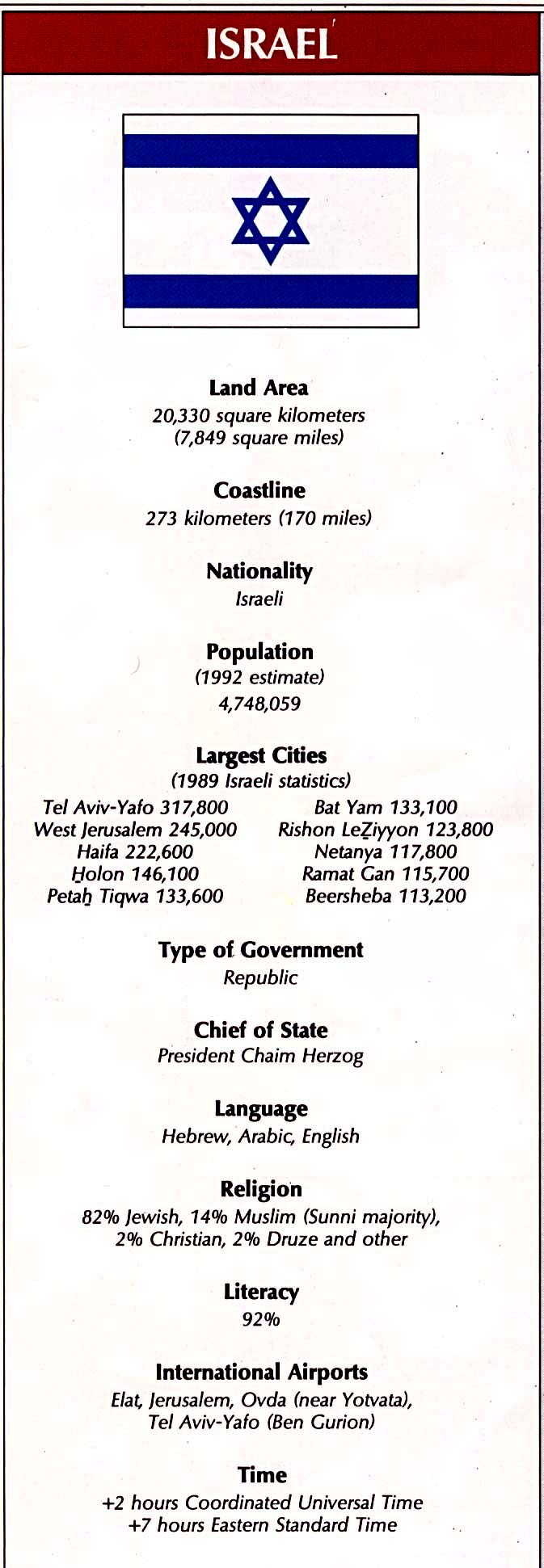
Israel
Country Map (819k)
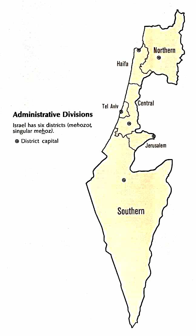
Administrative Divisions (41k)
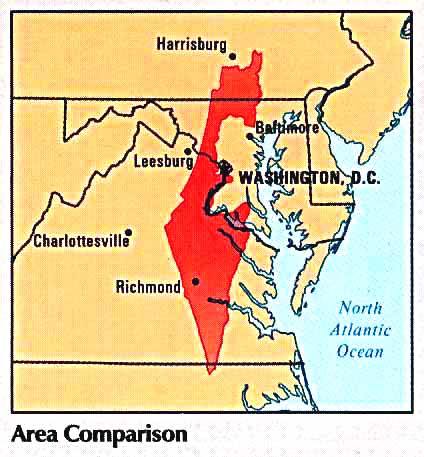
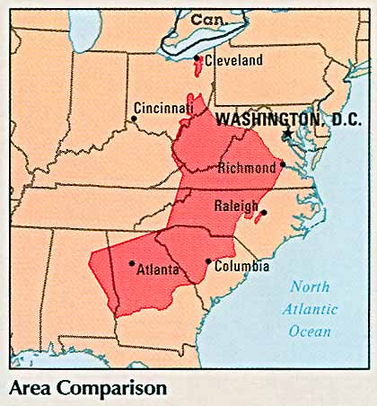
Area Comparison (37k)
Country Information (143k)
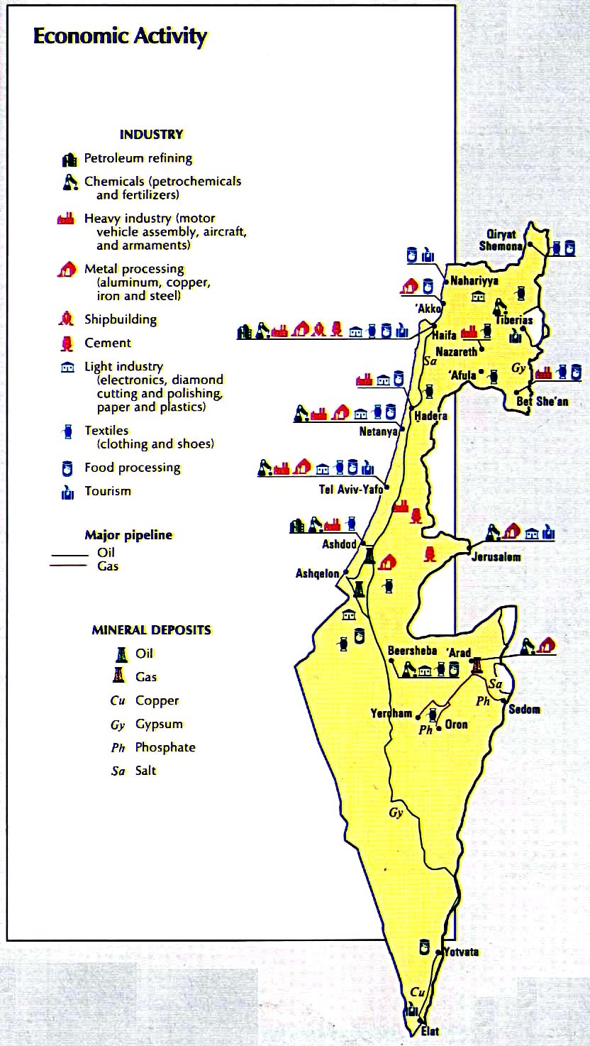
Economic Activity (196k)
Land Use (107k)
Population Density (114k)
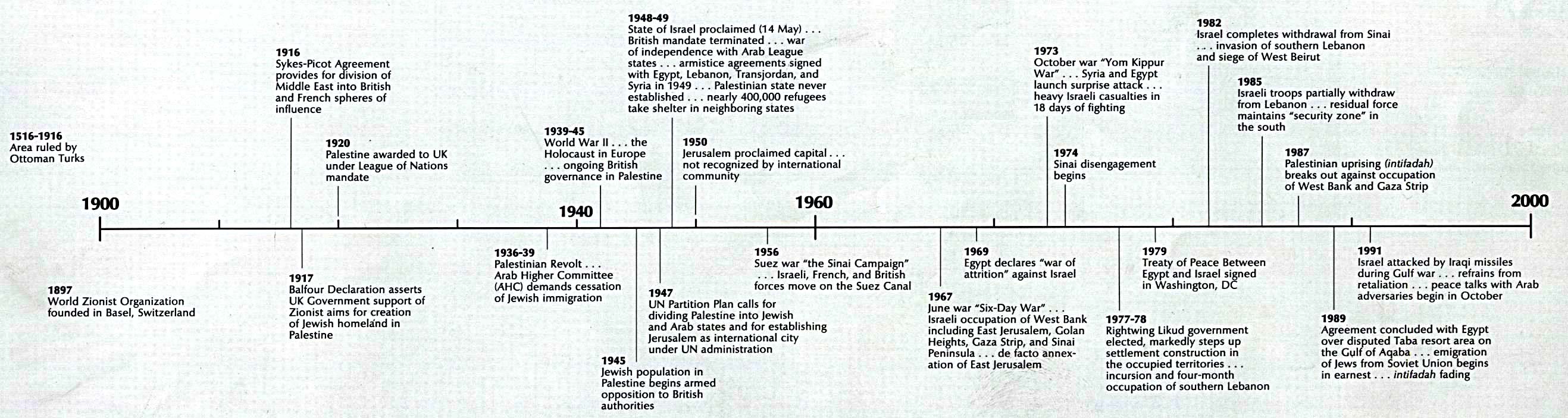
Time Line (390k)
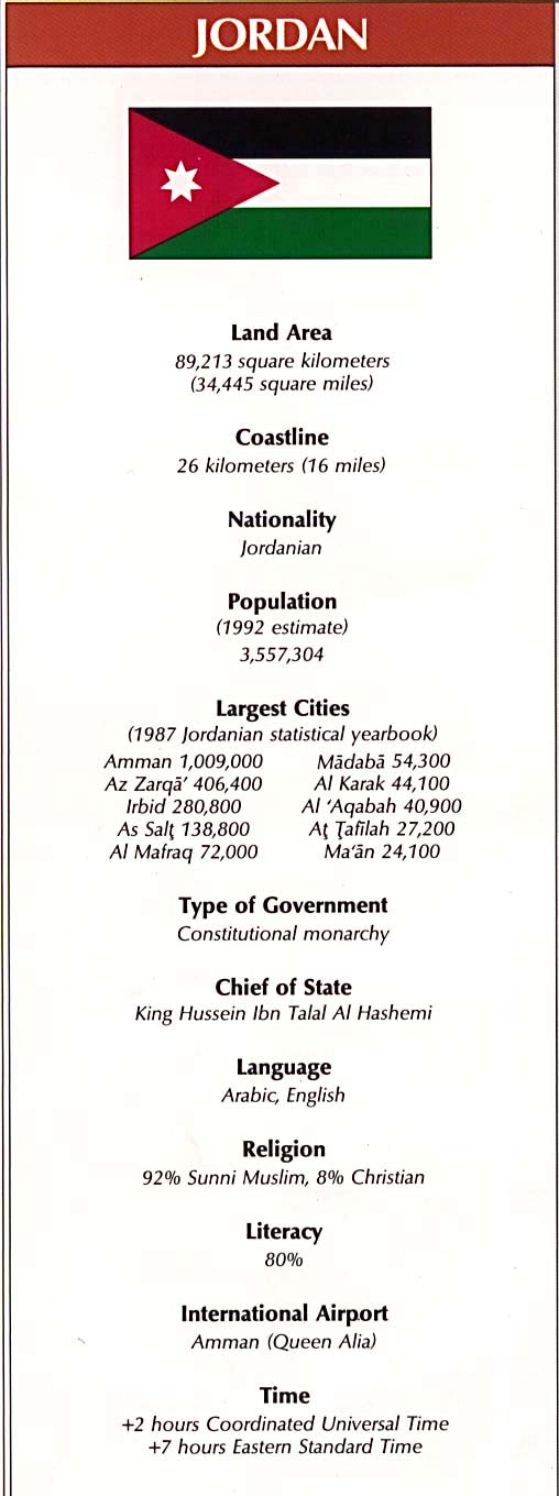
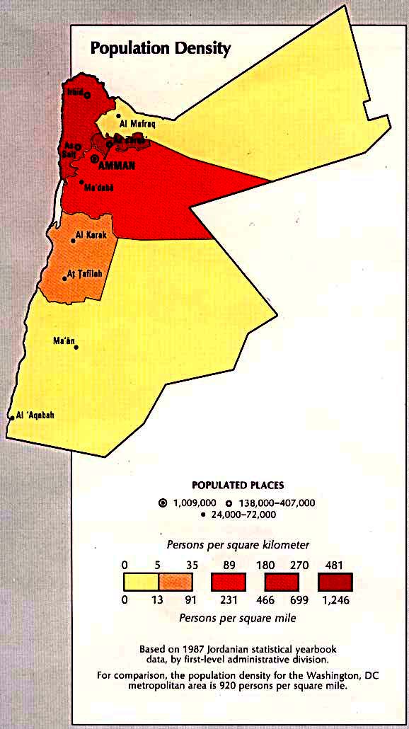
Jordan
Country Map (421k)
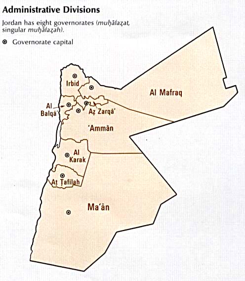
Administrative Divisions (41k)
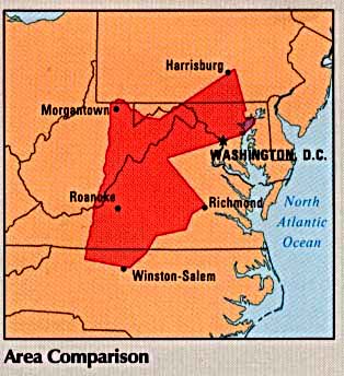
Area Comparison (29k)
Country Information (79k)
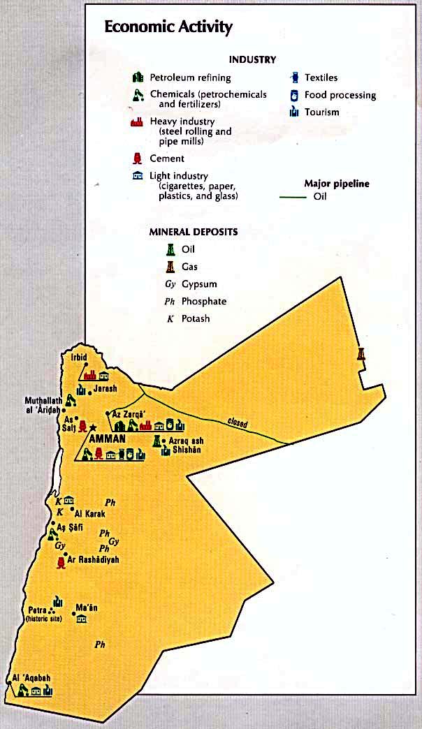
Economic Activity (89k)
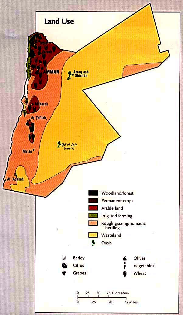
Land Use (83k)
Population Density (84k)
Time Line (131k)
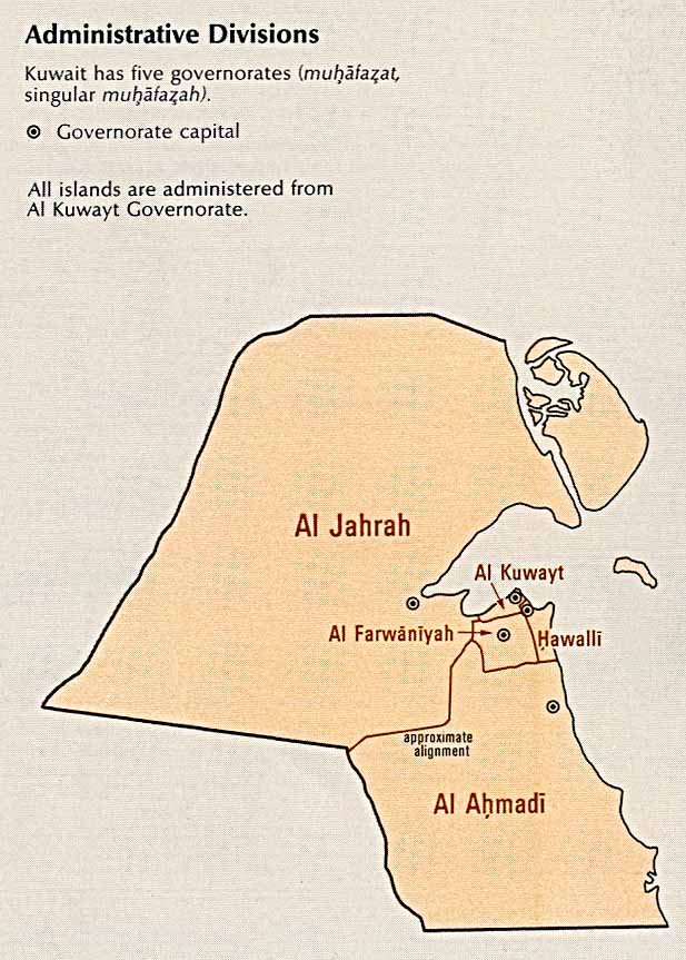
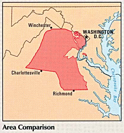
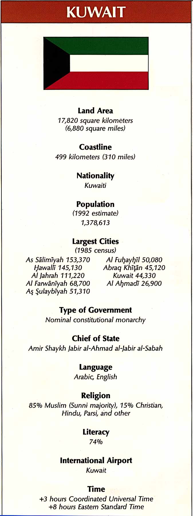
Kuwait
Administrative Divisions (85k)
Area Comparison (52k)
Country Information (120k)
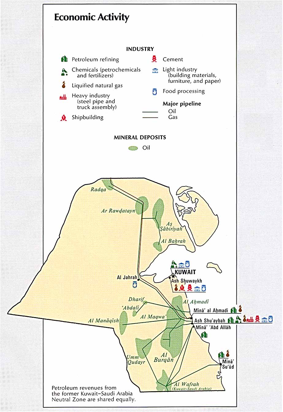
Economic Activity (138k)
Land Use (88k)
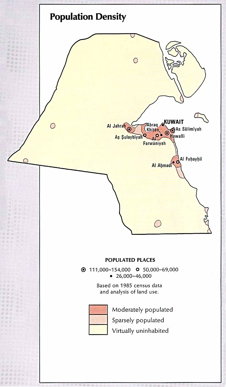
Population Density (107k)
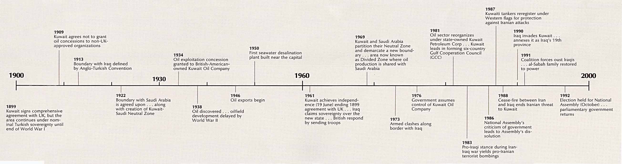
Time Line (208k)
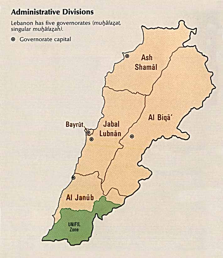
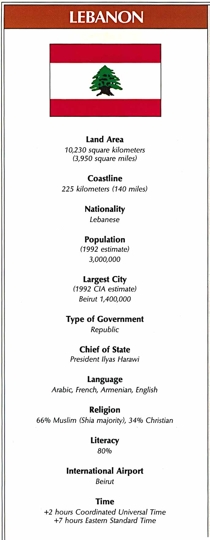
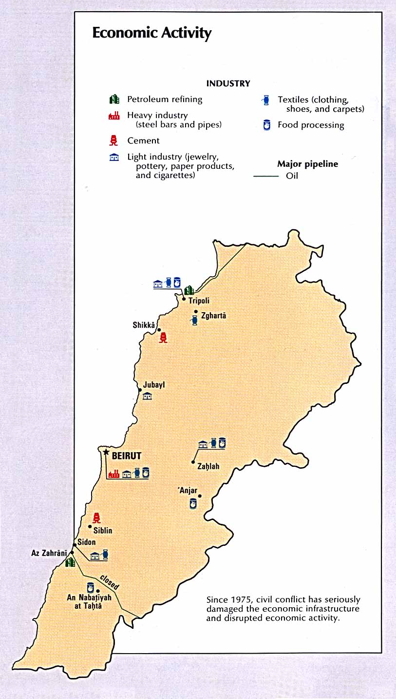
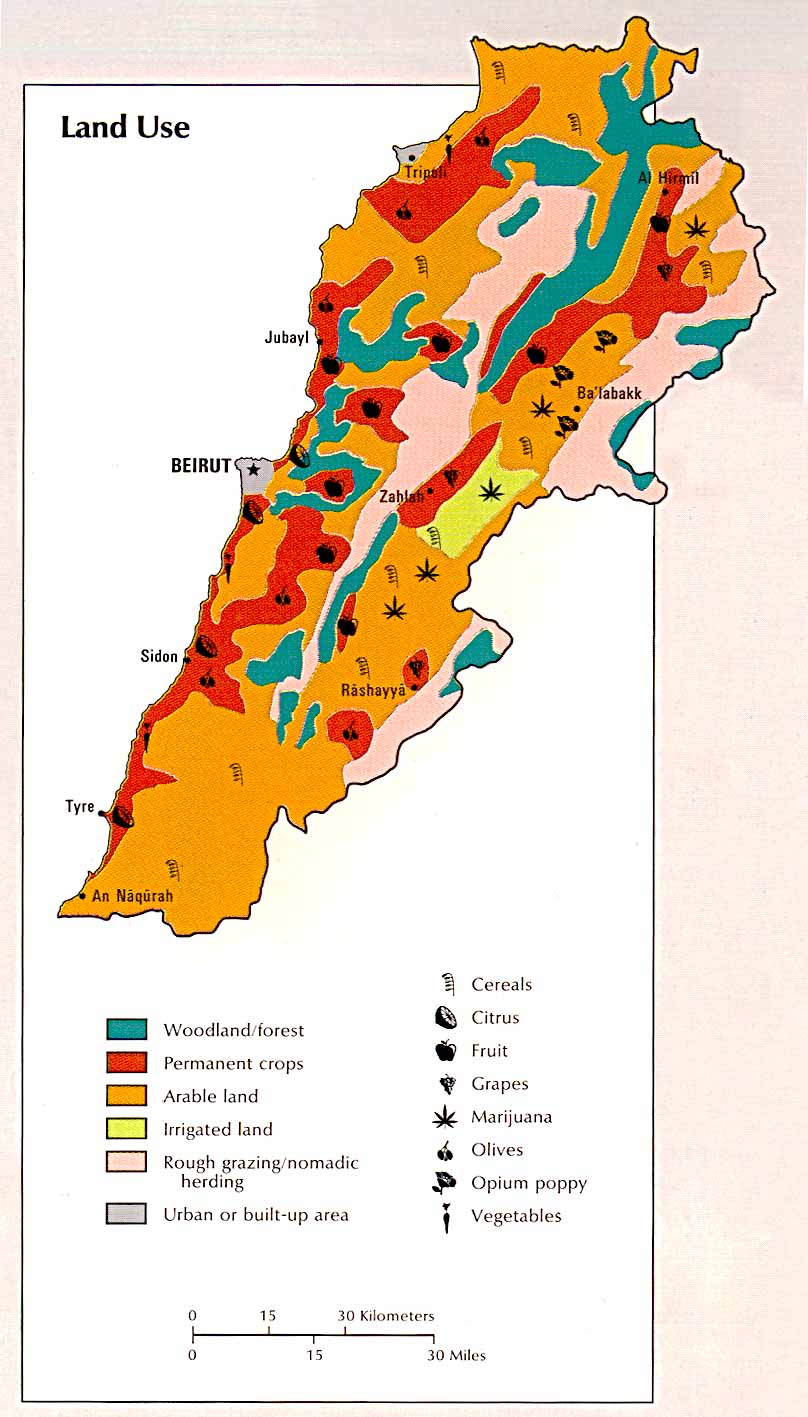
Lebanon
Country Map (604k)
Administrative Divisions (64k)
Area Comparison (50k)
Country Information (93k)
Economic Activity (148k)
Land Use (126k)
Population Density (119k)
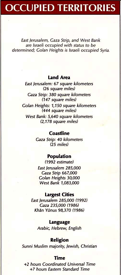
Occupied Territories
Occupied Territories Map (384k)
Area Comparison (30k)
Country Information (84k)
Gaza Strip Map (57k)
Golan Heights Map (62k)
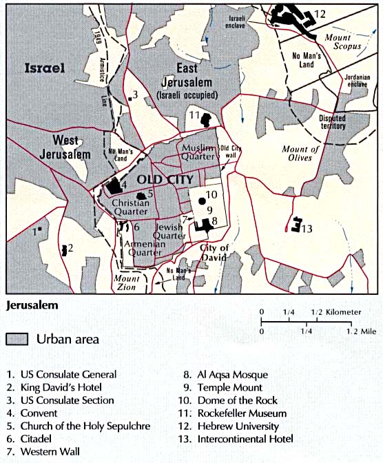
Jerusalem (67k)
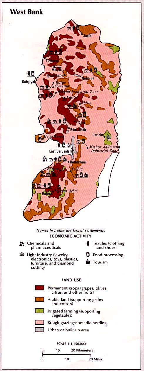
West Bank Map (103k)
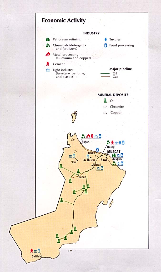
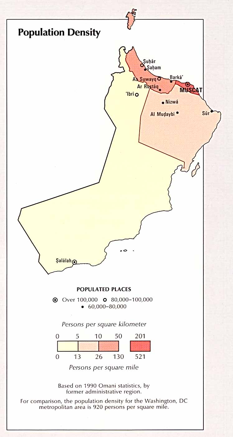
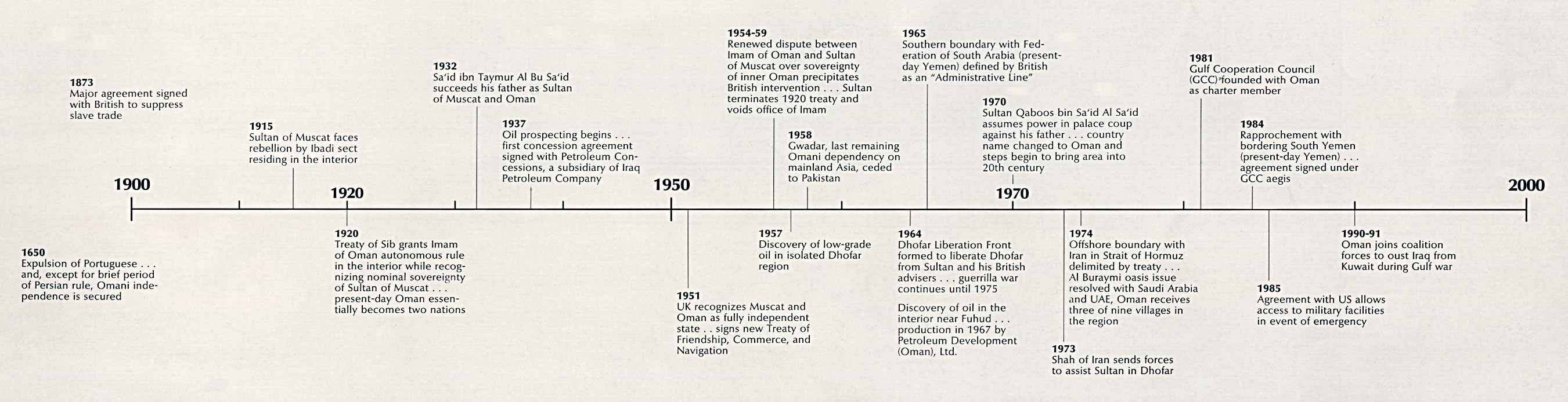
Oman
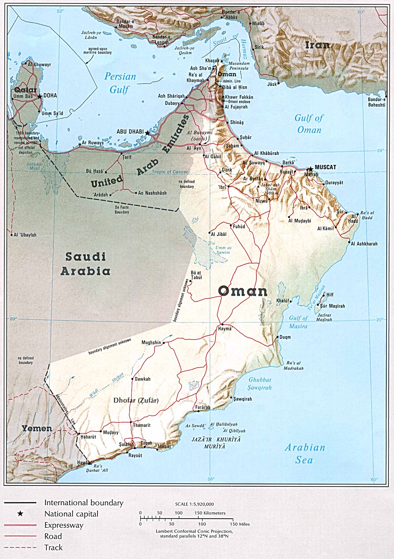
Country Map (402k)
Administrative Divisions (67k)
Area Comparison (37k)
Country Information (114k)
Economic Activity (124k)
Land Use (70k)
Population Density (73k)
Time Line(195k)
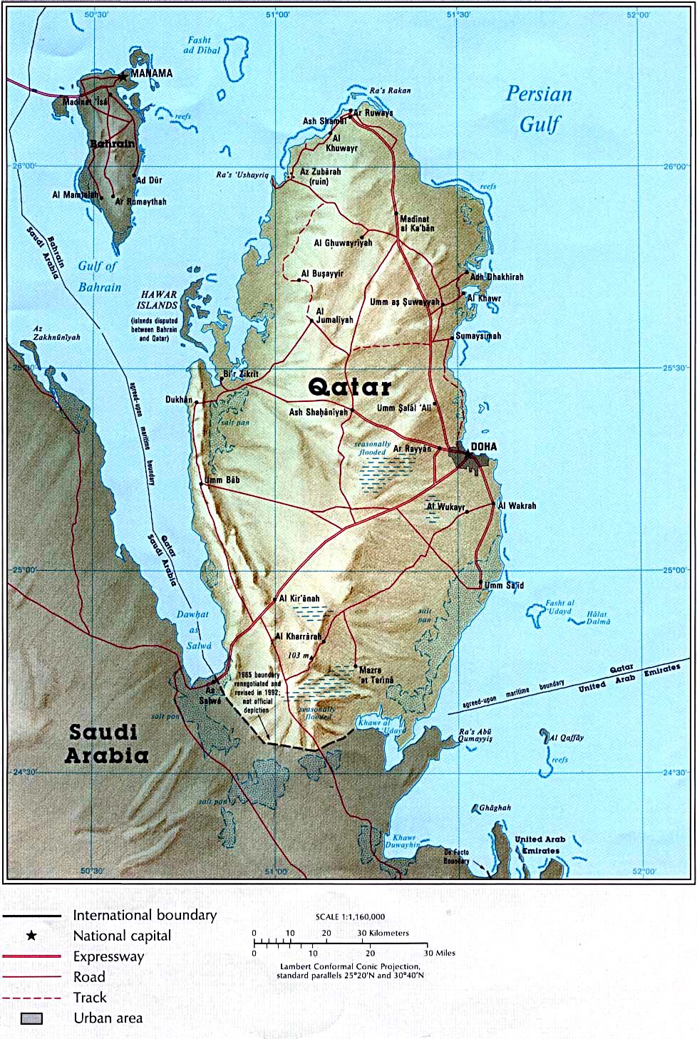
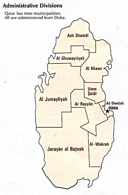
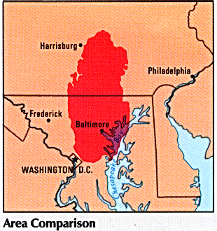
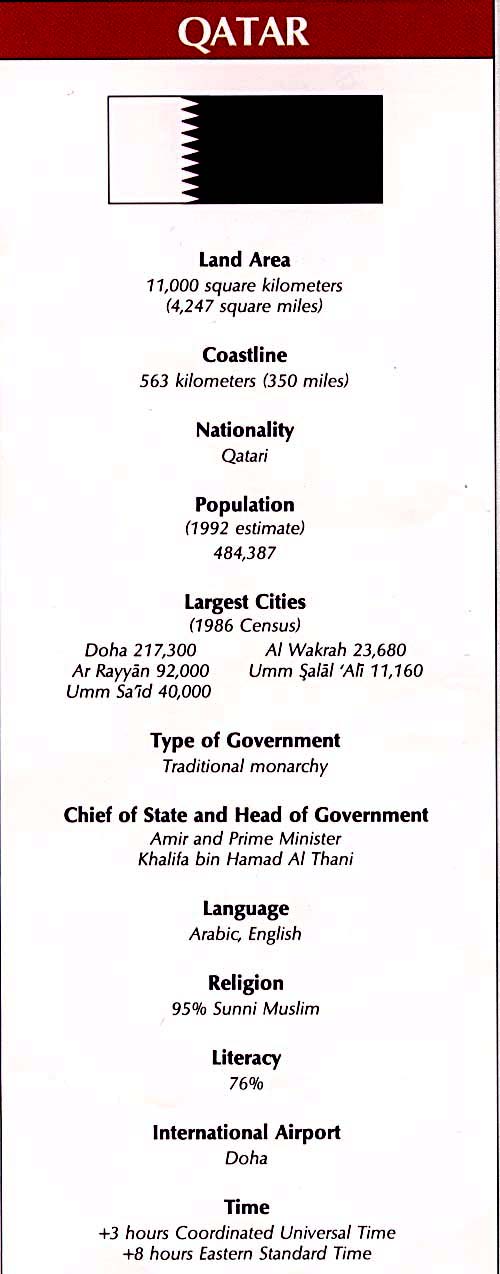
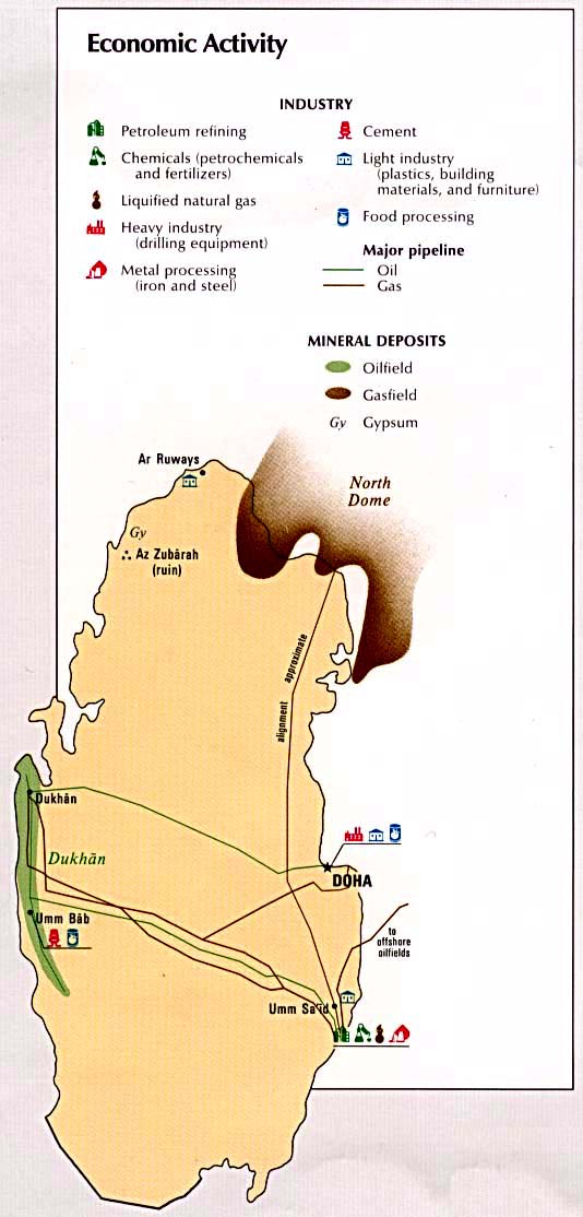
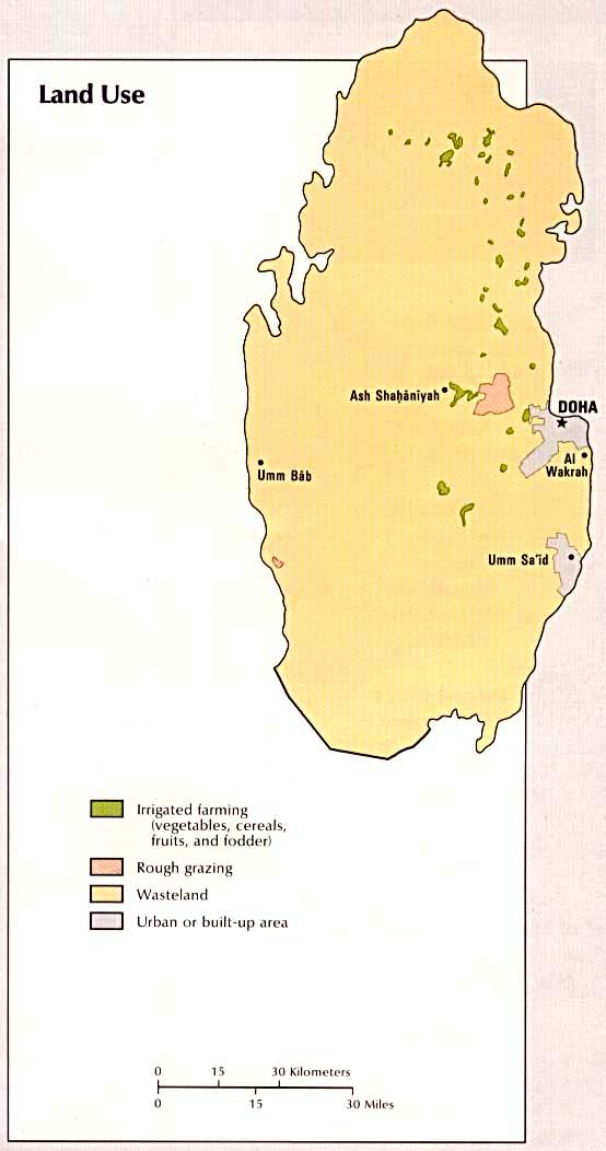
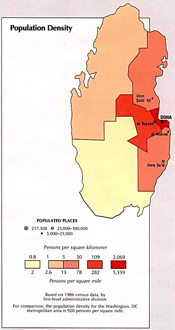
Qatar
Country Map (340k)
Administrative Divisions (39k)
Area Comparison (257k)
Country Information (71k)
Economic Activity (76k)
Land Use (50k)
Population Density (69k)
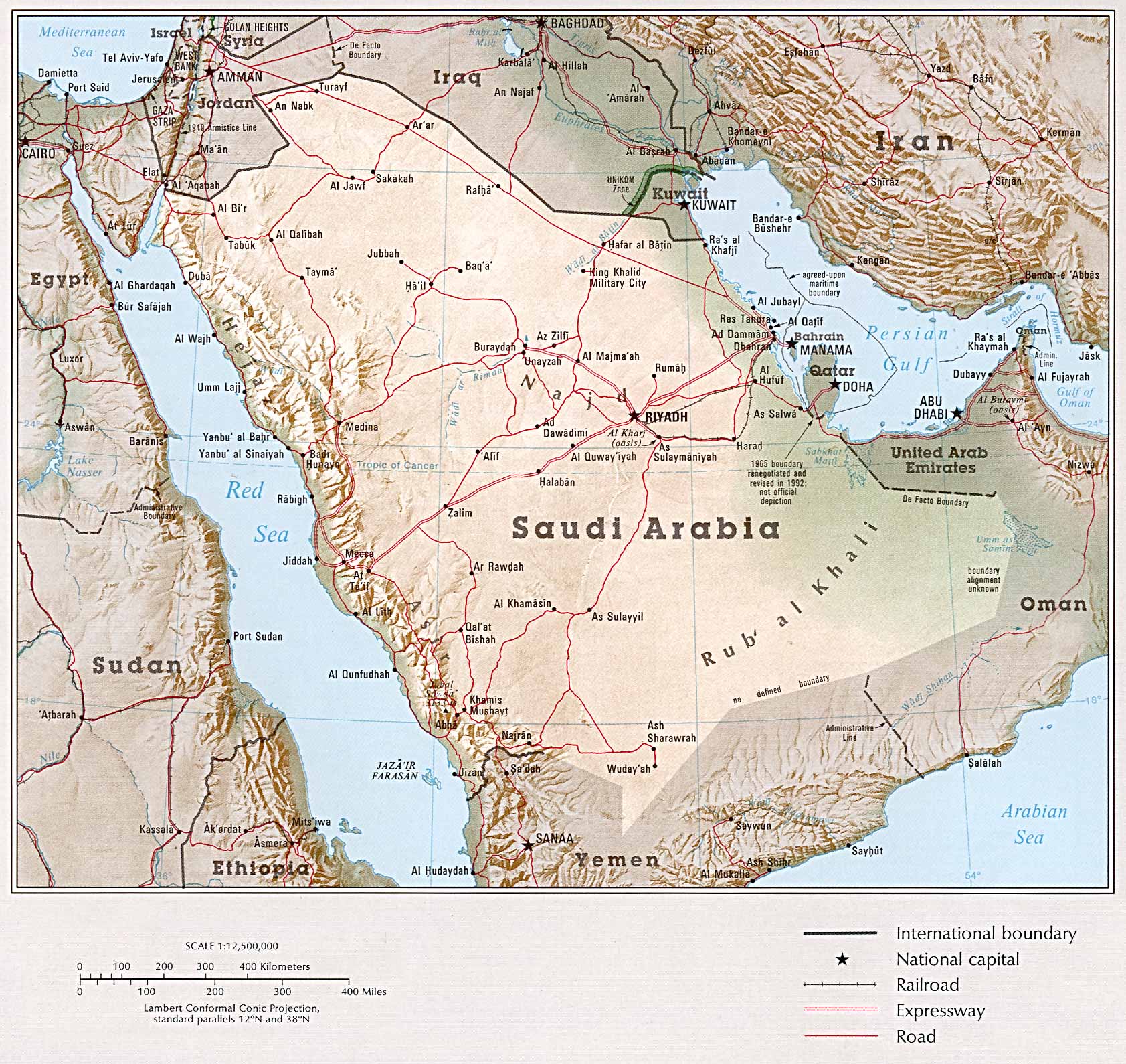
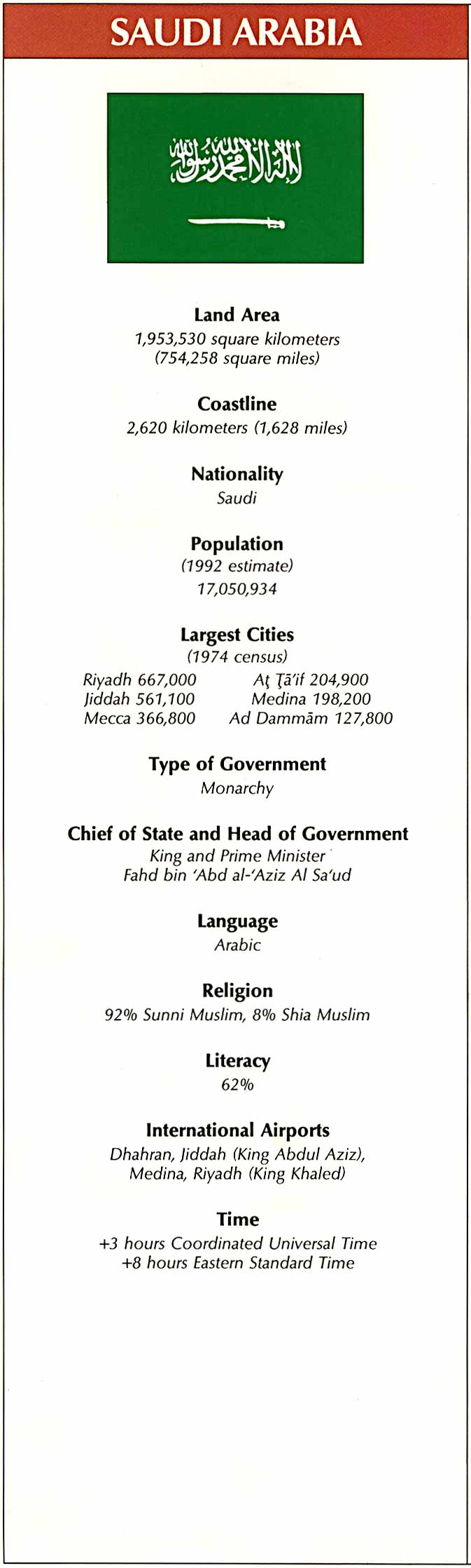
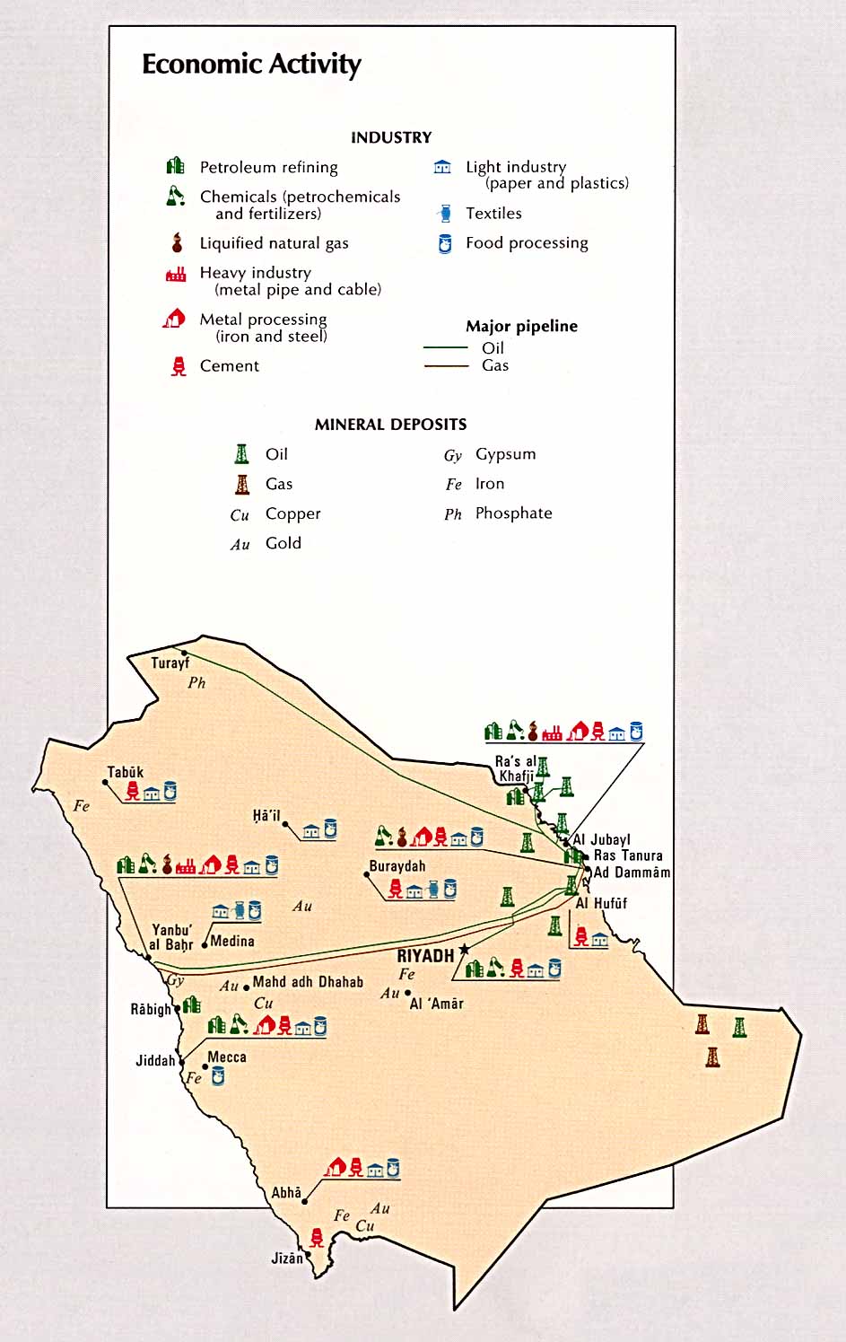
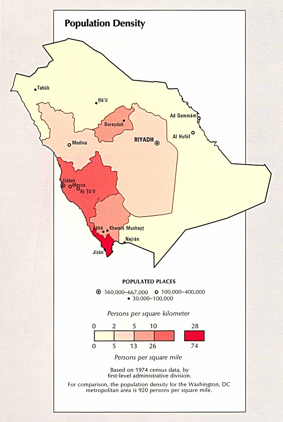
Saudi Arabia
Country Map (504k)
Administrative Divisions (61k)
Area Comparison (30k)
Country Information (107k)
Economic Activity (120k)
Land Use (105k)
Population Density (103k)
Time Line (222k)
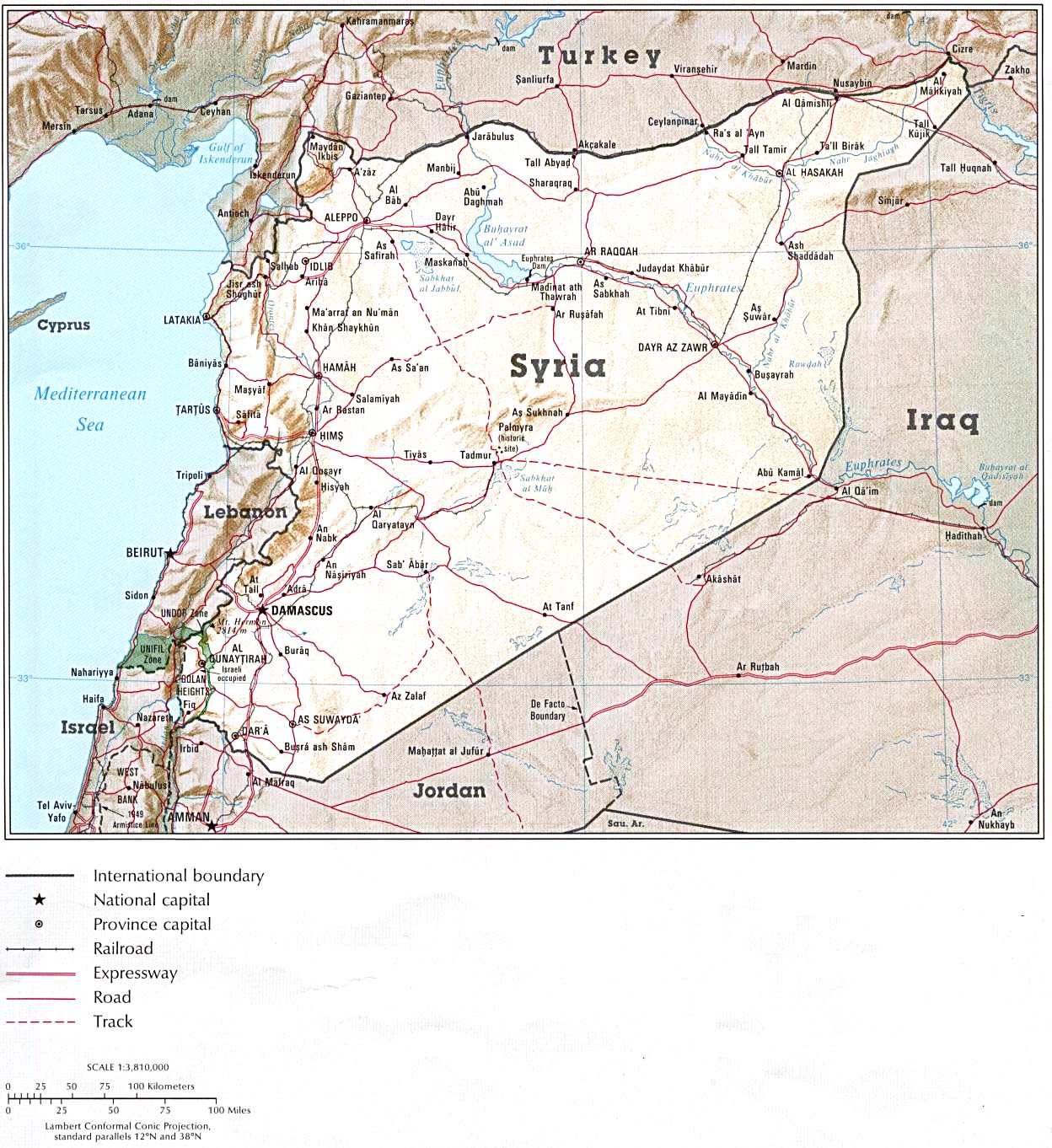
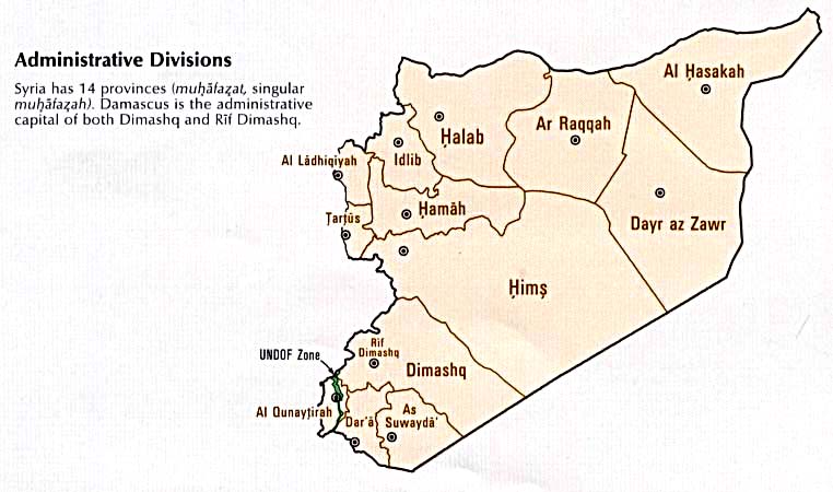
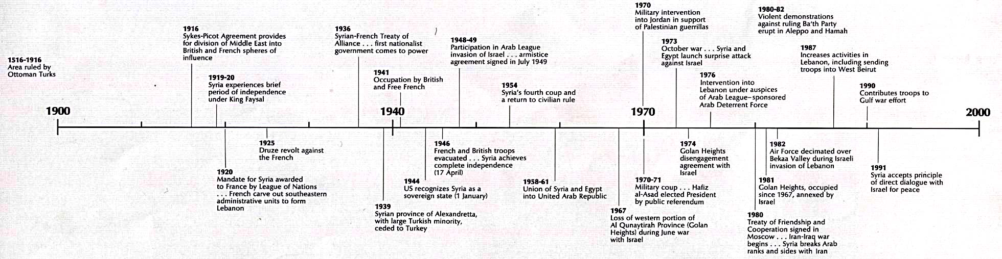
Syria
Country Map (339k)
Administrative Divisions (52k)
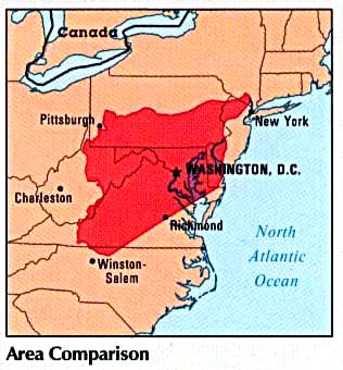
Area Comparison (29k)
Country Information (81k)
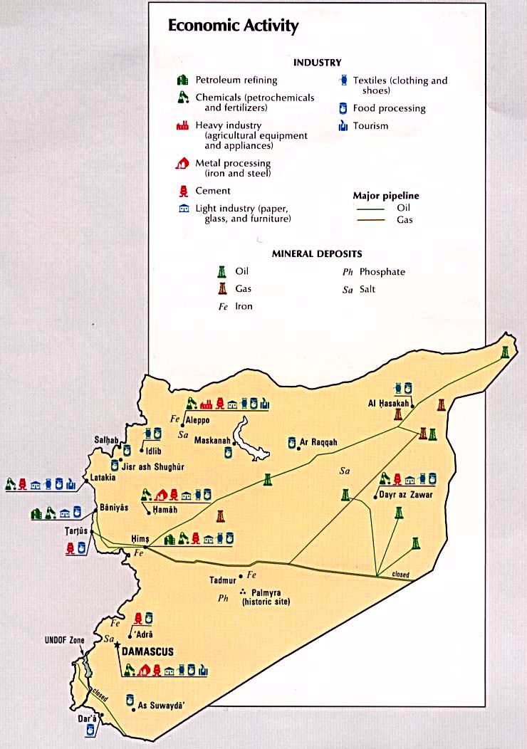
Economic Activity (103k)
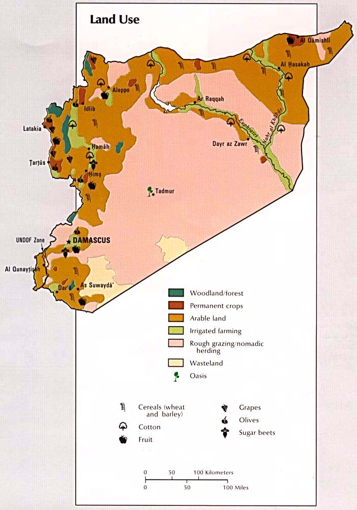
Land Use (89k)
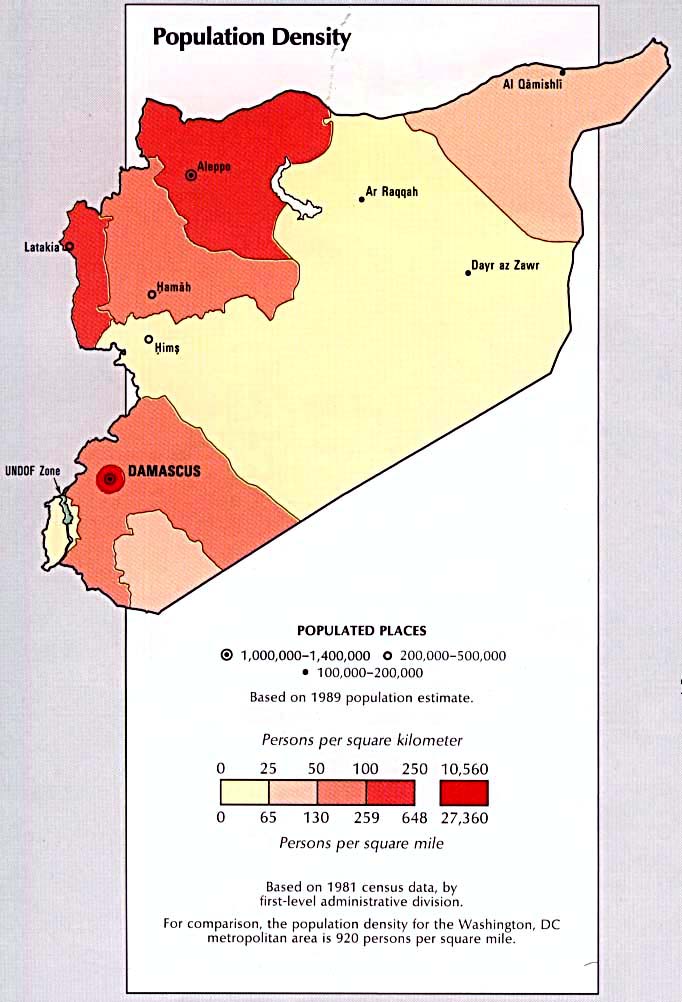
Population Density (86k)
Time Line (175k)
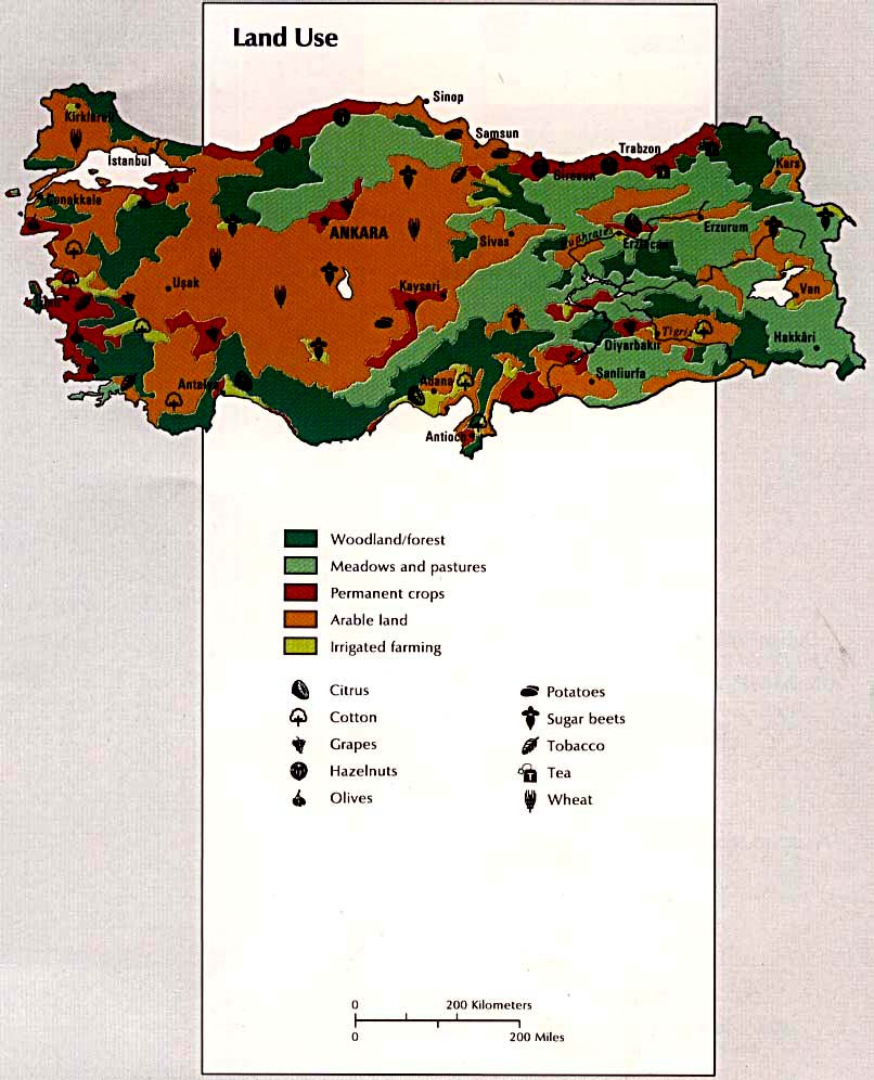
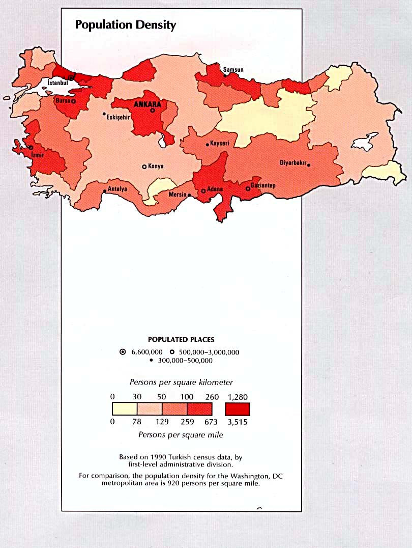
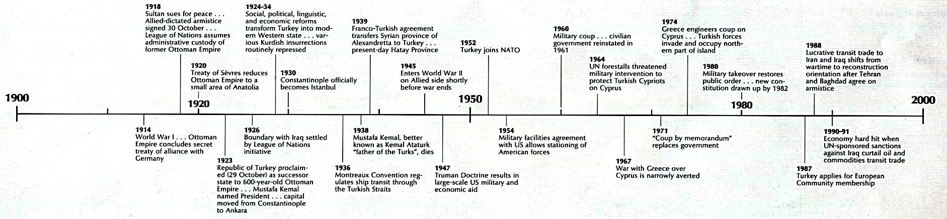
Turkey
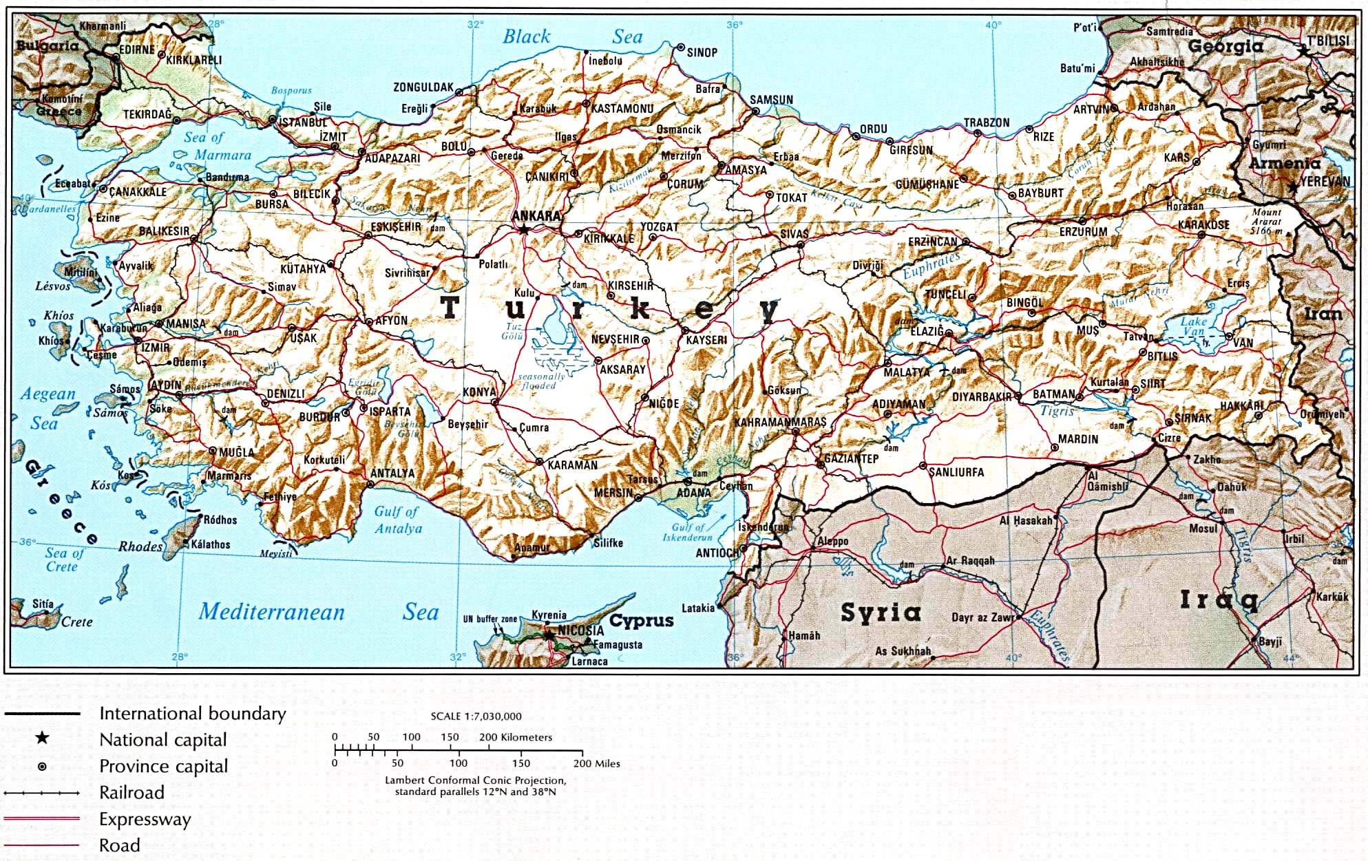
Country Map (709k)
Administrative Divisions (119k)
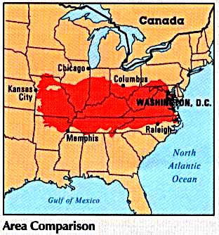
Area Comparison (34k)
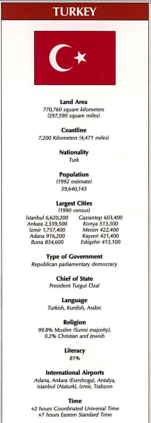
Country Information (88k)
Economic Activity (126k)
Land Use (112k)
Population Density (110k)
Time Line (158k)
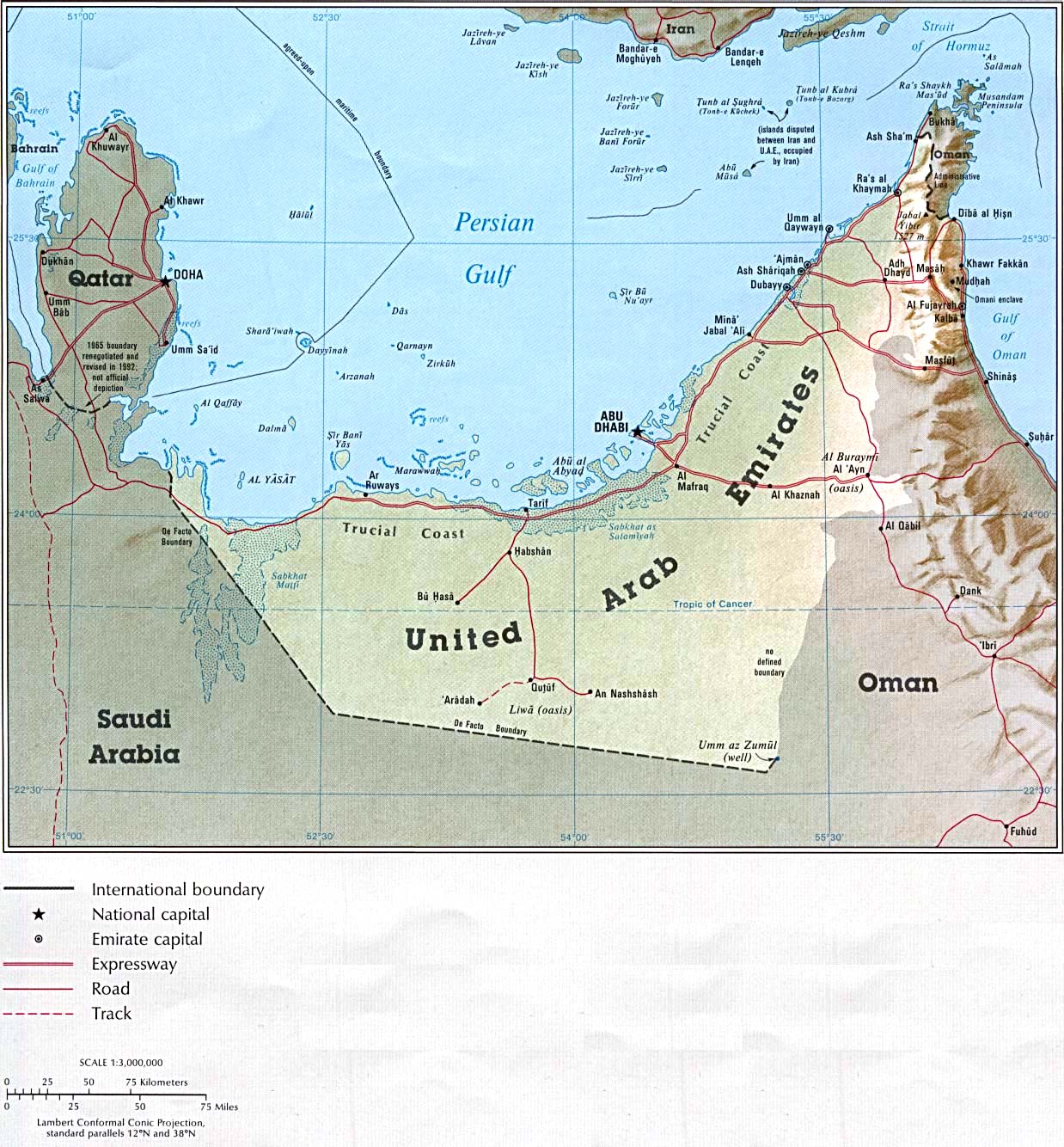
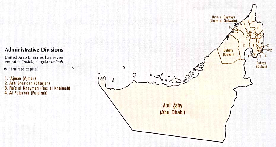
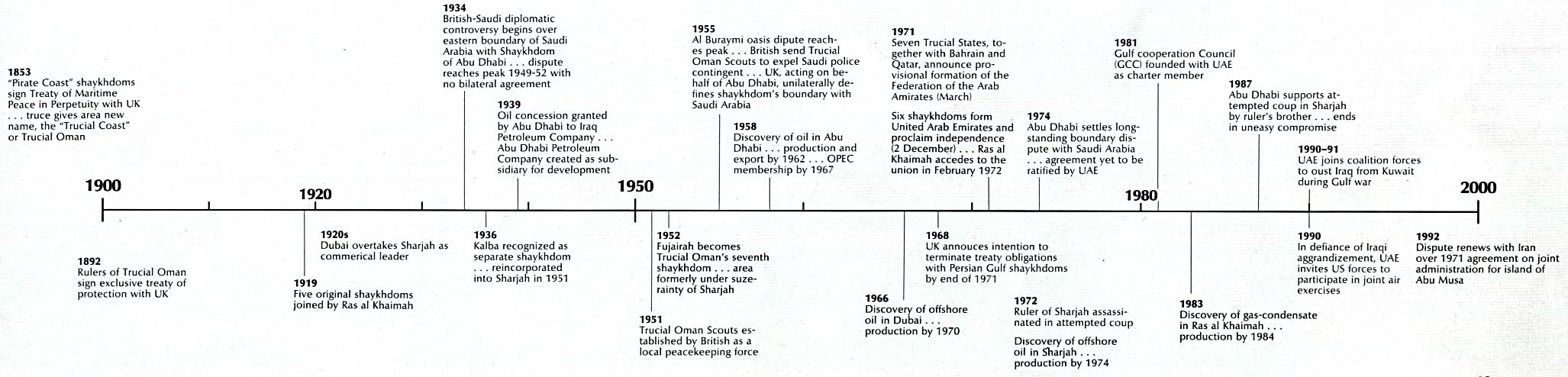
United Arab Emirates
Country Map (310k)
Administrative Divisions (61k)
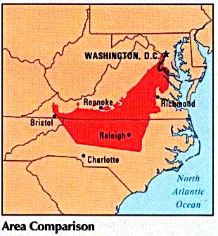
Area Comparison (30k)
Country Information (83k)
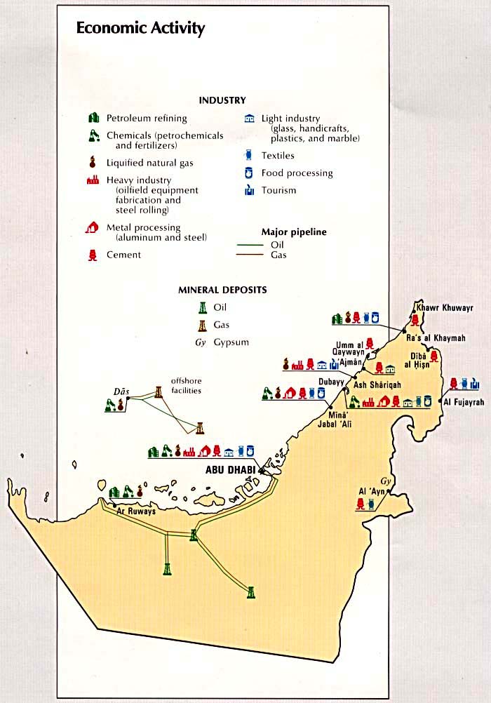
Economic Activity (87k)
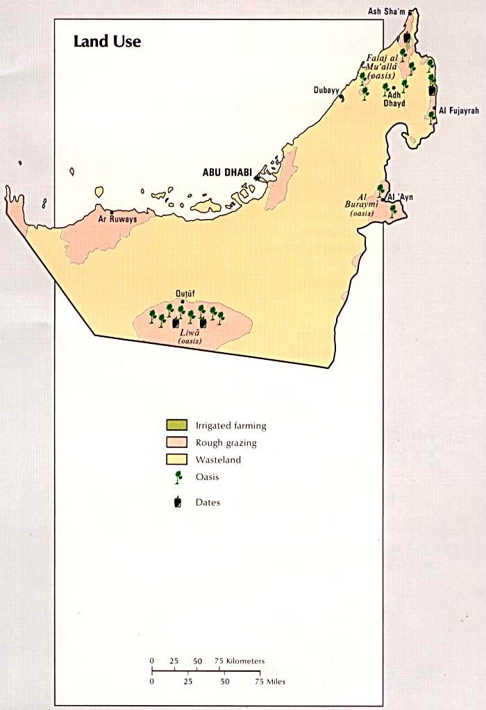
Land Use (62k)
Population Density (63k)
Time Line (154k)
West Bank
West Bank Map (103k)
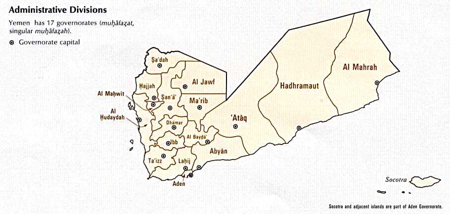
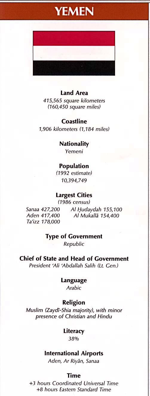
Yemen
Country Map (333k)
Administrative Divisions (60k)
Area Comparison (34k)
Country Information (73k)
Economic Activity (81k)
Land Use (82k)
Population Density (87k)
Time Line (225k)
Table of Contents of the Atlas of the Middle East:
Front Cover
Front Cover (verso)
Title Page
Title Page (verso)
Contents
[blank]
Page 1 - Part One: Region of the Middle East [section title page]
Page 2 - Geography
Page 3 - Elevation Zones; Area Comparison
Page 4 - Temperature [January; July]
Page 5 - Water [Mean Annual Precipitation; Freshwater Sources]
Page 6 - Historical Eras [Age of the Caliphs; Early Crusades]
Page 7 - [Historical Eras] [Ottoman Empire; Colonial Past]
Page 8 - Boundary Issues
Page 9 - Strategic Passages
Page 10 - Oil and Gas
Page 11 - [Oil and Gas] [Charts]
Page 12 - Economy [Gross National Product Per Capita, 1989]
Page 13 - [Economy] [Charts]
Page 14 - Expatriate Labor
Page 15 - Ethnicity
Page 16 - Religion
Page 17 - [Religion] [Table and Chart]
Page 18 - Demography
Page 19 - Part Two: Nations of the Middle East [section title page]
Page 20 - Bahrain
Page 21 - Bahrain [Population Density, Economic Activity, Land Use]
Page 22 - Cyprus
Page 23 - Cyprus [Population Density, Economic Activity, Land Use]
Page 24 - Egypt
Page 25 - Egypt [Population Density, Economic Activity, Land Use]
Page 26 - Iran
Page 27 - Iran [Population Density, Economic Activity, Land Use]
Page 28 - Iraq
Page 29 - Iraq [Population Density, Economic Activity, Land Use]
Page 30 - Israel
Page 31 - Israel [Population Density, Economic Activity, Land Use]
Page 32 - Jordan
Page 33 - Jordan [Population Density, Economic Activity, Land Use]
Page 34 - Kuwait
Page 35 - Kuwait [Population Density, Economic Activity, Land Use]
Page 36 - Lebanon
Page 37 - Lebanon [Population Density, Economic Activity, Land Use]
Page 38 - Oman
Page 39 - Oman [Population Density, Economic Activity, Land Use]
Page 40 - Qatar
Page 41 - Qatar [Population Density, Economic Activity, Land Use]
Page 42 - Saudi Arabia
Page 43 - Saudi Arabia [Population Density, Economic Activity, Land Use]
Page 44 - Syria
Page 45 - Syria [Population Density, Economic Activity, Land Use]
Page 46 - Turkey
Page 47 - Turkey [Population Density, Economic Activity, Land Use]
Page 48 - United Arab Emirates
Page 49 - United Arab Emirates [Population Density, Economic Activity, Land Use]
Page 50 - Yemen
Page 51 - Yemen [Population Density, Economic Activity, Land Use]
Page 52 - Occupied Territories
Page 53 - Occupied Territories [Gaza Strip, West Bank, Golan Heights]
Page 54 - [Blank]
Page 55 - National Facts
Page 56 - National Facts
Page 57 - National Facts
Page 58 - National Facts
Page 59 - National Facts
Page 60 - National Facts
Page 61 - National Facts
Page 62 - National Facts
Page 63 - National Facts
Page 64 - [Blank]
Page 65 - Index, Gazetteer, and Legend
Page 66 - Index, Gazetteer, and Legend
Page 67 - Index, Gazetteer, and Legend
Page 68 - Index, Gazetteer, and Legend
Page 69 - Index, Gazetteer, and Legend
Page 70 - Index, Gazetteer, and Legend
Page 71 - Index, Gazetteer, and Legend
Page 72 - Index, Gazetteer, and Legend
Page 73 - Index, Gazetteer, and Legend
Page 74 - [Blank]
Page 75 - Selected Bibliography
Page 76 - Selected Bibliography
[Blank]
Back Cover
Sources: These maps were provided by the University of Texas Library and/or
the U.S. Central Intelligence Agency (CIA) unless otherwise noted.
Sponsors
<-- Free Map Downloads
<-- Free World Country Map Downloads
Didn't find what you are looking for? We've been online since 1996 and have created 1000's of pages. Search below and you may find just what you are looking for.
Michael R. Meuser
Data Research & GIS Specialist
MapCruzin.com is an independent firm
specializing in GIS project development and data research.
We created the first U.S. based
interactive toxic chemical facility
maps on the internet in 1996 and we
have been online ever since. Learn more about us and our services.
Have a project in mind? If you have data, GIS project or custom shapefile needs contact Mike.
Contact Us
Report Broken Links
Subscribe for Updates


![[blank]](/free-maps-middle-east-atlas/txu-oclc-28514370-00e.jpg)
![Page 1 - Part One: Region of the Middle East [section title page]](/free-maps-middle-east-atlas/txu-oclc-28514370-01.jpg)
![Page 4 - Temperature [January; July]](/free-maps-middle-east-atlas/txu-oclc-28514370-04.jpg)
![Page 5 - Water [Mean Annual Precipitation; Freshwater Sources]](/free-maps-middle-east-atlas/txu-oclc-28514370-05.jpg)
![Page 6 - Historical Eras [Age of the Caliphs; Early Crusades]](/free-maps-middle-east-atlas/txu-oclc-28514370-06.jpg)
![Page 7 - [Historical Eras] [Ottoman Empire; Colonial Past]](/free-maps-middle-east-atlas/txu-oclc-28514370-07.jpg)
![Page 11 - [Oil and Gas] [Charts]](/free-maps-middle-east-atlas/txu-oclc-28514370-11.jpg)
![Page 12 - Economy [Gross National Product Per Capita, 1989]](/free-maps-middle-east-atlas/txu-oclc-28514370-12.jpg)
![Page 13 - [Economy] [Charts]](/free-maps-middle-east-atlas/txu-oclc-28514370-13.jpg)
![Page 17 - [Religion] [Table and Chart]](/free-maps-middle-east-atlas/txu-oclc-28514370-17.jpg)
![Page 19 - Part Two: Nations of the Middle East [section title page]](/free-maps-middle-east-atlas/txu-oclc-28514370-19.jpg)
![Page 21 - Bahrain [Population Density, Economic Activity, Land Use]](/free-maps-middle-east-atlas/txu-oclc-28514370-21.jpg)
![Page 23 - Cyprus [Population Density, Economic Activity, Land Use]](/free-maps-middle-east-atlas/txu-oclc-28514370-23.jpg)
![Page 25 - Egypt [Population Density, Economic Activity, Land Use]](/free-maps-middle-east-atlas/txu-oclc-28514370-25.jpg)
![Page 27 - Iran [Population Density, Economic Activity, Land Use]](/free-maps-middle-east-atlas/txu-oclc-28514370-27.jpg)
![Page 29 - Iraq [Population Density, Economic Activity, Land Use]](/free-maps-middle-east-atlas/txu-oclc-28514370-29.jpg)
![Page 31 - Israel [Population Density, Economic Activity, Land Use]](/free-maps-middle-east-atlas/txu-oclc-28514370-31.jpg)
![Page 33 - Jordan [Population Density, Economic Activity, Land Use]](/free-maps-middle-east-atlas/txu-oclc-28514370-33.jpg)
![Page 35 - Kuwait [Population Density, Economic Activity, Land Use]](/free-maps-middle-east-atlas/txu-oclc-28514370-35.jpg)
![Page 37 - Lebanon [Population Density, Economic Activity, Land Use]](/free-maps-middle-east-atlas/txu-oclc-28514370-37.jpg)
![Page 39 - Oman [Population Density, Economic Activity, Land Use]](/free-maps-middle-east-atlas/txu-oclc-28514370-39.jpg)
![Page 41 - Qatar [Population Density, Economic Activity, Land Use]](/free-maps-middle-east-atlas/txu-oclc-28514370-41.jpg)
![Page 43 - Saudi Arabia [Population Density, Economic Activity, Land Use]](/free-maps-middle-east-atlas/txu-oclc-28514370-43.jpg)
![Page 45 - Syria [Population Density, Economic Activity, Land Use]](/free-maps-middle-east-atlas/txu-oclc-28514370-45.jpg)
![Page 47 - Turkey [Population Density, Economic Activity, Land Use]](/free-maps-middle-east-atlas/txu-oclc-28514370-47.jpg)
![Page 49 - United Arab Emirates [Population Density, Economic Activity, Land Use]](/free-maps-middle-east-atlas/txu-oclc-28514370-49.jpg)
![Page 51 - Yemen [Population Density, Economic Activity, Land Use]](/free-maps-middle-east-atlas/txu-oclc-28514370-51.jpg)
![Page 53 - Occupied Territories [Gaza Strip, West Bank, Golan Heights]](/free-maps-middle-east-atlas/txu-oclc-28514370-53.jpg)
![Page 54 - [Blank]](/free-maps-middle-east-atlas/txu-oclc-28514370-54.jpg)
![Page 64 - [Blank]](/free-maps-middle-east-atlas/txu-oclc-28514370-64.jpg)
![Page 74 - [Blank]](/free-maps-middle-east-atlas/txu-oclc-28514370-74.jpg)
![[Blank]](/free-maps-middle-east-atlas/txu-oclc-28514370-76a.jpg)