Download Free Mozambique Maps
<-- Free Map Downloads
<-- Free World Country Map Downloads
Sponsors
Note that maps may not appear on the webpage in their full size and resolution. To save the maps to your computer, right-click on the link.
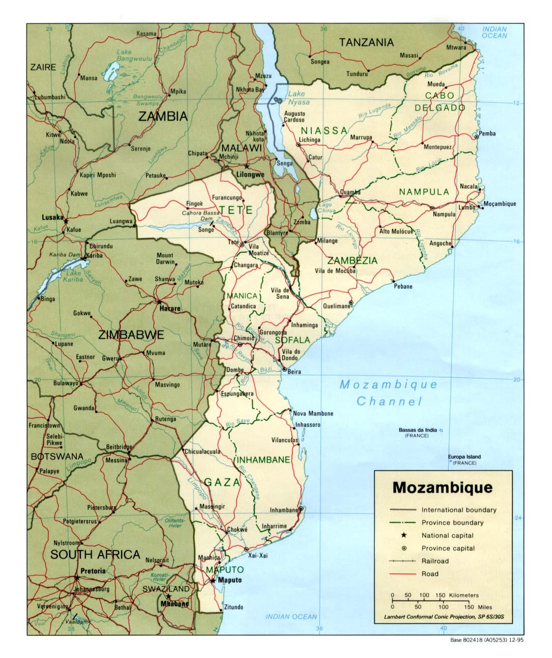
Mozambique (Political) 1995 (228K) and
pdf format (248K)
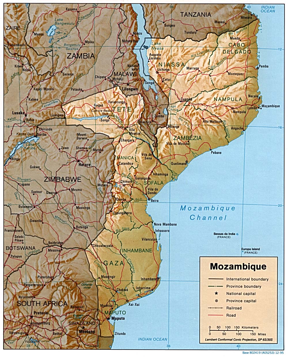
Mozambique (Shaded Relief) 1995 (324K) and
pdf format (370K)
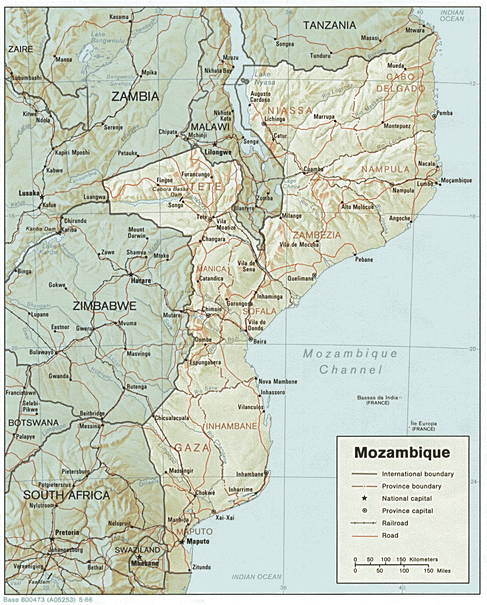
Mozambique (Shaded Relief) 1986 (340K) and
pdf format (355K)
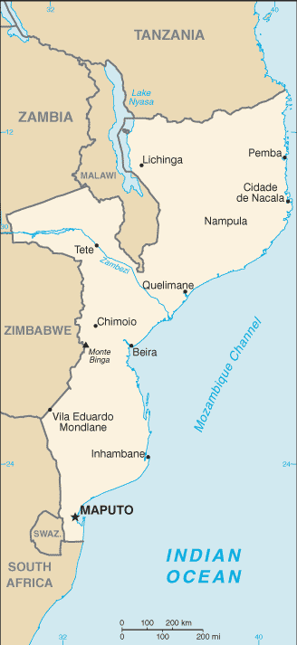
Mozambique (Small Map) 2008 (18K)
Beira original scale 1:12,500, Edition 4, Series Y961. National Imagery and Mapping Agency, 1967. (8.9MB)
Maputo original scale 1:12,500, Edition 3-NIMA, Series Y961. National Imagery and Mapping Agency, 1995. (11.8MB)
Nacala original scale 1:12,500, Edition 2, Series Y961. National Imagery and Mapping Agency, 1967. (13.3MB)
ONC N-5 with Malawi, Mozambique, Tanzania, Zaire, Zambia, Zimbabwe, 1:1,000,000, Operational Navigational Chart, U.S. Defense Mapping Agency [Not for Navigational Use] (15.2MB)
ONC P-5 with Botswana, Malawi, Mozambique, Republic of South Africa, Zimbabwe, Zambia, 1:1,000,000, Operational Navigational Chart, U.S. Defense Mapping Agency [Not for Navigational Use] (12.1MB)
Beira to the Zimbabwe Border Operational Navigation Chart, Portion of Defense Mapping Agency ONC P-5 1983 [Not for navigational use] (308K)
ONC Q-5 with Botswana, Lesotho, Mozambique, Republic of South Africa, Swaziland, 1:1,000,000, Operational Navigational Chart, U.S. Defense Mapping Agency [Not for Navigational Use] (13.2MB)
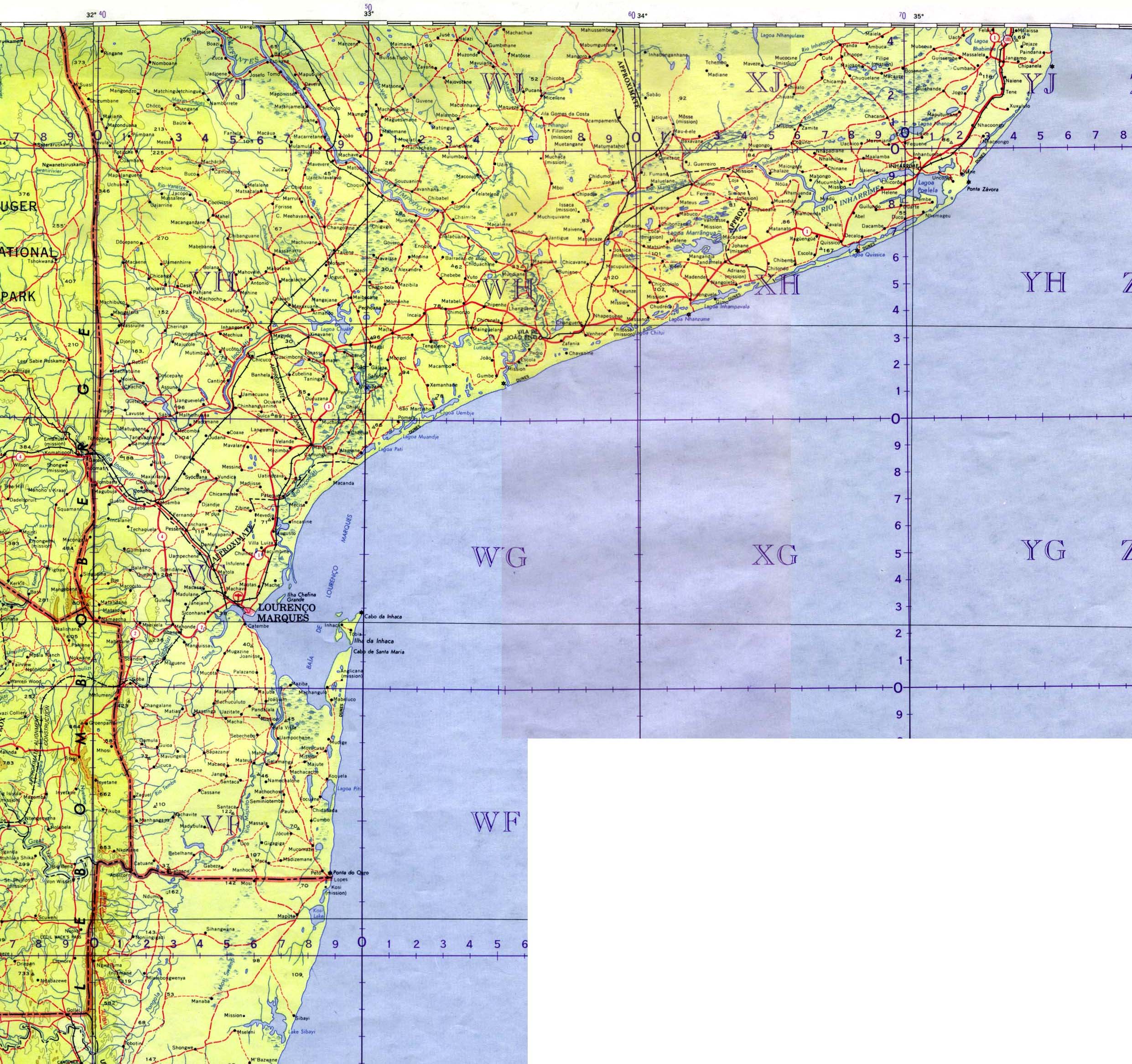
Southern Mozambique - Northern Section U.S. Army Map Service 1958 1:1,000,000. Portion of Inhambane Sheet, Series 1301, SF 36 (794K)
Southern Mozambique - Southern Section U.S. Army Map Service 1963 1:1,000,000. Portion of Lourenco Marques Sheet, Series 1301, SG 36 (825K)
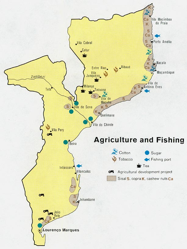
Mozambique - Agriculture and Fishing from Map No. 501370 1973 (102K)
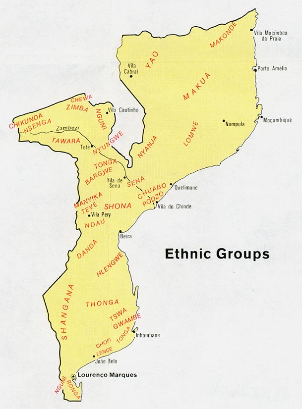
Mozambique - Ethnic Groups from Map No. 501370 1973 (91K)
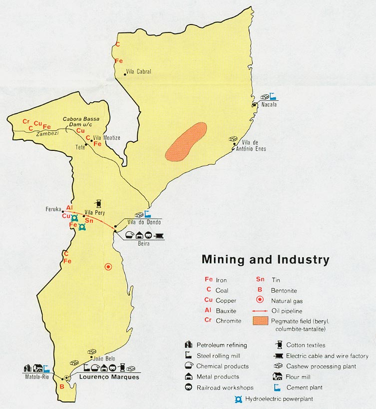
Mozambique - Mining and Industry from Map No. 501370 1973 (113K)
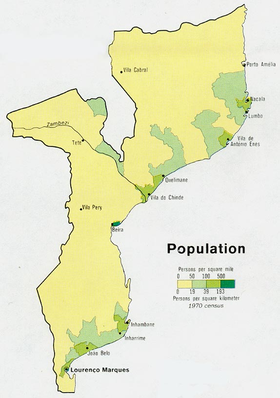
Mozambique - Population from Map No. 501370 1973 (82K)
Mozambique - Vegetation from Map No. 501370 1973 (108K)
Sources: These maps were provided by the University of Texas Library and/or
the U.S. Central Intelligence Agency (CIA) unless otherwise noted.
Maps on other websites
Mozambique (Lonely Planet)
Mozambique (UniMaps)
Mozambique (United Nations) [PDF]
Mozambique - Clickable Map (Go2Africa)
Mozambique Maps (ReliefWeb)
Sponsors
<-- Free Map Downloads
<-- Free World Country Map Downloads
Didn't find what you are looking for? We've been online since 1996 and have created 1000's of pages. Search below and you may find just what you are looking for.
Michael R. Meuser
Data Research & GIS Specialist
MapCruzin.com is an independent firm
specializing in GIS project development and data research.
We created the first U.S. based
interactive toxic chemical facility
maps on the internet in 1996 and we
have been online ever since. Learn more about us and our services.
Have a project in mind? If you have data, GIS project or custom shapefile needs contact Mike.
Contact Us
Report Broken Links
Subscribe for Updates


