Download Free New York National Park and Historic Monument Maps
Sponsors
<-- Download Free Maps
<-- Free National Park Maps
Fire Island National Seashore (Area Map) 1995 (65K) (PDF Format)
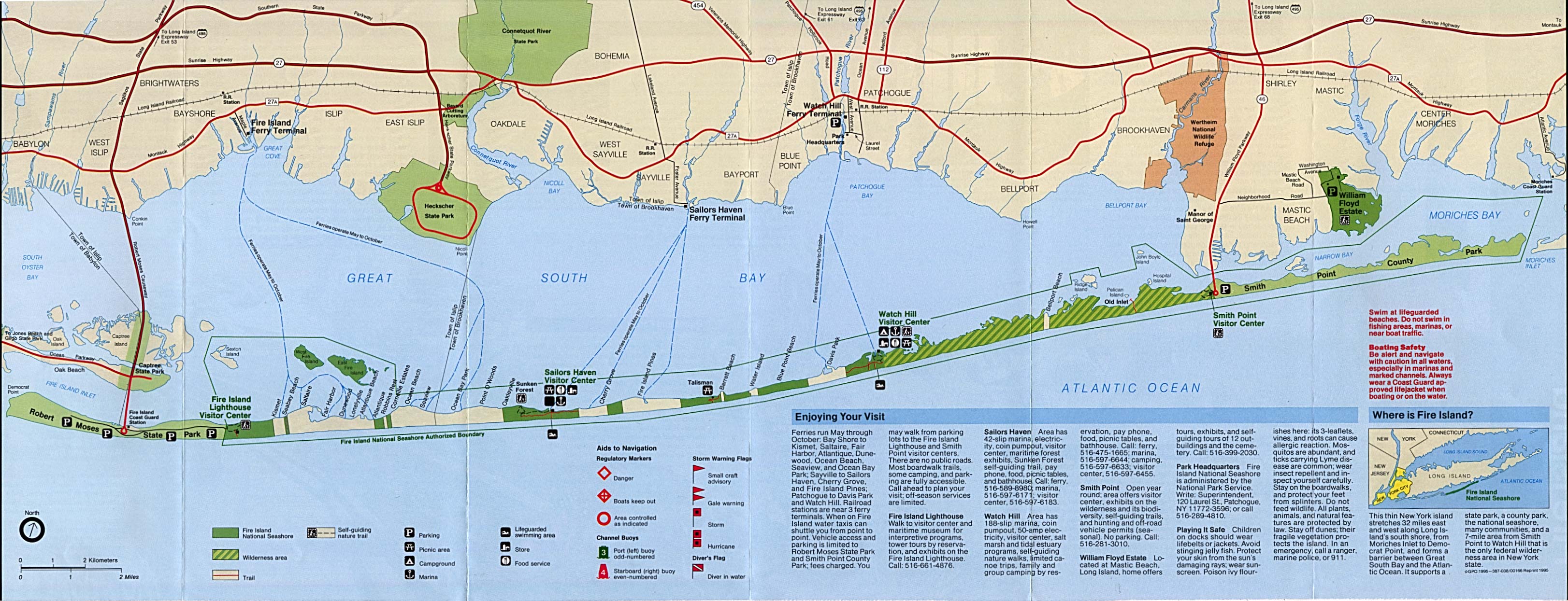
Fire Island National Seashore (Park Map) 1995 (722K)
Fort Stanwix National Monument (Area Map) 1995 (917K)
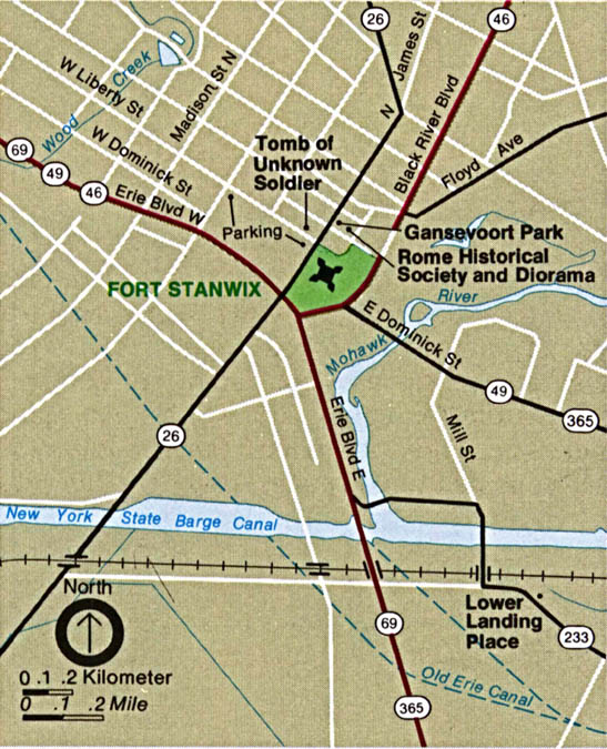
Fort Stanwix National Monument (Schematic) 1995 (1.7MB)
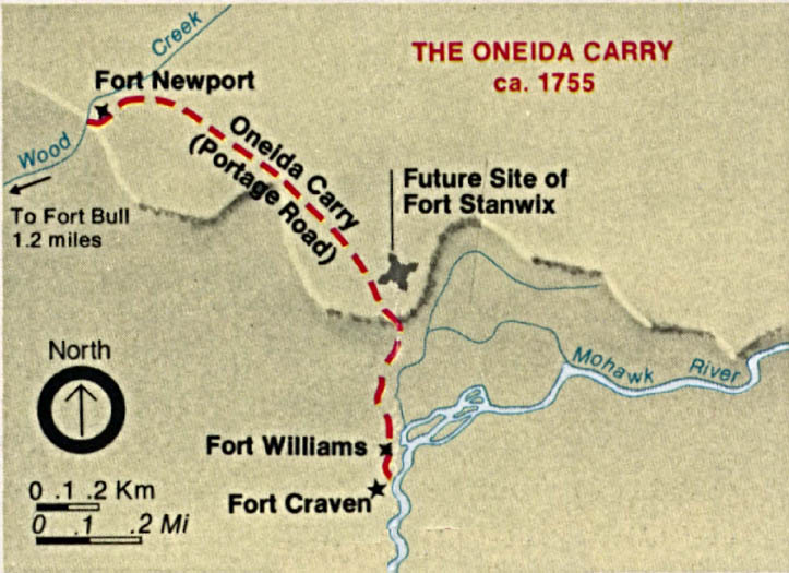
Fort Stanwix National Monument - The Oneida Carry 1755 (Detail Map) 1995 (468K)
Franklin D. Roosevelt National Historic Site (Park Map) 1997 (65K) (PDF Format)
Sponsors
Gateway National Recreation Area [New York / New Jersey] (Area Map) 1994 (111K)
Gateway National Recreation Area [New York / New Jersey] (Park Map) 1998 (387K) (PDF Format)
Gateway National Recreation Area - Jamaica Bay and Breezy Point [New York / New Jersey] (Detail Map) 1994 (801K)
Gateway National Recreation Area - Sandy Hook [New York / New Jersey] (Detail Map) 1994 (745K)
Gateway National Recreation Area - Staten Island [New York / New Jersey] (Detail Map) 1994 (631K)
Sagamore Hill National Historic Site (Park Map) 1997 (65K) (PDF Format)
Upper Delaware Scenic & Recreation River [Pennsylvania / New York] (Area Map) 1998 (65K) (PDF Format)
Upper Delaware Scenic & Recreation River [Pennsylvania / New York] (Park Map) 1998 (710K) (PDF Format)
<-- Download Free Maps
<-- Free National Park Maps
Didn't find what you are looking for? We've been online since 1996 and have created 1000's of pages. Search below and you may find just what you are looking for.
Michael R. Meuser
Data Research & GIS Specialist
MapCruzin.com is an independent firm
specializing in GIS project development and data research.
We created the first U.S. based
interactive toxic chemical facility
maps on the internet in 1996 and we
have been online ever since. Learn more about us and our services.
Have a project in mind? If you have data, GIS project or custom shapefile needs contact Mike.
Contact Us
Report Broken Links
Subscribe for Updates
Sponsors


![Gateway National Recreation Area [New York / New Jersey]](/download-national-park-maps/gate_loc94.jpg)
![Gateway National Recreation Area - Jamaica Bay and Breezy Point [New York / New Jersey]](/download-national-park-maps/gate94.jpg)
![Gateway National Recreation Area - Sandy Hook [New York / New Jersey]](/download-national-park-maps/gate_sand94.jpg)
![Gateway National Recreation Area - Staten Island [New York / New Jersey]](/download-national-park-maps/gate_stat94.jpg)