Download Free North Dakota National Park and Historic Monument Maps
Sponsors
<-- Download Free Maps
<-- Free National Park Maps
Fort Union Trading Post National Historic Site (Area Map) 1998 (129K) (PDF Format)
Fort Union Trading Post National Historic Site (Location Map) (1999) (27K)
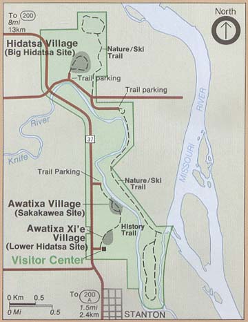
Knife River Indian Villages National Historic Site (Park Map) 2000 (34K)
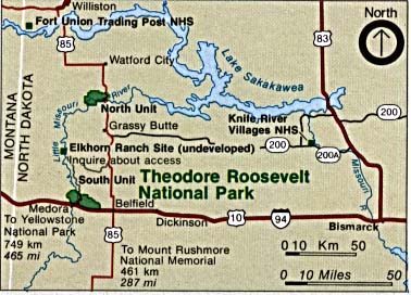
Theodore Roosevelt National Park (Area Map) (36K)
Sponsors
Theodore Roosevelt National Park (Area Map) 1999 (65K) (PDF Format)
Theodore Roosevelt National Park (Park Map) 1999 (323K) (PDF Format)
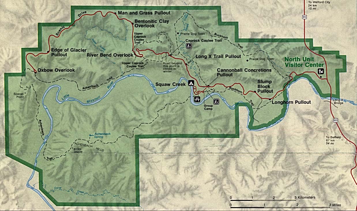
Theodore Roosevelt National Park - North Unit (Park Map) (288K)
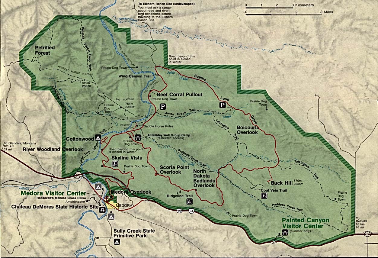
Theodore Roosevelt National Park - South Unit (Park Map) (258K)
<-- Download Free Maps
<-- Free National Park Maps
Sponsors
Didn't find what you are looking for? We've been online since 1996 and have created 1000's of pages. Search below and you may find just what you are looking for.
Michael R. Meuser
Data Research & GIS Specialist
MapCruzin.com is an independent firm
specializing in GIS project development and data research.
We created the first U.S. based
interactive toxic chemical facility
maps on the internet in 1996 and we
have been online ever since. Learn more about us and our services.
Have a project in mind? If you have data, GIS project or custom shapefile needs contact Mike.
Contact Us
Report Broken Links
Subscribe for Updates


