Download Free North Korea Maps
<-- Free Map Downloads
<-- Free World Country Map Downloads
Sponsors
Note that maps may not appear on the webpage in their full size and resolution. To save the maps to your computer, right-click on the link.
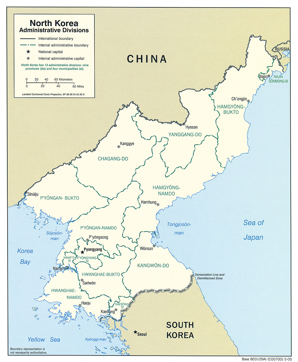
North Korea (Administrative Divisions) 2005 (700K)and
pdf format (712K)
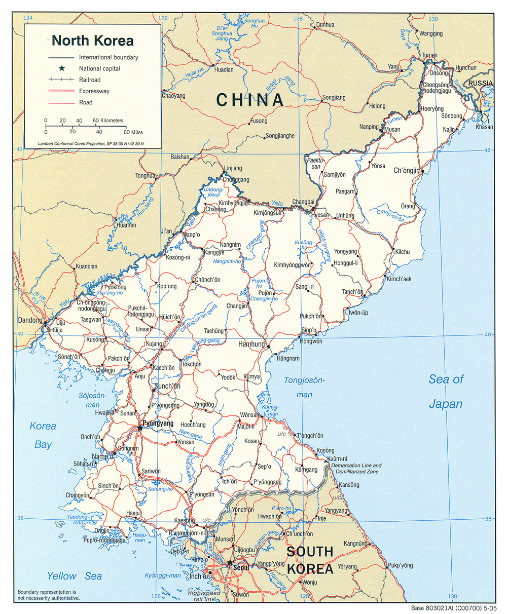
North Korea (Political) 2005 (728K)and
pdf format (712K)
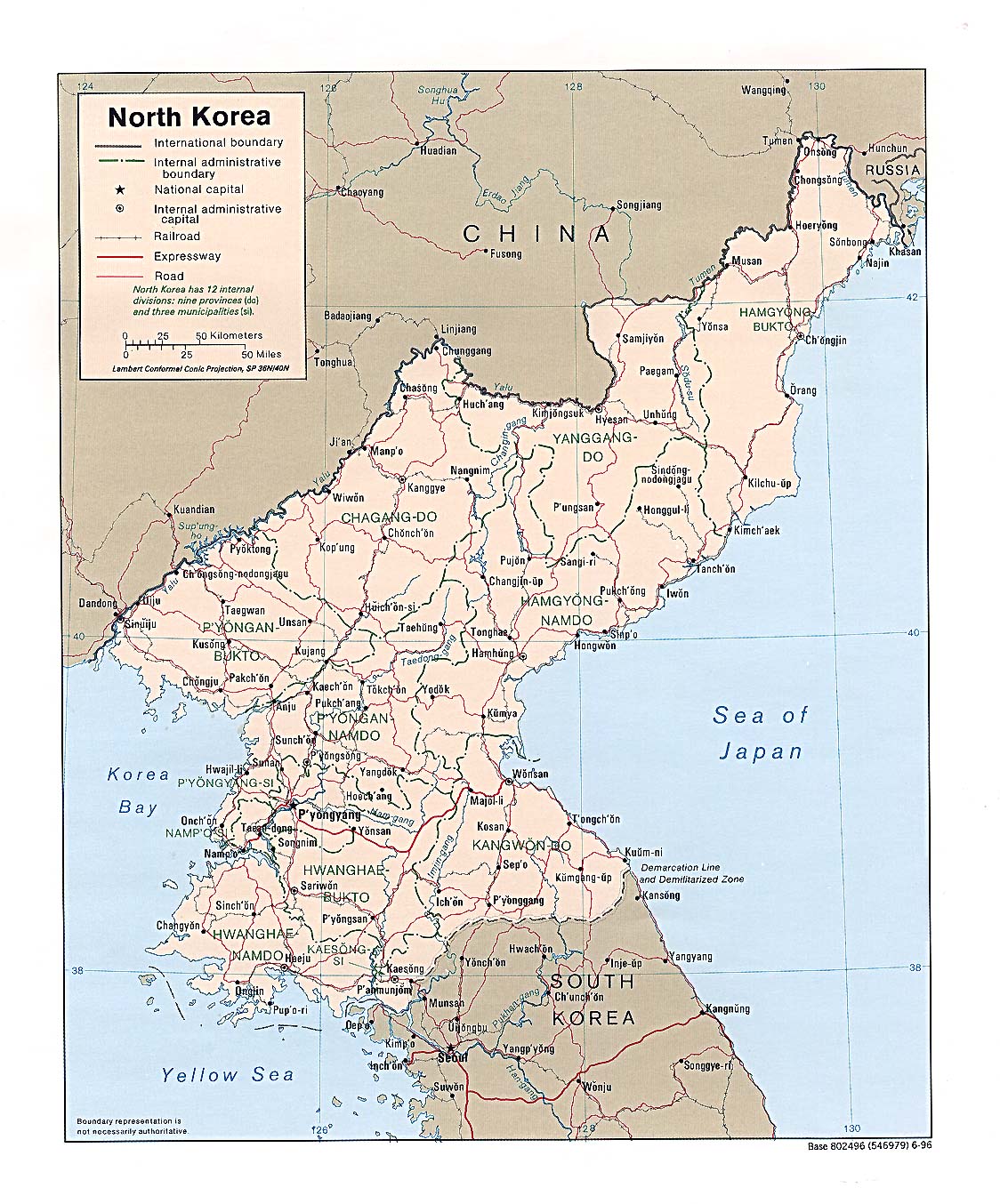
North Korea (Political) 1996 (355K) and
pdf format (365K)
North Korea (Political) 1989 (311K) and
pdf format (315K)
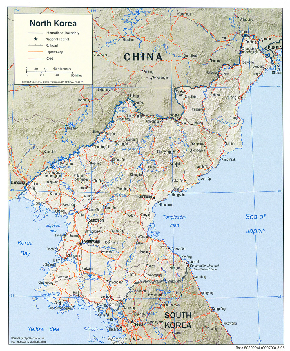
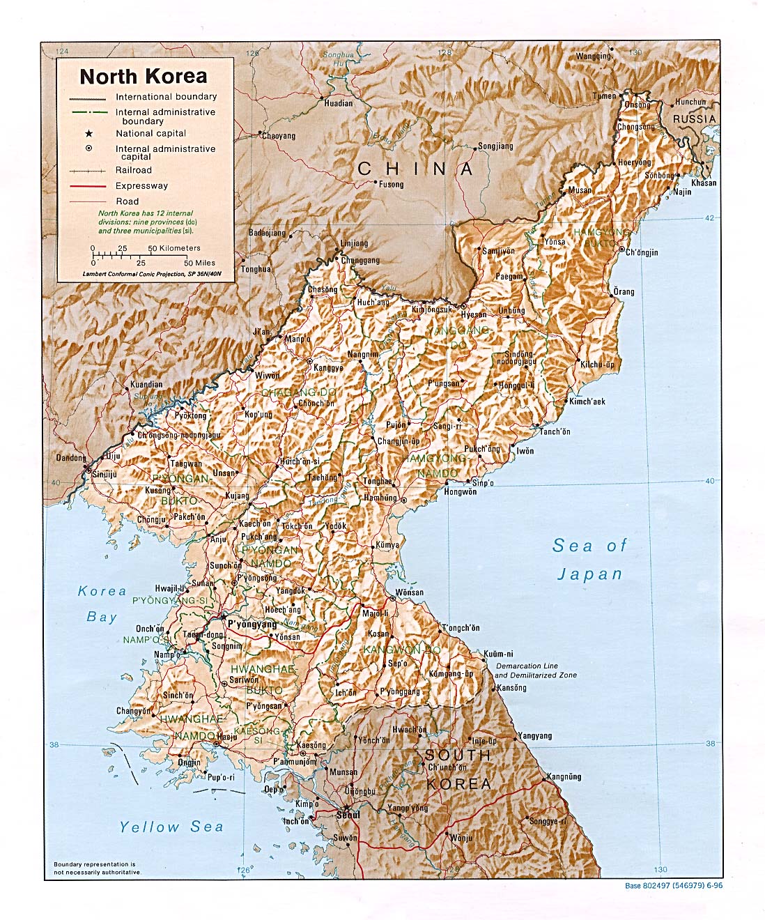
North Korea (Shaded Relief) 2005 (713K)and
pdf format (712K)
North Korea (Shaded Relief) 1996 (395K) and
pdf format (423K)
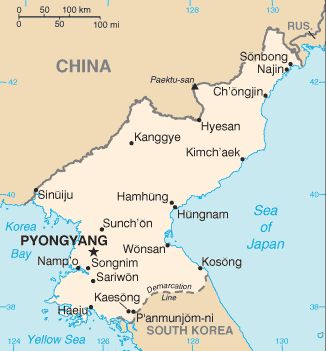
North Korea (Small Map) 2008 (12K)
Pyongyang (tactical pilotage chart) original scale 1:500,000. Portion of National Imagery and Mapping Agency TPC G-10B 1998 (793K) Not for navigational use
Korea [North] - Economic Activity from Map No. 500773 1972 (140K)
Korea [North] - Land Utilization from Map No. 500773 1972 (149K)
Korea [North] - Population from Map No. 500773 1972 (107K)
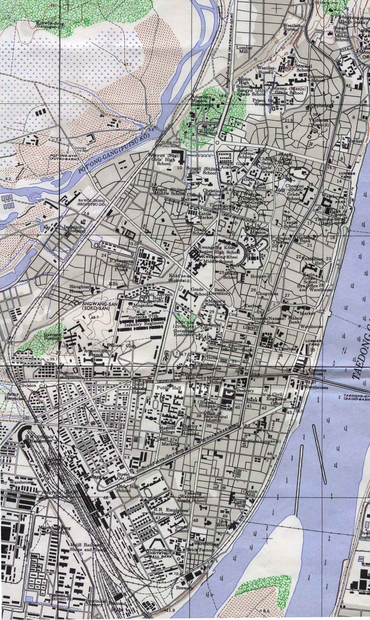
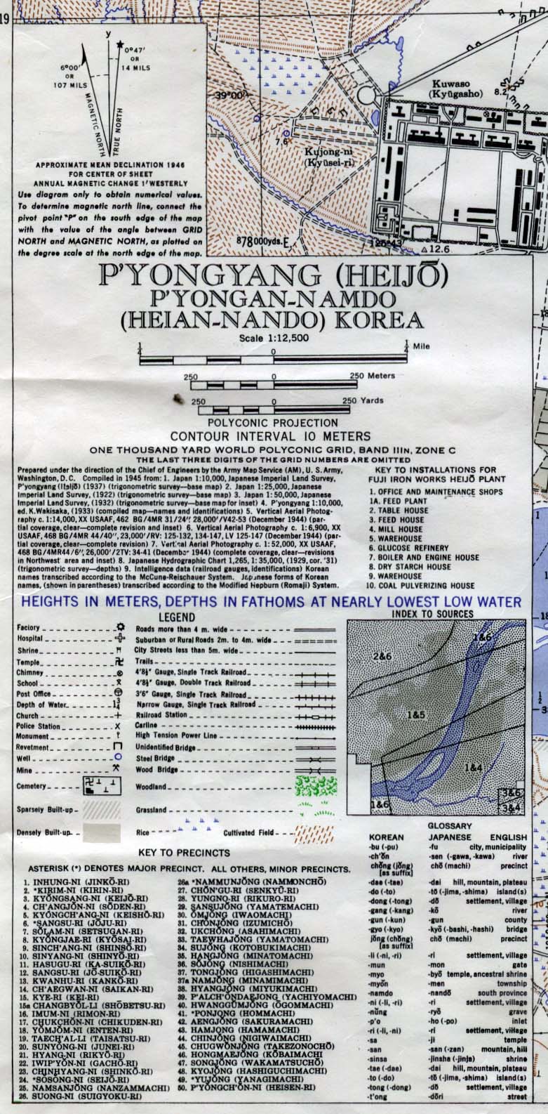
Pyongyang 1946 (549K) Map Key (277K) or Entire Map (8.1 MB) Original scale 1:12,500. Army Map Service L951 1946.
Sources: These maps were provided by the University of Texas Library and/or
the U.S. Central Intelligence Agency (CIA) unless otherwise noted.
Maps on other websites
Korea, North (Lonely Planet)
Korea, North (Robert Pelton)
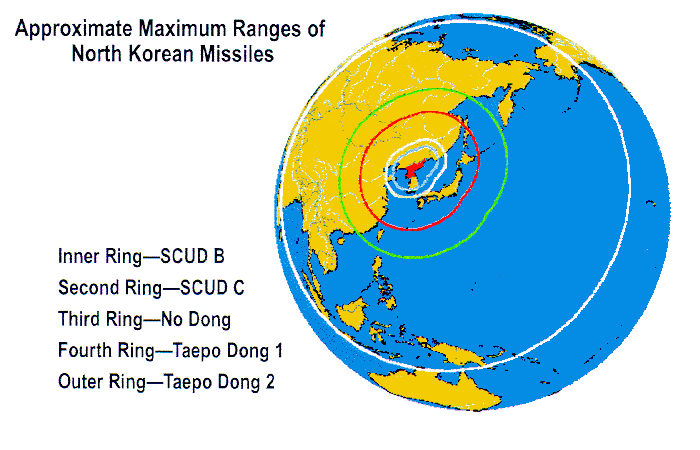
Korea, North - Approximate Ranges of North Korean Missiles (FAS)
Korea, North - Industrial and Mining Activity, 1992 from North Korea: A Country Study (GlobalSecurity.org) [PDF]
Korea, North - Key Nuclear Sites (BBC)
Korea, North - Maps [Nuclear, Biological, Chemical, Missile] (NTI)
Korea, North - Military Facilities (Globalsecurity.org) [PDF]
Korea, North - Mineral Industry (USGS) and Map Key
Korea, North - Missile Launches and Underground Nuclear Test, 2009 (BBC News)
Korea, North - Musudan-ri Missile Test Facility (GlobalSecurity.org)
Korea, North - North Korea Uncovered (via North Korean Economy Watch) [Requires Google Earth] Extensive mapping of North Korea�s economic, cultural, political, and military infrastructures
Korea, North - Nuclear Facilities (Carnegie Endowment)
Korea, North - Nuclear Facilities [links to maps for each facility] (GlobalSecurity.org)
Korea, North - Nuclear Programs (Center for Nonproliferation Studies)
Korea, North - Special Weapons Facilities - Maps (GlobalSecurity.org)
Korea, North - Taechon Reactor Construction Site - Images and Maps (GlobalSecurity.org)
Korea, North - Topographic Maps, AMS Series L751, 1:50,000 (Korean War Project)
Korea, North - Yongbyon Nuclear Complex - Images and Maps (GlobalSecurity.org)
<-- Free Map Downloads
<-- Free World Country Map Downloads
Didn't find what you are looking for? We've been online since 1996 and have created 1000's of pages. Search below and you may find just what you are looking for.
Michael R. Meuser
Data Research & GIS Specialist
MapCruzin.com is an independent firm
specializing in GIS project development and data research.
We created the first U.S. based
interactive toxic chemical facility
maps on the internet in 1996 and we
have been online ever since. Learn more about us and our services.
Have a project in mind? If you have data, GIS project or custom shapefile needs contact Mike.
Contact Us
Report Broken Links
Subscribe for Updates


![Korea [North] - Economic Activity](/free-maps-korea/north_korea_econ_1972.jpg)
![Korea [North] - Land Utilization](/free-maps-korea/north_korea_land_1972.jpg)
![Korea [North] - Population](/free-maps-korea/north_korea_pop_1972.jpg)