Download Free Palau Maps
<-- Free Map Downloads
<-- Free World Country Map Downloads
Sponsors
Note that maps may not appear on the webpage in their full size and resolution. To save the maps to your computer, right-click on the link.
Palau (Political) CIA 1995 (85K) and pdf format (90K)
Palau (Small Map) CIA 2008 (11K)
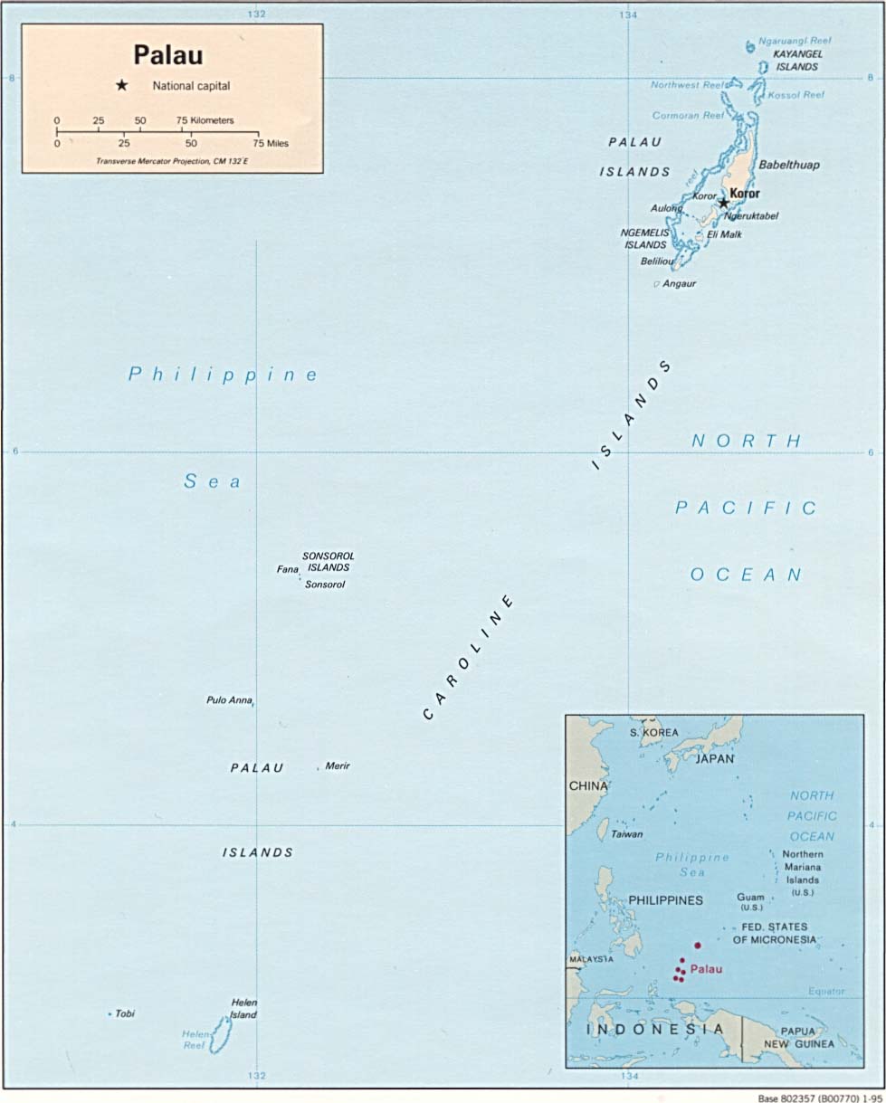
Palau From the U.S. National Atlas 1970 (110K)
Republic of Palau (Outline Map) U.S. Bureau of the Census 1990 (232K)
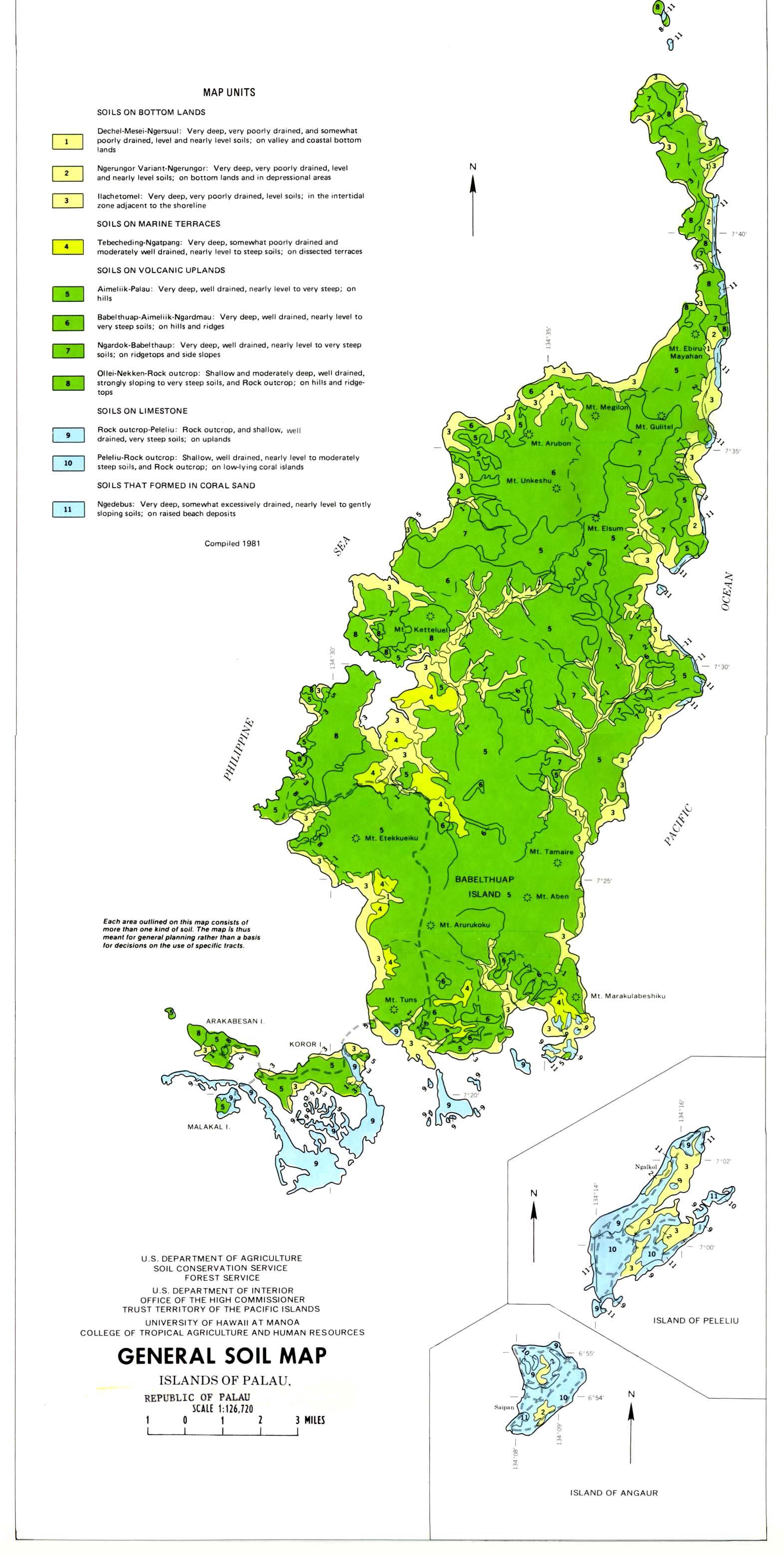
Palau - General Soil Map From Soil Survey of Islands of Palau Republic of Palau, United States Department of Agriculture, Soil Conservation Service. 1983 (355K)
Palau - Peleliu (Beliliou) Island (topographic) 1:25,000. Portion of Beliliou sheet, U.S. Geological Survey, 1984 (695K)
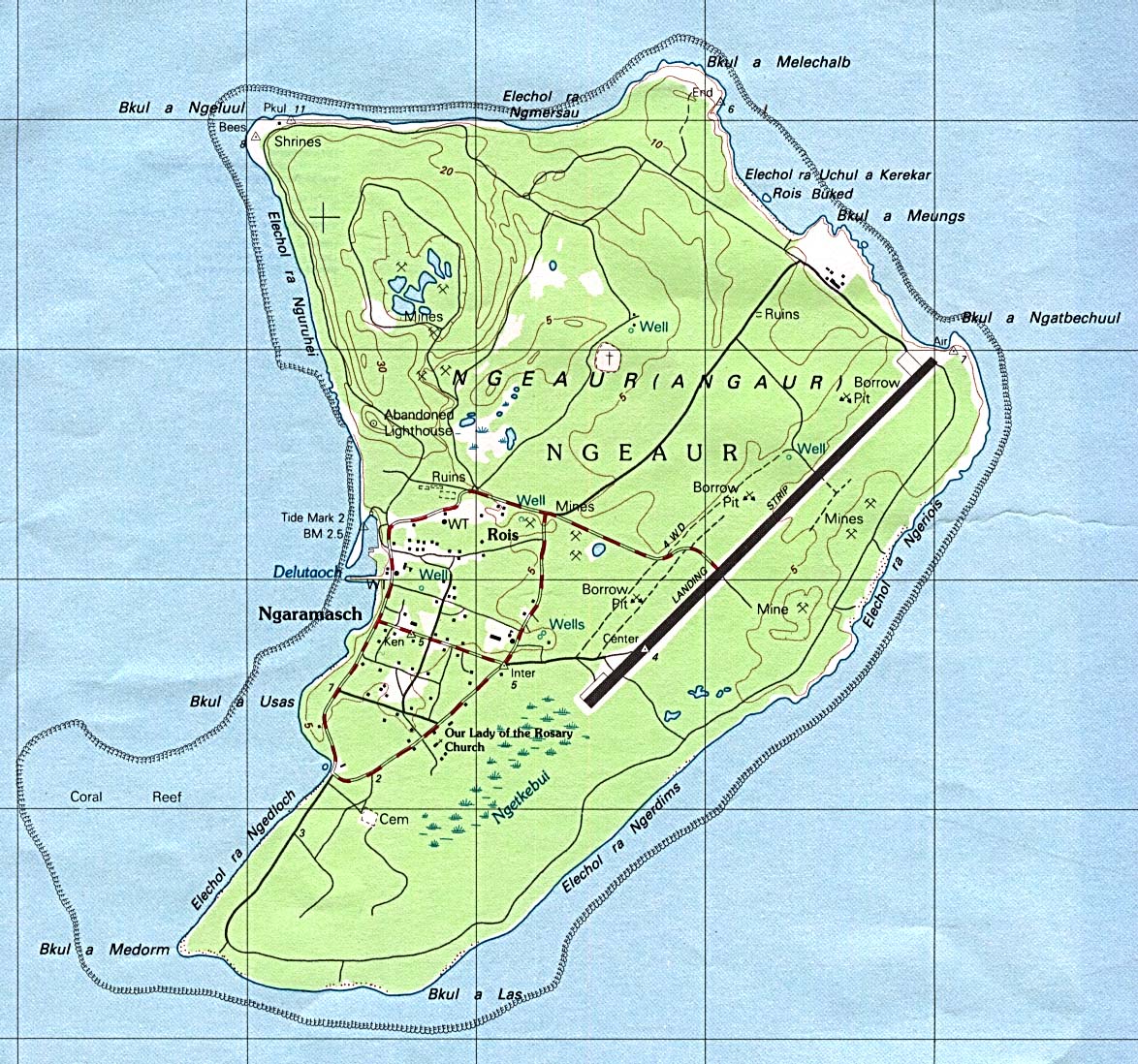
Palau - Angaur (Ngeaur) Island (topographic) 1:25,000. Portion of Beliliou sheet, U.S. Geological Survey, 1984 (351K)
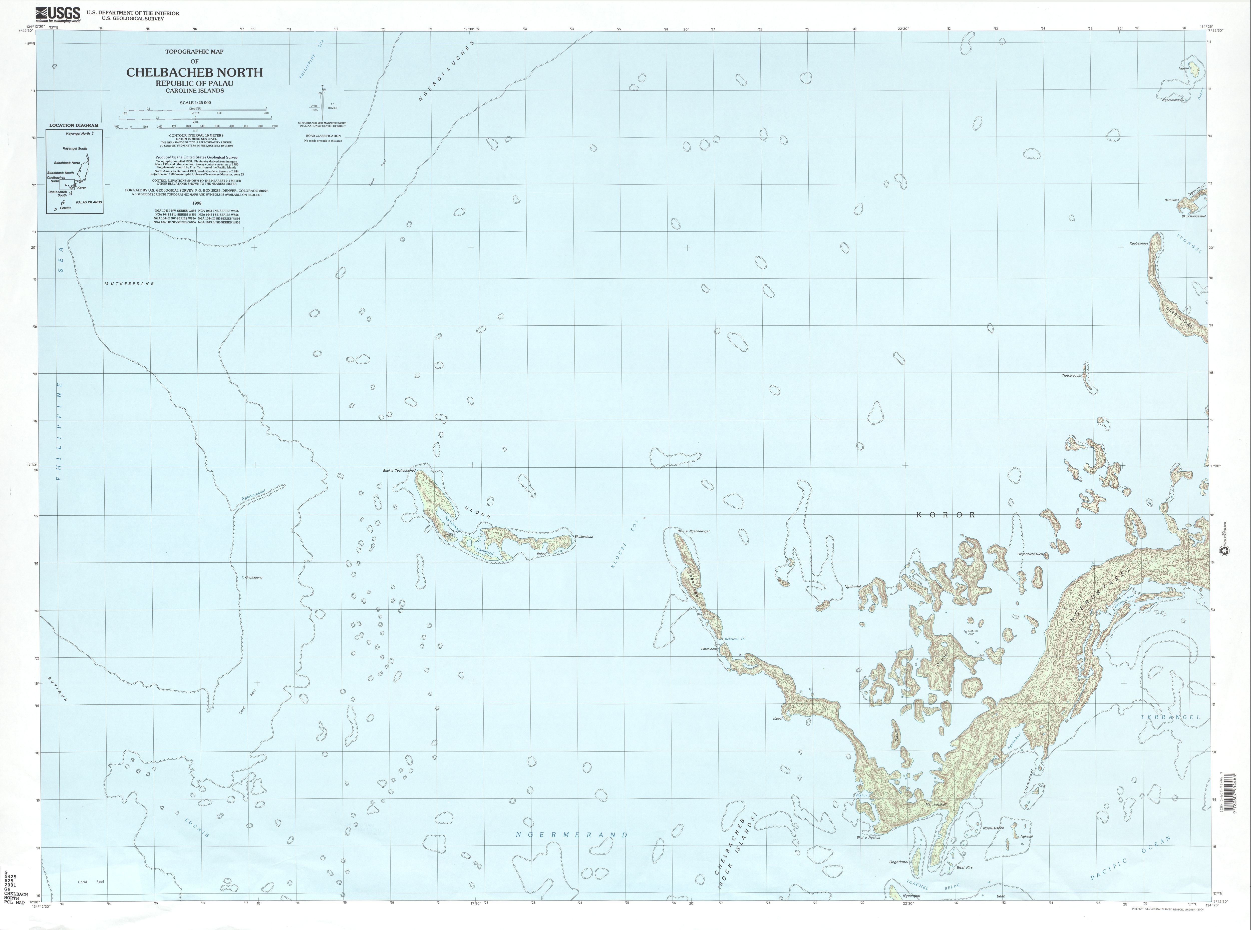
Chelbacheb North (topographic) 1:25,000 U.S. Geological Survey, 2001 (1.8 MB)
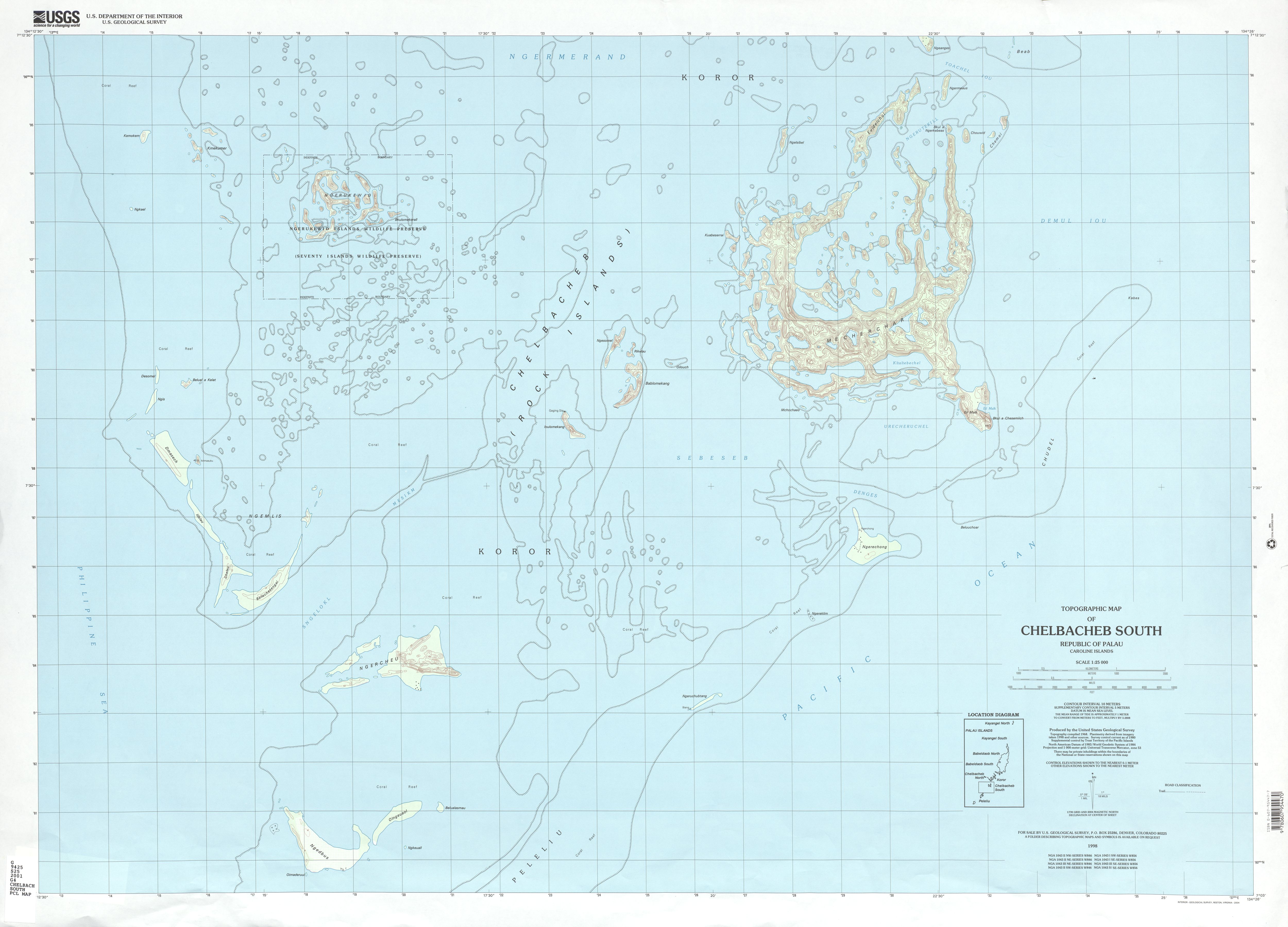
Chelbacheb South (topographic) 1:25,000 U.S. Geological Survey, 2001 (2.0 MB)
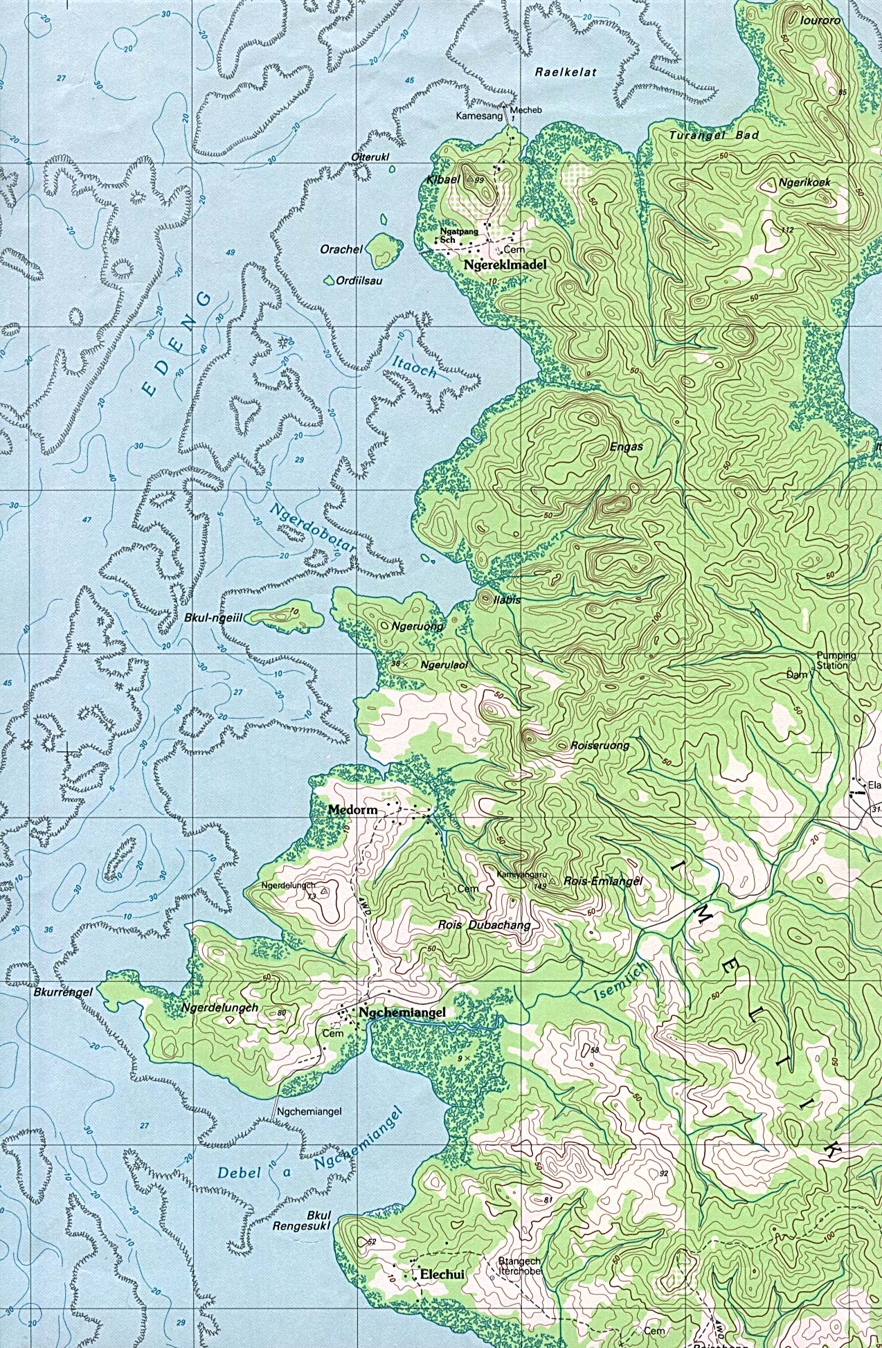
Palau - Aimeliik (Imeliik), Babeldaob Island (topographic) 1:25,000. Portion of Chelbacheb sheet, U.S. Geological Survey, 1983 (816K)
Palau - Mecherchar Island [Eil Malk Island] (topographic)1:25,000. Portion of Chelbacheb sheet, U.S. Geological Survey, 1984 (515K)
Palau - Palau Airport, Babeldaob Island (topographic)1:25,000. Portion of Chelbacheb sheet, U.S. Geological Survey, 1983 (933K)
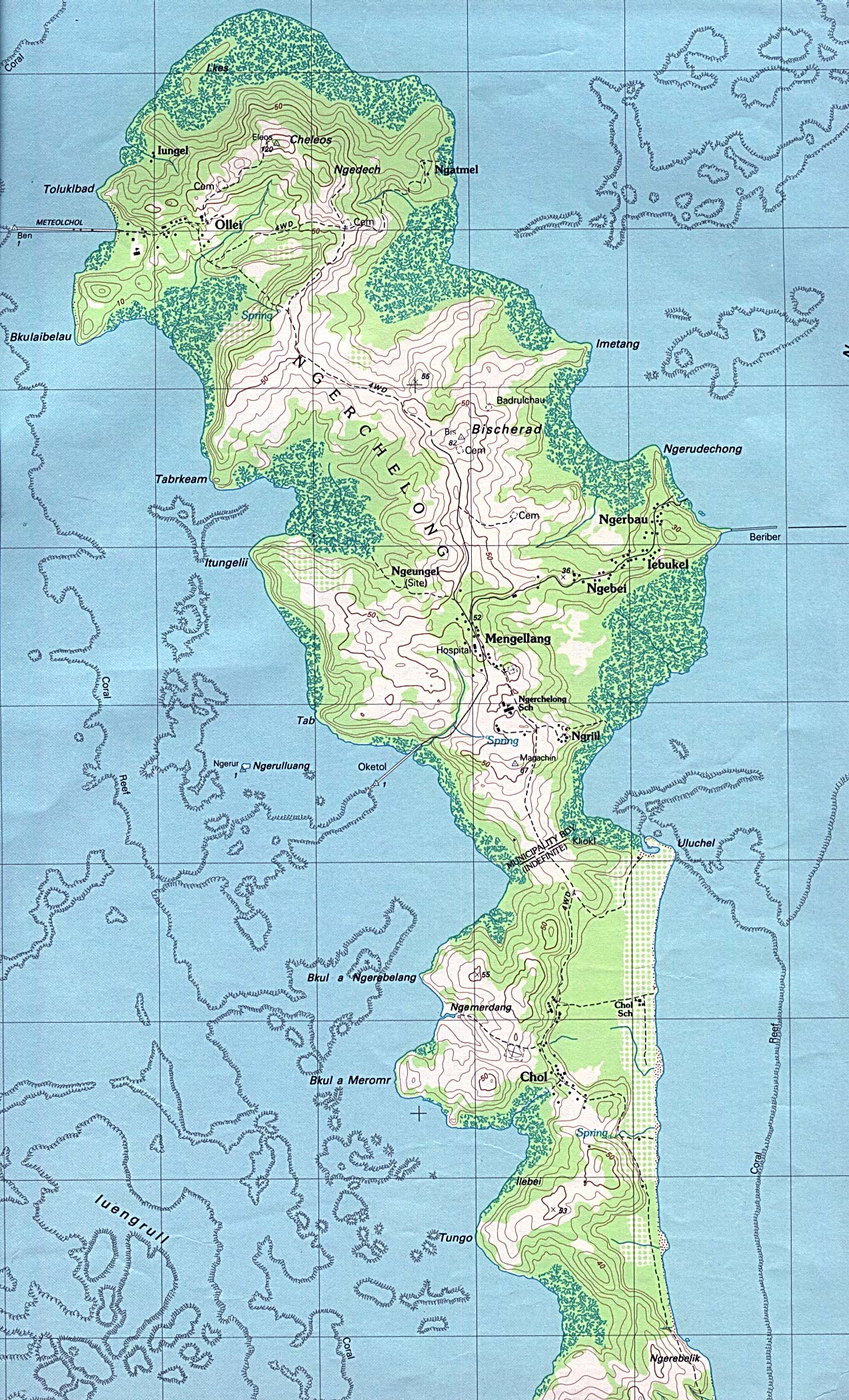
Palau - Ngarchelong (Ngerchelong), Babeldaob Island (topographic)1:25,000. Portion of Ngermetengel sheet, U.S. Geological Survey, 1983 (755K)
Palau - Ngeremlengui (Ngermetengel), Babeldaob Island (topographic) 1:25,000. Portion of Ngermetengel sheet, U.S. Geological Survey, 1983 (819K)
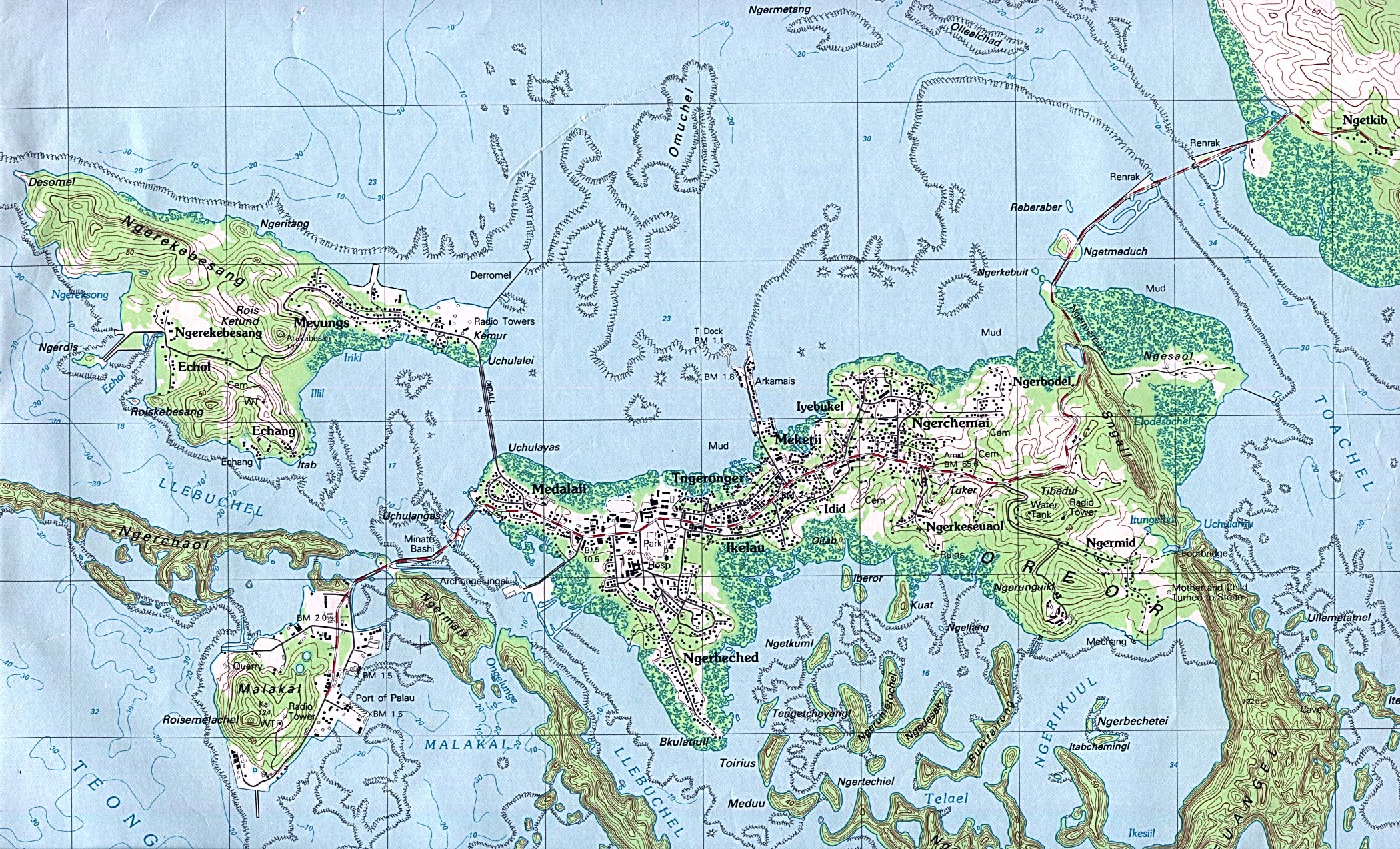
Palau - Koror, Oreor Island (topographic) 1:25,000. Portion of Oreor sheet, U.S. Geological Survey, 1983 (906K)
Palau - Mecherchar Island [Eil Malk Island] 1943 (topographic) original scale 1:40,000. Portion of Eil Malk I map, A.M.S. W752, second edition, U.S. Army Map Service 1943 (199K)
Pelew Islands 1890 From "The Earth and Its Inhabitants, Oceania" by Elisee Reclus, Edited by A.H. Keane, New York: D. Appleton and Company, 1890. (144K)
Sources: These maps were provided by the University of Texas Library and/or
the U.S. Central Intelligence Agency (CIA) unless otherwise noted.
Maps on other websites
Palau (Magellan)
Palau (Lonely Planet)
Palau (Pacific ENSO Applications Center)
Palau - Dive Sites Map (Neco Marine)
Sponsors
<-- Free Map Downloads
<-- Free World Country Map Downloads
Didn't find what you are looking for? We've been online since 1996 and have created 1000's of pages. Search below and you may find just what you are looking for.
Michael R. Meuser
Data Research & GIS Specialist
MapCruzin.com is an independent firm
specializing in GIS project development and data research.
We created the first U.S. based
interactive toxic chemical facility
maps on the internet in 1996 and we
have been online ever since. Learn more about us and our services.
Have a project in mind? If you have data, GIS project or custom shapefile needs contact Mike.
Contact Us
Report Broken Links
Subscribe for Updates


![Palau - Mecherchar Island [Eil Malk Island]](/free-maps-palau/mecherchar_84.jpg)
![Palau - Mecherchar Island [Eil Malk Island] 1943](/free-maps-palau/eil_malk1_1943.jpg)