Download Free Puerto Rico Maps
<-- Free Map Downloads
<-- Free World Country Map Downloads
Sponsors
Note that maps may not appear on the webpage in their full size and resolution. To save the maps to your computer, right-click on the link.
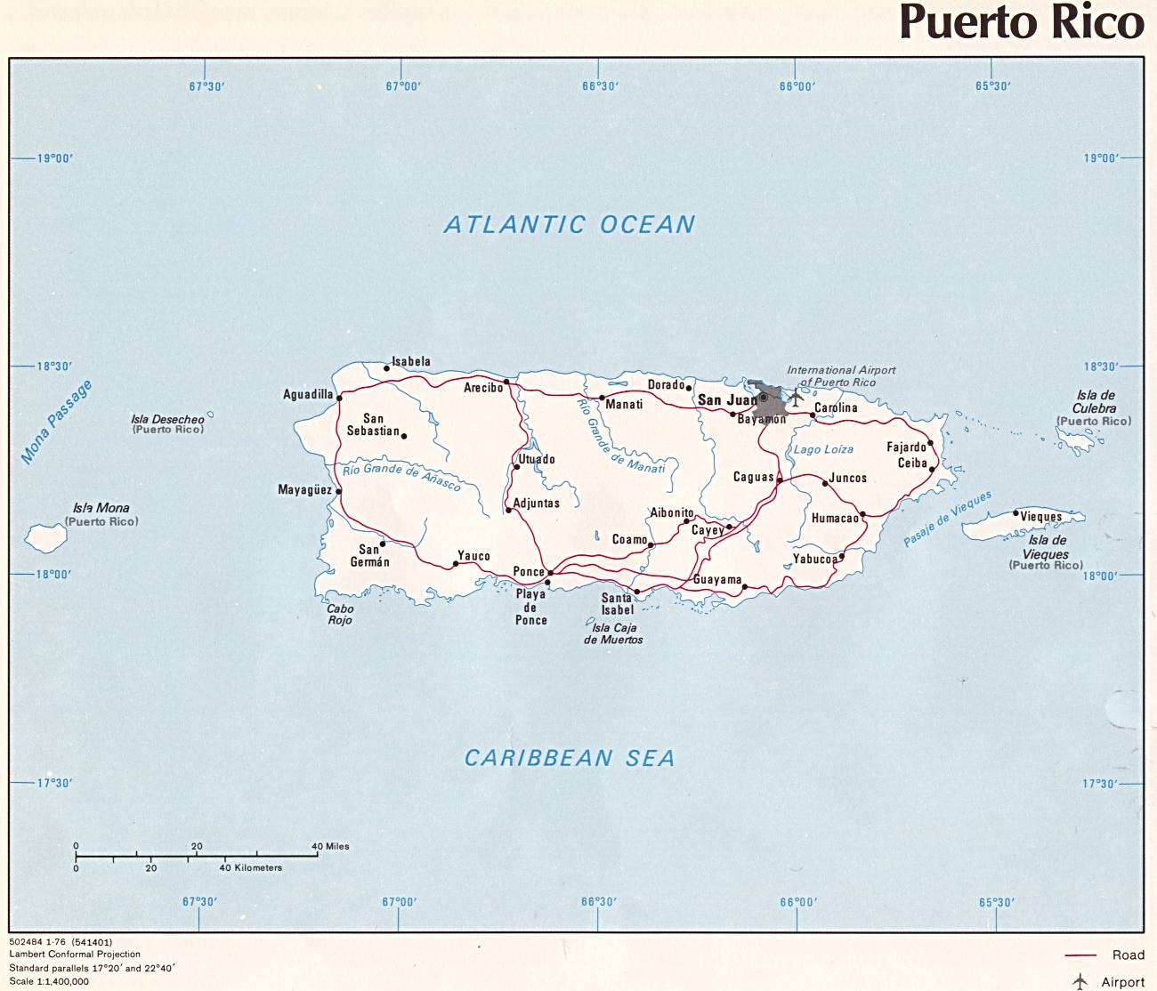
Puerto Rico (Political) U.S. Central Intelligence Agency 1976 (152K) and pdf format (155K)
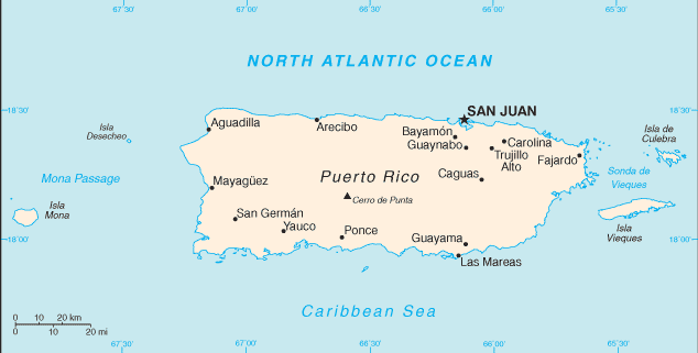
Puerto Rico (Small Map) U.S. Central Intelligence Agency 2008 (12K)
Puerto Rico U.S. National Atlas 1970 (214K) Note: The locations of the cities of Sabana Grande and San German are reversed in error on this map.
Puerto Rico - Federal Lands and Indian Reservations PDF format (635K) The National Atlas of the United States of America, U.S. Geological Survey, 2003
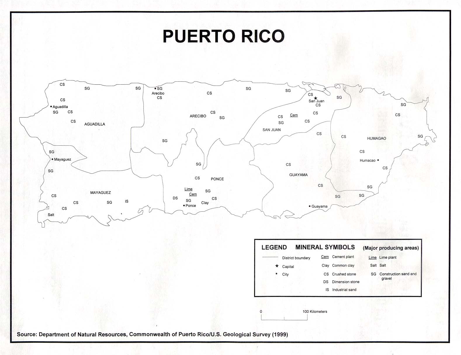
Puerto Rico - Minerals U.S.G.S 1999 (129K)
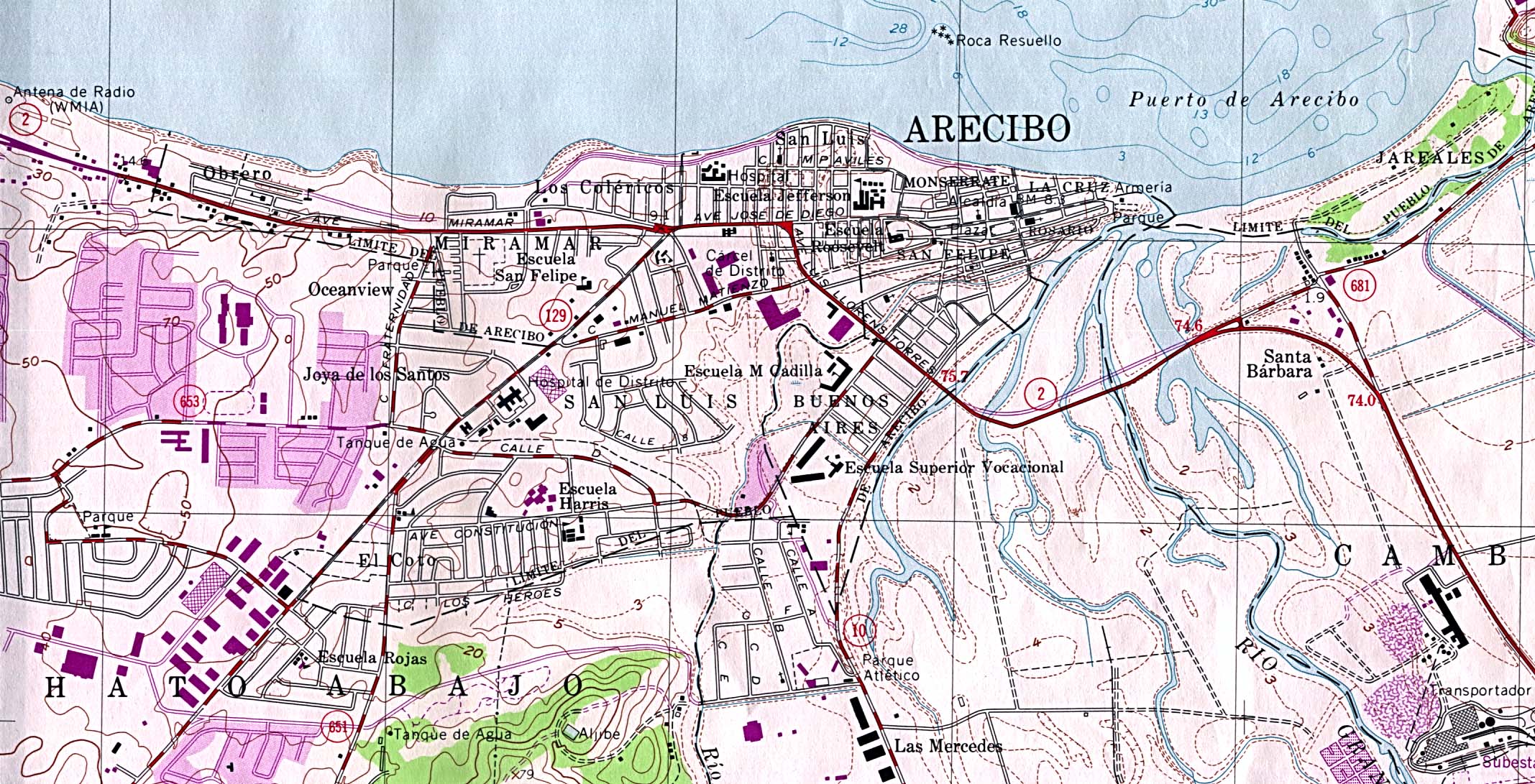
Arecibo (Topographic) original scale 1:20,000 U.S. Geological Survey 1964, photorevised 1982 (612K)
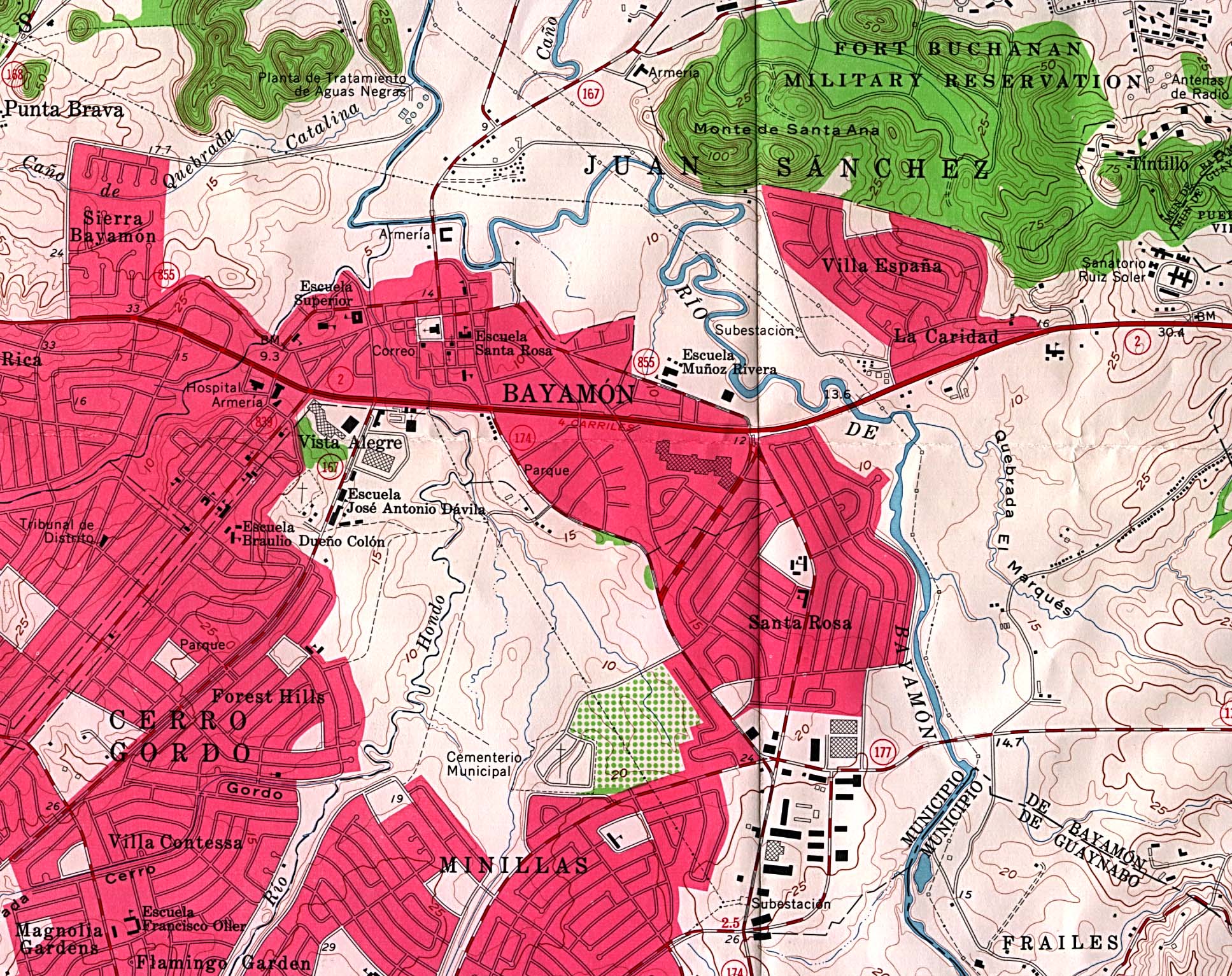
Bayamon (Topographic) original scale 1:20,000 U.S. Geological Survey 1963 (706K)
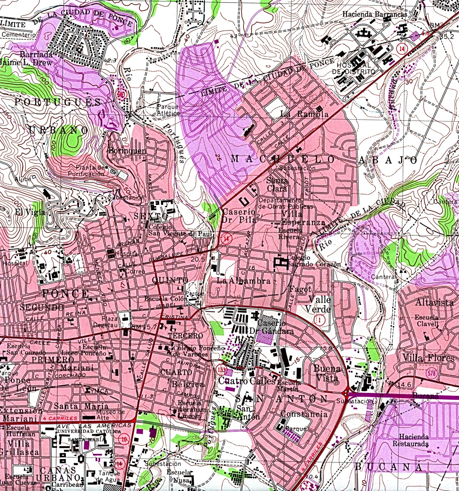
Ponce (Topographic) original scale 1:20,000 U.S. Geological Survey 1970, photorevised 1982 (927K)
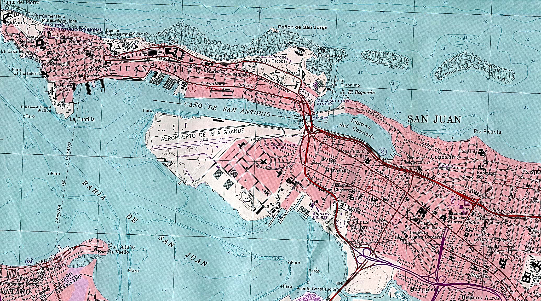
San Juan (Topographic) original scale 1:20,000 U.S. Geological Survey 1982 (1,037K)
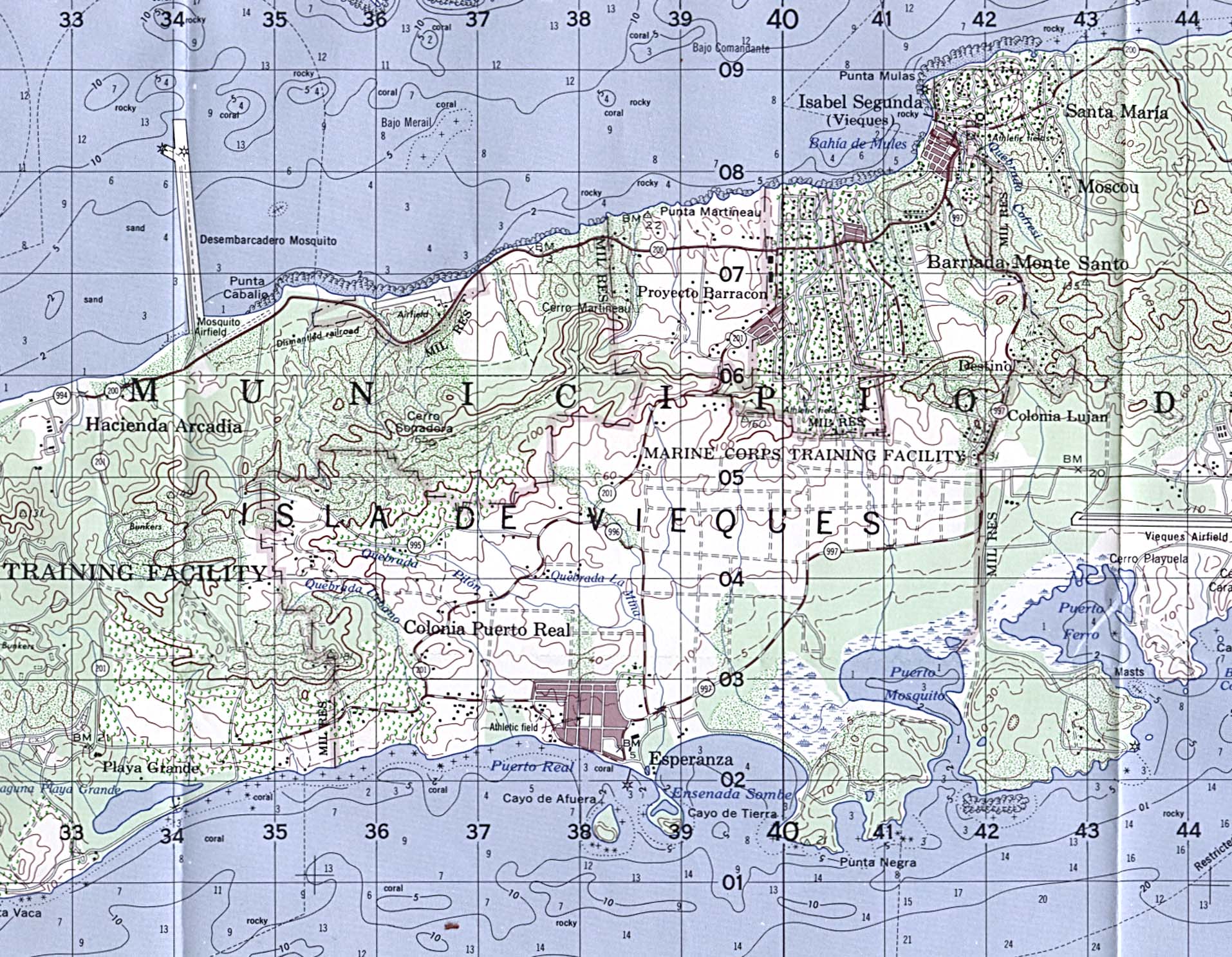
Isla De Vieques - Central Section (Topographic) original scale 1:50,000 U.S. Geological Survey 1981 (591K)
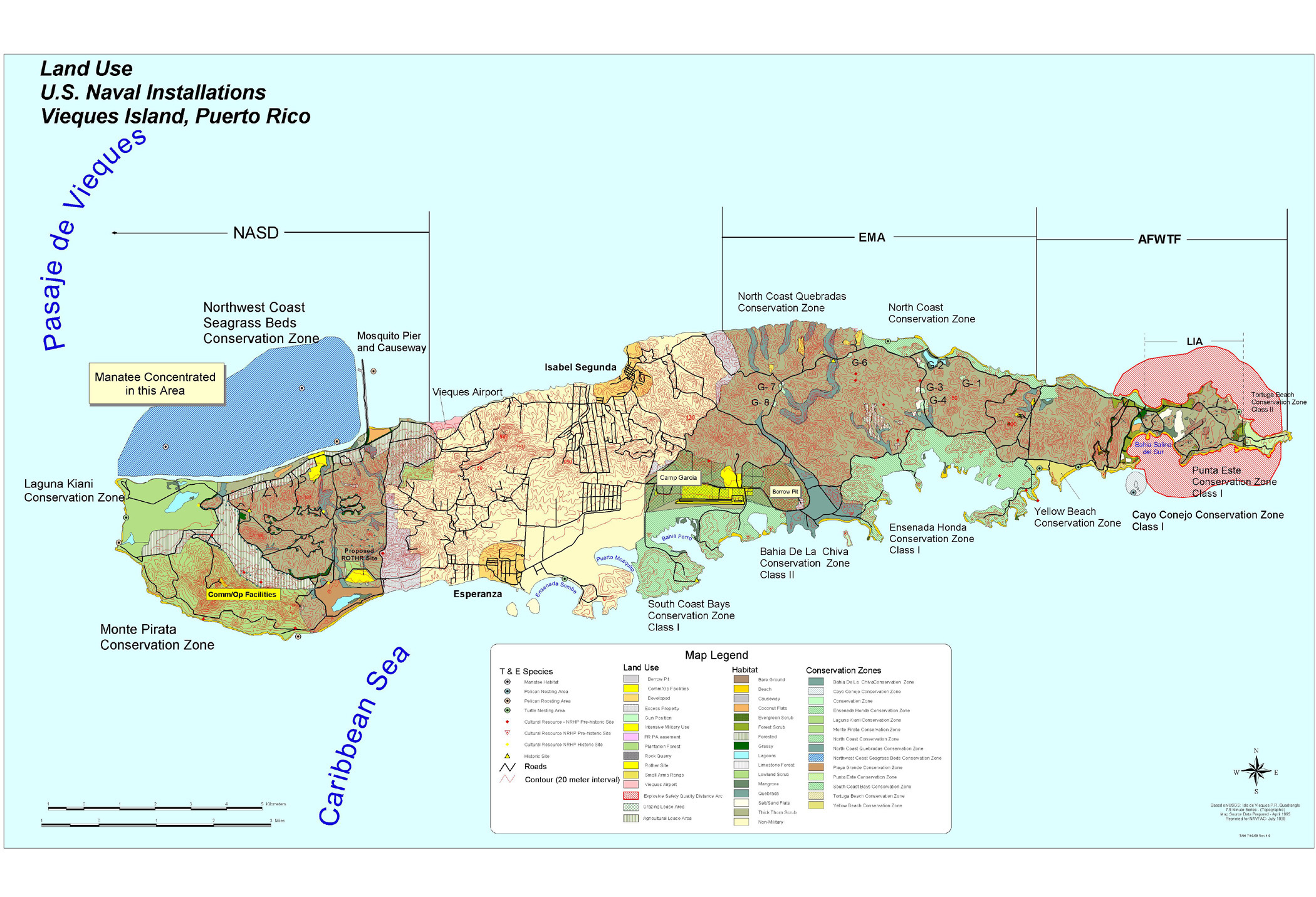
Land Use: U.S. Naval Installations Vieques Island, Puerto Rico U.S. Navy Office of Information Press Release - October 18, 1999 (846K)
Porto [Puerto] Rico, 1920 (387K) From Putnam's Handy Volume Atlas of the World, with an Index of Cities and Towns giving the Complete 1920 Census of the United States and lists of the Countries and Cities of the World, With Latest Population Figures and Useful Statistical Information. 1921.
Sources: These maps were provided by the University of Texas Library and/or
the U.S. Central Intelligence Agency (CIA) unless otherwise noted.
Maps on other websites
Puerto Rico (Lonely Planet)
Puerto Rico Maps (Travelmaps.com)
<-- Free Map Downloads
<-- Free World Country Map Downloads
Didn't find what you are looking for? We've been online since 1996 and have created 1000's of pages. Search below and you may find just what you are looking for.
Michael R. Meuser
Data Research & GIS Specialist
MapCruzin.com is an independent firm
specializing in GIS project development and data research.
We created the first U.S. based
interactive toxic chemical facility
maps on the internet in 1996 and we
have been online ever since. Learn more about us and our services.
Have a project in mind? If you have data, GIS project or custom shapefile needs contact Mike.
Contact Us
Report Broken Links
Subscribe for Updates
Sponsors


![Porto [Puerto] Rico, 1920](/free-maps-puerto-rico/porto_rico_1920.jpg)