Download Free Sierra Leone Maps
<-- Free Map Downloads
<-- Free World Country Map Downloads
Sponsors
Note that maps may not appear on the webpage in their full size and resolution. To save the maps to your computer, right-click on the link.
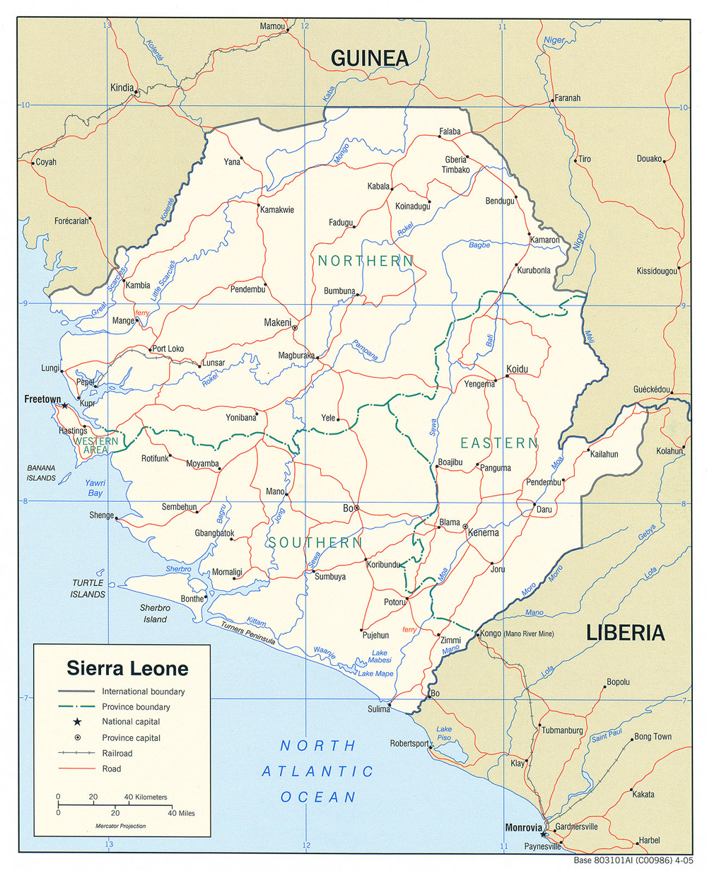
Sierra Leone (Political) 2005 (702K)and
pdf format (719K)
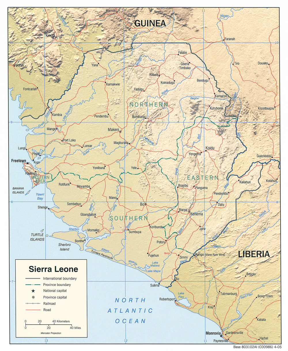
Sierra Leone (Shaded Relief) 2005 (716K)and
pdf format (712K)
Sierra Leone (Shaded Relief) 1982 (412K)
Sierra Leone (Small Map) 2008 (10K)
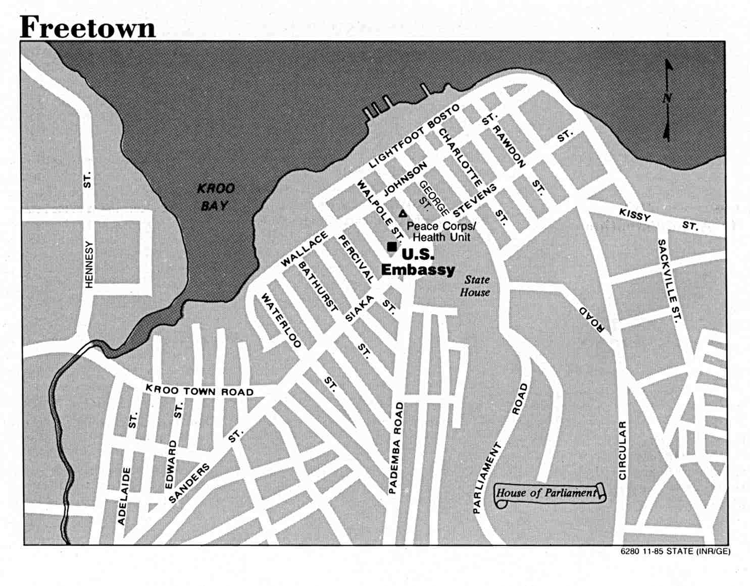
Freetown, Sierra Leone U.S. Department of State 1985 (100K)
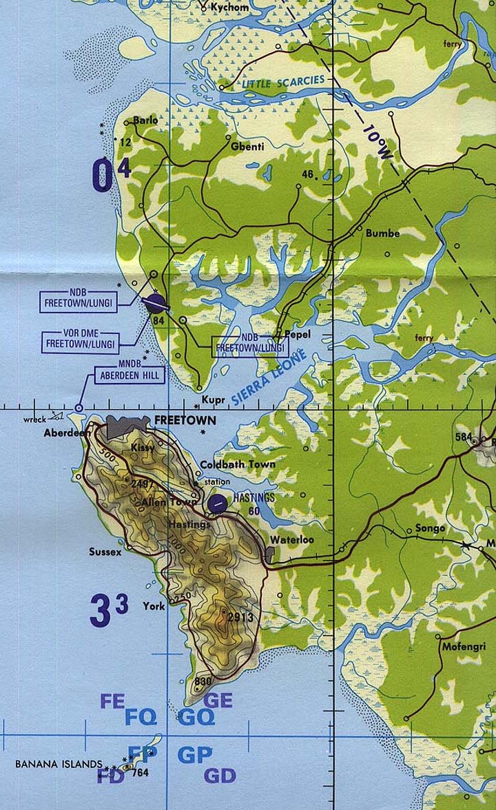
Freetown Area (Tactical Pilotage Chart) original scale 1:500,000 Portion of Defense Mapping Agency TPC K-1D 1995 (387K) Not for navigational use
Freetown (Nautical Chart) original scale 1:297,500 Portion of Defense Mapping Agency "Cape Sierra Leone to Cape Mount" 1983 (581K) Not for navigational use
Western Sierra Leone CIA 1969 (398K)
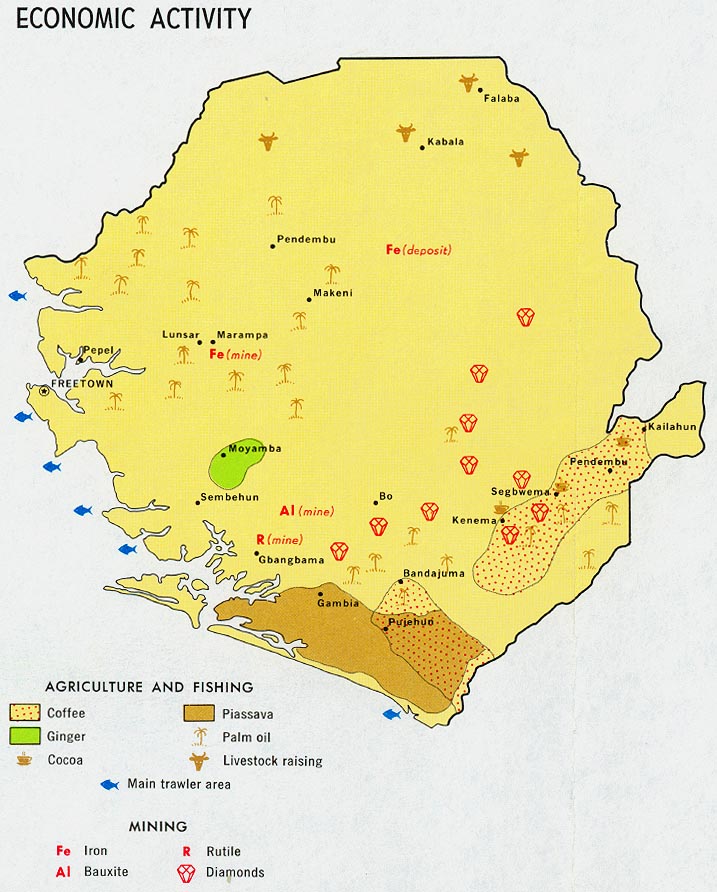
Sierra Leone - Economic Activity from Map No. 58962 1969 (137K)
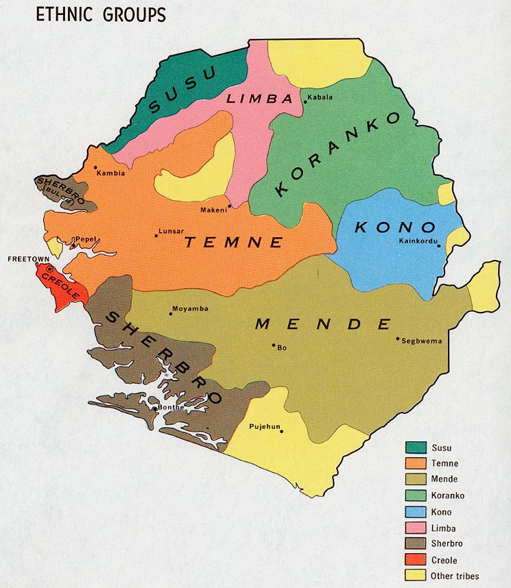
Sierra Leone - Ethnic Groups from Map No. 58962 1969 (163K)
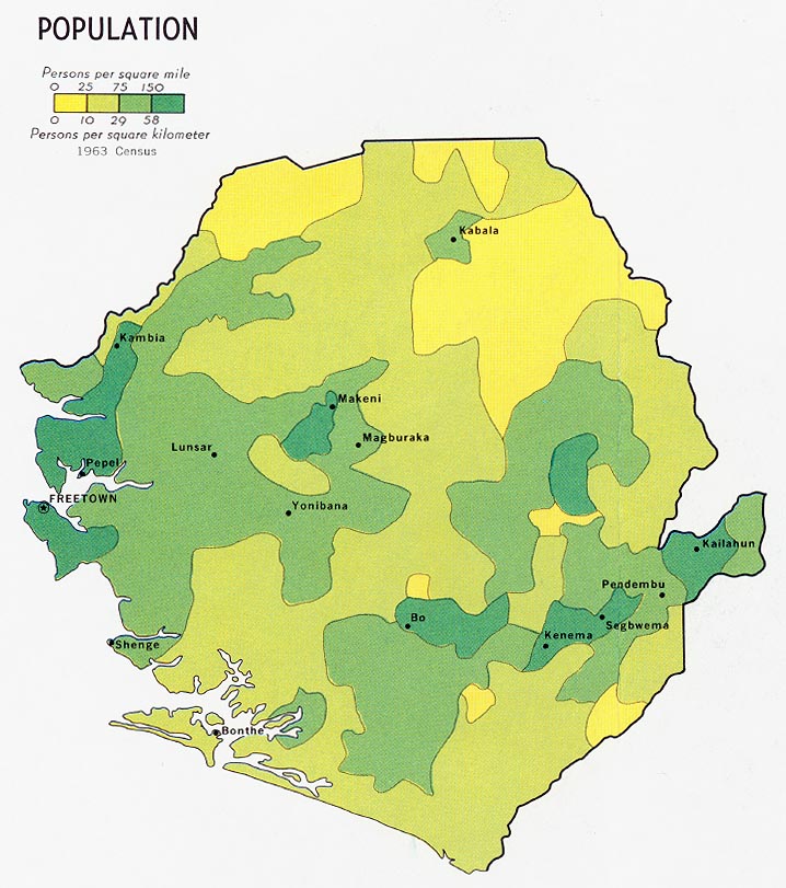
Sierra Leone - Population from Map No. 58962 1969 (133K)
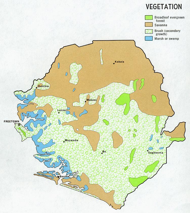
Sierra Leone - Vegetation from Map No. 58962 1969 (177K)
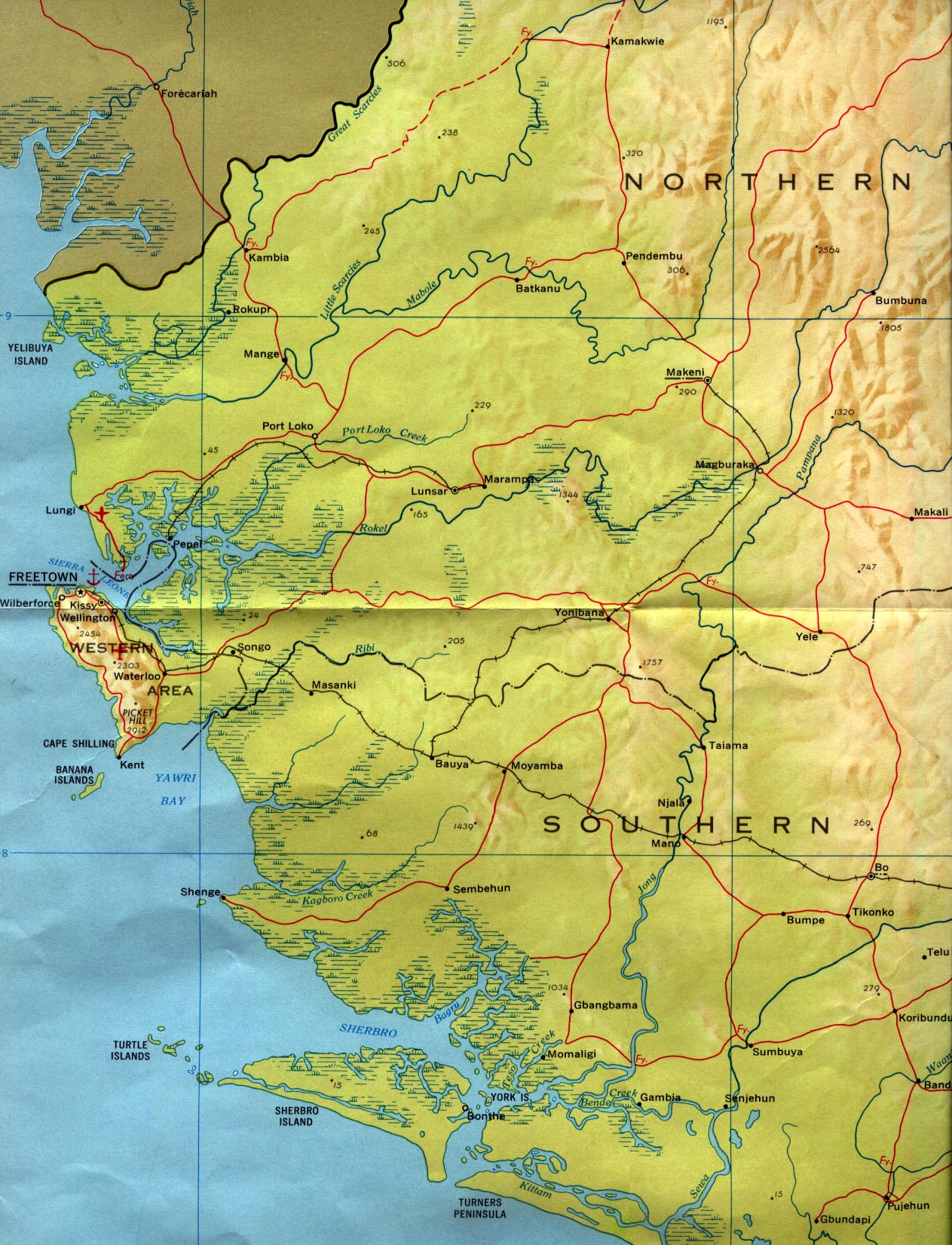
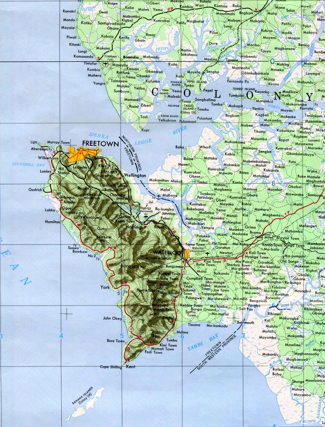
Freetown Area 1958 original scale 1:250,000 Portion of Army Map Service, Corps of Engineers NC 28-16 1958 (582K)
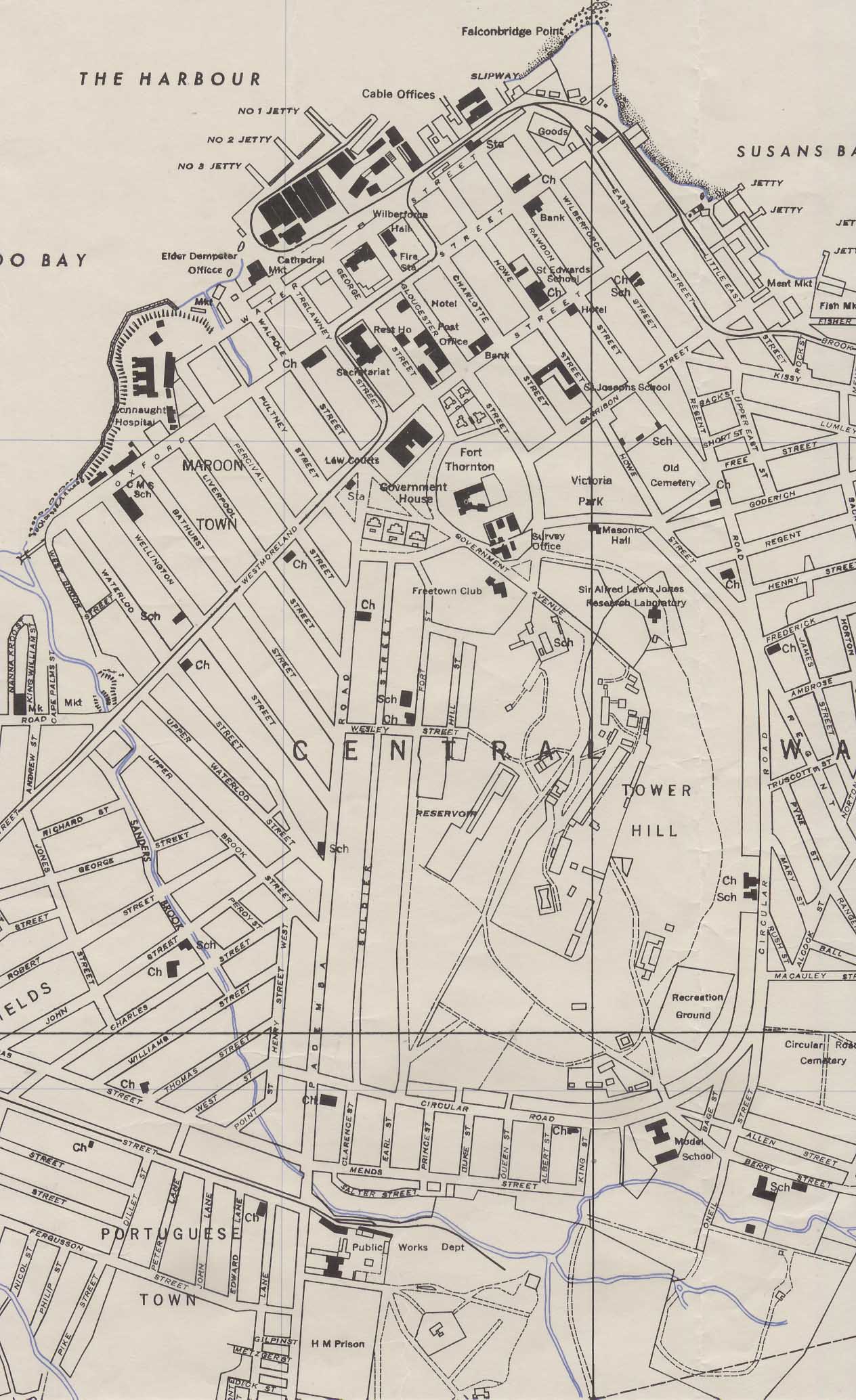
Freetown (Central Ward) original scale 1:6,250 Portion of Army Map Service, First Edition AMS-2 1947 (452K)
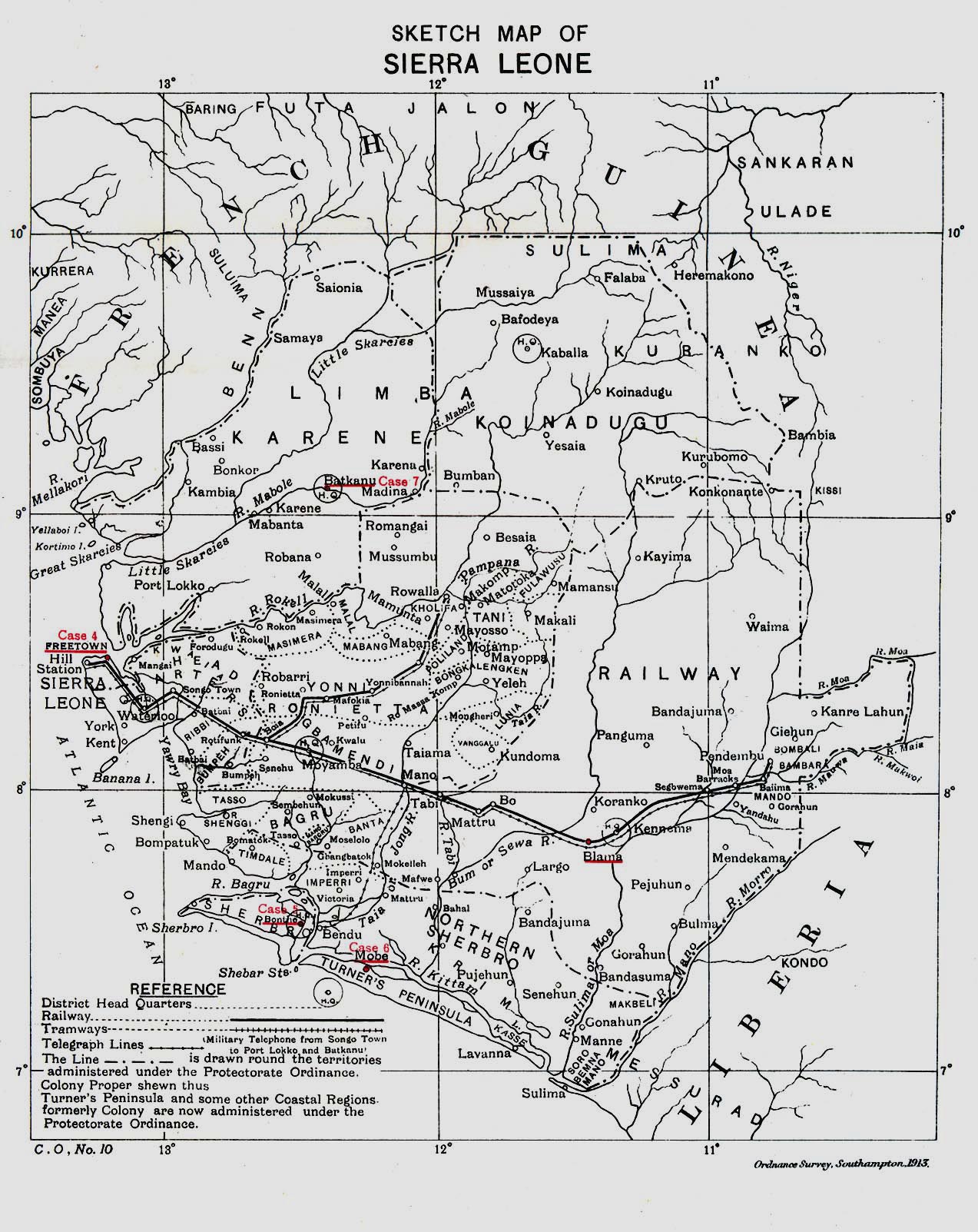
Sierra Leone 1913 "Sketch Map of Sierra Leone" from Great Britain Parliament House of Commons Sessional Papers, Colonial Reports - Annual. No. 797, 1913. (516K)
Sources: These maps were provided by the University of Texas Library and/or
the U.S. Central Intelligence Agency (CIA) unless otherwise noted.
Maps on other websites
Sierra Leone (UniMaps)
Sierra Leone (United Nations) [PDF]
Sierra Leone - Maps (ReliefWeb)
<-- Free Map Downloads
<-- Free World Country Map Downloads
Didn't find what you are looking for? We've been online since 1996 and have created 1000's of pages. Search below and you may find just what you are looking for.
Michael R. Meuser
Data Research & GIS Specialist
MapCruzin.com is an independent firm
specializing in GIS project development and data research.
We created the first U.S. based
interactive toxic chemical facility
maps on the internet in 1996 and we
have been online ever since. Learn more about us and our services.
Have a project in mind? If you have data, GIS project or custom shapefile needs contact Mike.
Contact Us
Report Broken Links
Subscribe for Updates
Sponsors


