Download Free Somalia Puntland Maps
<-- Free Map Downloads
<-- Free World Country Map Downloads
Sponsors
Note that maps may not appear on the webpage in their full size and resolution. To save the maps to your computer, right-click on the link.
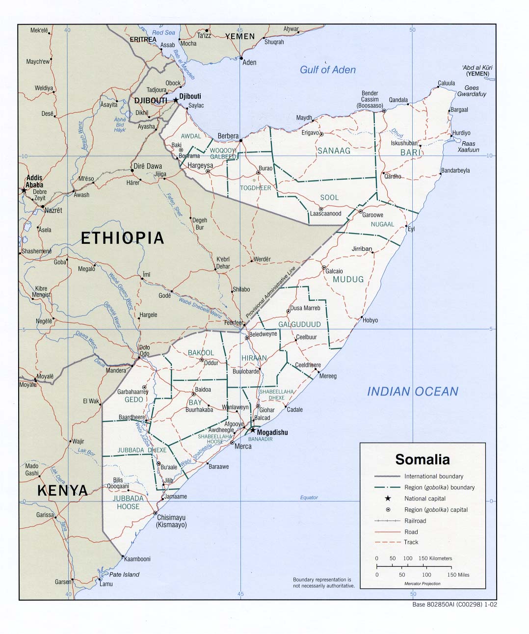
Somalia (Political) 2002 (203K) and pdf format (210K)
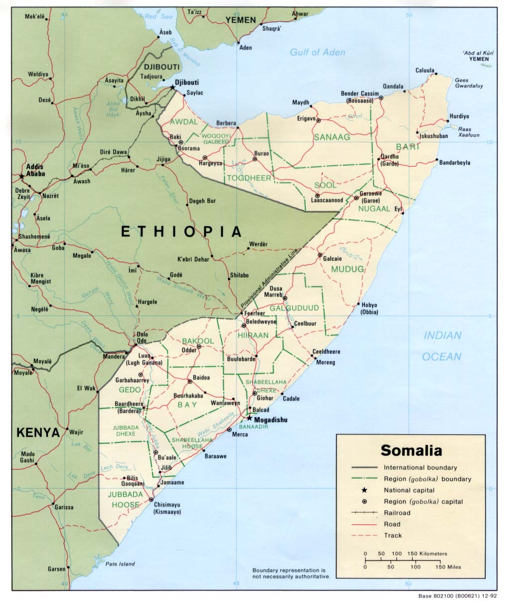
Somalia (Political) 1992 (162K) and pdf format (170K)
Somalia (Political) 1988 (213K) and pdf format (217K)
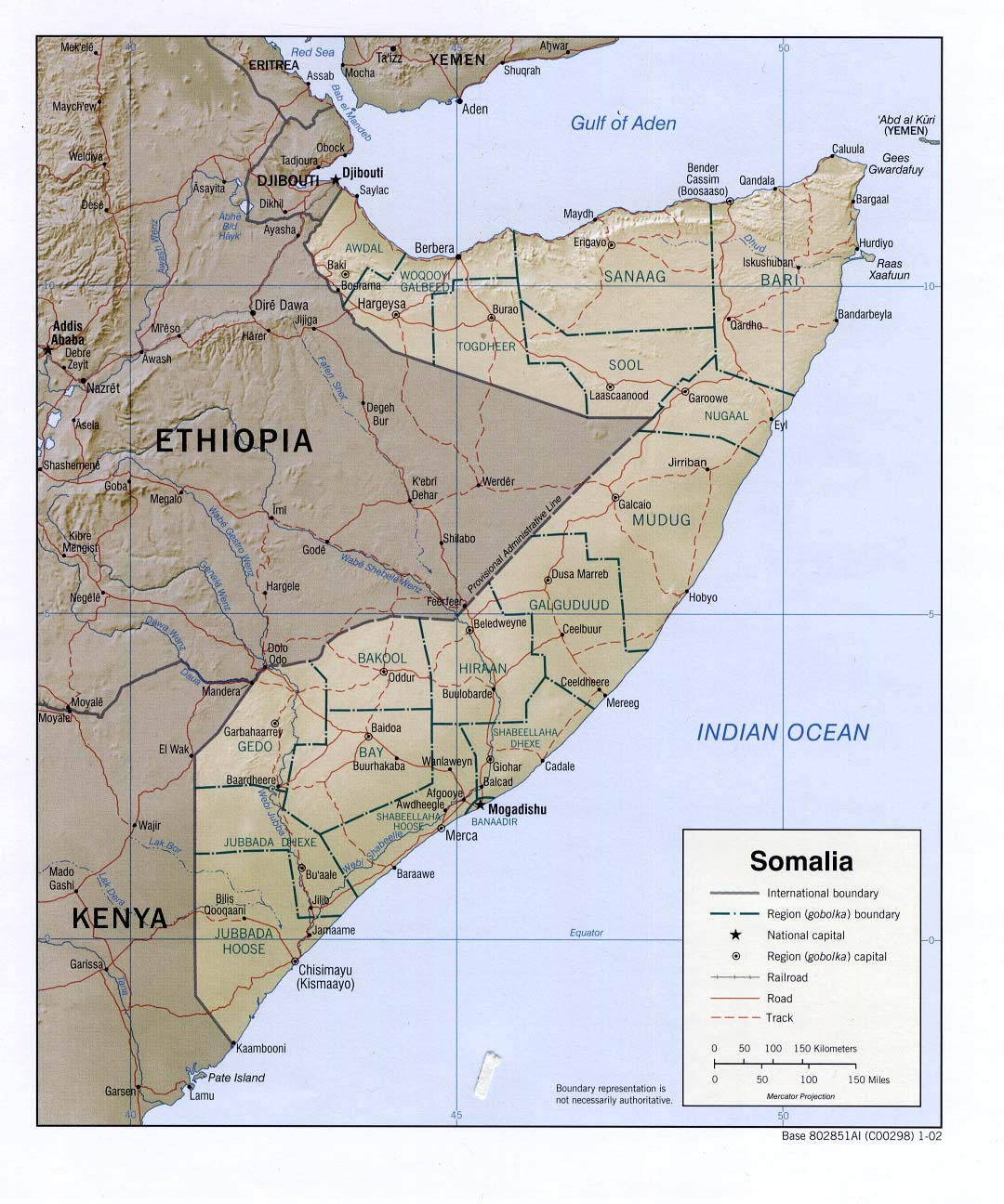
Somalia (Shaded Relief) 2002 (206K) and pdf format (250K)
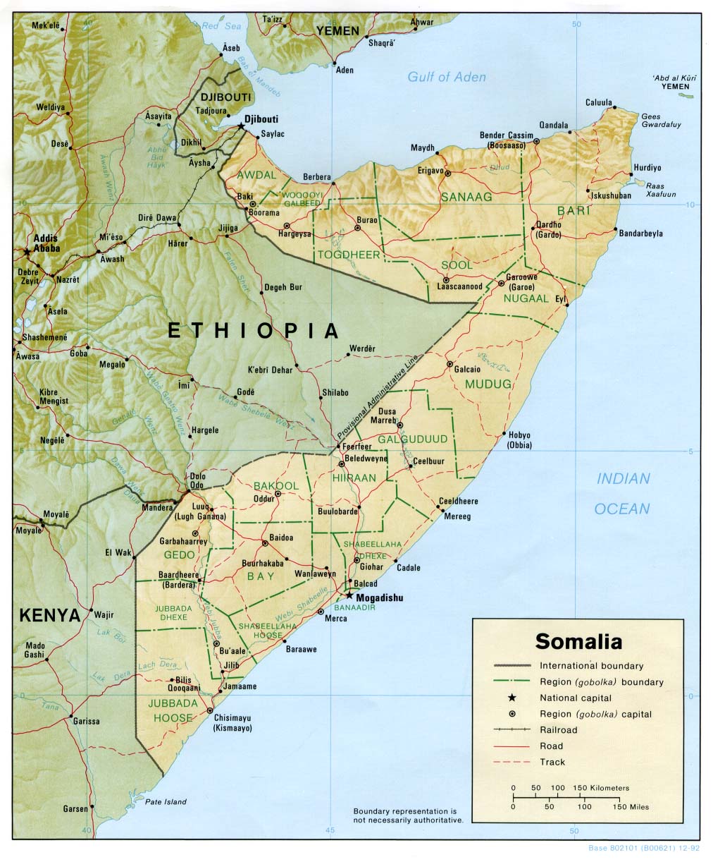
Somalia (Shaded Relief) 1992 (206K) and pdf format (212K)
Somalia (Small Map) 2008 (15K)
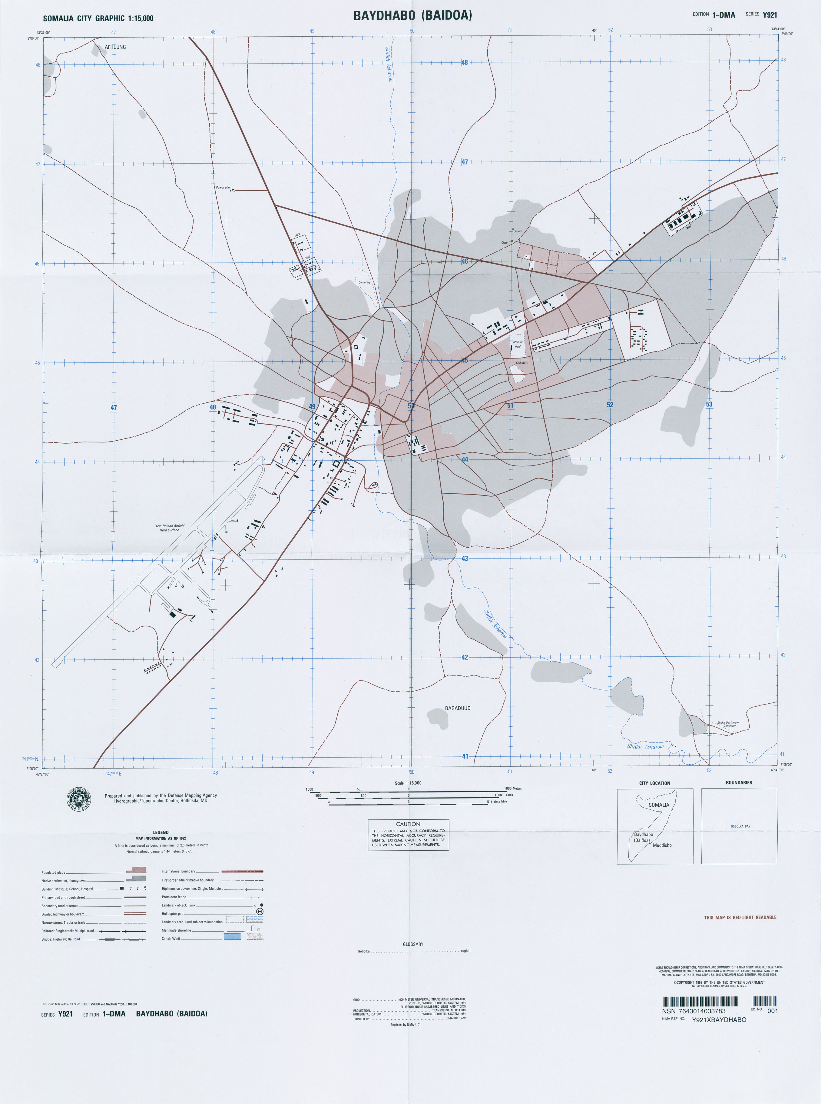
Baydhabo (Baidoa) Series Y921, Edition 1-DMA, Somalia City Graphic, Original scale 1:15,000, U.S. National Imagery and Mapping Agency, 1992, reprinted 2001 (1.3MB)
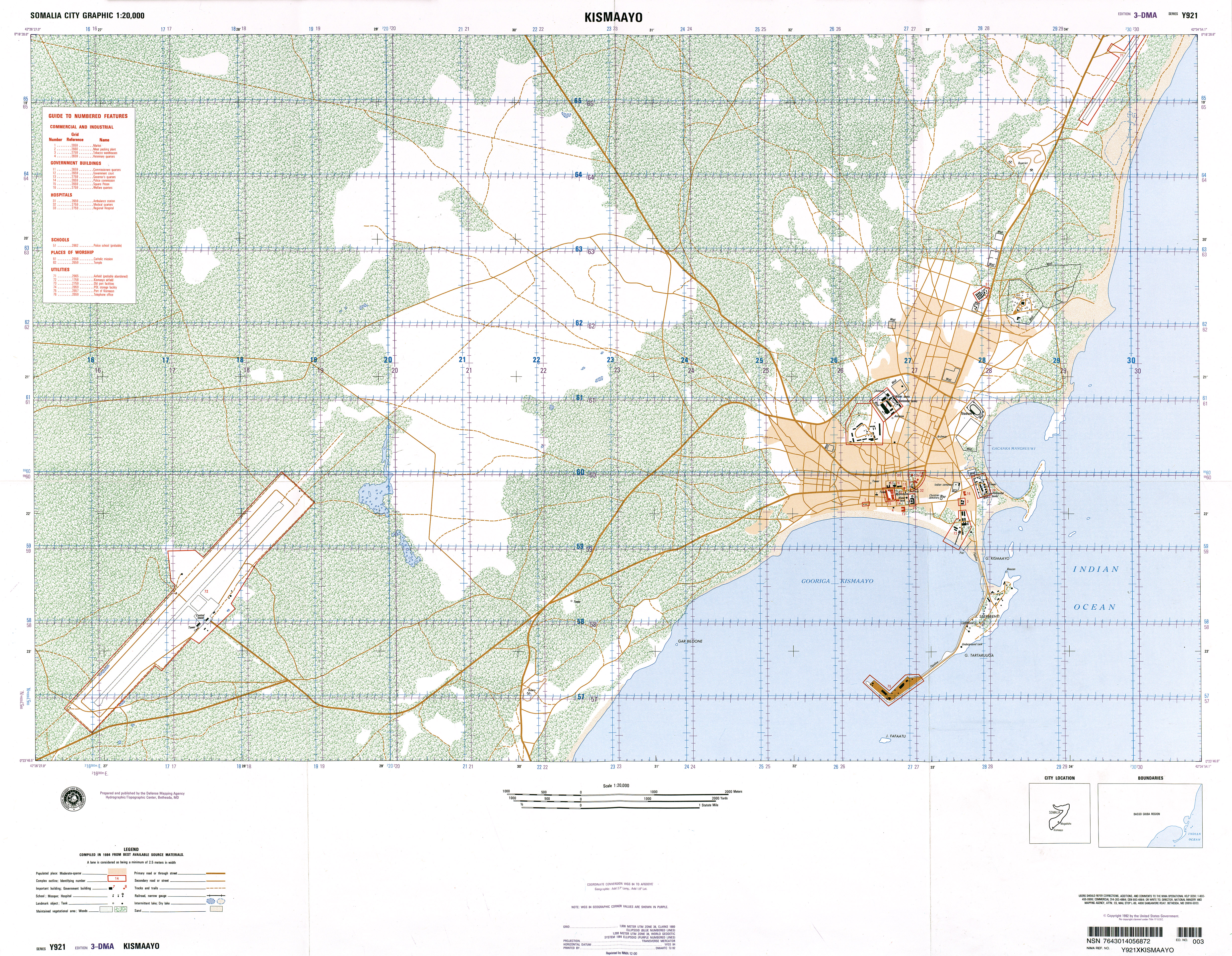
Kismaayo Series Y921, Edition 3-DMA, Somalia City Graphic, Original scale 1:20,000, U.S. National Imagery and Mapping Agency, compiled 1984, published 1992, reprinted 2000 (9.8MB)
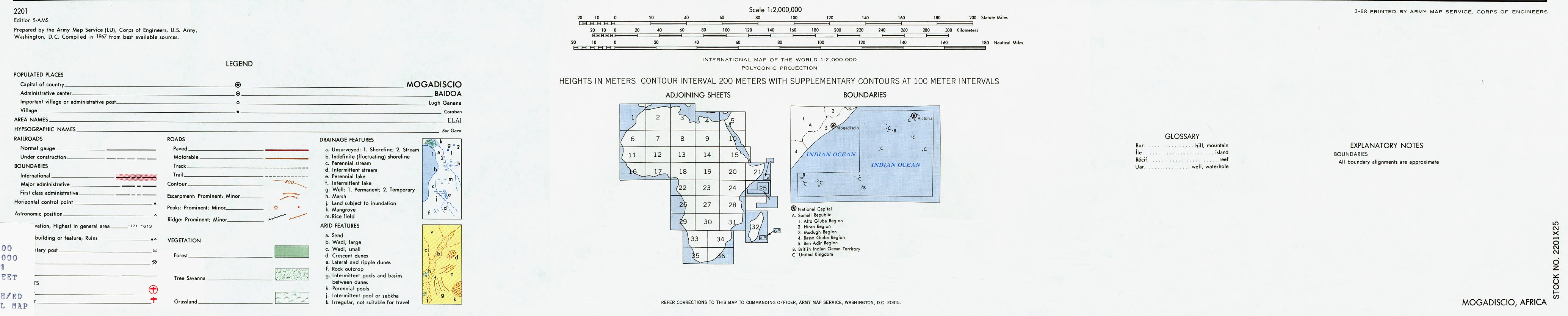
[Mogadishu] Mogadiscio Region (1MB) and map key and scale (354K)
Portion of AMS Series 2201, Sheet 25 "Mogadiscio", Original scale 1:2,000,000, U.S. Army Map Service, 1968.
[Mogadishu] City Plan Portion of sheet NA-38-67, Original scale 1:200,000, U.S. Defense Mapping Agency, 1992 (586K)
Waajid Series Y921, Edition 1-DMA, Somalia City Graphic, Original scale 1:15,000, U.S. National Imagery and Mapping Agency, published 1992, reprinted 2001 (1.8MB)
1:100,000 - Ras Kamboni Area, Southern Tip of Somalia Portion of Sheet SA-37-60, Series Y630, DMA, 1992 (2.5 MB)
Horn of Africa (Shaded Relief) 1992 (218K)
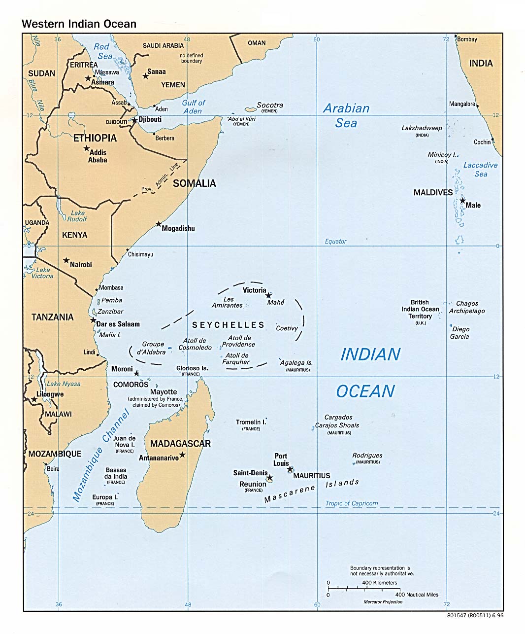
Western Indian Ocean (Political) 1996 (193K)
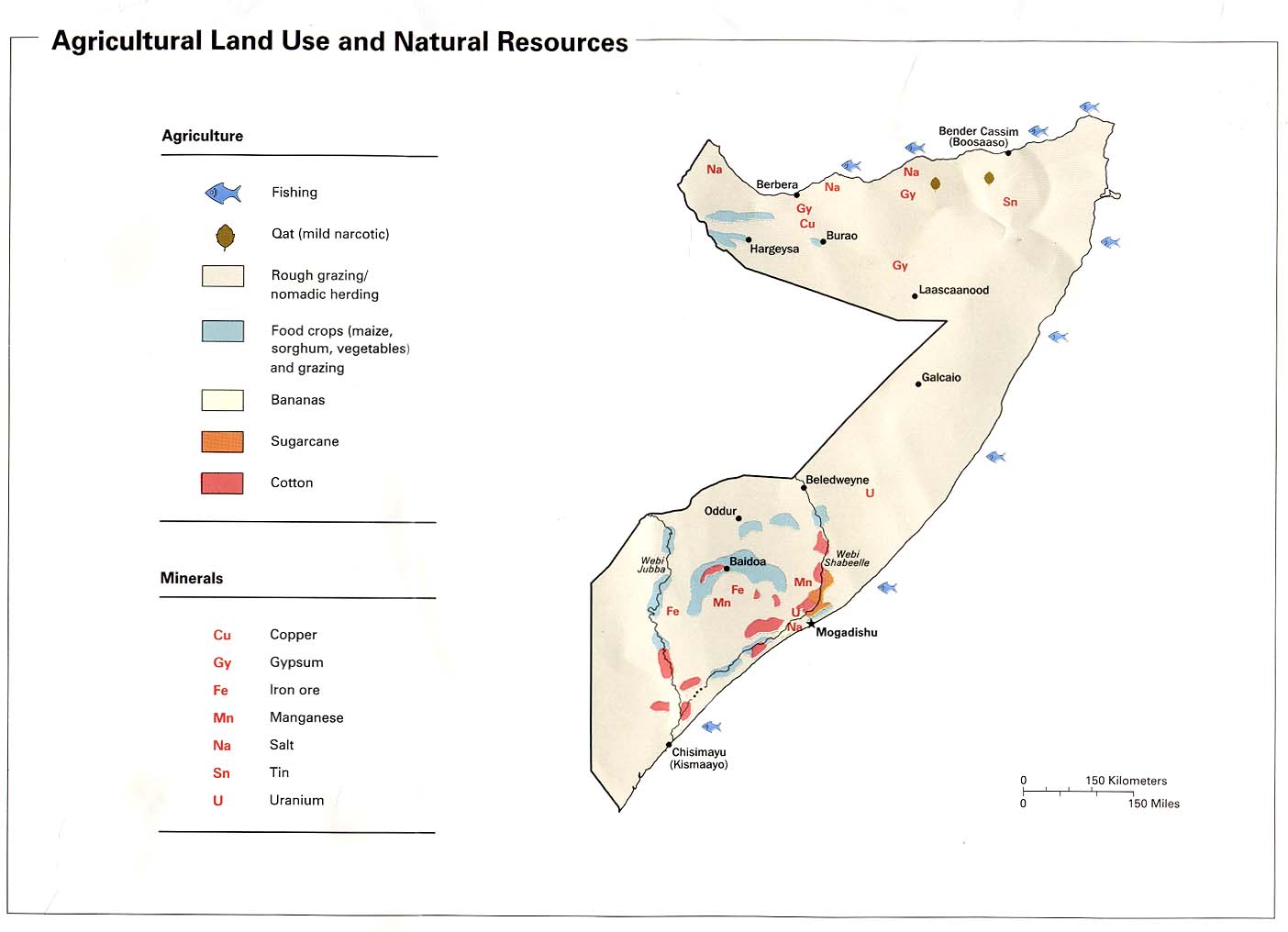
Agricultural Land Use and Natural Resources from Somalia Summary Map, CIA 2002 (84K)
Agricultural Land Use and Natural Resources from Somalia Summary Map, CIA 1992 (89K)
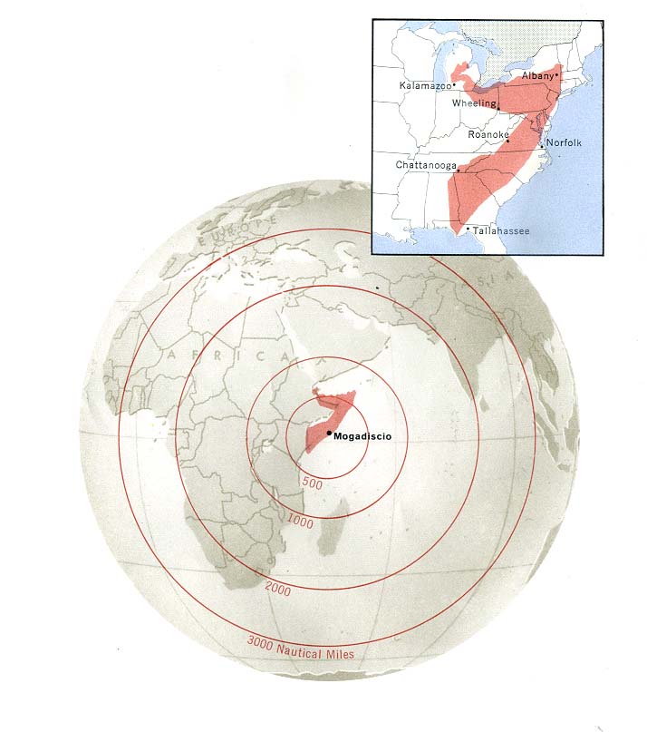
Area Comparison from Somalia and Djibouti Map, CIA 1977 (67K)
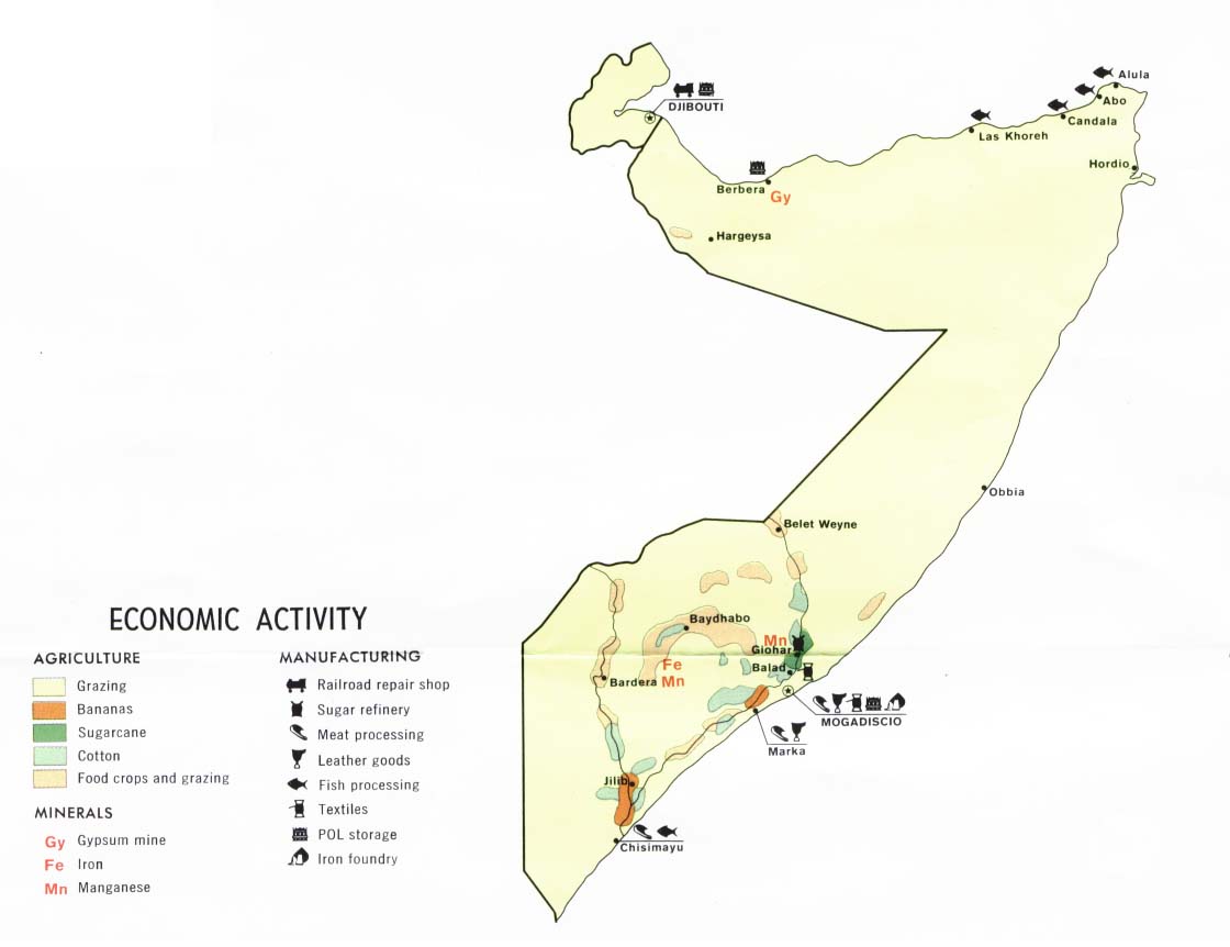
Economic Activity from Somalia and Djibouti Map, CIA 1977 (61K)
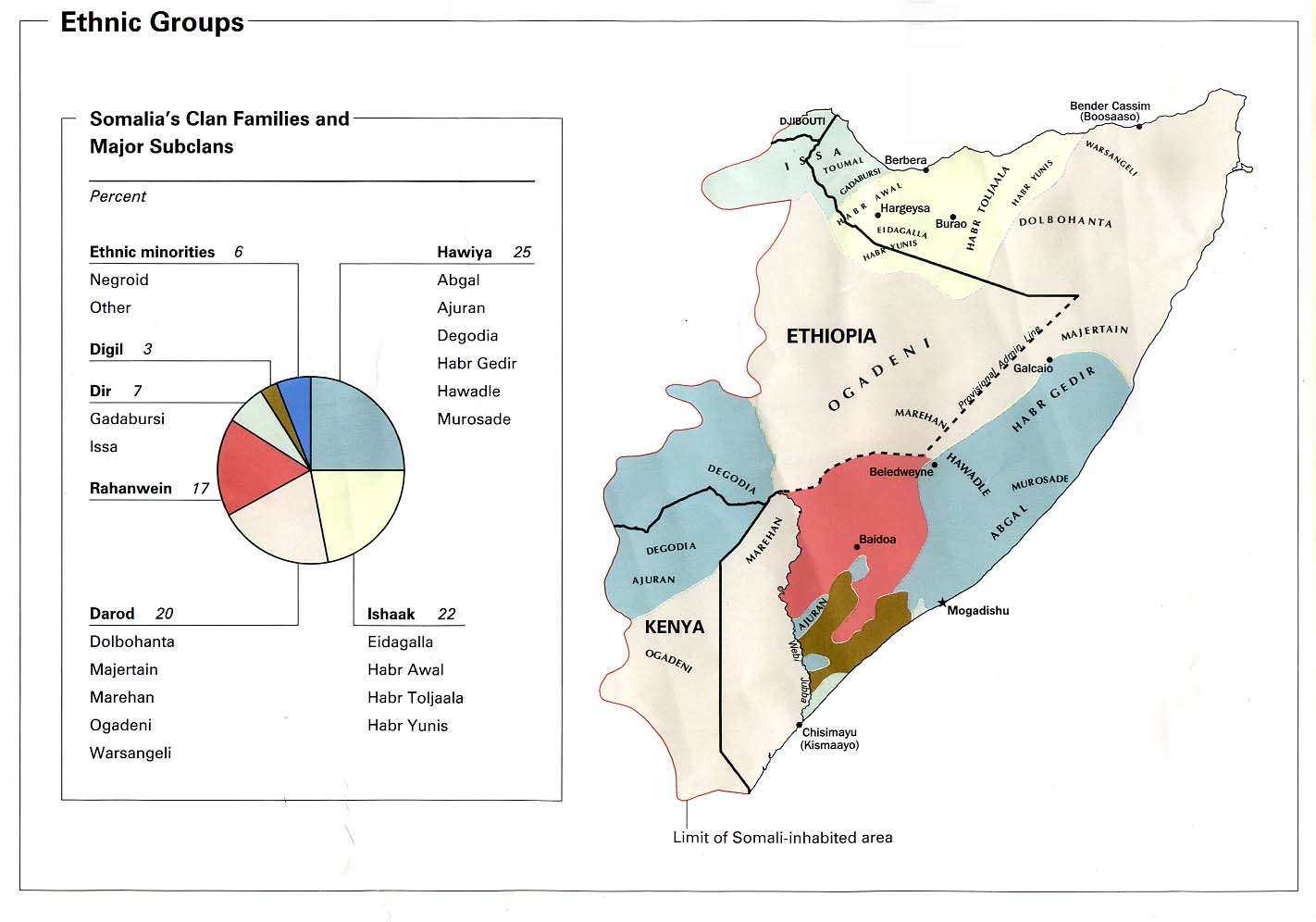
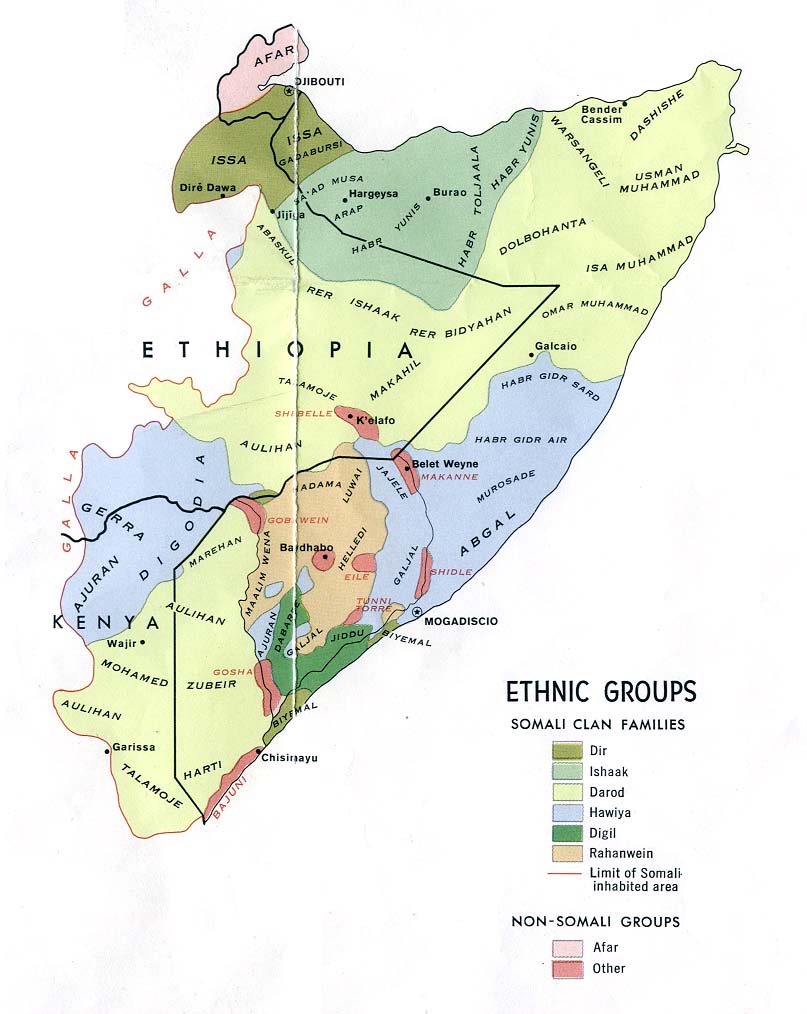
Ethnic Groups from Somalia Summary Map, CIA 2002 (103K)
Ethnic Groups from Somalia Summary Map, CIA 1992 (119K)
Ethnic Groups from Somalia and Djibouti Map, CIA 1977 (105K)
Ethnic Groups - Horn of Africa 1980 (213K)
Population from Somalia Summary Map, CIA 2002 (83K)
Population from Somalia Summary Map, CIA 1992 (91K)
Population from Somalia and Djibouti Map, CIA 1977 (75K)
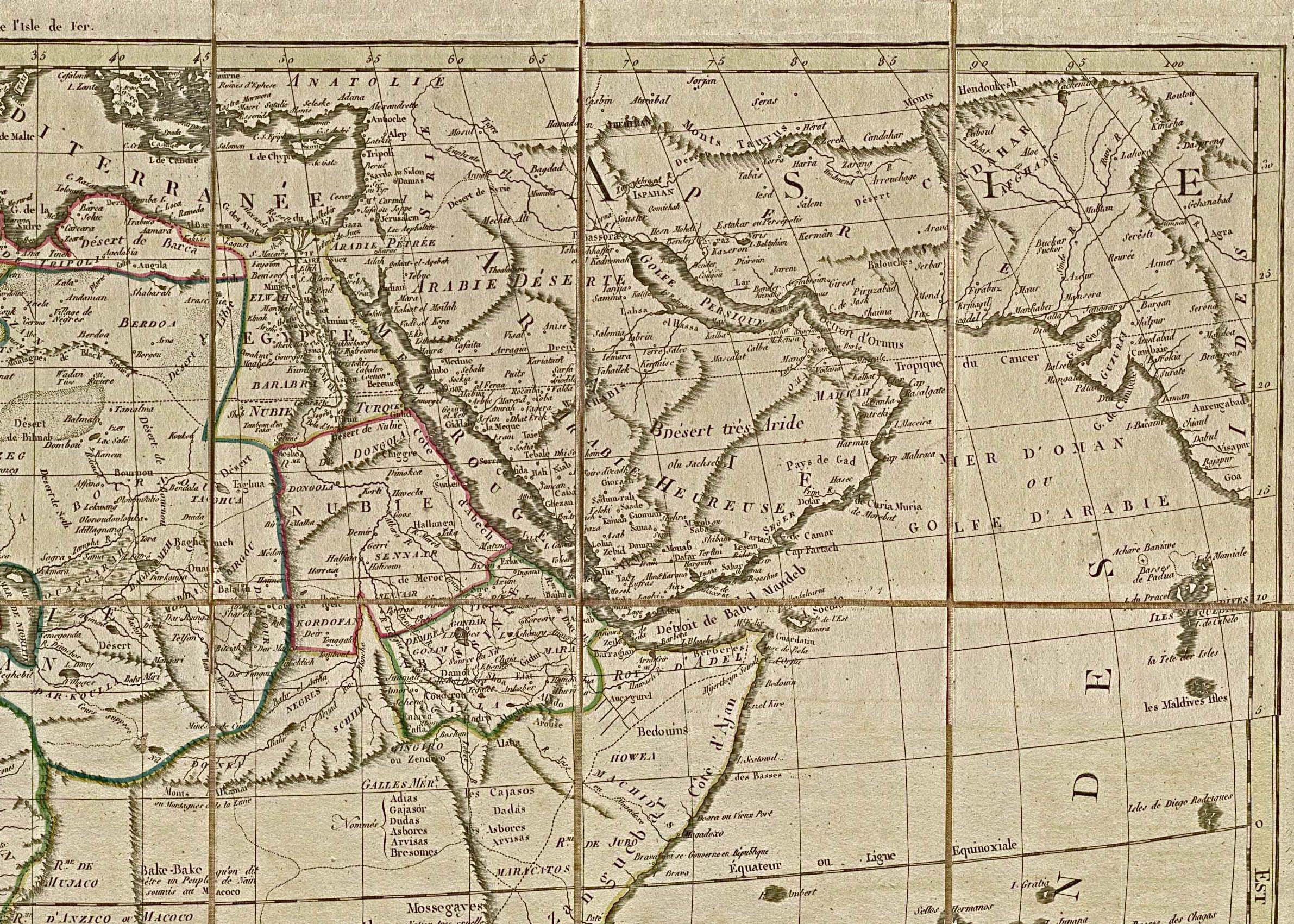
Northeast Africa and the Near East 1829 (942K)
A portion of "Carte Generale De L'Afrique" by Eustache Herisson, 1829.
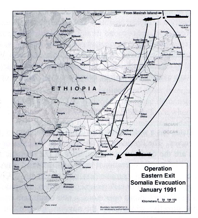
Operation Eastern Exit, Somalia Evacuation January 1991 (174K)
From U.S. Marines in the Persian Gulf, 1990-1991: With Marine Forces Afloat in Desert Shield and Desert Storm by Ronald J. Brown. U.S. Marine Corps, History and Museums Division, Washington, D.C. 1998.
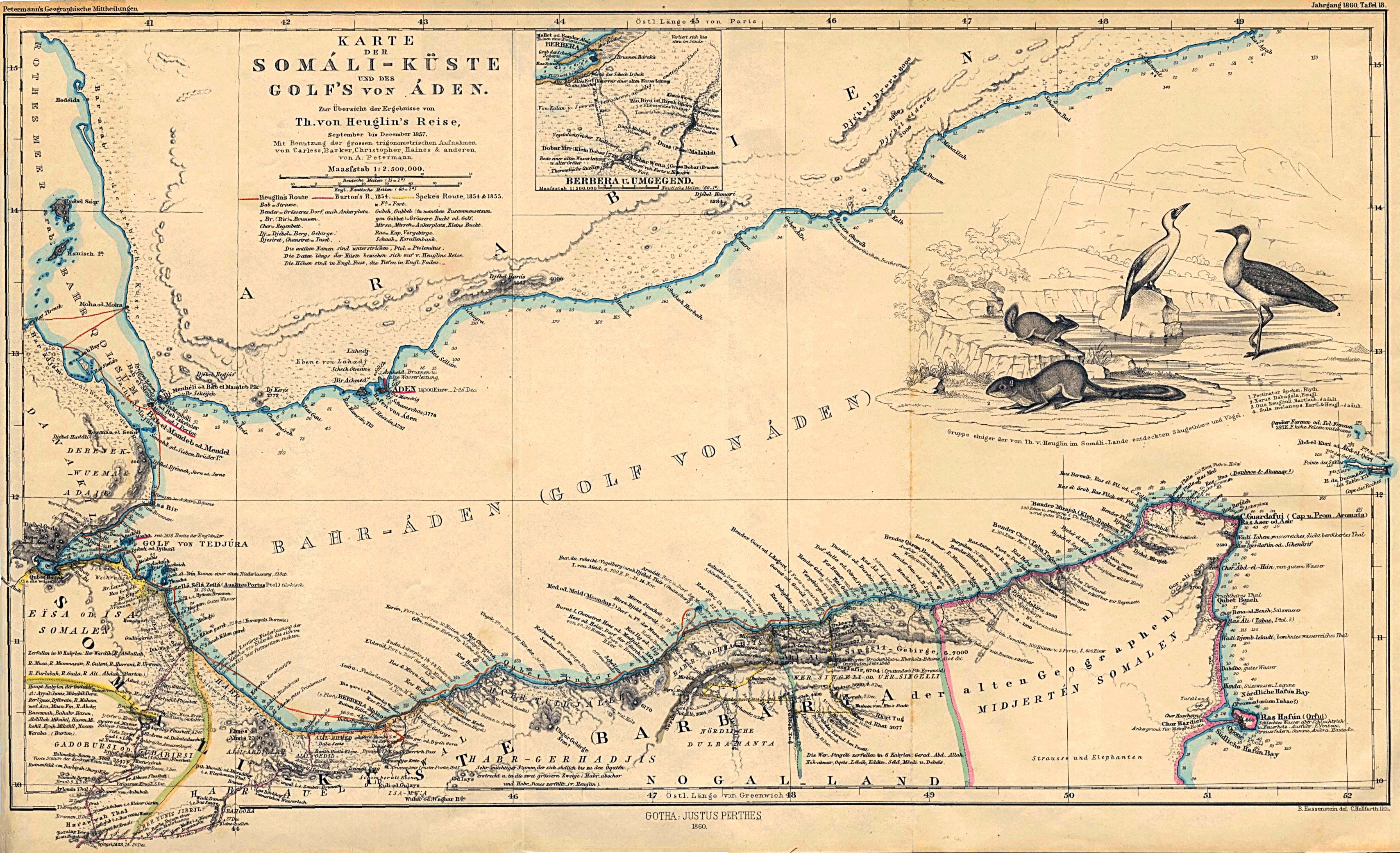
Somali Coast and Aden Gulf 1860 (1MB) "Karte der Somali-Kuste und des Golf's von Aden" From Mittheilungen aus Justus Perthes' Geographischer Anstalt uber Wichtige Neue Erforschungen auf dem Gesammtgebiete der Geographie von Dr. A. Petermann. Volume 6, 1860.
Sources: These maps were provided by the University of Texas Library and/or
the U.S. Central Intelligence Agency (CIA) unless otherwise noted.
Sponsors
Maps on other websites
Somalia (Robert Pelton)
Somalia (UniMaps)
Somalia (United Nations) [PDF]
Somalia - Ethnic Groups (Magellan)
Somalia - Ethnic Groups (Wikimedia)
Somalia - Northern (Peter Loud)
Somalia - Southern (Peter Loud)
Puntland [Northern Somalia] (BBC News)
Puntland [Northern Somalia] (Puntland State of Somalia)
Somaliland [Northern Somalia] (BBC News)
Somaliland [Northern Somalia] (Republic of Somaliland Web Site)
[2009] Live Piracy Map (International Maritime Bureau)
[2009] Piracy Attacks off Somalia [April 2009] (BBC News)
[2009] Somalia - Political Situation Map (Wikipedia)
[2008] Somalia - Piracy Map (BBC News)
[2007] Somaliland Border Dispute (Wikipedia)
[2007] Ras Kamboni Area, Satellite Image [Site of battle, January 2007] (Google Maps)
[2007] Somalia - U.S. Navy Patrols and Air Strikes [January 2007] (BBC News)
[2006] Somalia - Ethiopian Troop Movements Map [December 30, 2006] (The Fourth Rail/Magellan)
[2006] Somalia - Offshore Pirate Attacks (UNOSAT)
<-- Free Map Downloads
<-- Free World Country Map Downloads
Didn't find what you are looking for? We've been online since 1996 and have created 1000's of pages. Search below and you may find just what you are looking for.
Michael R. Meuser
Data Research & GIS Specialist
MapCruzin.com is an independent firm
specializing in GIS project development and data research.
We created the first U.S. based
interactive toxic chemical facility
maps on the internet in 1996 and we
have been online ever since. Learn more about us and our services.
Have a project in mind? If you have data, GIS project or custom shapefile needs contact Mike.
Contact Us
Report Broken Links
Subscribe for Updates


![[Mogadishu] Mogadiscio Region](/free-maps-somalia/mogadiscio_1968.jpg)
![[Mogadishu] City Plan](/free-maps-somalia/mogadishu_1992.jpg)
![[2009] Piracy Attacks off Somalia [April 2009] (BBC News)](https://newsimg.bbc.co.uk/media/images/45647000/gif/_45647302_africa_piracy_maersk_226.gif)
![[2009] Somalia - Political Situation Map (Wikipedia)](https://en.wikipedia.org/wiki/Image:Somalia_map_states_regions_districts.png)
![[2008] Somalia - Piracy Map (BBC News)](https://newsimg.bbc.co.uk/media/images/45217000/gif/_45217511_africa_piracy_map226_3.gif)
![[2007] Somaliland Border Dispute (Wikipedia)](https://en.wikipedia.org/wiki/File:Map_of_somaliland_border_claims.jpg)
![[2007] Somalia - U.S. Navy Patrols and Air Strikes [January 2007] (BBC News)](https://newsimg.bbc.co.uk/media/images/42429000/gif/_42429309_somalia_hayo_map416.gif)
![[2006] Somalia - Ethiopian Troop Movements Map [December 30, 2006] (The Fourth Rail/Magellan)](https://billroggio.com/maps/Somalia-battle-12302006.jpg)
![[2006] Somalia - Offshore Pirate Attacks (UNOSAT)](https://unosat.web.cern.ch/unosat/freeproducts/east_and_horn_of_africa/UNOSAT_horn_piracy28mar06_small.jpg)