Download Free Maps of California
<-- Free Maps
<-- Free U.S. State Maps
<-- Free World Country Maps
See Also:
Topographic Maps
ArcGIS Shapefile Map Layers
Download these maps of California for your reports, websites, research, projects, presentations...
Note that maps may not appear on the webpage in their full size and resolution. To save the maps to your computer, right-click on the link.
State Maps
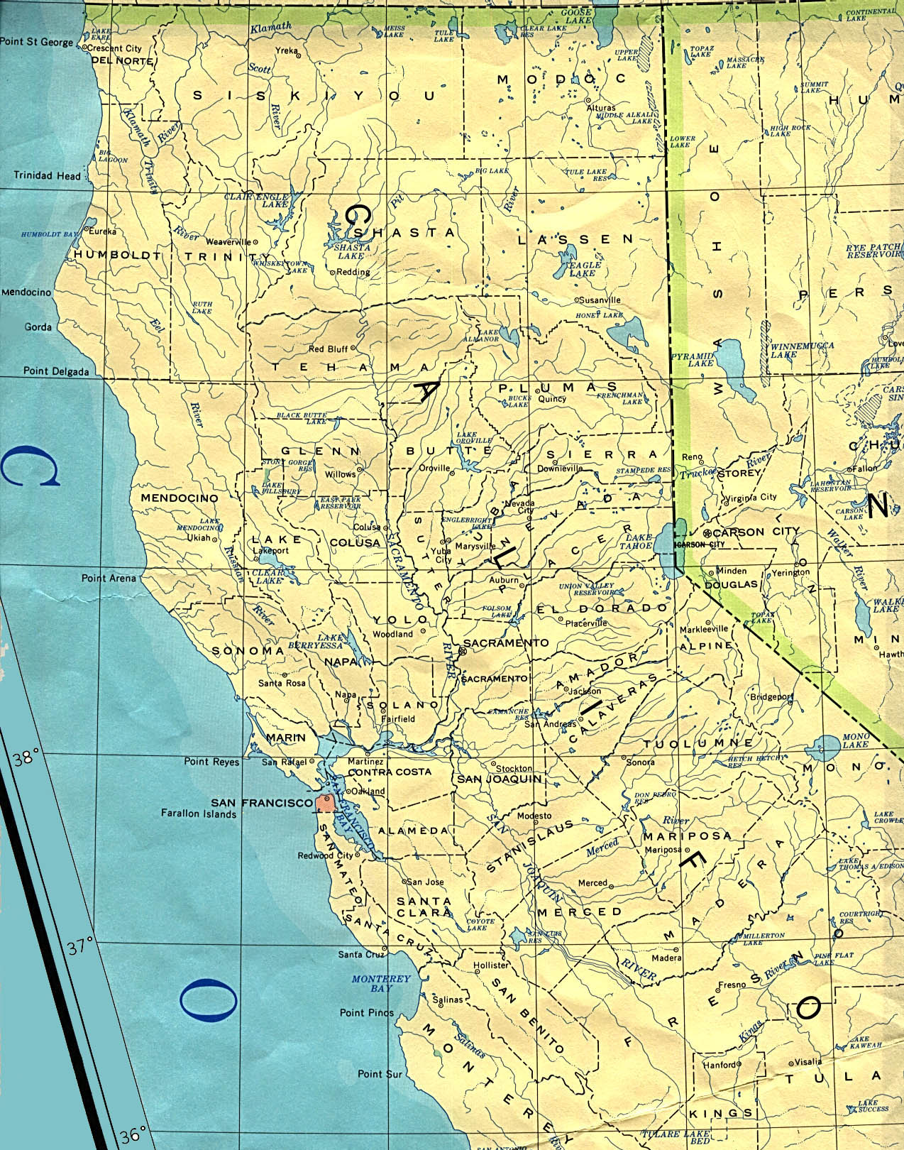
California - Northern (base map) JPEG format (604K) County boundaries and names, county seats, rivers. Original scale 1:2,500,000 U.S. Geological Survey, 1972 limited update 1990
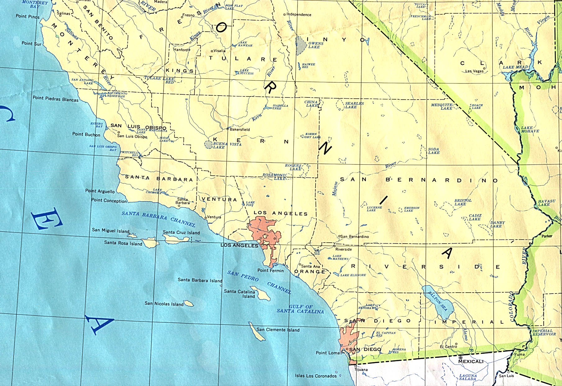
California - Southern (base map) JPEG format (468K) County boundaries and names, county seats, rivers. Original scale 1:2,500,000 U.S. Geological Survey, 1972 limited update 1990
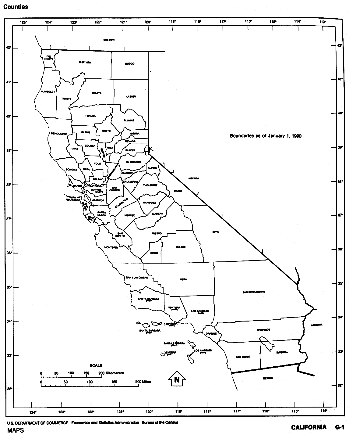
California (outline map) JPEG format (71K) County boundaries and names. U.S. Bureau of the Census, 1990
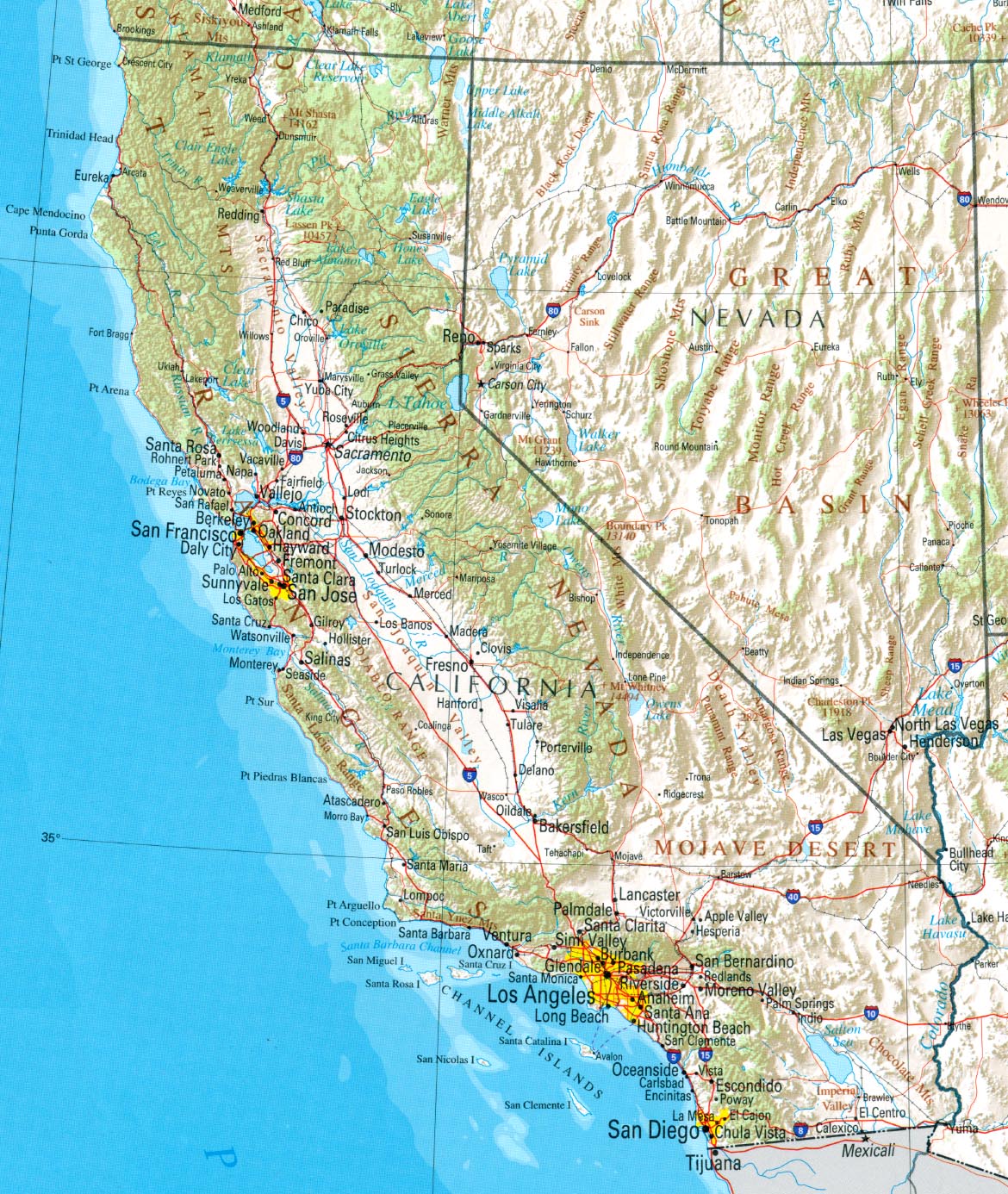
California (reference map) JPEG format (471K) Shaded relief map with state boundaries, forest cover, place names, major highways. Portion of "The National Atlas of the United States of America. General Reference", compiled by U.S. Geological Survey 2001, printed 2002
California (reference map) PDF format (474K) Shaded relief map with state boundaries, forest cover, place names, major highways. Portion of "The National Atlas of the United States of America. General Reference", compiled by U.S. Geological Survey 2001, printed 2002
California - Federal Lands and Indian Reservations PDF format (5.4MB) The National Atlas of the United States of America, U.S. Geological Survey, 2003
City Maps
Barstow (topographic) original scale 1:24,000 U.S.G.S. 1993 (672K)
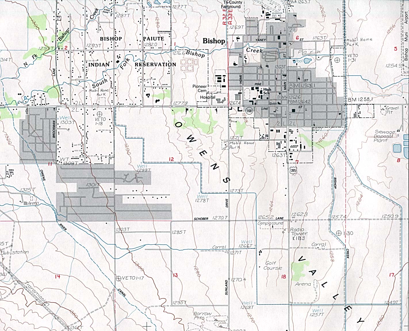
Bishop (topographic) original scale 1:24,000 U.S.G.S. provisional edition 1984, minor revision 1994 (391K)
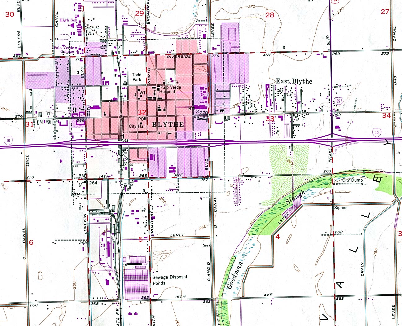
Blythe (topographic) original scale 1:24,000 U.S.G.S. 1951, photorevised 1970 and 1975 (332K)
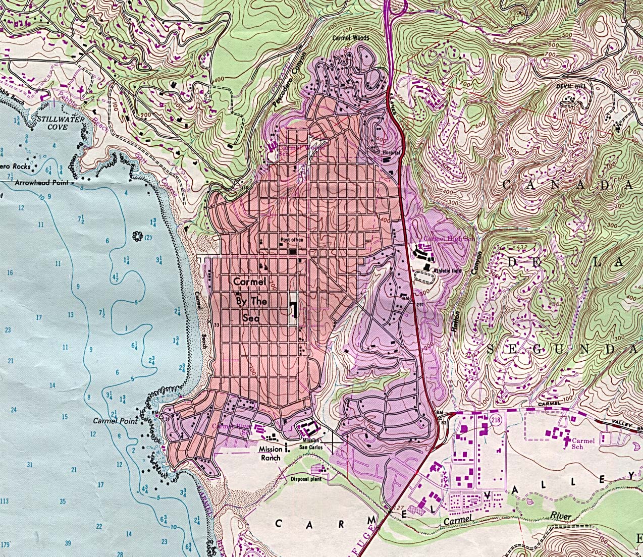
Carmel By The Sea (topographic) original scale 1:24,000 U.S.G.S. 1983 (553K)
Chico (topographic) original scale 1:24,000 U.S.G.S. 1978 (655K)
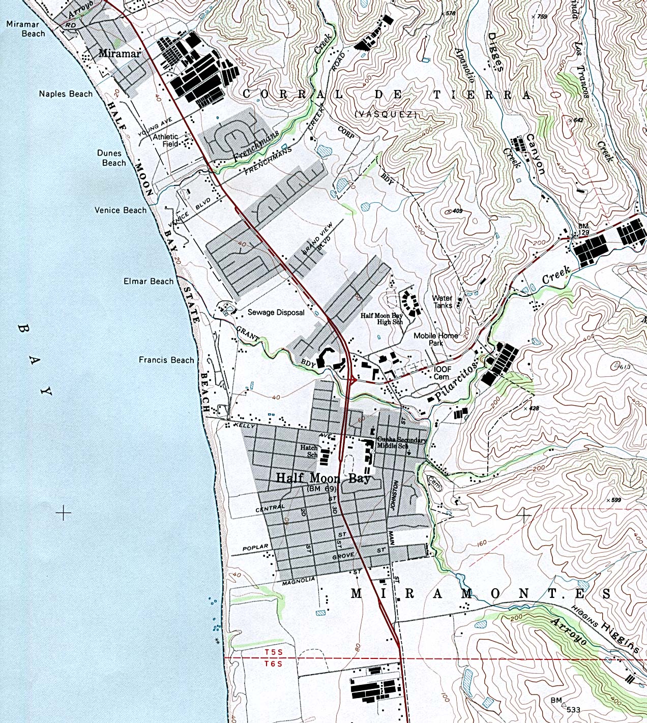
Half Moon Bay (topographic) original scale 1:24,000 U.S.G.S. 1991 (578K)
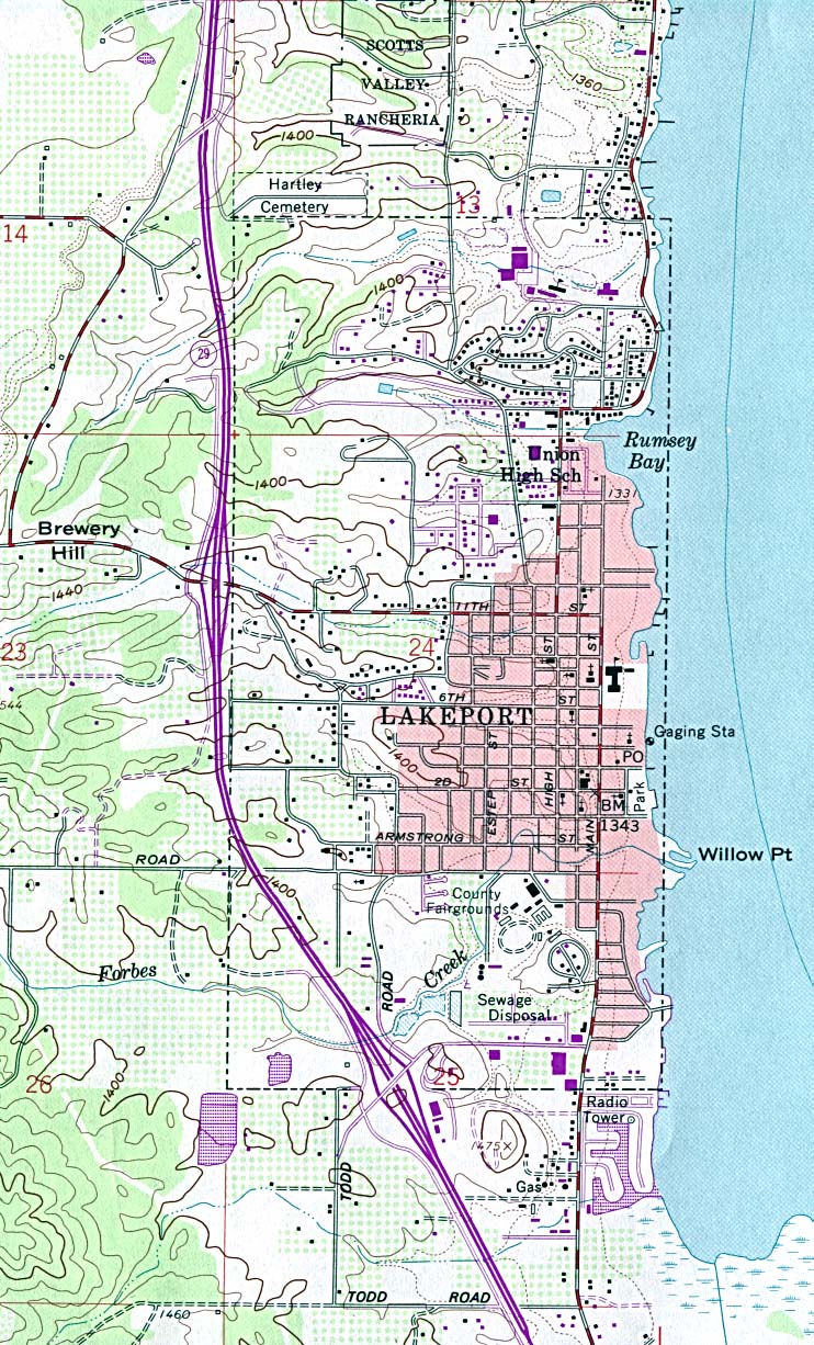
Lakeport (topographic) original scale 1:24,000 U.S.G.S. 1958, photorevised 1978, minor revision 1994 (332K)
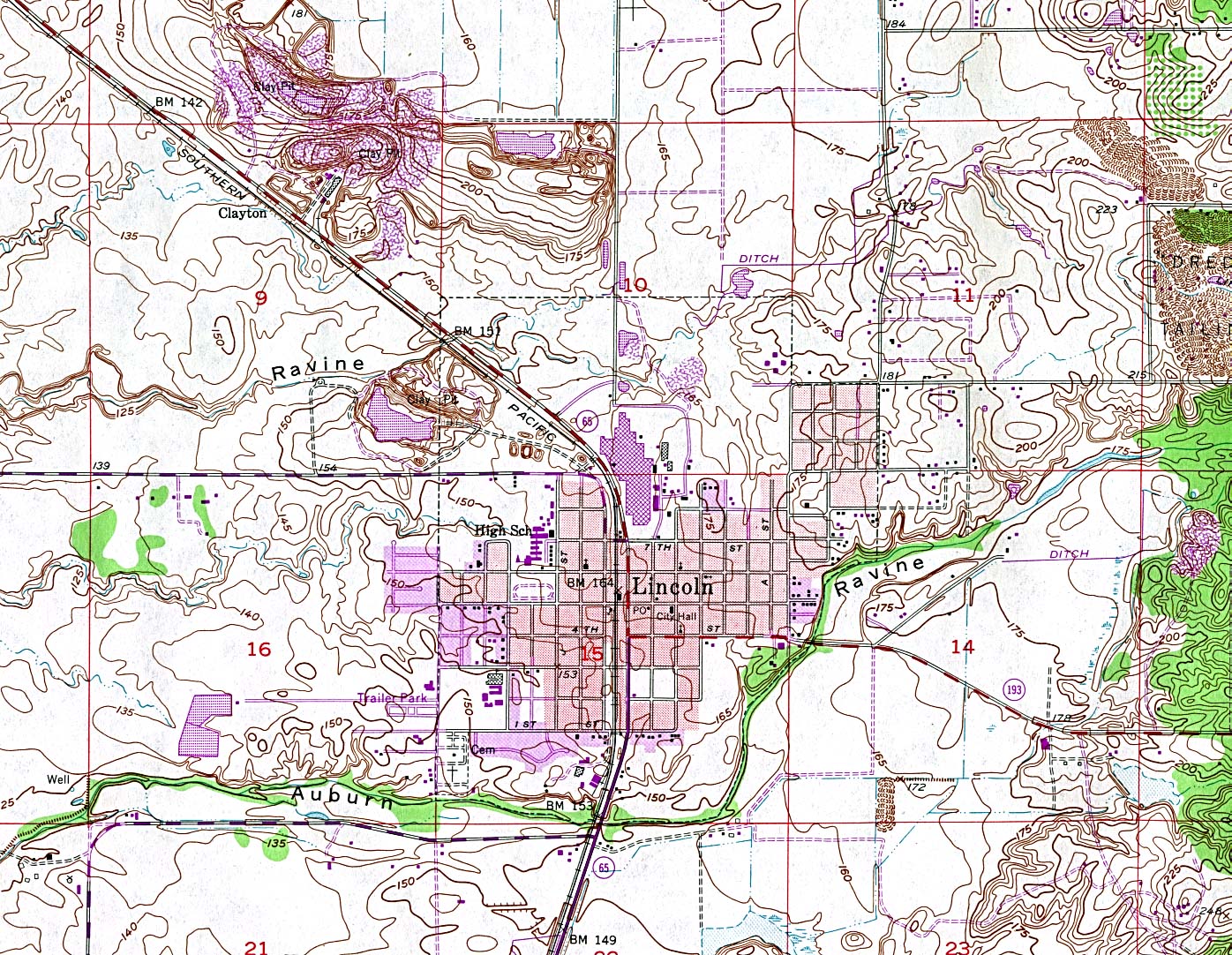
Lincoln (topographic) original scale 1:24,000 U.S.G.S. 1953, photorevised 1981 (621K)
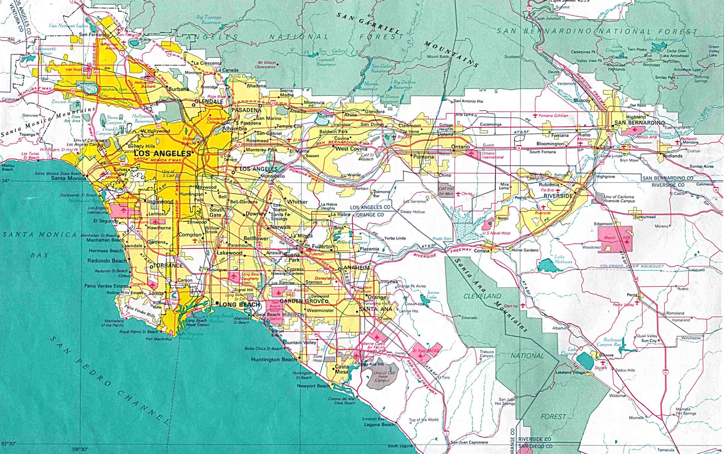
Los Angeles original scale 1:500,000 U.S. National Atlas 1970 (326K)
Monterey (topographic) original scale 1:24,000 U.S.G.S. 1983 (697K)
Palm Springs (topographic) original scale 1:24,000 U.S.G.S. 1988 (850K)
San Francisco original scale 1:500,000 U.S. National Atlas 1970 (333K)
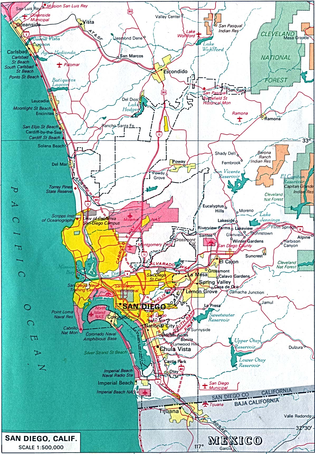
San Diego original scale 1:500,000 U.S. National Atlas 1970 (515K)
Historical City Maps
Bakersfield 1917 Automobile Blue Book 1917, Vol. 8, Section 1 (125K)
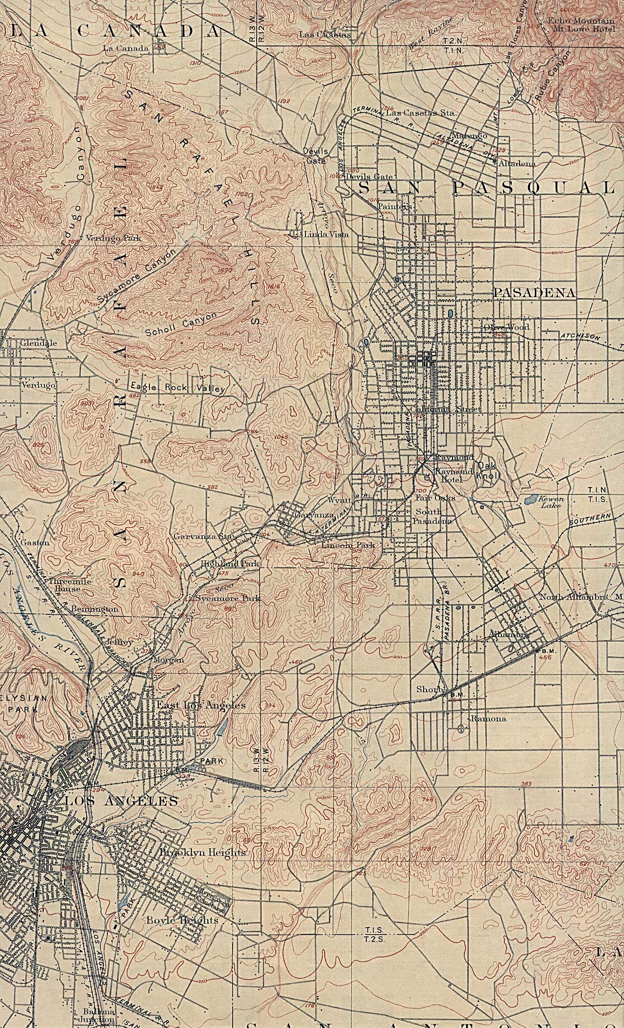
Los Angeles (East) 1900 U.S. Geological Survey (1,063K) includes Pasadena
Los Angeles (West) 1902 U.S. Geological Survey (1,097K) includes Burbank and Hollywood
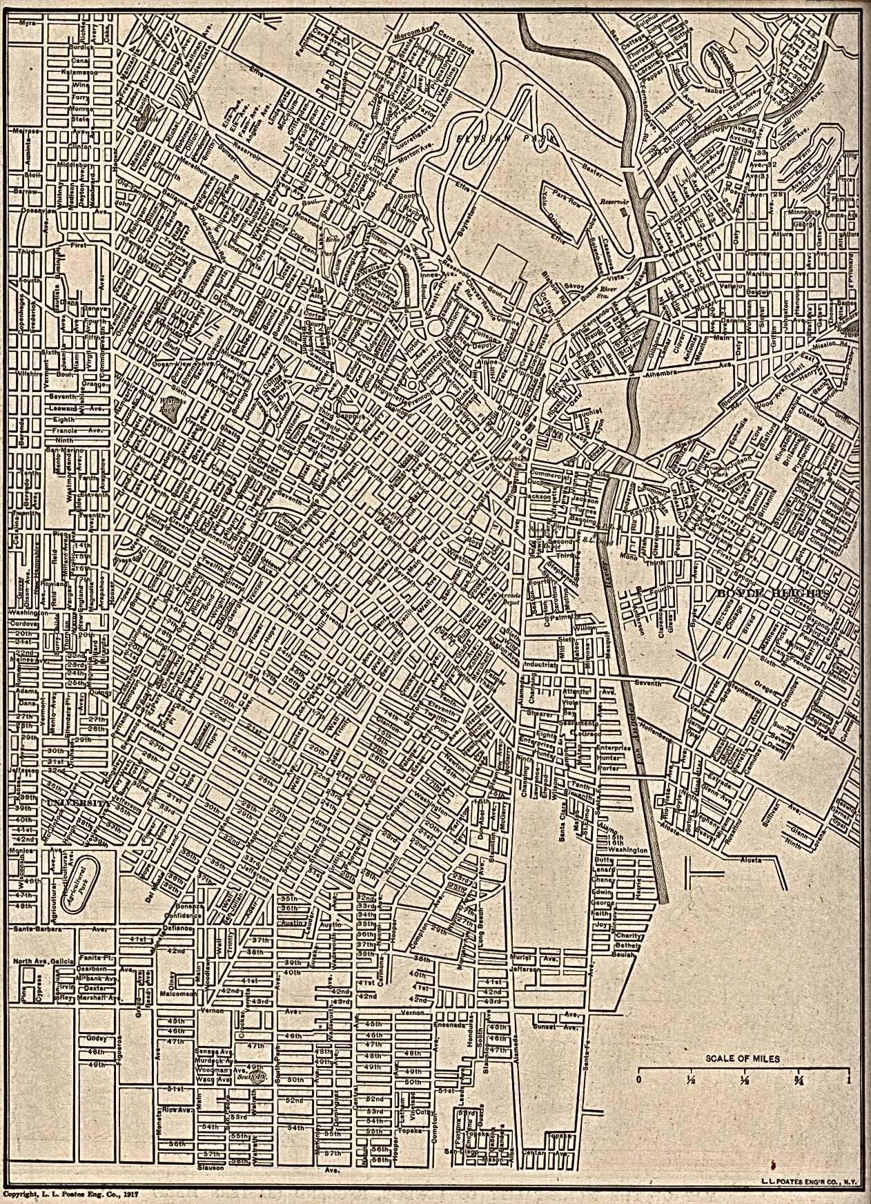
Los Angeles (Central) 1917 From The New Encyclopedic Atlas and Gazetteer of the World. New York: P.F. Collier & Son. 1917 (903K)
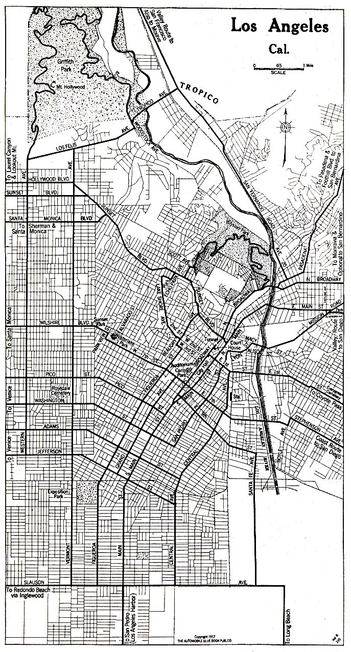
Los Angeles 1917 Automobile Blue Book (417K)
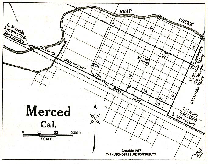
Merced 1917 Automobile Blue Book (128K)
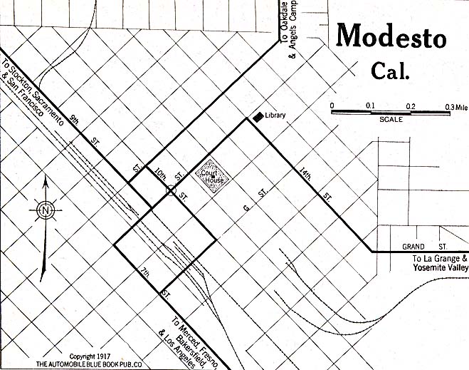
Modesto 1917 Automobile Blue Book (119K)
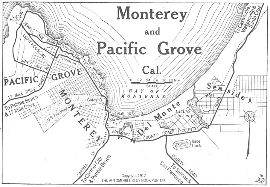
Monterey and Pacific Grove 1917 Automobile Blue Book, 1917 Vol. 8, Section 1 (153K)
Northern California Detail Map 1917 Automobile Blue Book, 1917 Vol. 8, Section 2 (497K)
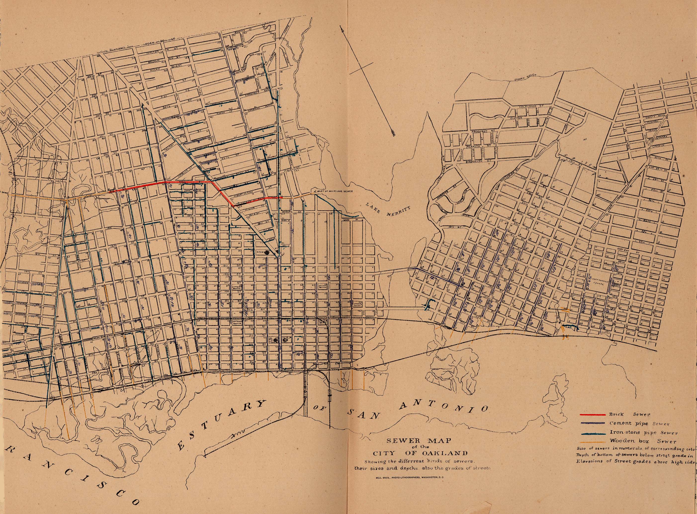
Oakland 1880 "Sewer Map of the City of Oakland, showing their sizes and depths, also the grades of streets." From Report on the Social Statistics of Cities, Compiled by George E. Waring, Jr., United States. Census Office, Part I, 1886. (1,131K)
Oakland and Berkeley 1917 Automobile Blue Book (451K)
Pasadena 1917 Automobile Blue Book 1917, Vol. 8, Section 1 (252K)
Redding 1917 Automobile Blue Book 1917 Vol. 8, Section 2 (93K)
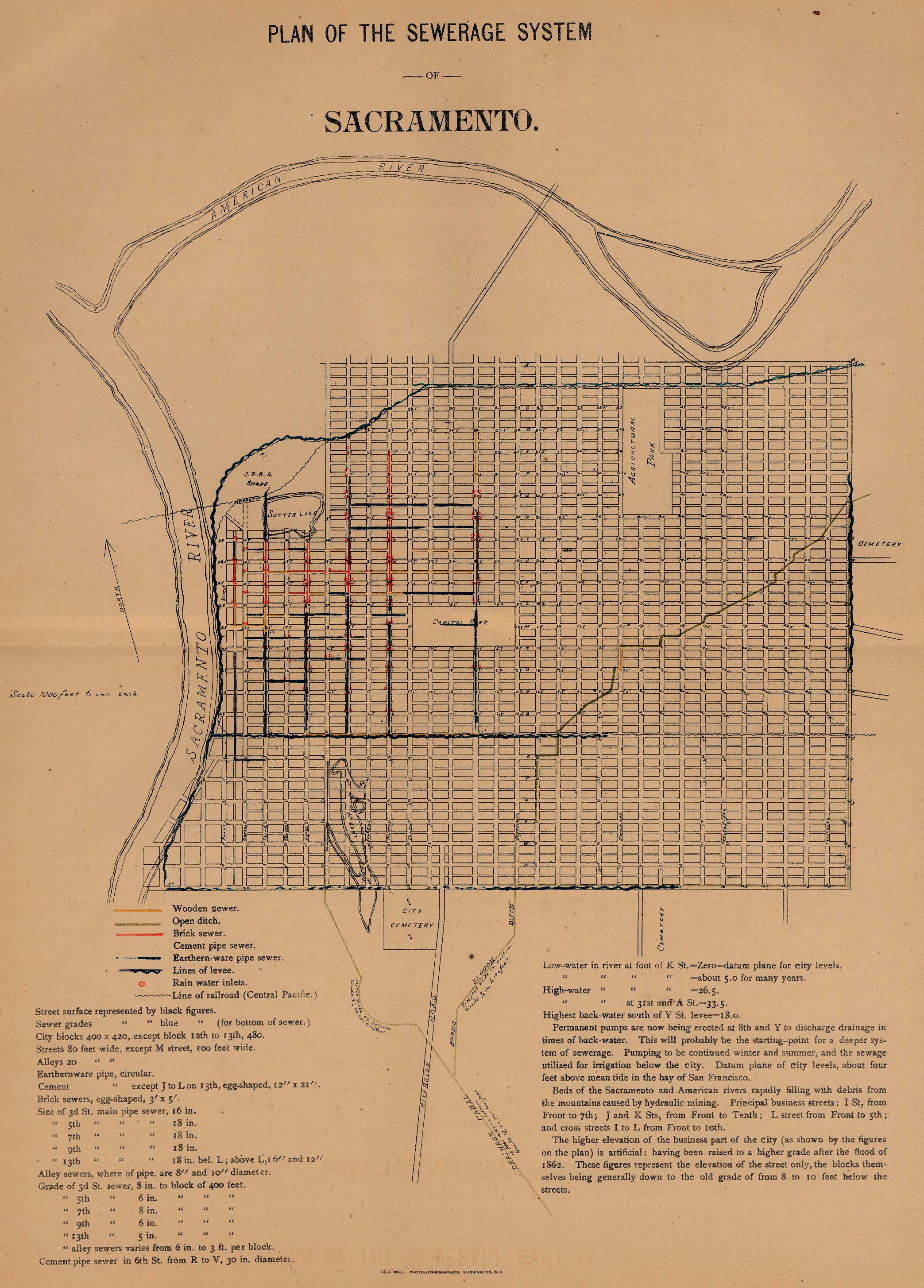
Sacramento 1880 "Plan of the Sewerage System" From Report on the Social Statistics of Cities, Compiled by George E. Waring, Jr., United States. Census Office, Part I, 1886. (148K)
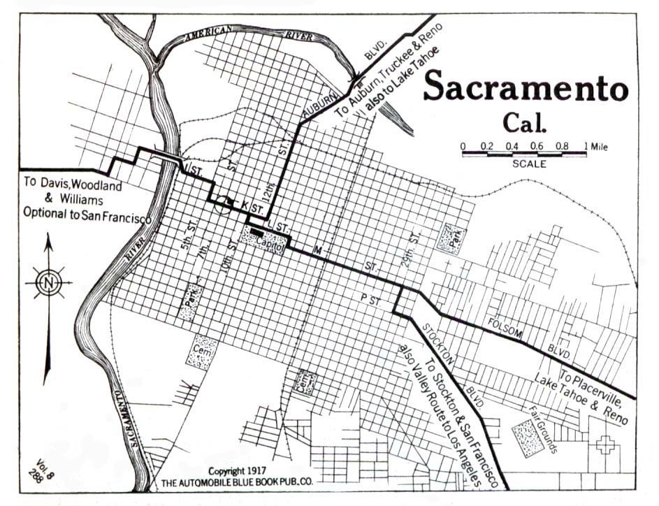
Sacramento 1917 Automobile Blue Book 1917, Vol. 8, Section 1 (150K)
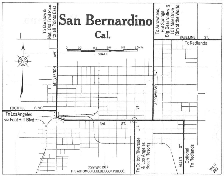
San Bernadino 1917 Automobile Blue Book 1917, Vol.8, Section 1 (107K)
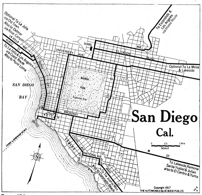
San Diego 1917 Automobile Blue Book (153K)
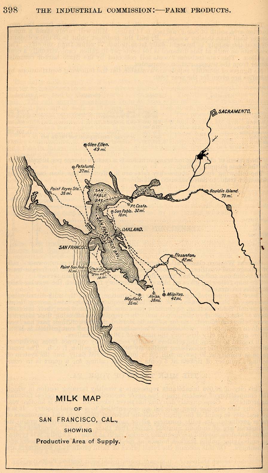
San Francisco 1901
"Milk Map of San Franciso, Cal., Showing Productive Area of Supply." From Report of the Industrial Commission on the Distribution of Farm Products. Volume VI of the Commission's Reports. House of Representatives, 1901. (181K)
San Francisco 1915 U.S. Geological Survey (1,403K)
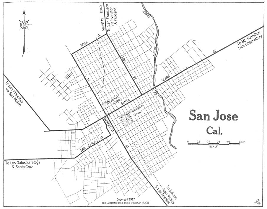
San Jose 1917 Automobile Blue Book 1917, Vol. 8, Section 1 (128K)
Santa Cruz 1917 Automobile Blue Book 1917, Vol. 8, Section 1 (181K)
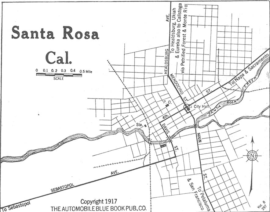
Santa Rosa 1917 Automobile Blue Book 1917, Vol. 8, Section 1 (117K)
Maps of National Parks, Monuments, and Historic Sites
The following maps were produced by the U.S. National Park Service unless otherwise noted.
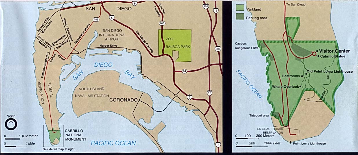
Cabrillo National Monument (Area Map) 1995 (124K)
Cabrillo National Monument (Area Map) 1997 (129K) (PDF Format)
Cabrillo National Monument (Park Map) 1997 (129K) (PDF Format)
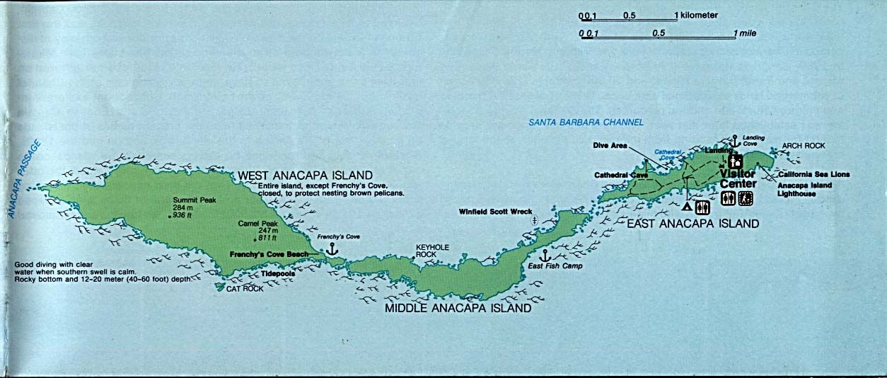
Channel Islands National Park - Anacapa Island (Detail Map) (107K)
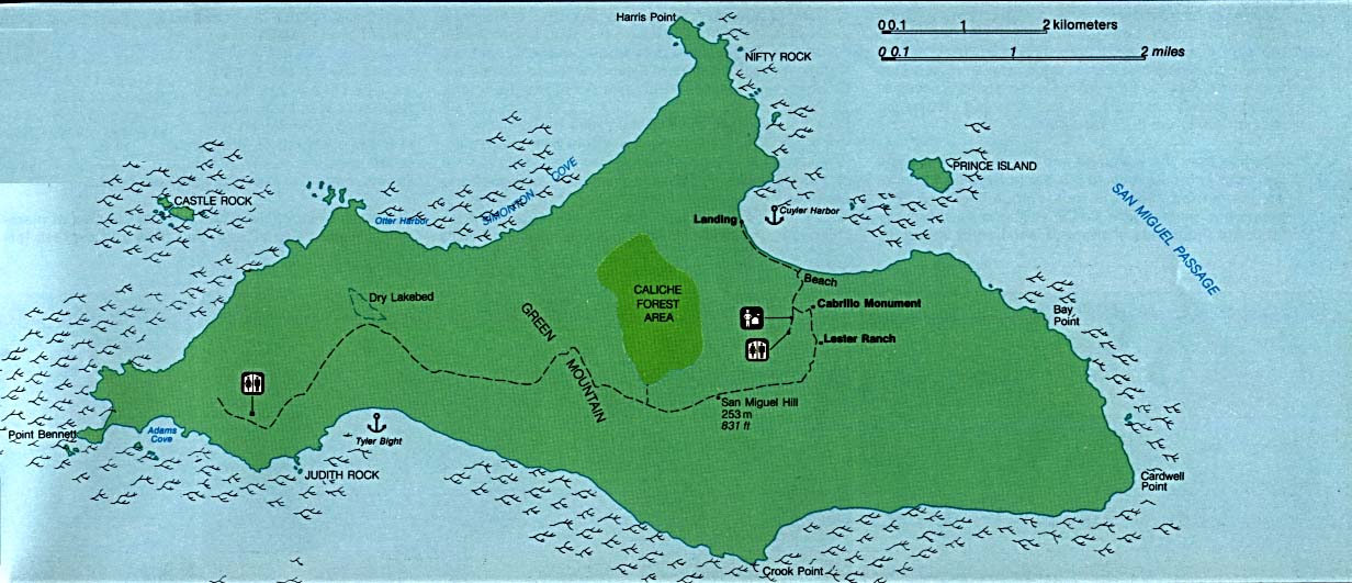
Channel Islands National Park - San Miguel Island (Detail Map) (119K)
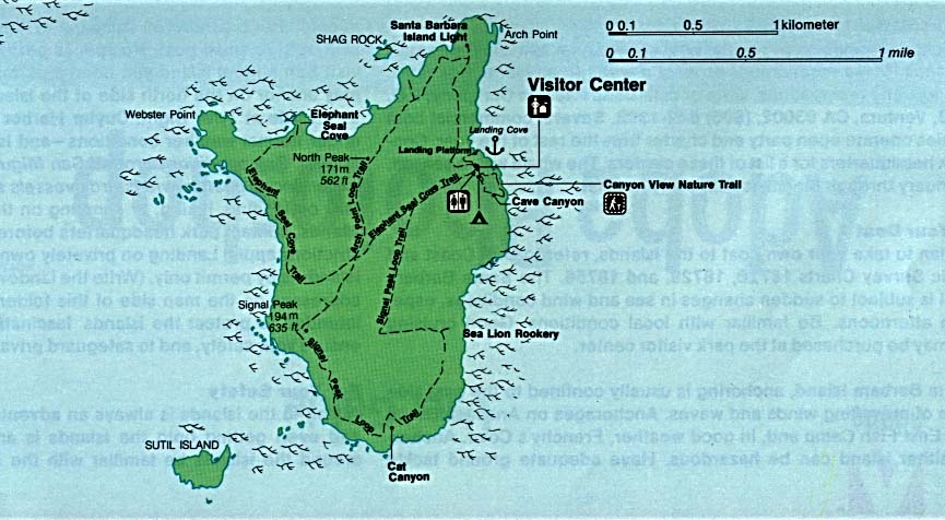
Channel Islands National Park - Santa Barbara Island (Detail Map) (80K)
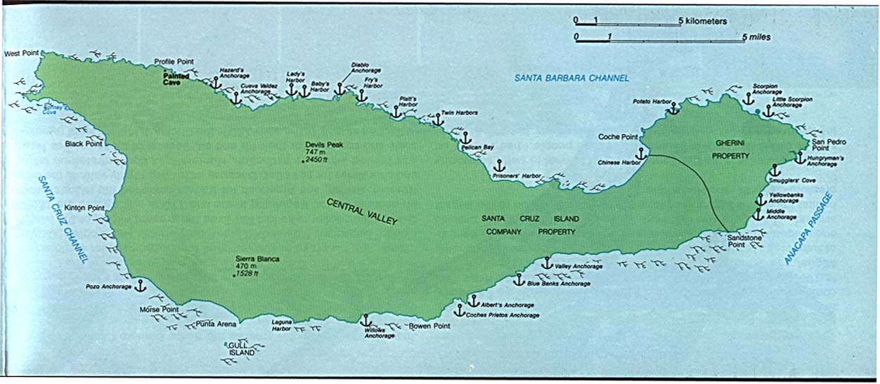
Channel Islands National Park - Santa Cruz Island (Detail Map) (96K)
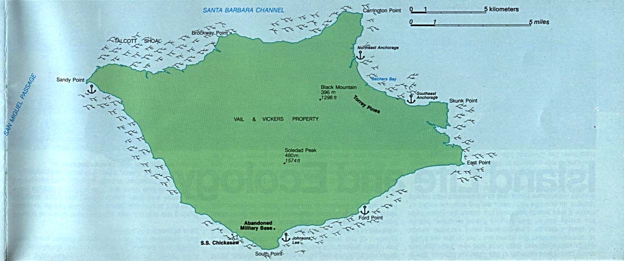
Channel Islands National Park - Santa Rosa Island (Detail Map) (89K)
Death Valley National Park [California / Nevada] (Shaded Relief Map) 1:250,000 U.S.G.S. 1977 (791K)
Death Valley National Park [California / Nevada] (Park Map) 1997 (836K) (PDF Format)
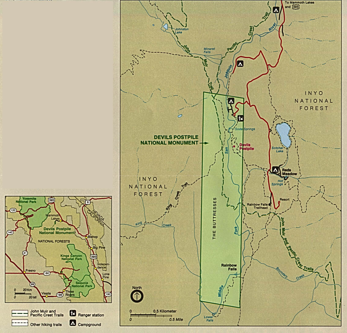
Devils Postpile National Monument (Area Map) 1997 (65K) (PDF Format)
Devils Postpile National Monument (Park Map) 1997 (65K) (PDF Format)
Devils Postpile National Monument (Park and Area Maps) 1993 (289K)
Fort Point National Historic Site (Range Map) (1999) (65K) (PDF Format)
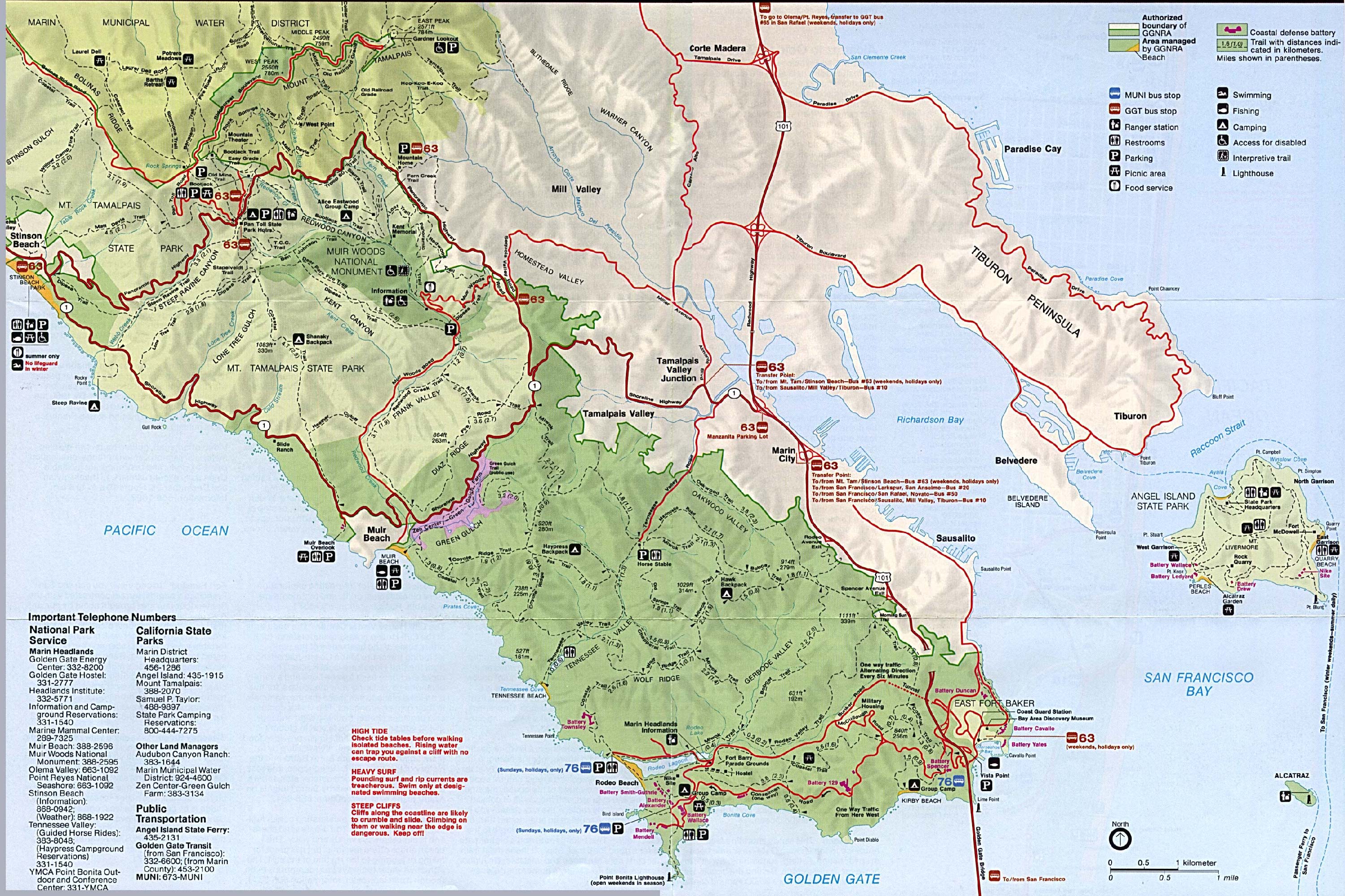
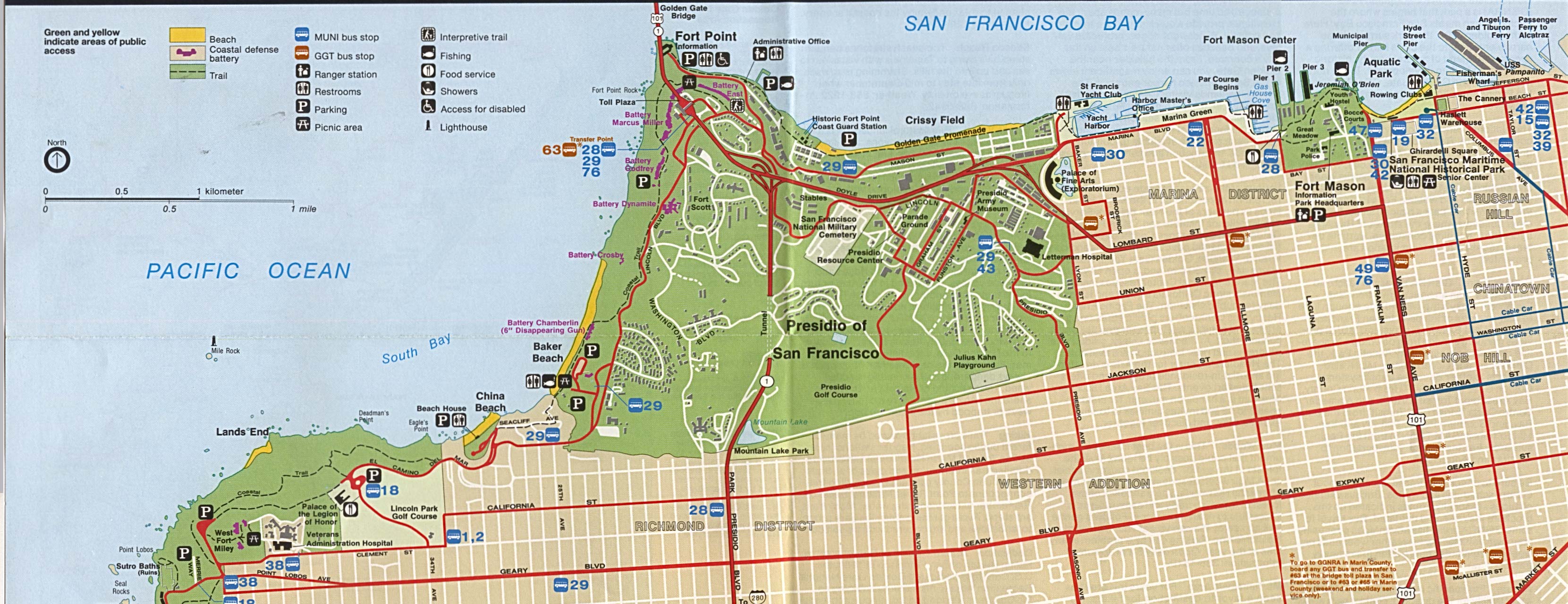
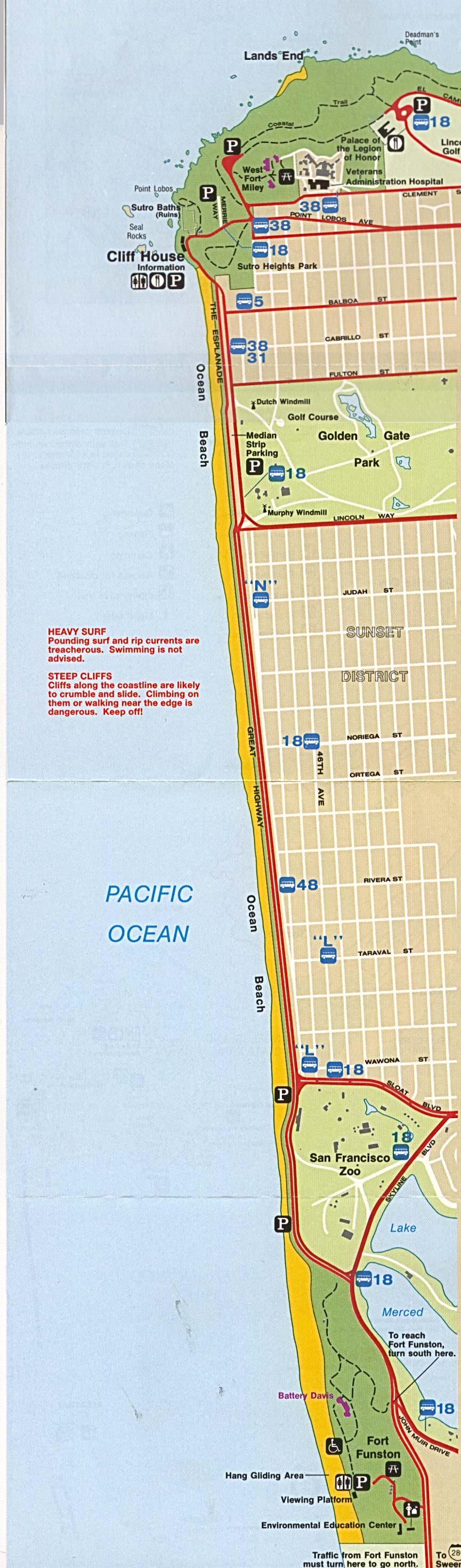
Golden Gate National Recreation Area (Park Map / Shaded Relief) 1995 (1.1MB)
Golden Gate National Recreation Area - Northern (Park Map) 1995 (705K)
Golden Gate National Recreation Area - Southern (Park Map) 1995 (411K)
Imperial Sand Dunes Recreation Area (Park Map) [Bureau of Land Management] 2007 (156K) (PDF Format)
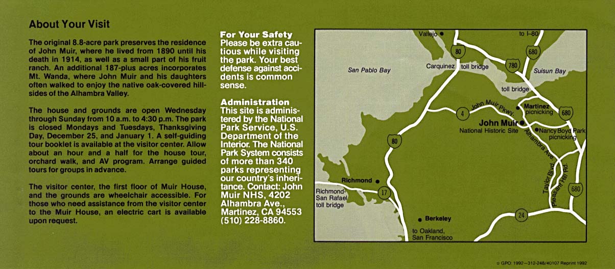
John Muir National Historic Site (Area Map) 1992 (137K)
Joshua Tree National Park (Park Map) 1997 (258K) (PDF Format)
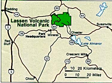
Lassen Volcanic National Park (Area Map) (36K)
Lassen Volcanic National Park (Park Map) (740K)
Lassen Volcanic National Park (Park Map) 1999 (323K) (PDF Format)
Lava Beds National Monument (Area Map) 1995 (65K) (PDF Format)
Pinnacles National Monument (Park Map) 1999 (194K) (PDF Format)
Point Reyes National Seashore (Park Map) 1997 (516K) (PDF Format)
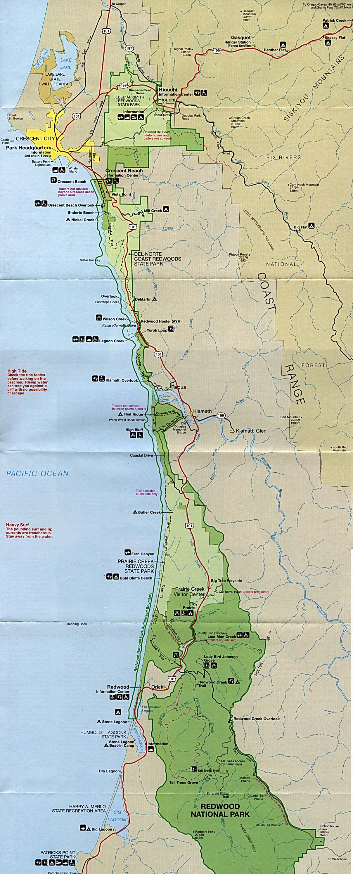
Redwood National Park (Park Map) (687K)
Redwood National Park (Park Map) 1999 (323K) (PDF Format)
Redwood National Park (Perspective Map of Redwood Range) 1997 (323K) (PDF Format)
Redwood National Park (Prehistoric Worldwide Redwood Distribution Map) 1997 (65K) (PDF Format)
Redwood National Park (Redwood Area Tribes Map) 1997 (65K) (PDF Format)
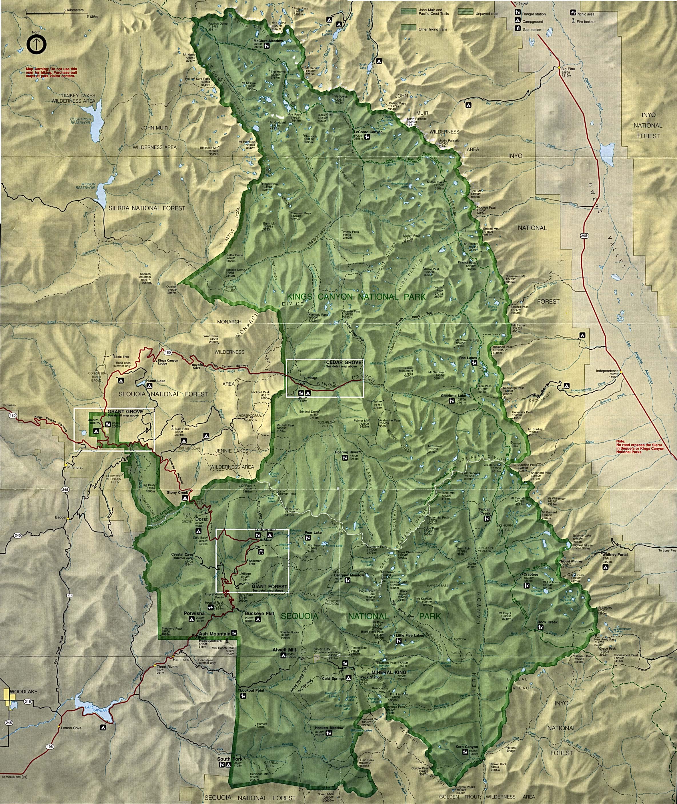
Sequoia and Kings Canyon National Park (Detail Map) 1998 (232K) (PDF Format)
Sequoia and Kings Canyon National Park (Park Map) (1.5MB)
Sequoia and Kings Canyon National Park (Park Map) 1998 (839K) (PDF Format)
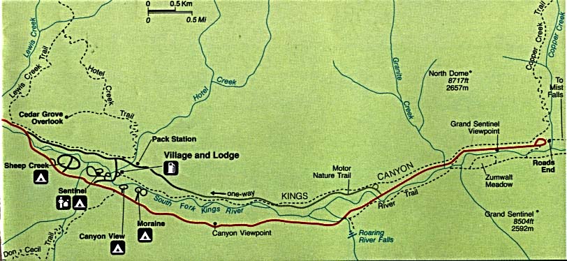
Sequoia and Kings Canyon National Park - Cedar Grove Area (Detail Map) (83K)
Sequoia and Kings Canyon National Park - Lodgepole Area (Detail Map) (55K)
Whiskeytown National Recreation Area (Area Map) 1999 (65K) (PDF Format)
Whiskeytown National Recreation Area (Park Map) 1999 (323K) (PDF Format)
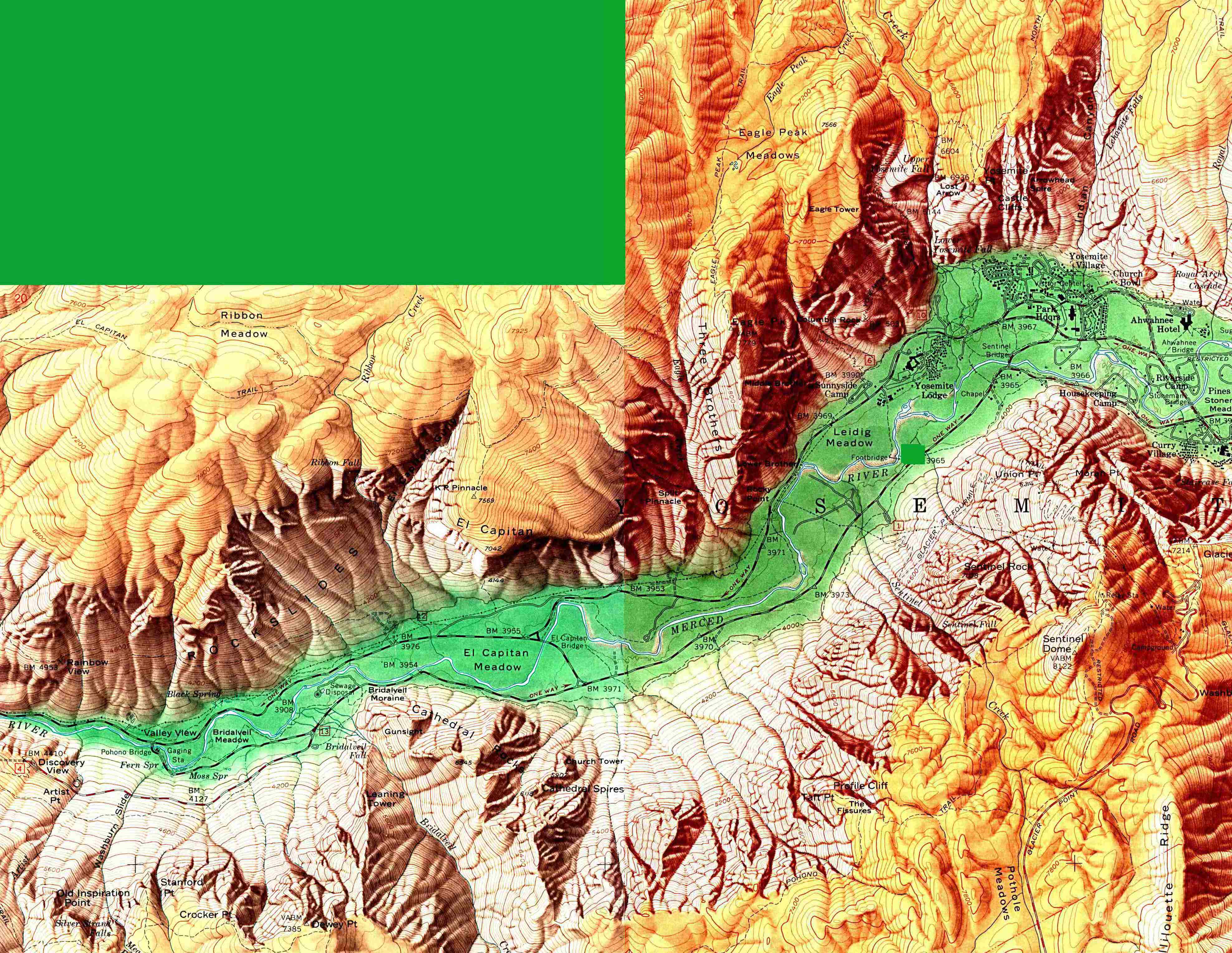
Yosemite National Park (Detail Map) 1994 (312K)
Yosemite National Park (Detail Map) 1998 (129K) (PDF Format)
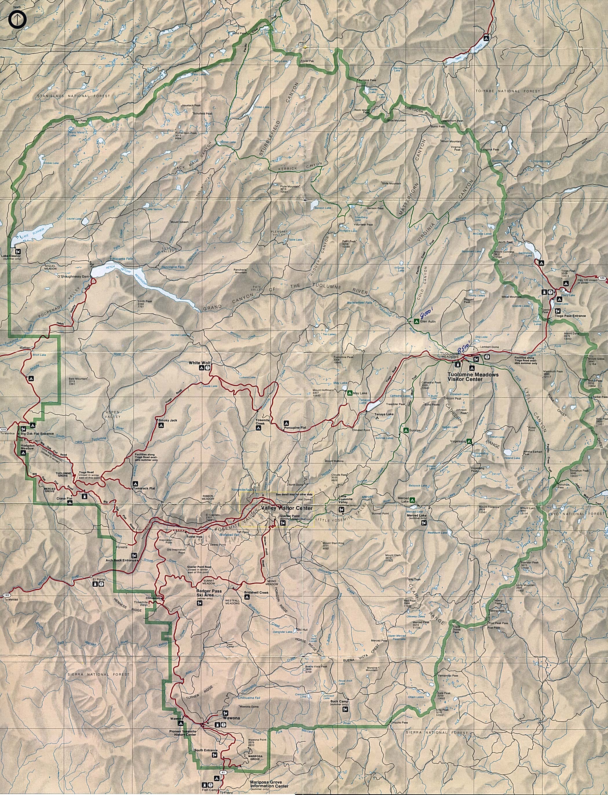
Yosemite National Park (Park Map) (1MB)
Yosemite National Park (Park Map) 1998 (1MB) (PDF Format)
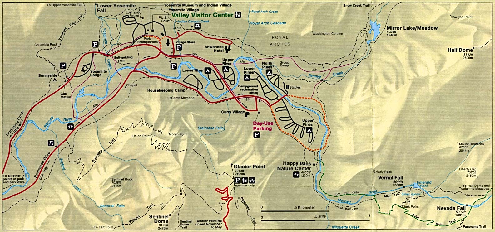
Yosemite National Park - Yosemite Valley (Shaded Relief Map) 1:24,000, U.S. Geological Survey, 1958 (1MB)
Sources: Many of these maps were provided by the University of Texas Library and/or the U.S. Central Intelligence Agency (CIA).
Maps on other websites:
California - Atlas of California (Humboldt State University)
California - Atlas of Panoramic Aerial Images (William Bowen)
California - County Names (Census Bureau)
California - Death Valley National Park (Desert Maps) [PDF format]
California Digital Atlas - Demographic Maps (William Bowen)
California - Ground Water Atlas (U.S. Geological Survey)
California - Highways - Clickable Map (California Dept. of Transportation)
California - Maps (Geology.com)
California - Maps (Netstate)
California - Napa Valley Region (Lonely Planet)
California - Panoramic Aerial Images Atlas (William Bowen)
California - Road Map (World Sites Atlas)
California - Satellite Image (Geology.com)
California - Scenic Highways [clickable map] (CDOT)
California - Shaded Relief (Purdue University)
California Spatial Information Library
California - Topographic Maps (California Spatial Information Library)
California - Topographic Maps (klofas.com)
California - Topographic Maps (Libre Map Project)
California - Tribal and Federal Lands (EPA) [PDF format]
See Also:
Topographic Maps
ArcGIS Shapefile Map Layers
<-- Free Maps
<-- Free U.S. State Maps
<-- Free World Country Maps
Didn't find what you are looking for? We've been online since 1996 and have created 1000's of pages. Search below and you may find just what you are looking for.
Michael R. Meuser
Data Research & GIS Specialist
MapCruzin.com is an independent firm
specializing in GIS project development and data research.
We created the first U.S. based
interactive toxic chemical facility
maps on the internet in 1996 and we
have been online ever since. Learn more about us and our services.
Have a project in mind? If you have data, GIS project or custom shapefile needs contact Mike.
Contact Us
Report Broken Links
Subscribe for Updates
Sponsors


![Death Valley National Park [California / Nevada]](/free-state-maps/states/california/death_valley.jpg)