Download Free Louisiana Maps
<-- Free Maps
<-- Free U.S. State Maps
<-- Free World Country Maps
See Also:
Topographic Maps
ArcGIS Shapefile Map Layers
Download or link to these maps for your reports, websites, research, projects, presentations...

Note that maps may not appear on the webpage in their full size and resolution. To save the maps to your computer, right-click on the link.
State Maps
Louisiana (base map) JPEG format (452K) Parish boundaries and names, parish seats, rivers. Original scale 1:2,500,000 U.S. Geological Survey, 1972 limited update 1990
Louisiana (outline map) JPEG format (90K) Parish boundaries and names. U.S. Bureau of the Census, 1990
Louisiana (reference map) JPEG format (268K) Shaded relief map with state boundaries, forest cover, place names, major highways. Portion of "The National Atlas of the United States of America. General Reference", compiled by U.S. Geological Survey 2001, printed 2002
Louisiana (reference map) PDF format (196K) Shaded relief map with state boundaries, forest cover, place names, major highways. Portion of "The National Atlas of the United States of America. General Reference", compiled by U.S. Geological Survey 2001, printed 2002
Louisiana - Federal Lands and Indian Reservations PDF format (2 MB) The National Atlas of the United States of America, U.S. Geological Survey, 2003
Louisiana - Low-Lying Areas (3.9 MB) U.S. Geological Survey, 2008
City Maps
New Orleans National Atlas of the United States of America, 1970 (163K)
[New Orleans, Louisiana to Gulfport, Mississippi] Gulfport Sheet, Metric Topographic Map 30089-A1-TM-100, U.S. Geological Survey, 1982 (5.1MB)
Historical Maps
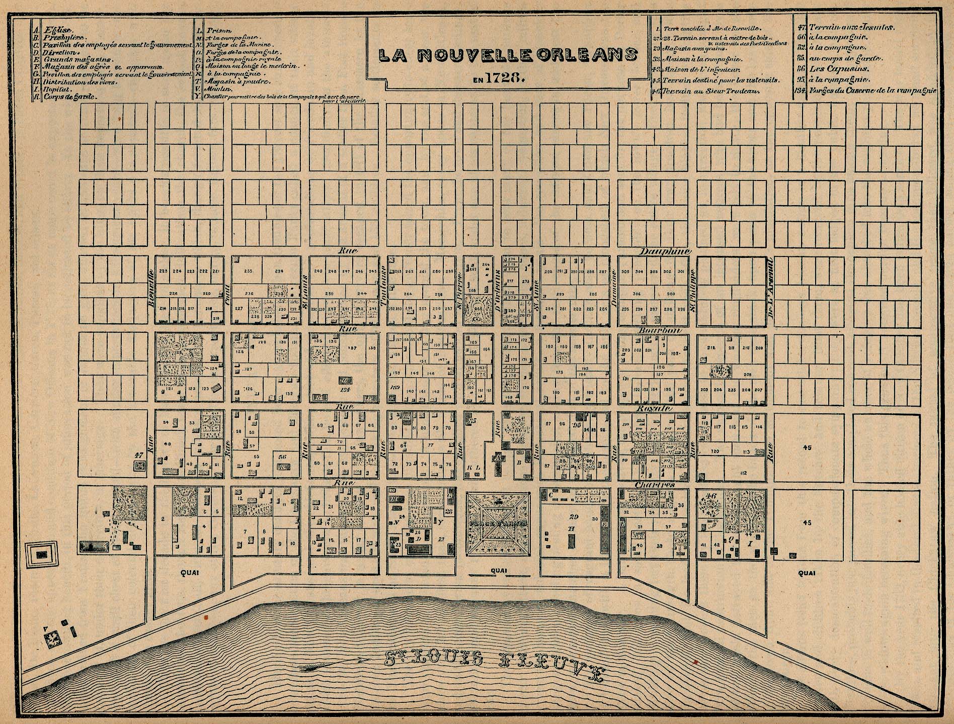
New Orleans 1728 "La Nouvelle Orleans en 1728." From Report on the Social Statistics of Cities, Compiled by George E. Waring, Jr., United States. Census Office, Part II, 1886. (715K)
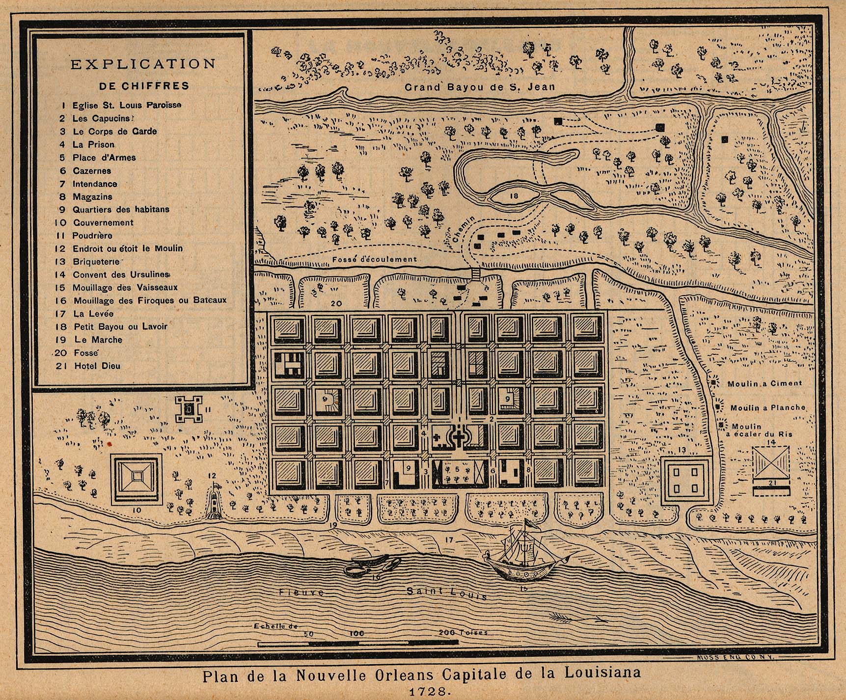
New Orleans 1728 "Plan de la Nouvelle Orleans Capitale de la Louisiana 1728." From Report on the Social Statistics of Cities, Compiled by George E. Waring, Jr., United States. Census Office, Part II, 1886. (679K)
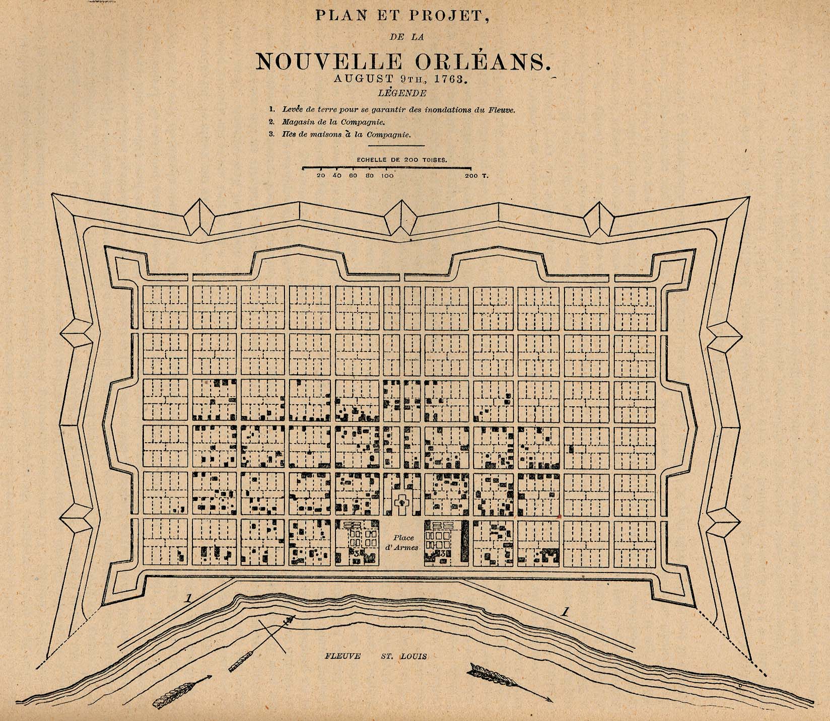
New Orleans 1763 "Plan et Projet, de la Nouvelle Orléans. August 9, 1763." From Report on the Social Statistics of Cities, Compiled by George E. Waring, Jr., United States. Census Office, Part II, 1886. (441K)
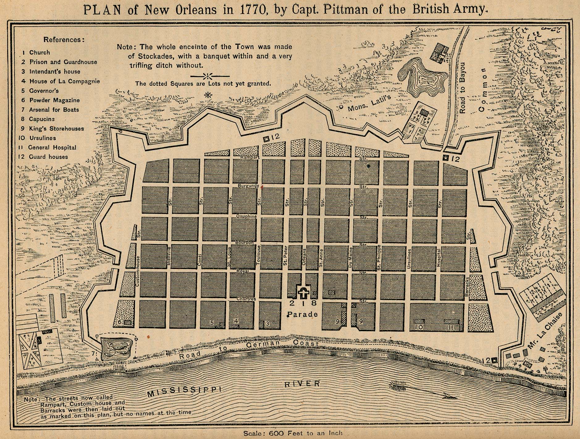
New Orleans 1770 "Plan of New Orleans in 1770, by Capt. Pittman of the British Army." From Report on the Social Statistics of Cities, Compiled by George E. Waring, Jr., United States. Census Office, Part II, 1886. (736K)
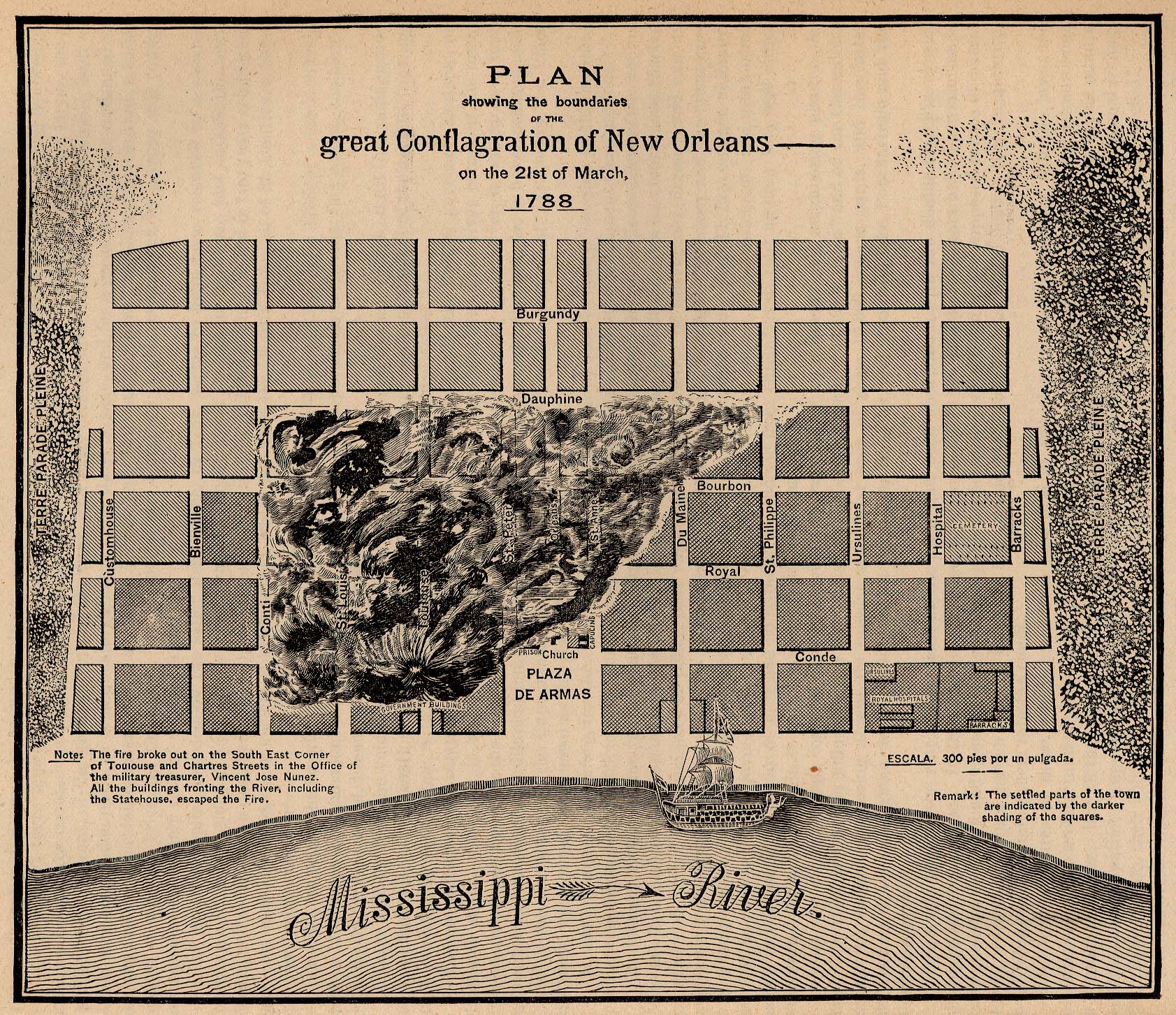
New Orleans 1788 "Plan showing the boundaries of the great Conflagration of New Orleans on the 21st of March, 1788." From Report on the Social Statistics of Cities, Compiled by George E. Waring, Jr., United States. Census Office, Part II, 1886. (914K)
New Orleans 1798 "New Orleans in 1798 in accordance with an ordinance of the Illustrious Ministry and Royal Charter." From Report on the Social Statistics of Cities, Compiled by George E. Waring, Jr., United States. Census Office, Part II, 1886. (554K)
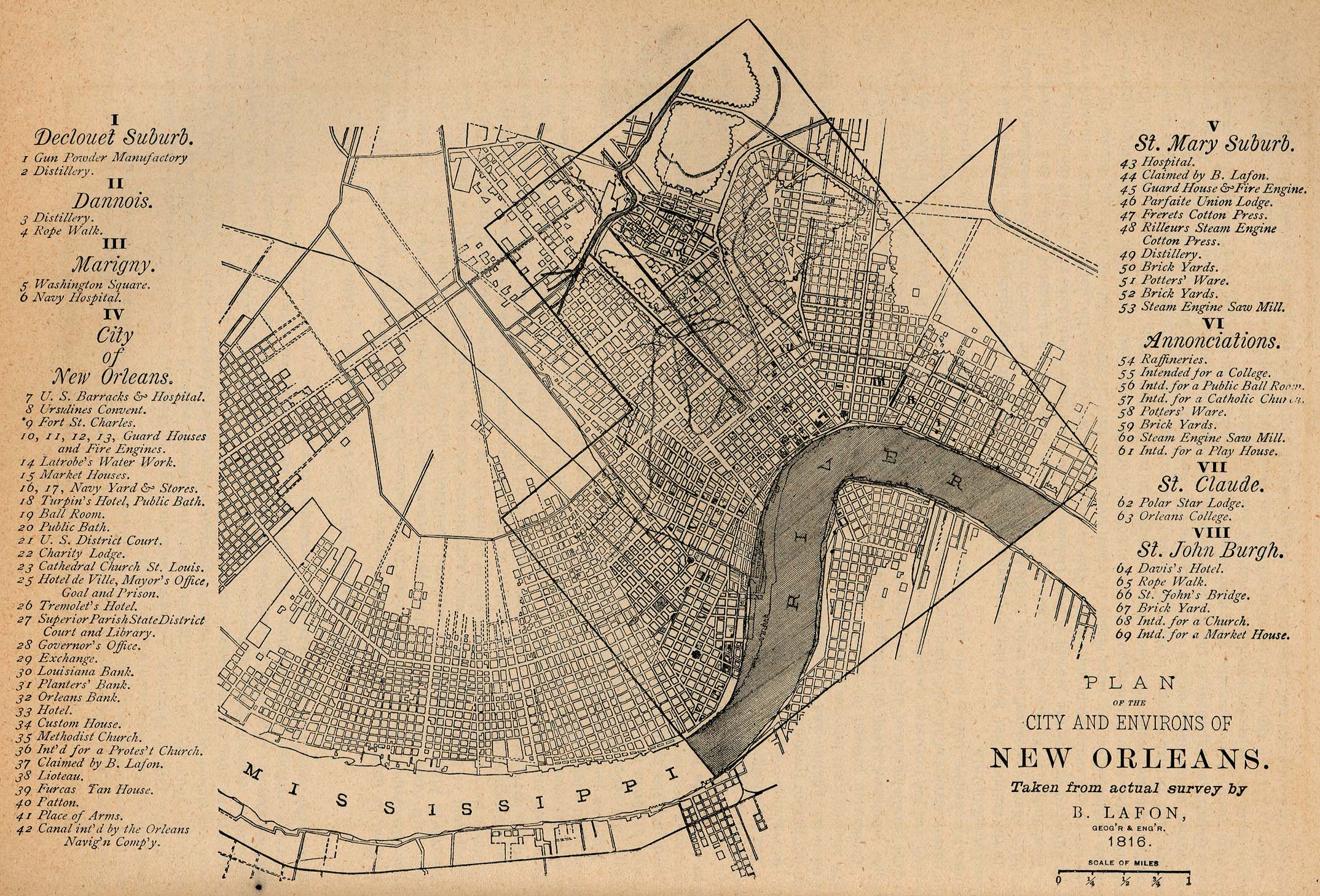
New Orleans 1816 "Plan of the City and Environs of New Orleans." From Report on the Social Statistics of Cities, Compiled by George E. Waring, Jr., United States. Census Office, Part II, 1886. (815K)
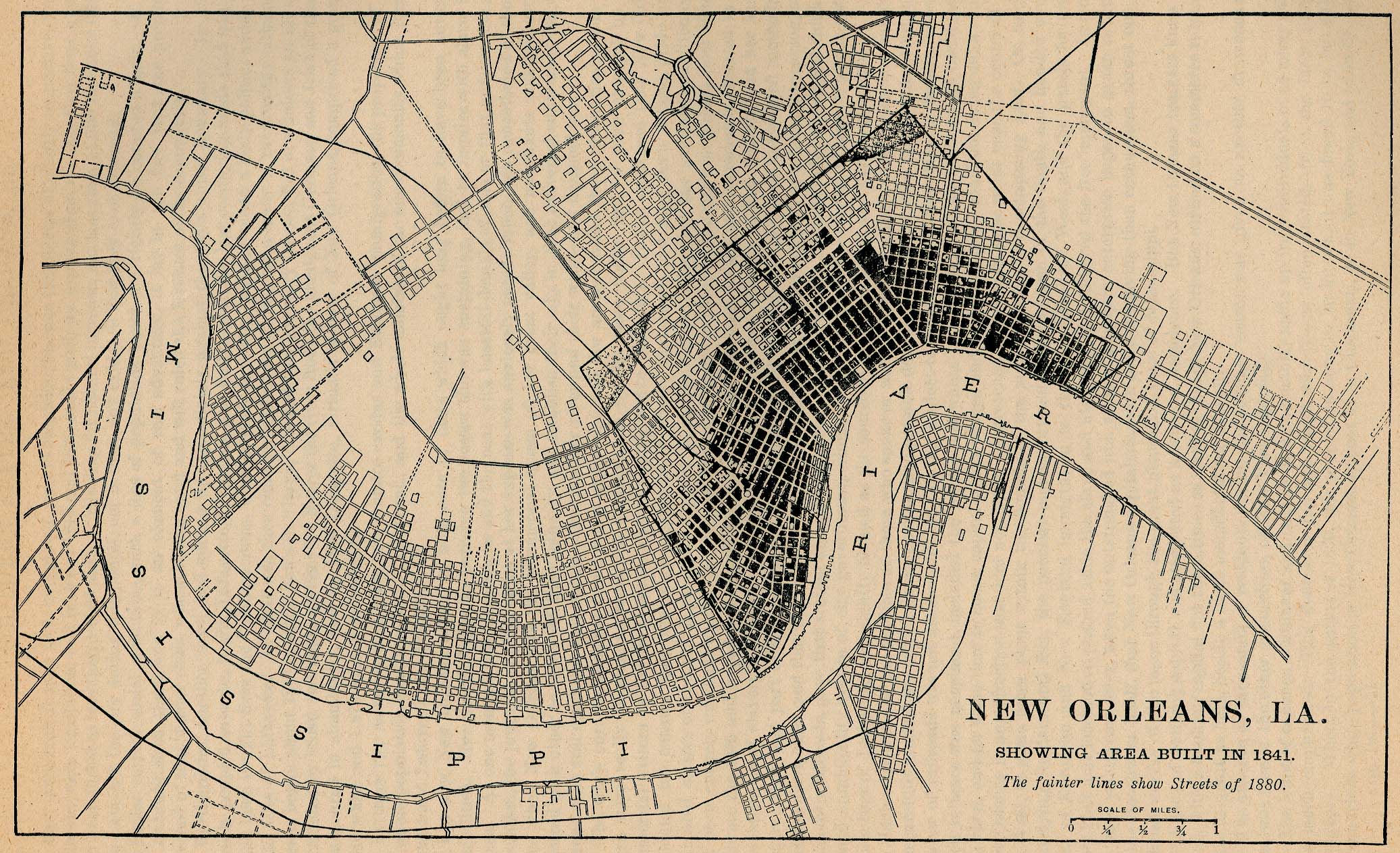
New Orleans 1841 "New Orleans, La. Showing Area Built in 1841. The fainter lines show Streets of 1880." From Report on the Social Statistics of Cities, Compiled by George E. Waring, Jr., United States. Census Office, Part II, 1886. (741K)
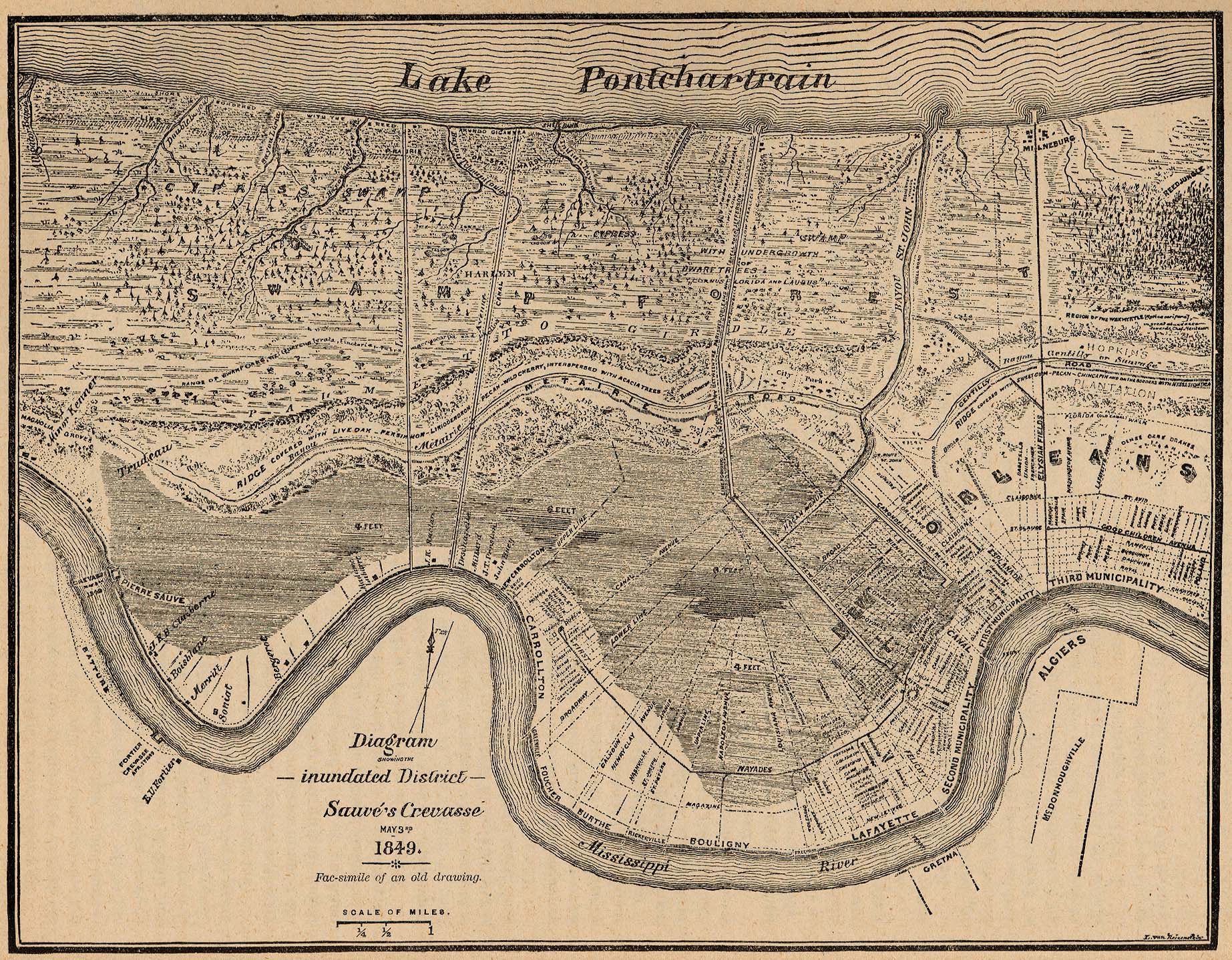
New Orleans 1849 "Diagram showing the inundated District Sauvé's Crevasse May 3rd 1849. Fac-similie of an old drawing." From Report on the Social Statistics of Cities, Compiled by George E. Waring, Jr., United States. Census Office, Part II, 1886. (917K)
New Orleans 1869 Appletons' Hand-Book of American Travel. New York: D. Appleton and Company. 1869 (646K)
New Orleans 1873 Appletons' Hand-Book of American Travel, Southern Tour. Compiled and Edited by Charles H. Jones. 1873 (839K)
New Orleans 1878 "New Orleans, La. Showing the Area Closely Built in 1878. With houses then existing in the suburban part of the city." From Report on the Social Statistics of Cities, Compiled by George E. Waring, Jr., United States. Census Office, Part II, 1886. (662K)
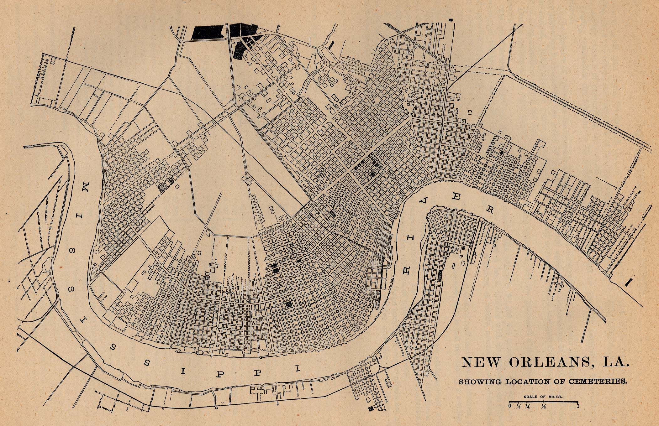
New Orleans 1880 - Location of Cemeteries "New Orleans, La. Showing Location of Cemeteries." From Report on the Social Statistics of Cities, Compiled by George E. Waring, Jr., United States. Census Office, Part II, 1886. (728K)
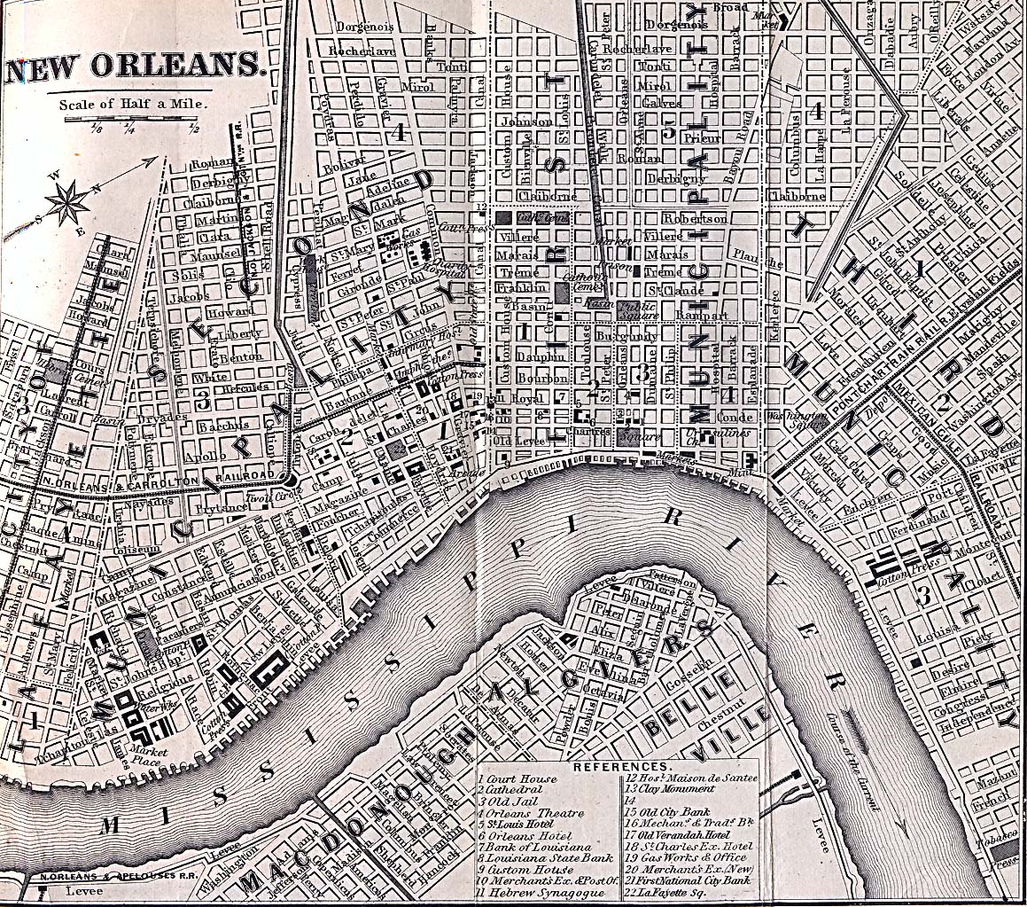
New Orleans 1880 - Location of Markets "New Orleans, La. Showing Location of Markets." From Report on the Social Statistics of Cities, Compiled by George E. Waring, Jr., United States. Census Office, Part II, 1886. (763K)
New Orleans 1891 U.S. Geological Survey (740K)
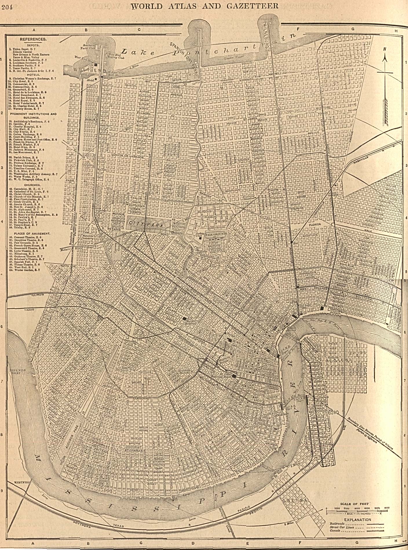
New Orleans 1908 From The New Encyclopedic Atlas and Gazetteer of the World. New York: P.F. Collier & Son. 1917 (945K)
New Orleans 1917 Automobile Blue Book 1917, Volume 4 (170K)
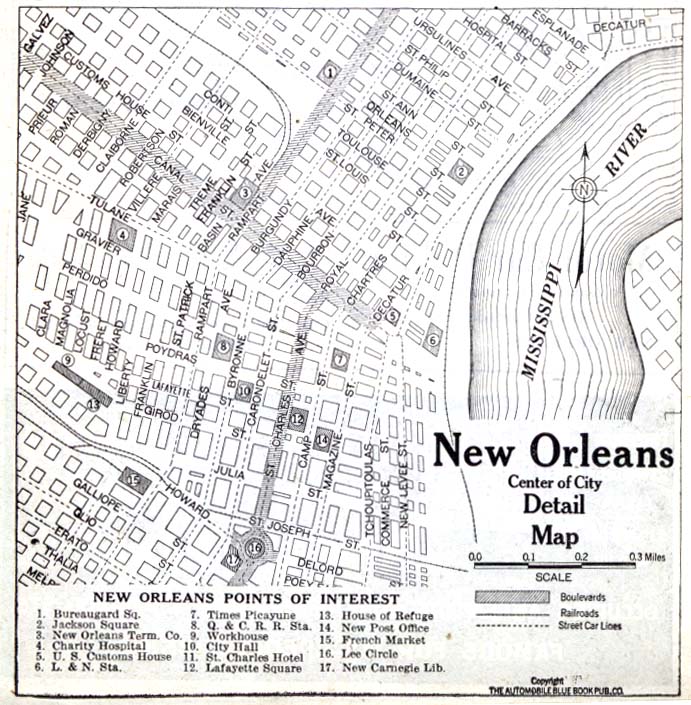
New Orleans - Detail 1920 Automobile Blue Book 1920, Volume 7 (162K)
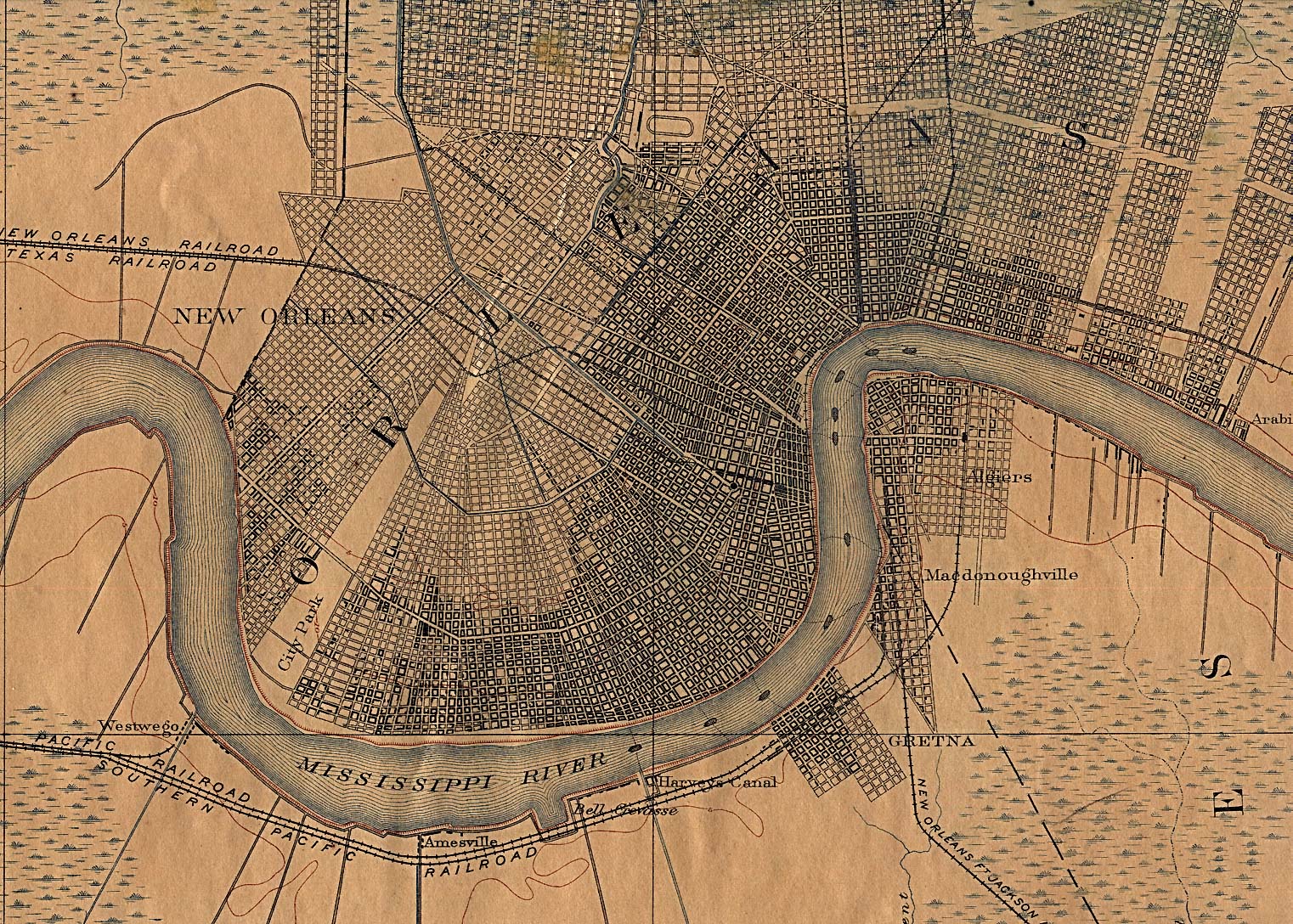
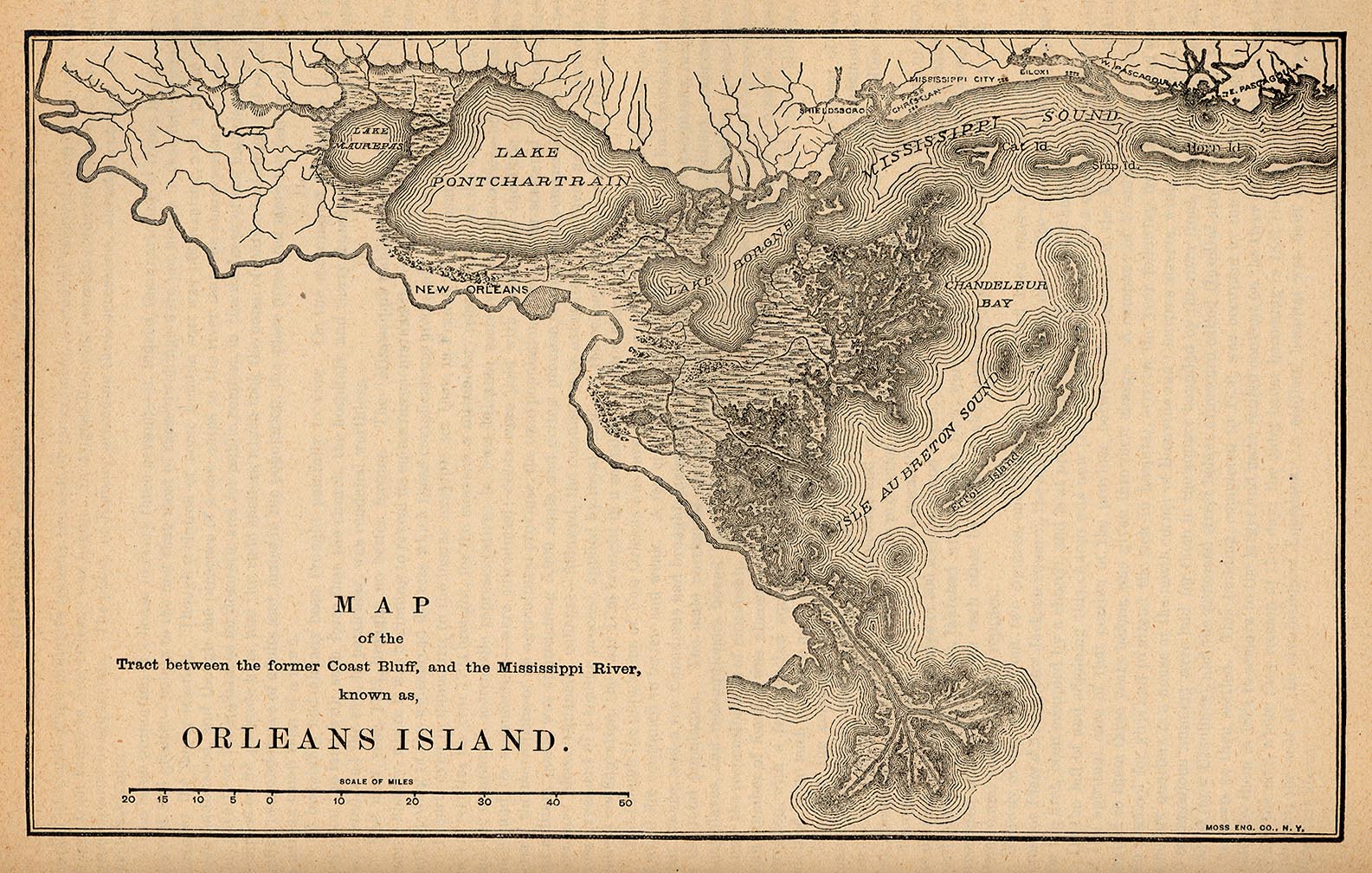
Orleans Island 1880 "Map of the Tract between the former Coast Bluff, and the Mississippi River, known as, Orleans Island." From Report on the Social Statistics of Cities, Compiled by George E. Waring, Jr., United States. Census Office, Part II, 1887. (433K)
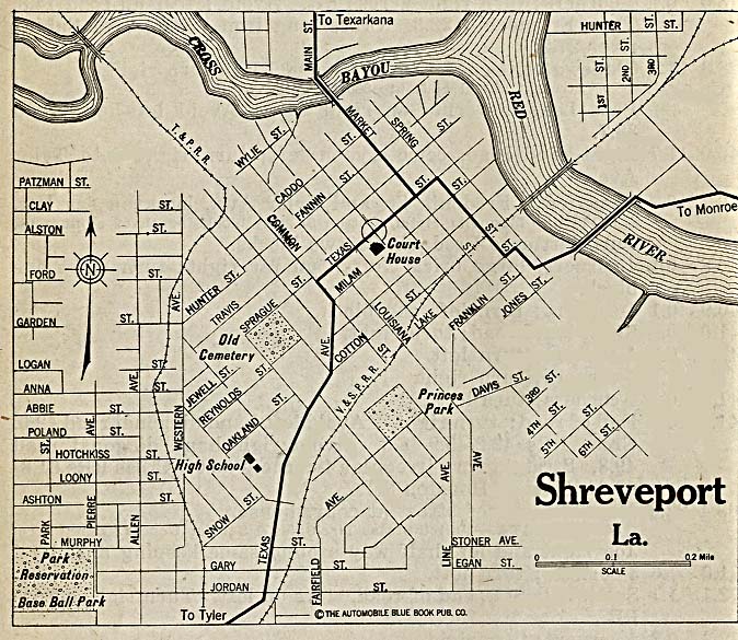
Shreveport 1920 Automobile Blue Book (162K)
Maps of National Parks, Monuments, and Historic Sites
The following maps were produced by the U.S. National Park Service unless otherwise noted.
Jean Lafitte National Historic Park & Preserve (Area Map) 1998 (129K) (PDF Format)
Jean Lafitte National Historic Park & Preserve (Park Map) 1998 (65K) (PDF Format)
Mississippi River Valley [Louisiana / Mississippi] (Burial Mounds Map) 1997 (452K) (PDF Format)
Mississippi River Valley [Louisiana / Mississippi] (Plantations Map) 1997 (452K) (PDF Format)
Mississippi River Valley [Southern U.S.] (Route of DeSoto Map) 1997 (65K) (PDF Format)
Sources: Many of these maps were provided by the University of Texas Library and/or the U.S. Central Intelligence Agency (CIA).
Maps on other websites
Louisiana - Geospatial Metadata Catalog (LAGIC)
Louisiana - GIS - Atlas: The Louisiana Statewide GIS (LSU)
Louisiana - GIS (Louisiana Department of Environmental Quality)
Louisiana - GIS - LOSCO Data Catalog (Louisiana Oil Spill Coordinator's Office)
Louisiana - Hurricane Katrina Maps (PCL Map Collection)
Louisiana - Maps (Geology.com)
Louisiana - Parish Names (Census Bureau)
Louisiana - Road Map (World Sites Atlas)
Louisiana - Satellite Image (Geology.com)
Louisiana - Topographic Map Viewer (Louisiana State University)
Louisiana - Topographic Maps (Libre Map Project)
See Also:
Topographic Maps
ArcGIS Shapefile Map Layers
<-- Free Maps
<-- Free U.S. State Maps
<-- Free World Country Maps
Didn't find what you are looking for? We've been online since 1996 and have created 1000's of pages. Search below and you may find just what you are looking for.
Michael R. Meuser
Data Research & GIS Specialist
MapCruzin.com is an independent firm
specializing in GIS project development and data research.
We created the first U.S. based
interactive toxic chemical facility
maps on the internet in 1996 and we
have been online ever since. Learn more about us and our services.
Have a project in mind? If you have data, GIS project or custom shapefile needs contact Mike.
Contact Us
Report Broken Links
Subscribe for Updates
Sponsors
| 


![[New Orleans, Louisiana to Gulfport, Mississippi]](/free-state-maps/states/louisiana/gulfport_1982.jpg)