Download Free North Carolina Maps
<-- Free Maps
<-- Free U.S. State Maps
<-- Free World Country Maps
See Also:
Topographic Maps
ArcGIS Shapefile Map Layers
Download or link to these maps for your reports, websites, research, projects, presentations...
Note that maps may not appear on the webpage in their full size and resolution. To save the maps to your computer, right-click on the link.
State Maps
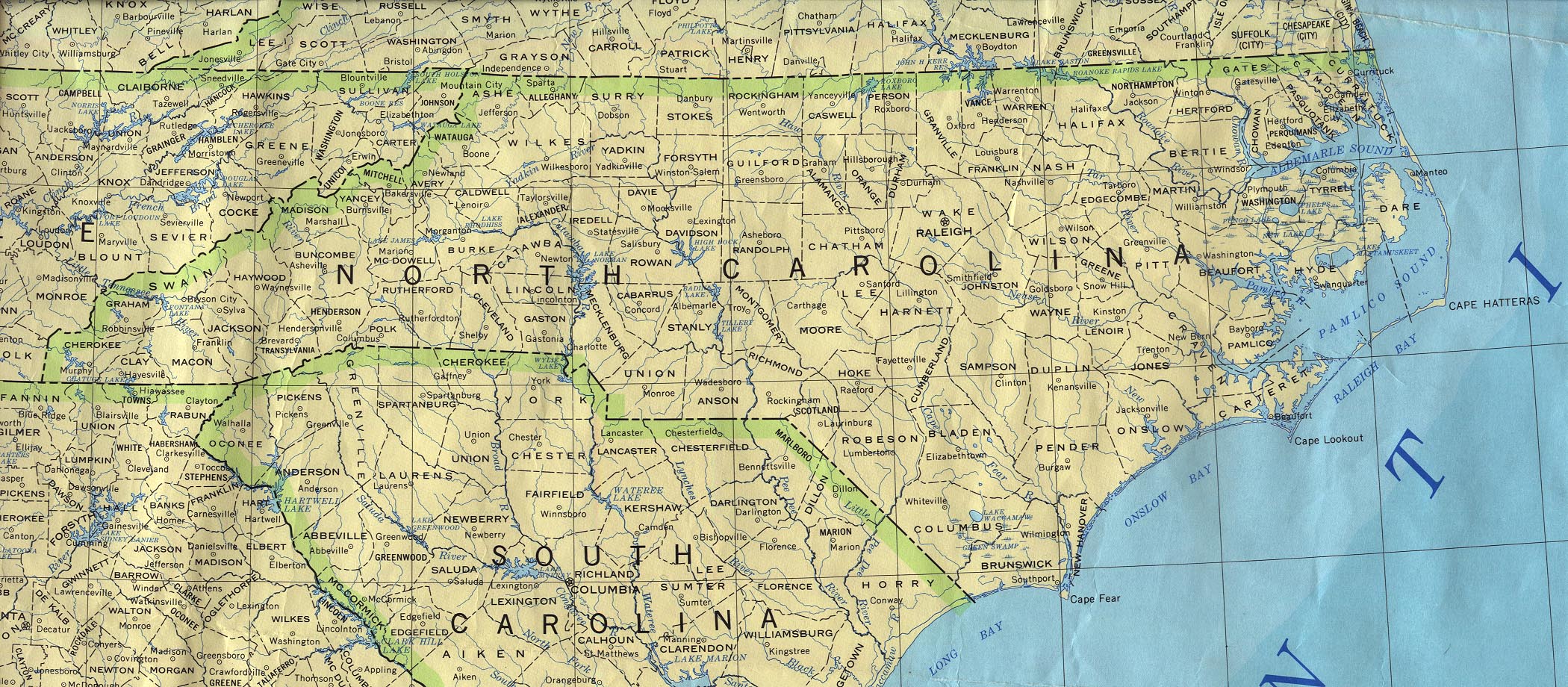
North Carolina (base map)
JPEG format (774K) County boundaries and names, county seats, rivers.
Original scale 1:2,500,000 U.S. Geological Survey, 1972 limited update
1990
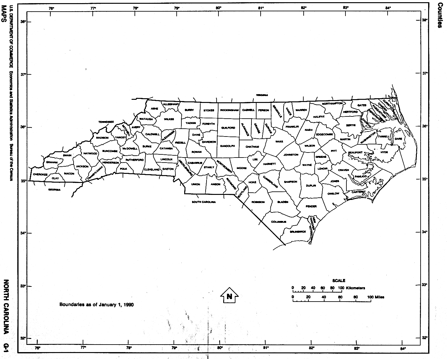
North Carolina (outline map) JPEG format (92K) County boundaries and names. U.S. Bureau of the Census, 1990
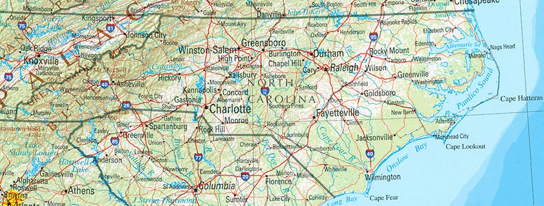
North Carolina (reference map)
JPEG format (220K) Shaded relief map with state boundaries, forest
cover, place names, major highways. Portion of "The National Atlas of
the United States of America. General Reference", compiled by U.S.
Geological Survey 2001, printed 2002
North Carolina (reference map)
PDF format (223K) Shaded relief map with state boundaries, forest
cover, place names, major highways. Portion of "The National Atlas of
the United States of America. General Reference", compiled by U.S.
Geological Survey 2001, printed 2002
North Carolina (road map) JPEG format (587K) original scale 1:6,000,000 U.S.Geological Survey, 1975
North Carolina - Federal Lands and Indian Reservations PDF format (1MB) The National Atlas of the United States of America, U.S. Geological Survey, 2003
City Maps
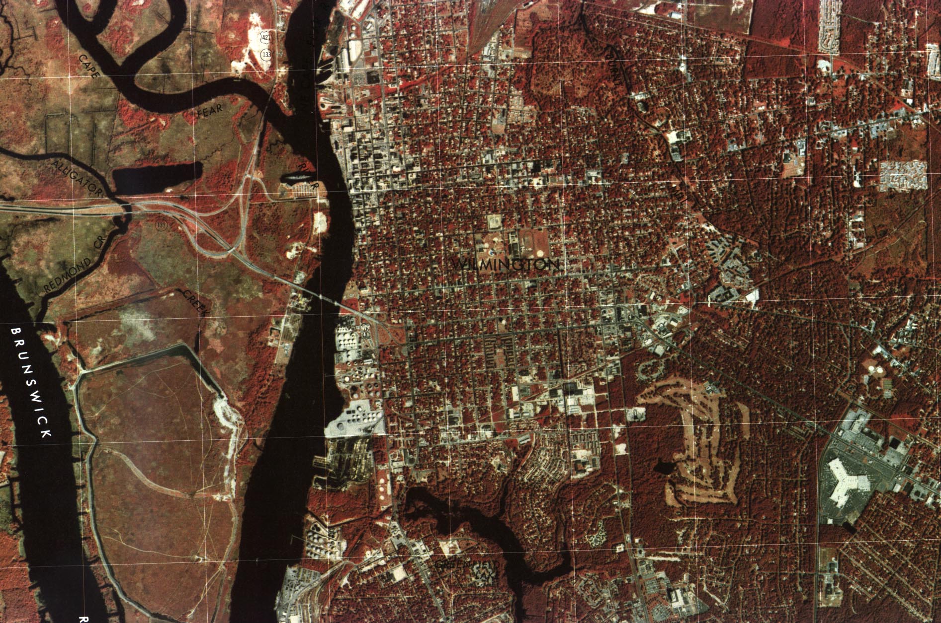
Wilmington Color Orthophotoquad - original scale 1:24,000 U.S.G.S. 1980 (581K)
Wilmington OrthophotoMap (Topographic) [includes major street names] - original scale 1:24,000 U.S.G.S. 1970, photorevised 1979 (839K)
Historical City Maps
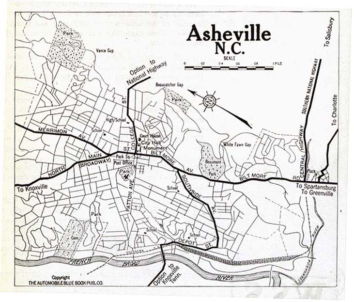
Asheville 1919 Automobile Blue Book, Volume 6, 1919 (109K)
Charlotte 1919 Automobile Blue Book (258K)
Durham 1919 Automobile Blue Book (194K)
Greensboro 1919 Automobile Blue Book, Volume 6, 1919 (44K)
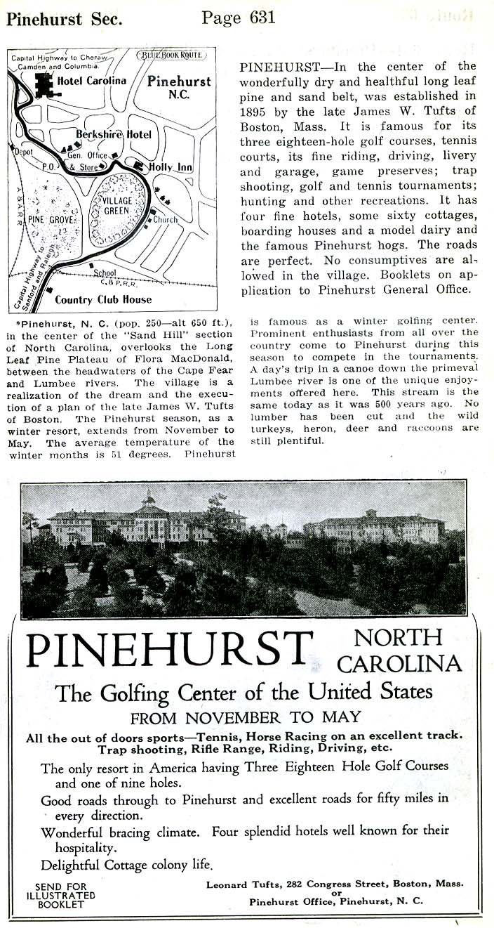
Pinehurst 1920 Automobile Blue Book (117K)
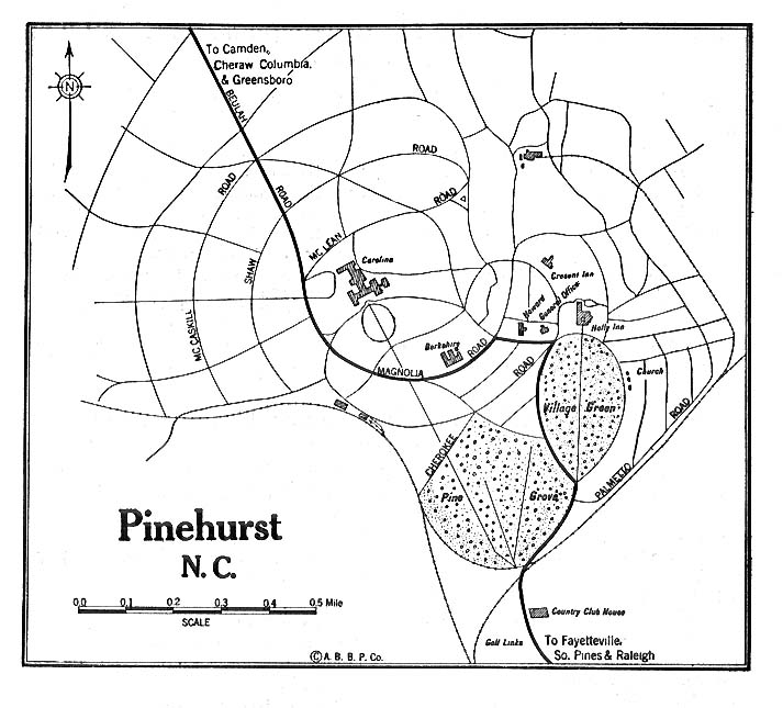
Pinehurst - Detail 1919 Automobile Blue Book 1919, Volume 6 (216K)
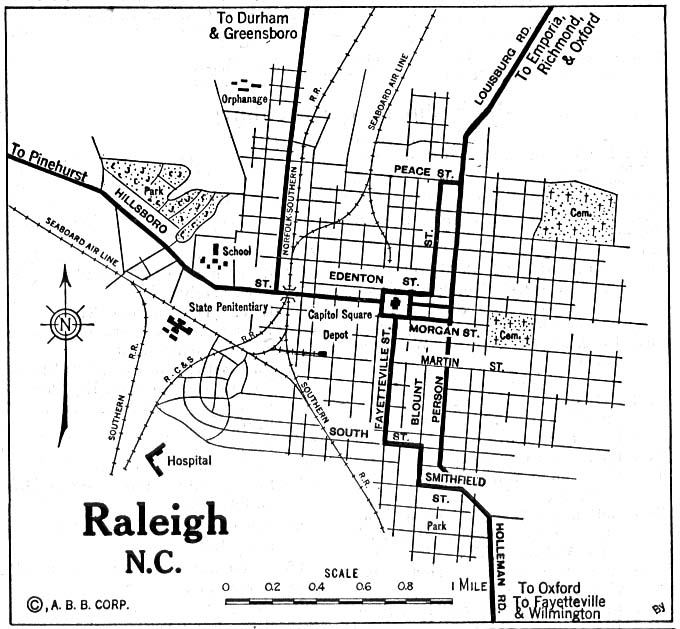
Raleigh 1920 Automobile Blue Book (137K)
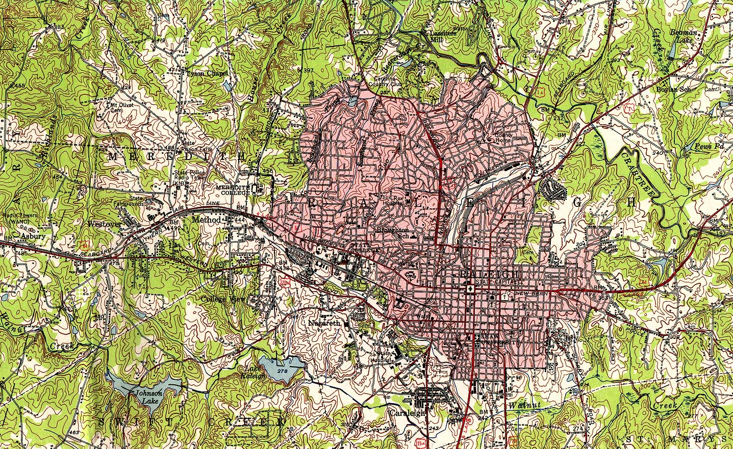
Raleigh 1951 original scale 1:62,500 U.S. Geological Survey 1951 (839K)
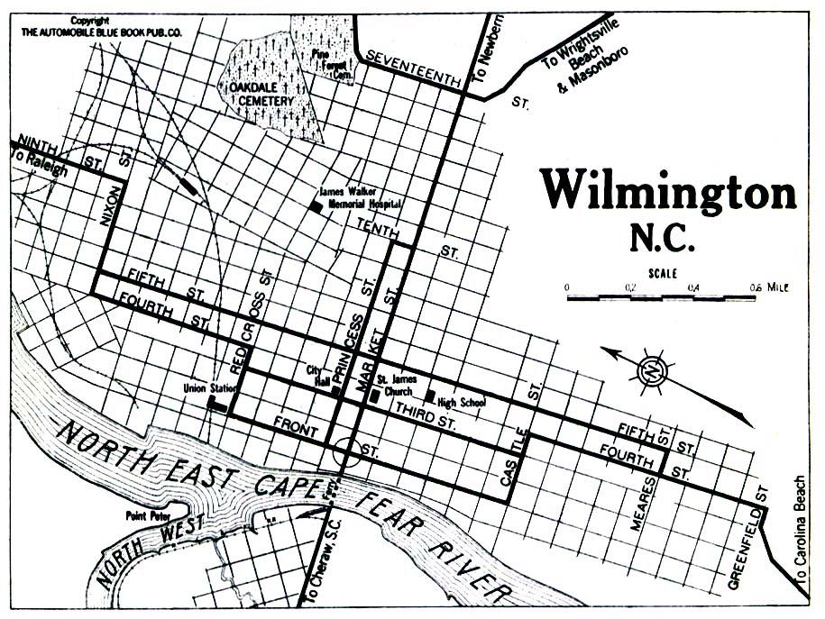
Wilmington 1919 Automobile Blue Book (258K)
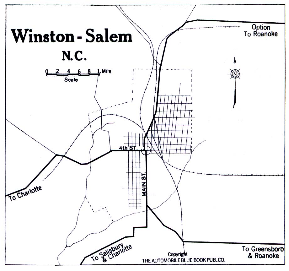
Winston-Salem 1919 Automobile Blue Book (194K)
Maps of National Parks, Monuments, and Historic Sites
The following maps were produced by the U.S. National Park Service unless otherwise noted.
Blue Ridge Parkway [North Carolina / Virginia] (Park Map) 1998 (968K) (PDF Format)
Blue Ridge Parkway - Northern Section [North Carolina / Virginia] (Park Map) 1995 (901K)
Blue Ridge Parkway - Southern Section [North Carolina / Virginia] (Park Map) 1995 (764K)
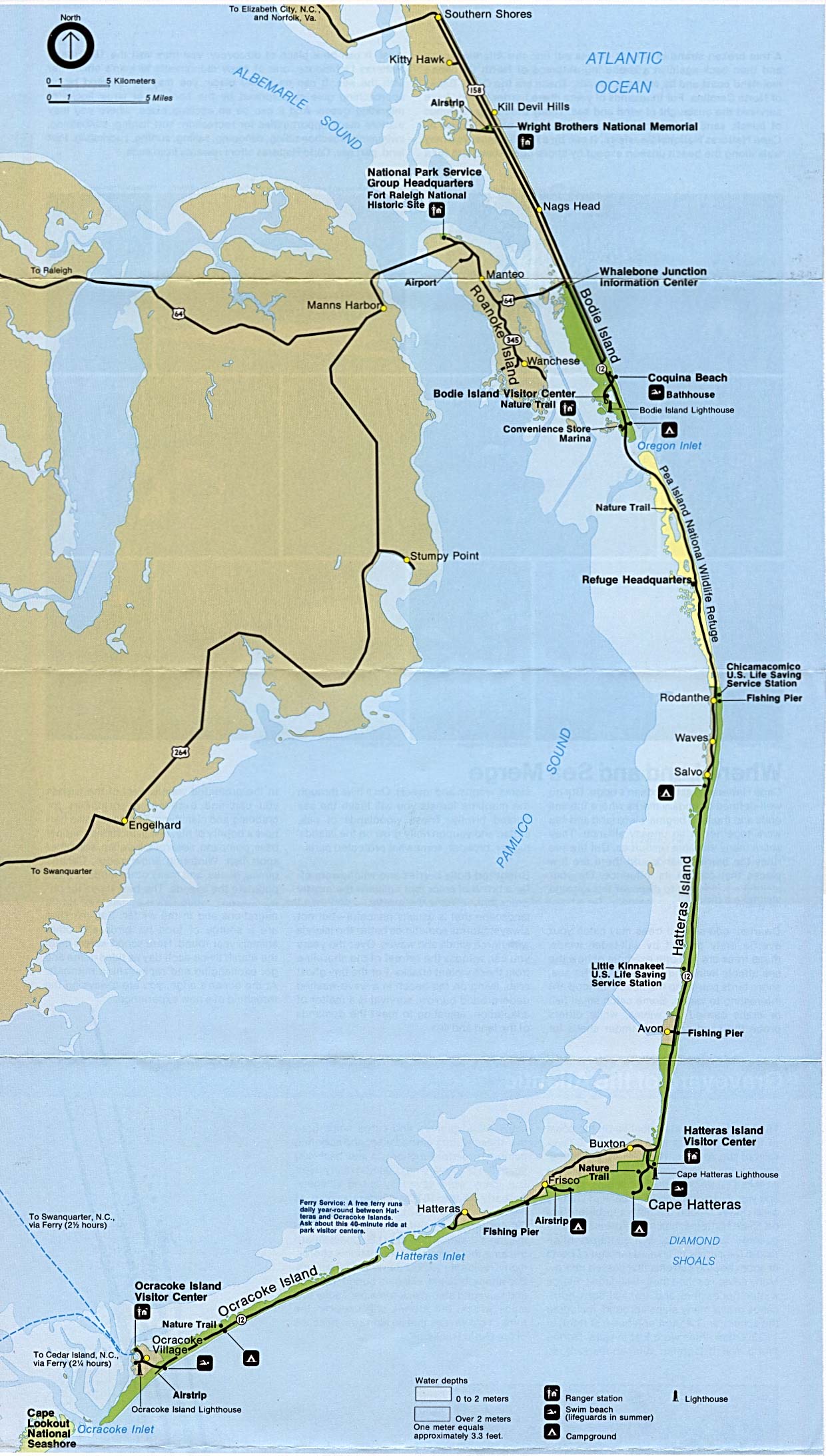
Cape Hatteras National Seashore (Area Map) 1993 (347K)
Cape Hatteras National Seashore (Park Map) 1998 (1.8MB) (PDF Format)
Carl Sandburg Home National Historic Site (Schematic Map) 1997 (323K) (PDF Format)
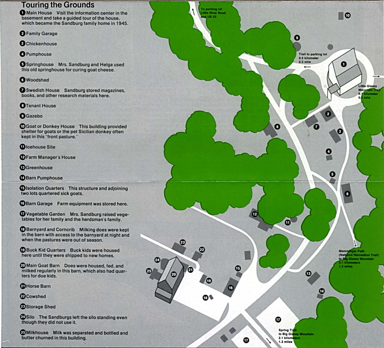
Carl Sandburg Home National Historic Site (Schematic Tour Map) 1996 (194K)
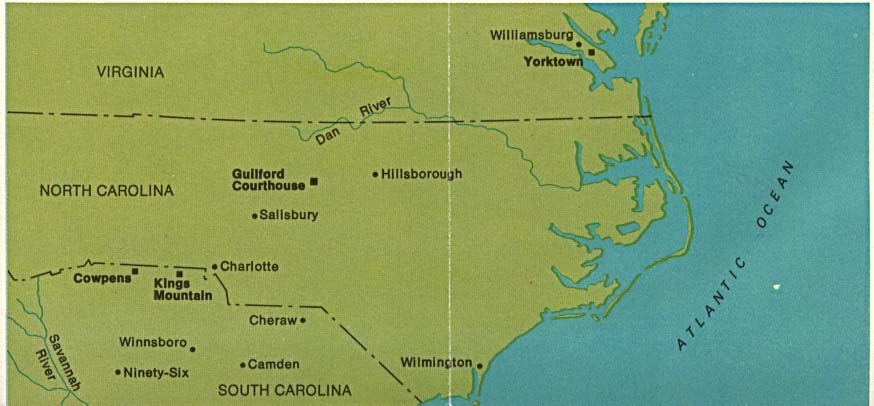
Guilford Courthouse National Military Park (Regional Map) (46K)
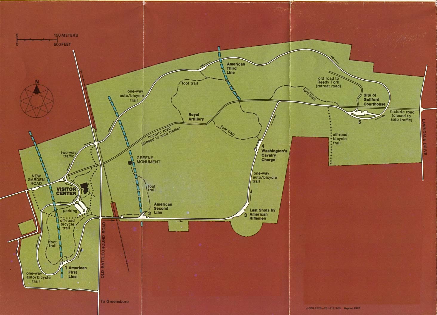
Guilford Courthouse National Military Park (Park Map) (165K)
Guilford Courthouse National Military Park (Park Map) (65K) (PDF Format)
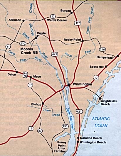
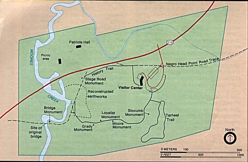
Moores Creek National Battlefield (Area Map) (53K)
Moores Creek National Battlefield (Area Map) 1997 (65K) (PDF Format)
Moores Creek National Battlefield (Park Map) (80K)
Moores Creek National Battlefield (Park Map) 1997 (65K) (PDF Format)
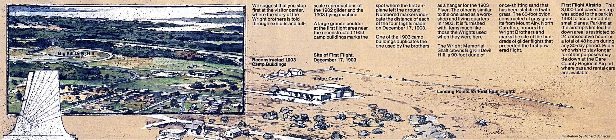
Wright Brothers National Memorial (Site Illustration) 1995 (351K)
See Also:
Topographic Maps
ArcGIS Shapefile Map Layers
<-- Free Maps
<-- Free U.S. State Maps
<-- Free World Country Maps
Didn't find what you are looking for? We've been online since 1996 and have created 1000's of pages. Search below and you may find just what you are looking for.
Michael R. Meuser
Data Research & GIS Specialist
MapCruzin.com is an independent firm
specializing in GIS project development and data research.
We created the first U.S. based
interactive toxic chemical facility
maps on the internet in 1996 and we
have been online ever since. Learn more about us and our services.
Have a project in mind? If you have data, GIS project or custom shapefile needs contact Mike.
Contact Us
Report Broken Links
Subscribe for Updates


![Blue Ridge Parkway - Northern Section [North Carolina / Virginia]](/free-state-maps/states/north-carolina/blue_n95.jpg)
![Blue Ridge Parkway - Southern Section [North Carolina / Virginia]](/free-state-maps/states/north-carolina/blue_s95.jpg)