Download Free Sudan Darfur Maps
<-- Free Map Downloads
<-- Free World Country Map Downloads
Sponsors
Note that maps may not appear on the webpage in their full size and resolution. To save the maps to your computer, right-click on the link.
Sudan (Political) 2007 (1.1MB)
Sudan (Political) 2000 (210K) and
pdf format (229K)
Sudan (Political) 1994 (387K) and pdf format (301K)
Sudan (Political) 1989 (324K)
Sudan (Shaded Relief) 2000 (276K) and
pdf format (295K)
Sudan (Shaded Relief) 1994 (280K) and pdf format (283K)
Sudan (Small Map) 2008 (16K)
Darfur Region, Sudan (1.4MB)
Sudan (Darfur)/Chad Border Region - Confirmed Damaged and Destroyed Villages Digital Globe, Inc. and Department of State via USAID August 2, 2004 (878KB)
Sudan (Darfur)/Chad Border Region - Ongoing USG Prgrams in Darfur Digital Globe, Inc. and Department of State via USAID July 16, 2004 (214KB) [PDF format]
Sudan (Darfur)/Chad Border Region - Ongoing USG Prgrams in Darfur Digital Globe, Inc. and Department of State via USAID July 4, 2004 (224KB)
Sudan (Darfur)/Chad Border Region - Confirmed Damaged and Destroyed Villages Digital Globe, Inc. and Department of State via USAID June 21, 2004 (2.3MB) [PDF format]
Destroyed Village near Shataya (129 of 133 structures destroyed Digital Globe, Inc. and Department of State via USAID June 21, 2004 (1.2MB) [PDF format]
Destroyed Village near Darurja (180 of 240 structures destroyed) Digital Globe, Inc. and Department of State via USAID June 21, 2004 (767K) [PDF format]
Farchana - UNHCR Camp Digital Globe, Inc. and Department of State via USAID June 21, 2004 (1.5K)[PDF format]
Destroyed Village near Fata Barno (278 structures destroyed) Digital Globe, Inc. and Department of State via USAID June 17, 2004 (1.1MB) [PDF format]
Destroyed Village near Shataya (1300 structures destroyed) Digital Globe, Inc. and Department of State via USAID June 21, 2004 (2MB) [PDF format]
Destroyed Village near Shataya (206 structures destroyed) Digital Globe, Inc. and Department of State via USAID June 21, 2004 (1.2MB) [PDF format]
Destroyed Village near Shataya (258 of 269 structures destroyed) Digital Globe, Inc. and Department of State via USAID June 21, 2004 (1.3K) [PDF format]
1:2,000,000 - Juba Portion of U.S. Defense Mapping Agency Series 2201, Sheet 20 1980 (970K)
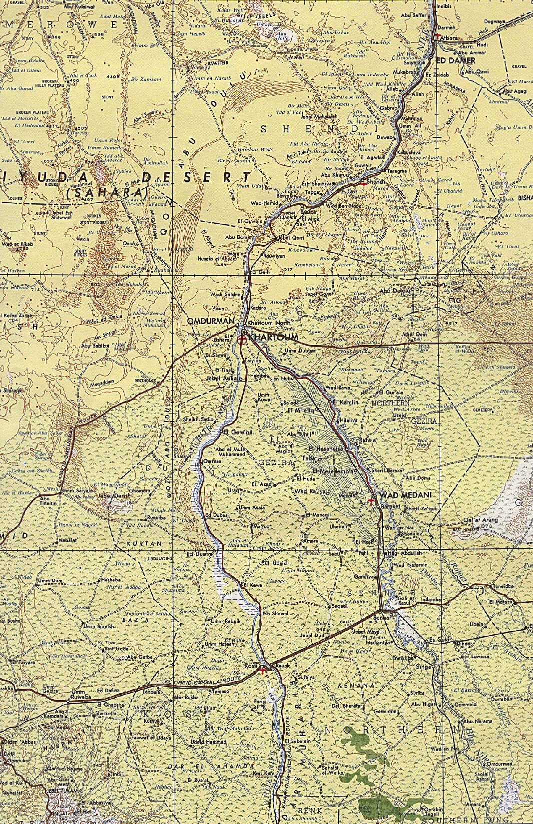
1:2,000,000 - Khartoum Portion of U.S. Defense Mapping Agency Series 2201, Sheet 15 1968 (1MB)
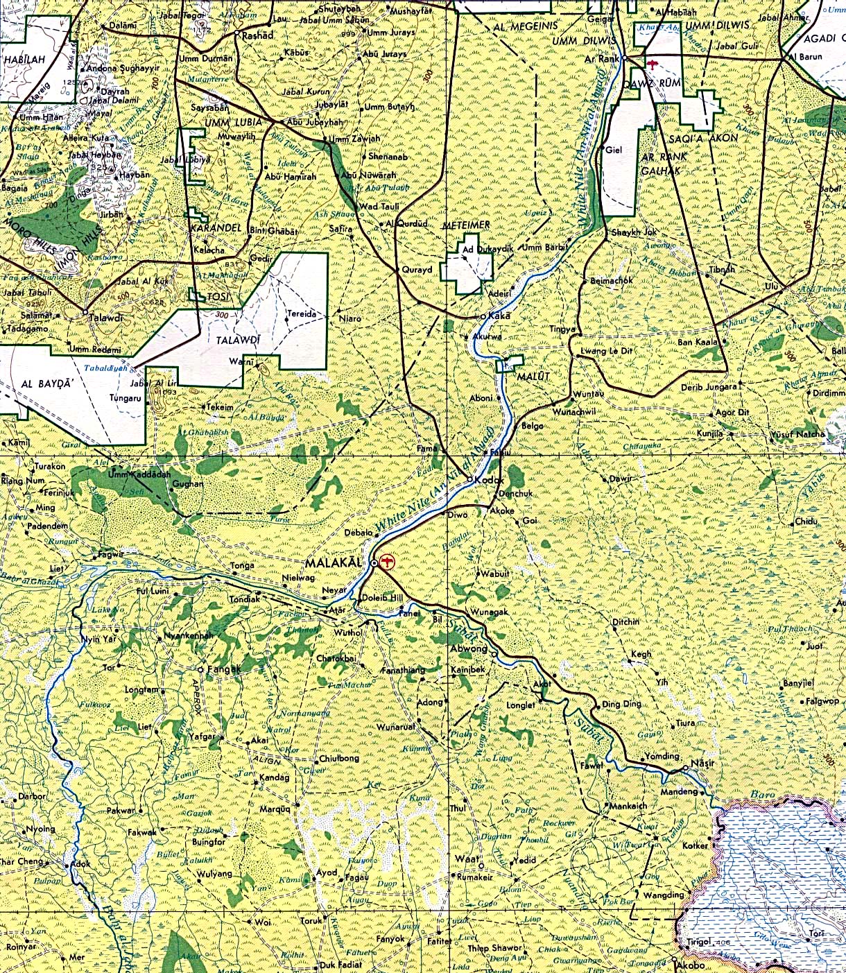
1:2,000,000 - Malakal Portion of U.S. Army Map Service Series 2201, Sheet 20 1980 (808K)
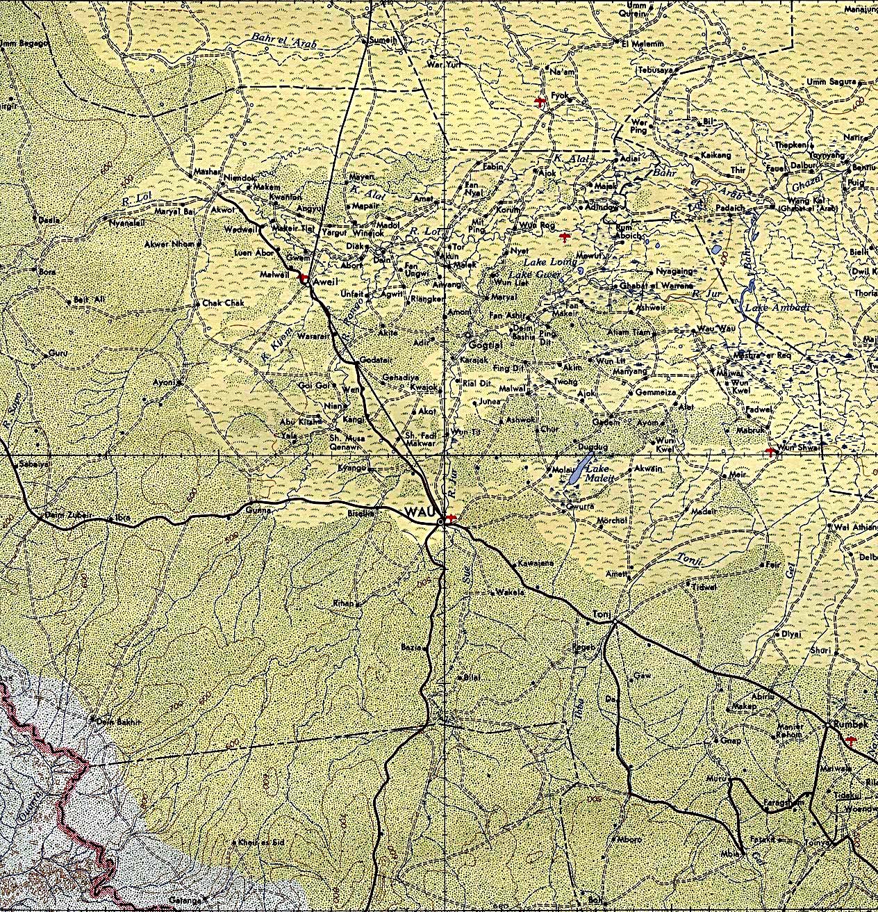
1:2,000,000 - Wau Portion of U.S. Army Map Service Series 2201, Sheet 19 1965 (1MB)
Oil and Gas Concession Holders in Sudan U.S. Agency for International Development 2001 (1.1MB) [pdf format]
Air Access in Southern Sudan July 2002 U.S. Agency for International Development 2002 (1.9MB) [pdf format]
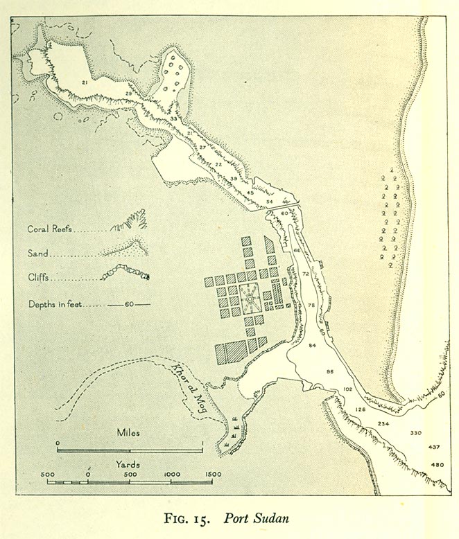
Port Sudan 1946 From Western Arabia and The Red Sea, Geographical Handbook Series B.R. 527, [U.K.] Naval Intelligence Division, June 1946.
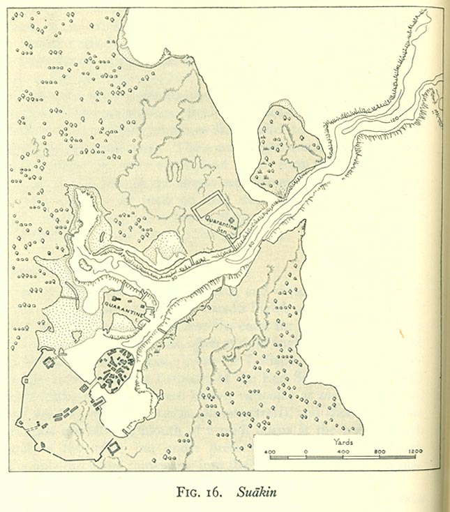
Suakin 1946 From Western Arabia and The Red Sea, Geographical Handbook Series B.R. 527, [U.K.] Naval Intelligence Division, June 1946.
Sources: These maps were provided by the University of Texas Library and/or
the U.S. Central Intelligence Agency (CIA) unless otherwise noted.
Maps on other websites
Sudan (UniMaps)
Sudan (United Nations) [PDF]
Sudan (WorldAtlas.com)
Sudan Interagency Mapping [including metadata files, shape files and Google Earth KML files]
Sudan - Languages (Dr. Walter Huffman) [large PDF]
Sudan Maps (ReliefWeb)
Sudan Maps (UNOSAT)
Sudan Maps (U.S. Agency for International Development)
Sudan Maps (World Health Organization)
Sudan - UN Sudan Information Gateway - Maps (Office of the UN Resident and Humanitarian Coordinator for the Sudan)
Darfur Conflict Map [2007] (BBC News)
Darfur Maps and Satellite Maps (UNOSAT)
<-- Free Map Downloads
<-- Free World Country Map Downloads
Didn't find what you are looking for? We've been online since 1996 and have created 1000's of pages. Search below and you may find just what you are looking for.
Michael R. Meuser
Data Research & GIS Specialist
MapCruzin.com is an independent firm
specializing in GIS project development and data research.
We created the first U.S. based
interactive toxic chemical facility
maps on the internet in 1996 and we
have been online ever since. Learn more about us and our services.
Have a project in mind? If you have data, GIS project or custom shapefile needs contact Mike.
Contact Us
Report Broken Links
Subscribe for Updates
Sponsors


