Download Free Tennessee National Park and Historic Monument Maps
Sponsors
<-- Download Free Maps
<-- Free National Park Maps
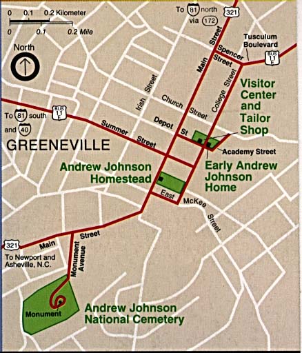
Andrew Johnson National Historic Site (Location Map) 1995 (58K)
Big South Fork National River and Recreation Area [Tennessee / Kentucky] (Park Map) 1997 (581K) (PDF Format)
Cumberland Gap National Historical Park [Tennessee / Kentucky / Virginia] (Park Map) 1999 (323K) (PDF Format)
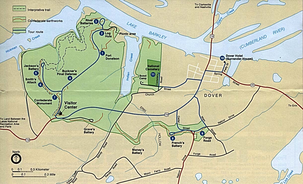
Fort Donelson National Battlefield (Park Map) (260K)
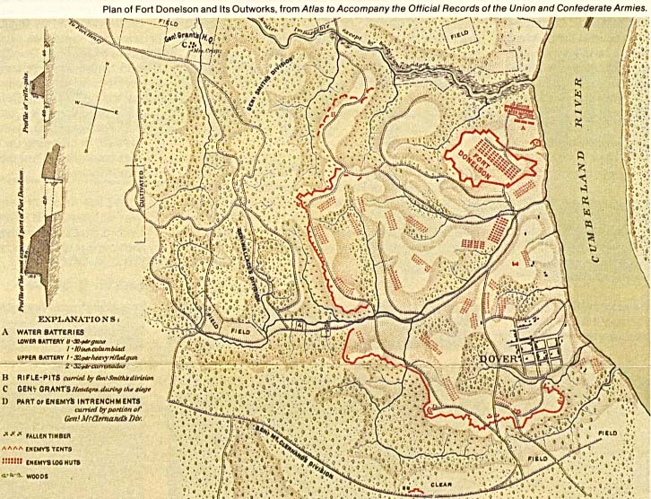
Fort Donelson National Battlefield (Schematic Map) (145K)
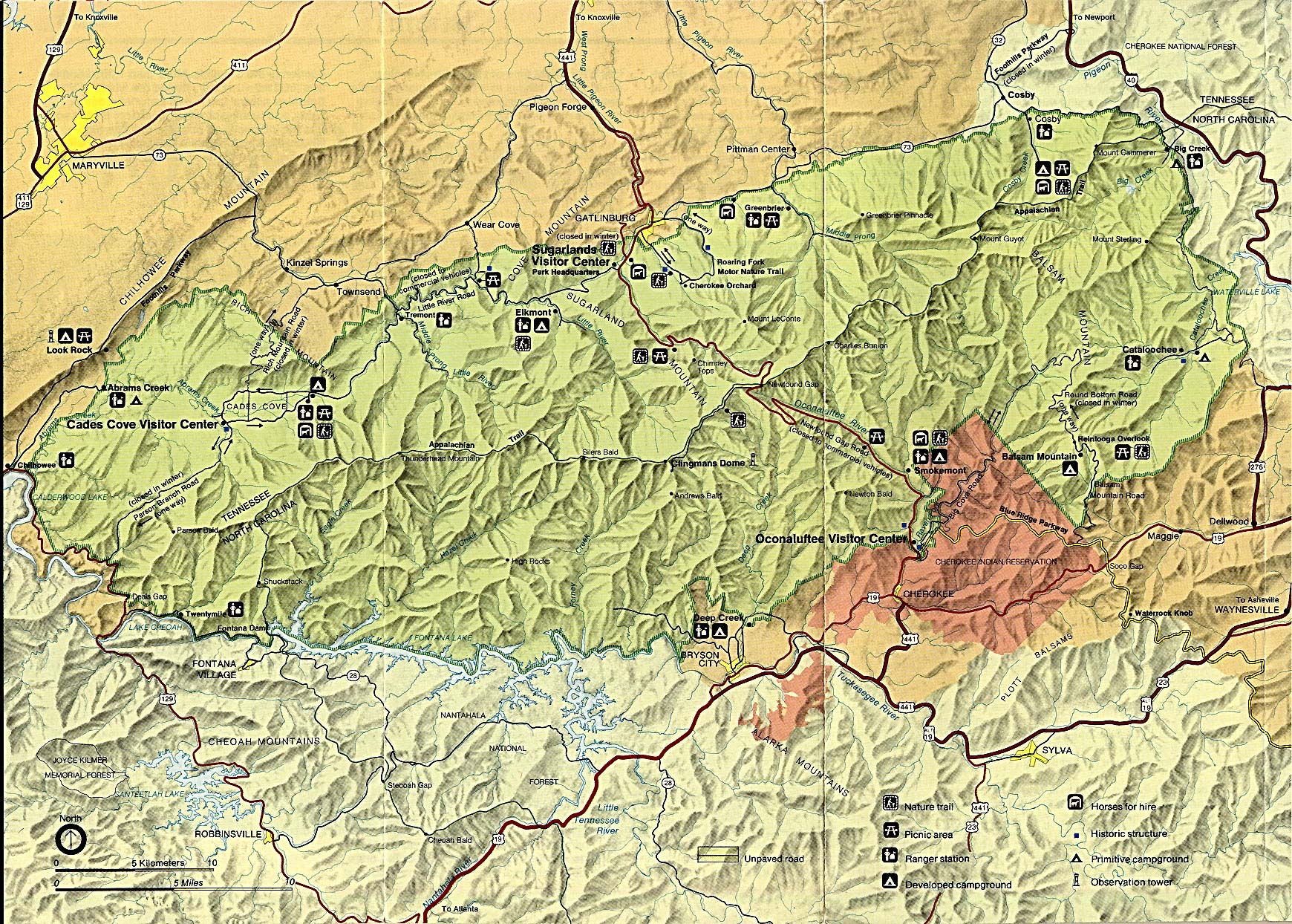
Great Smoky Mountains National Park (Park Map / Shaded Relief) 1995 (546K)
Great Smoky Mountains National Park (Park Map) 1999 (645K) (PDF Format)
Great Smoky Mountains National Park (Trail Map) 1999 (774K) (PDF Format)
Sponsors
Natchez Trace Parkway National Scenic Trail [Mississippi, Alabama, and Tennessee] (Area Map) 1999 (65K) (PDF Format)
Natchez Trace Parkway National Scenic Trail [Mississippi, Alabama, and Tennessee] (Park Map) 1999 (516K) (PDF Format)
Natchez Trace Parkway National Scenic Trail [Mississippi, Alabama, and Tennessee] (Natchez to Jackson, Mississippi) 1997 (387K)
Natchez Trace Parkway National Scenic Trail [Mississippi, Alabama, and Tennessee] (Jackson to Dancy, Mississippi) 1997 (323K)
Natchez Trace Parkway National Scenic Trail [Mississippi, Alabama, and Tennessee] (Dancy, Mississippi to Rock Spring, Alabama) 1997 (387K)
Natchez Trace Parkway National Scenic Trail [Mississippi, Alabama, and Tennessee] (Rock Spring, Alabama to Nashville, Tennessee) 1997 (452K)
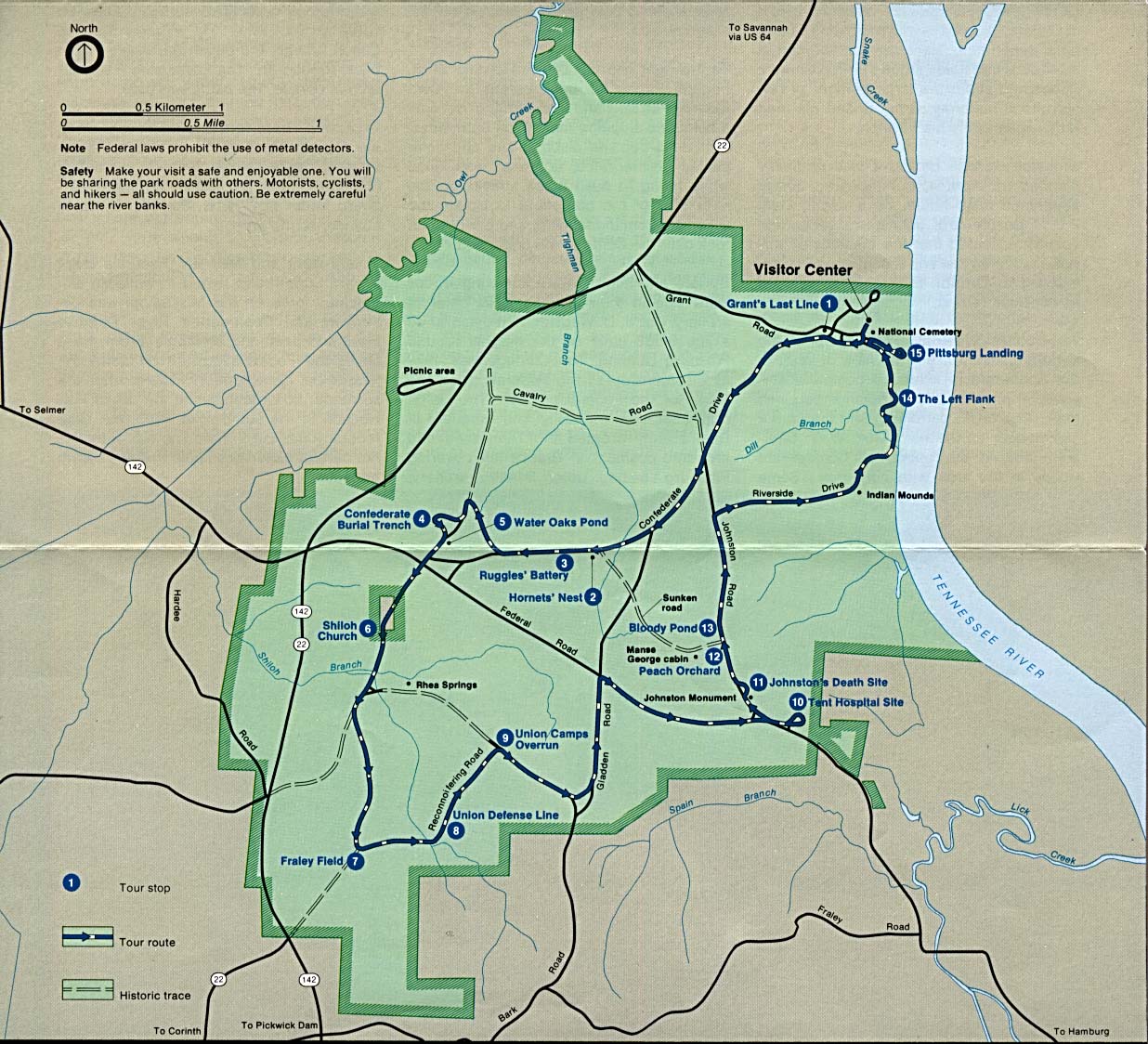
Shiloh National Military Park (Park Map) (284K)
Shiloh National Military Park (Park Map) 1997 (129K) (PDF Format)
Shiloh National Military Park (Tour Map) 1997 (129K) (PDF Format)
Stones River National Cemetery (Battle Map of 1862) 1997 (194K) (PDF Format)
Stones River National Cemetery (Battle Map of 1863) 1997 (194K) (PDF Format)
Stones River National Cemetery (Park Map) 1997 (129K) (PDF Format)
<-- Download Free Maps
<-- Free National Park Maps
Didn't find what you are looking for? We've been online since 1996 and have created 1000's of pages. Search below and you may find just what you are looking for.
Michael R. Meuser
Data Research & GIS Specialist
MapCruzin.com is an independent firm
specializing in GIS project development and data research.
We created the first U.S. based
interactive toxic chemical facility
maps on the internet in 1996 and we
have been online ever since. Learn more about us and our services.
Have a project in mind? If you have data, GIS project or custom shapefile needs contact Mike.
Contact Us
Report Broken Links
Subscribe for Updates
Sponsors


![Natchez Trace Parkway National Scenic Trail [Mississippi, Alabama, and Tennessee]](/download-national-park-maps/traceparkway4_97.jpg)
![Natchez Trace Parkway National Scenic Trail [Mississippi, Alabama, and Tennessee]](/download-national-park-maps/traceparkway3_97.jpg)
![Natchez Trace Parkway National Scenic Trail [Mississippi, Alabama, and Tennessee]](/download-national-park-maps/traceparkway2_97.jpg)
![Natchez Trace Parkway National Scenic Trail [Mississippi, Alabama, and Tennessee]](/download-national-park-maps/traceparkway1_97.jpg)