USDA Forest Service Remote Sensing Application Center Active Fire Mapping Program & Drought Information
Sponsors
<-- GIS News
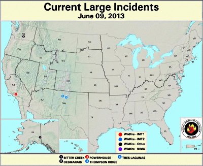
Provides an overview of wildfires in the U.S. You can select fires of your choice for more information.
Another good source of information about wildfires is the USFS Inciweb.
The drought - once contributing factor to increased danger of wildfires - is deepening over much of the country. Drought maps and information can be found here.
<-- GIS News
Didn't find what you are looking for? We've been online since 1996 and have created 1000's of pages. Search below and you may find just what you are looking for.
Michael R. Meuser
Data Research & GIS Specialist
MapCruzin.com is an independent firm
specializing in GIS project development and data research.
We created the first U.S. based
interactive toxic chemical facility
maps on the internet in 1996 and we
have been online ever since. Learn more about us and our services.
Have a project in mind? If you have data, GIS project or custom shapefile needs contact Mike.
Contact Us
Report Broken Links
Subscribe for Updates
Sponsors


