USDA Forest Service Remote Sensing Application Center MODIS and VIIRS Fire Detection GIS Data in Shapefile Format
Sponsors
<-- GIS News
<-- Free GIS Shapefiles
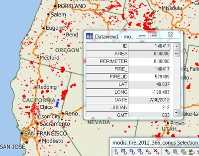
This is a simple map I created using the MODIS 2012 shapefile in Maptitude. Descriptions of the MODIS and VIIRS satellite fire detection shapefiles follows. Shapefiles are available for the previous 7 days and for previous years.
You can download the shapefiles directly from this website. A click on any shapefile link takes you to the metadata. Scroll to near the bottom of the page and you will find a link to download the shapefile.
The MODIS active fire product detects fires in 1km pixels that are burning at the time of overpass under relatively cloud-free conditions using a contextual algorithm, where thresholds are first applied to the observed middle–infrared and thermal infrared brightness temperature and then false detections are rejected by examining the brightness temperature relative to neighboring pixels (Giglio, L. et al. 2003).
Sponsors
MODIS fire detections for the last 7 days
Cumulative MODIS fire detections for 2013
Cumulative MODIS fire detections for 2012
Cumulative MODIS fire detections for 2011
Cumulative MODIS fire detections for 2010
Cumulative MODIS fire detections for 2009
Cumulative MODIS fire detections for 2008
Cumulative MODIS fire detections for 2007
Cumulative MODIS fire detections for 2006
Cumulative MODIS fire detections for 2005
Cumulative MODIS fire detections for 2004
Cumulative MODIS fire detections for 2003
Cumulative MODIS fire detections for 2002
Cumulative MODIS fire detections for 2001
VIIRS represents a continuation of high quality AF monitoring capabilities started with the Moderate Resolution Imaging Spectroradiometer (MODIS) on the NASA EOS Terra and Aqua satellites, and also a significant improvement of the current capabilities of the Advanced Very High Resolution Radiometer (AVHRR) on the current NOAA operational polar satellites. Initial evaluation, following the activation of the thermal bands on January 18, 2012, has provided empirical evidence of the good quality of the VIIRS fire observations.
VIIRS fire detections for the last 7 days
Cumulative VIIRS fire detections for 2013
Cumulative VIIRS fire detections for 2012
Source: USDA FS Active Fire Maps GIS Data
<-- GIS News
<-- Free GIS Shapefiles
Didn't find what you are looking for? We've been online since 1996 and have created 1000's of pages. Search below and you may find just what you are looking for.
Michael R. Meuser
Data Research & GIS Specialist
MapCruzin.com is an independent firm
specializing in GIS project development and data research.
We created the first U.S. based
interactive toxic chemical facility
maps on the internet in 1996 and we
have been online ever since. Learn more about us and our services.
Have a project in mind? If you have data, GIS project or custom shapefile needs contact Mike.
Contact Us
Report Broken Links
Subscribe for Updates
Sponsors