Caliper Releases Maptitude 6.0: Easy to Use, Affordable and Includes New Geodata
Sponsors
Maptitude 6.0: New Features Overview
Maptitude 6.0 is a major new release of Caliper Corporation's award-winning GIS and mapping software.
This latest version of Maptitude continues to provide easy-to-use, professional mapping tools at an
affordable price. This version also contains the most detailed and accurate U.S. data ever included with
Maptitude.
 The new features and enhancements enable you to create the maps you need faster, with better accuracy,
more attractively, and in a wider variety of formats than ever before.
The new features and enhancements enable you to create the maps you need faster, with better accuracy,
more attractively, and in a wider variety of formats than ever before.
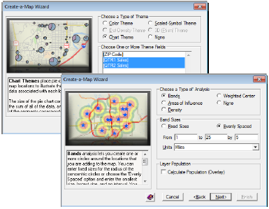
Improved Create-a-Map Wizard
Create-a-Map Wizard is now more
robust and easier to use. When you need
to map your own data, descriptive text and
illustrations accompany each option so
that you can understand and envision
what each step will accomplish.
The Create-a-Map Wizard maps are all
revised. They use the latest geography and
are simpler to customize. The maps also
take advantage of the new features in
Maptitude including autoscaled feature
display settings and new label
alignment, display, and placement
options.
New and Updated Data
New U.S. data sets provide access to
up-to-date geographic information.
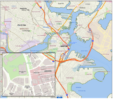
Maptitude includes a 2010 NAVTEQ map,
allowing accurate address locating and
street visualization, plus robust data on
which to calculate shortest paths, network
bands, and network partitions.
Other new U.S. layers from NAVTEQ include
building footprints for many urban
locations, highways, railroads, and 3D
landmarks. The Points of Interest (POI)
layer contains over 2 million named
locations that range from public facilities
to commercial buildings including shops,
restaurants, and retail stores.
Why we at MapCruzin.com use Maptitude for all of our projects.
Learn more about Maptitude 6.0.
BTW if you order Maptitude 6.0 let them know that you heard about it at MapCruzin.com. We don't get a commission or anything like that, but we would like them to know that we support their work and products.
Sponsors
Didn't find what you are looking for? We've been online since 1996 and have created 1000's of pages. Search below and you may find just what you are looking for.
Michael R. Meuser
Data Research & GIS Specialist
MapCruzin.com is an independent firm
specializing in GIS project development and data research.
We created the first U.S. based
interactive toxic chemical facility
maps on the internet in 1996 and we
have been online ever since. Learn more about us and our services.
Have a project in mind? If you have data, GIS project or custom shapefile needs contact Mike.
Contact Us
Report Broken Links
Subscribe for Updates
| 


