U.S. Forest Service Active Fire Mapping Program
Sponsors
<-- Fire Weather Wildfire Risk Maps
<-- Free Geography Maps
<-- Free U.S. State Shapefiles
<-- Free World Country Maps
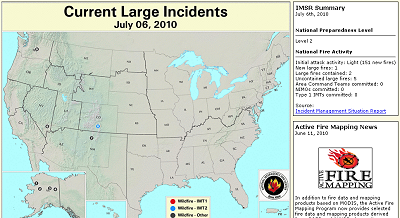
U.S. Forest Service Remote Sensing Applications Center Active Fire Mapping Program - Fire locations are based on data provided by the National Interagency Coordination Center and are subject to change.
Large Incident: A wildfire of 100 acres or more occuring in timber, or a wildfire of 300 acres or more occuring in grass/sage.
- Wildland Fire: Any nonstructure fire, other than prescribed fire, that occurs in the wildland.
- Wildland Fire - IMT1: Wildland fire; Type 1 Incident Management Team Assigned.
- Wildland Fire - IMT2: Wildland fire; Type 2 Incident Management Team Assigned.
- Wildland Fire - Other: Wildland fire; Other Incident Management Team Assigned besides a Type 1 or Type 2 team (e.g. Type 3).
Download Google Earth KMZ files:
Visit the U.S. Forest Service Remote Sensing Applications Center
<-- Fire Weather Wildfire Risk Maps
<-- Free Geography Maps
<-- Free U.S. State Shapefiles
<-- Free World Country Maps
Didn't find what you are looking for? We've been online since 1996 and have created 1000's of pages. Search below and you may find just what you are looking for.
Michael R. Meuser
Data Research & GIS Specialist
MapCruzin.com is an independent firm
specializing in GIS project development and data research.
We created the first U.S. based
interactive toxic chemical facility
maps on the internet in 1996 and we
have been online ever since. Learn more about us and our services.
Have a project in mind? If you have data, GIS project or custom shapefile needs contact Mike.
Contact Us
Report Broken Links
Subscribe for Updates
Sponsors
| 


