Download Free Mississippi Maps
<-- Free Maps
<-- Free U.S. State Maps
<-- Free World Country Maps
See Also:
Topographic Maps
ArcGIS Shapefile Map Layers
Download or link to these maps for your reports, websites, research, projects, presentations...

Note that maps may not appear on the webpage in their full size and resolution. To save the maps to your computer, right-click on the link.
State Map
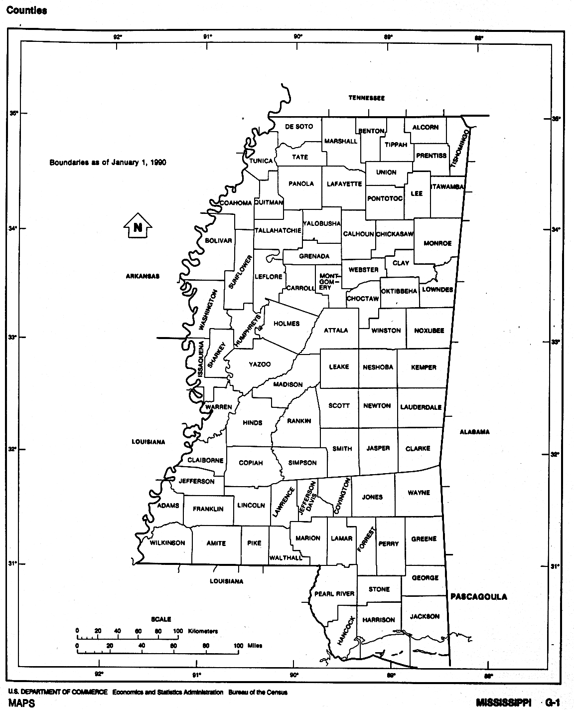
Mississippi (base map) JPEG format (452K) County boundaries and names, county seats, rivers. Original scale 1:2,500,000 U.S. Geological Survey, 1972 limited update 1990
Mississippi (outline map) JPEG format (96K) County boundaries and names. U.S. Bureau of the Census, 1990
Mississippi (reference map) JPEG format (256K) Shaded relief map with state boundaries, forest cover, place names, major highways. Portion of "The National Atlas of the United States of America. General Reference", compiled by U.S. Geological Survey 2001, printed 2002
Mississippi (reference map) PDF format (200K) Shaded relief map with state boundaries, forest cover, place names, major highways. Portion of "The National Atlas of the United States of America. General Reference", compiled by U.S. Geological Survey 2001, printed 2002
Mississippi - Federal Lands and Indian Reservations PDF format (789K) The National Atlas of the United States of America, U.S. Geological Survey, 2003
City Maps
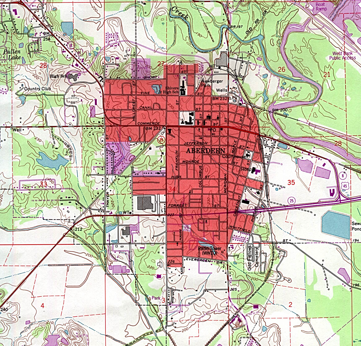
Aberdeen (topographic) original scale 1:24,000 U.S.G.S. 1992 (561K)
Batesville (topographic) original scale 1:24,000 U.S.G.S. 1982 (680K)
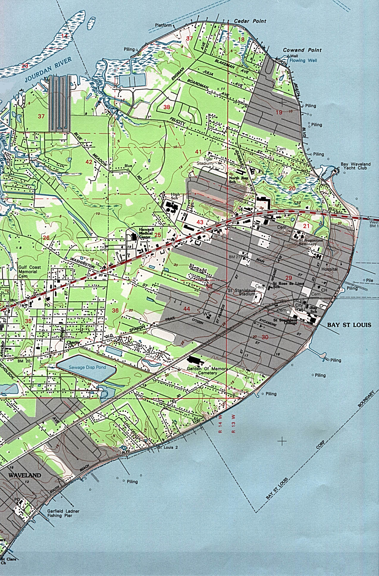
Bay St. Louis (topographic) original scale 1:24,000 U.S.G.S. 1993 (757K)
[Biloxi, Mississippi to Dauphin Island, Alabama] Biloxi Sheet, Metric Topographic Map 30088-A1-TM-100, U.S.G.S., 1982 (3.4MB)
[New Orleans, Louisiana to Gulfport, Mississippi] Gulfport Sheet, Metric Topographic Map 30089-A1-TM-100, U.S.G.S., 1982 (5.1MB)
Corinth (topographic) original scale 1:24,000 U.S.G.S. 1982 (774K)
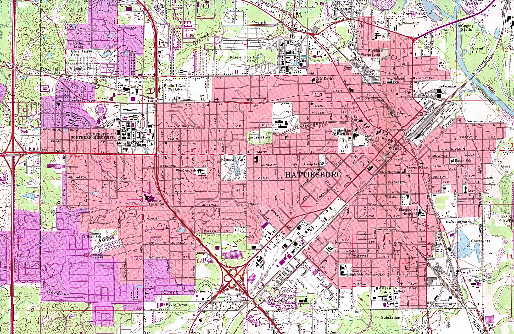
Hattiesburg (topographic) original scale 1:24,000 U.S.G.S. 1964, photorevised 1982 (1MB)
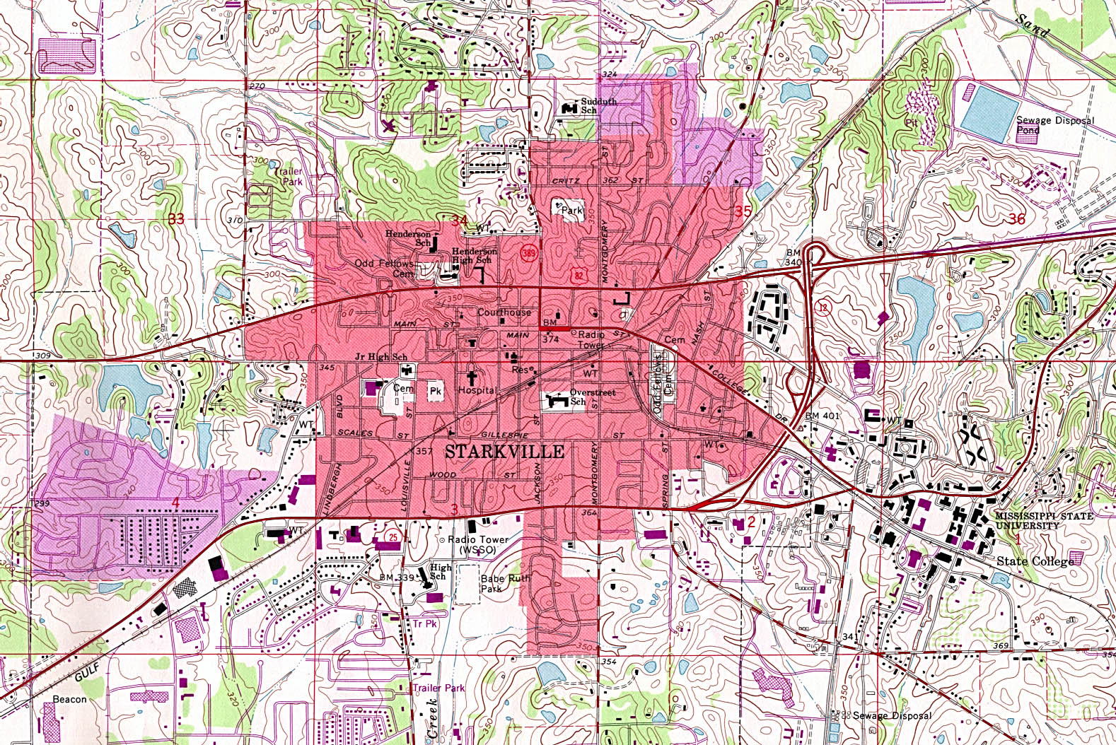
Starkville (topographic) original scale 1:24,000 U.S.G.S. 1965, photorevised 1982 (714K)
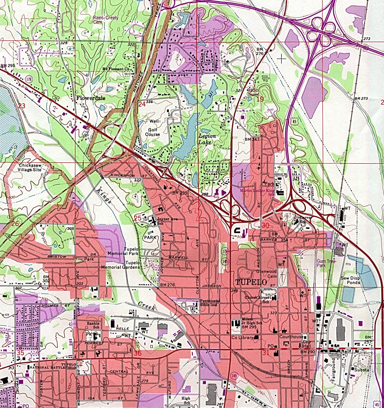
Tupelo (topographic) original scale 1:24,000 U.S.G.S. 1992 (621K)
Historical City Maps
Jackson 1919 Automobile Blue Book 1919, Vol. 6 (139K)
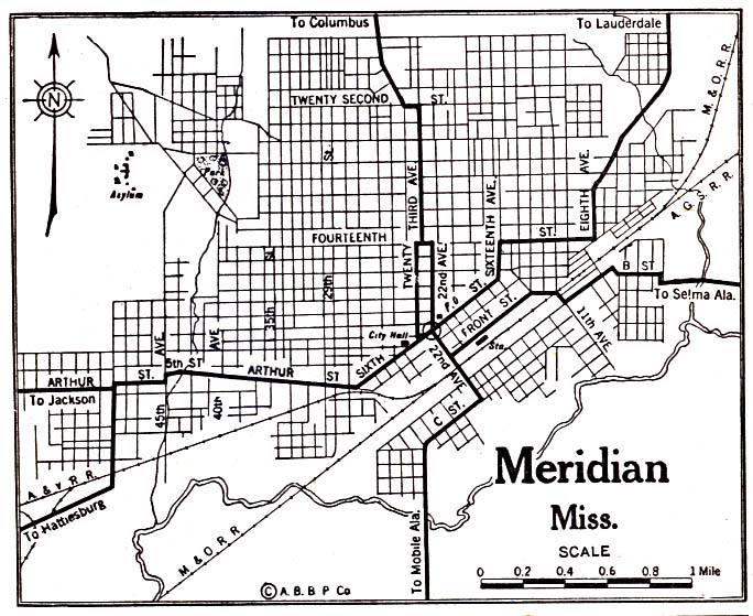
Meridian 1920 Automobile Blue Book 1920 (137K)
Mississippi Topographic Maps
Bay Saint Louis, Topographic Map Prototype, 1:24,000, U.S. Geological Survey, September 12, 2005 (754K)
Biloxi, Topographic Map Prototype, 1:24,000, U.S. Geological Survey, September 12, 2005 (1.5MB)
Dead Tiger Creek, Topographic Map Prototype, 1:24,000, U.S. Geological Survey, September 12, 2005 (1.2MB)
Dedeaux, Topographic Map Prototype, 1:24,000, U.S. Geological Survey, September 12, 2005 (1.4MB)
Deer Island, Topographic Map Prototype, 1:24,000, U.S. Geological Survey, September 12, 2005 (287K)
Dog Keys Pass, Topographic Map Prototype, 1:24,000, U.S. Geological Survey, September 12, 2005 (195K)
Gautier North, Topographic Map Prototype, 1:24,000, U.S. Geological Survey, September 12, 2005 (1.6MB)
Gautier South, Topographic Map Prototype, 1:24,000, U.S. Geological Survey, September 12, 2005 (525K)
Gulfport North, Topographic Map Prototype, 1:24,000, U.S. Geological Survey, September 12, 2005 (1.8MB)
Gulfport NW, Topographic Map Prototype, 1:24,000, U.S. Geological Survey, September 12, 2005 (1.2MB)
Gulfport South, Topographic Map Prototype, 1:24,000, U.S. Geological Survey, September 12, 2005 (443K)
Horn Island East, Topographic Map Prototype, 1:24,000, U.S. Geological Survey, September 12, 2005 (267K)
Horn Island West, Topographic Map Prototype, 1:24,000, U.S. Geological Survey, September 12, 2005 (285K)
Kiln, Topographic Map Prototype, 1:24,000, U.S. Geological Survey, September 12, 2005 (1.3MB)
Ocean Springs, Topographic Map Prototype, 1:24,000, U.S. Geological Survey, September 12, 2005 (1.4MB)
Pascagoula North, Topographic Map Prototype, 1:24,000, U.S. Geological Survey, September 12, 2005 (1.3MB)
Pass Christian, Topographic Map Prototype, 1:24,000, U.S. Geological Survey, September 12, 2005 (701K)
Petit Bois Island, Topographic Map Prototype, 1:24,000, U.S. Geological Survey, September 12, 2005 (201K)
Ship Island, Topographic Map Prototype, 1:24,000, U.S. Geological Survey, September 12, 2005 (265K)
Waveland, Topographic Map Prototype, 1:24,000, U.S. Geological Survey, September 12, 2005 (845K)
Maps of National Parks, Monuments, and Historic Sites
The following maps were produced by the U.S. National Park Service unless otherwise noted.
Gulf Islands National Seashore [Mississippi / Alabama / Florida] (Detail and Park Maps) 1999 (387K) (PDF Format)
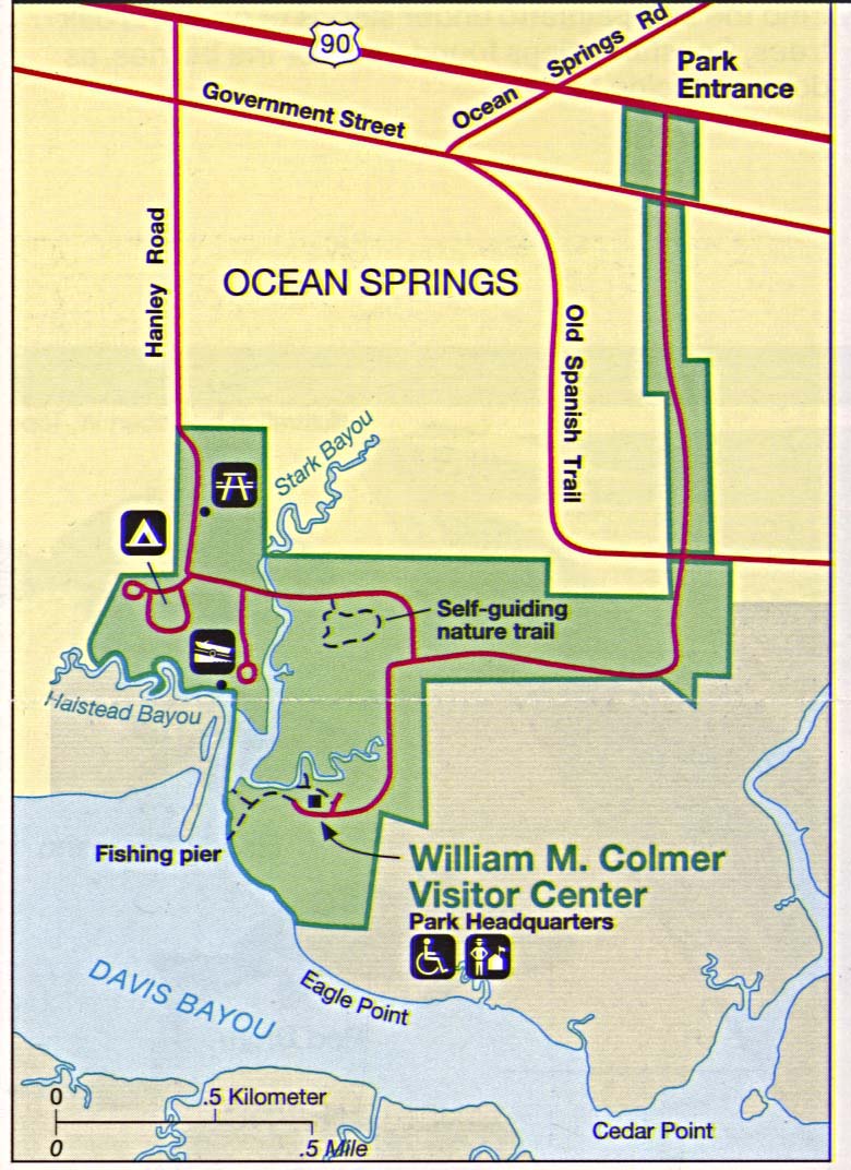
Gulf Islands National Seashore - Davis Bayou (Detail Map) 1994 (195K)
Gulf of Mexico [Mississippi / Alabama / Florida] (Area Features) 1994 (351K)
Mississippi River Valley [Mississippi / Louisiana] (Burial Mounds Map) 1997 (452K) (PDF Format)
Mississippi River Valley [Mississippi / Louisiana] (Plantations Map) 1997 (452K) (PDF Format)
Mississippi River Valley [Southern U.S.] (Route of DeSoto Map) 1997 (65K) (PDF Format)
Natchez Trace Parkway National Scenic Trail [Mississippi, Alabama, and Tennessee] (Area Map) 1999 (65K) (PDF Format)
Natchez Trace Parkway National Scenic Trail [Mississippi, Alabama, and Tennessee] (Park Map) 1999 (516K) (PDF Format)
Natchez Trace Parkway National Scenic Trail [Mississippi, Alabama, and Tennessee] (Natchez to Jackson, Mississippi) 1997 (387K)
Natchez Trace Parkway National Scenic Trail [Mississippi, Alabama, and Tennessee] (Jackson to Dancy, Mississippi) 1997 (323K)
Natchez Trace Parkway National Scenic Trail [Mississippi, Alabama, and Tennessee] (Dancy, Mississippi to Rock Spring, Alabama) 1997 (387K)
Natchez Trace Parkway National Scenic Trail [Mississippi, Alabama, and Tennessee] (Rock Spring, Alabama to Nashville, Tennessee) 1997 (452K)
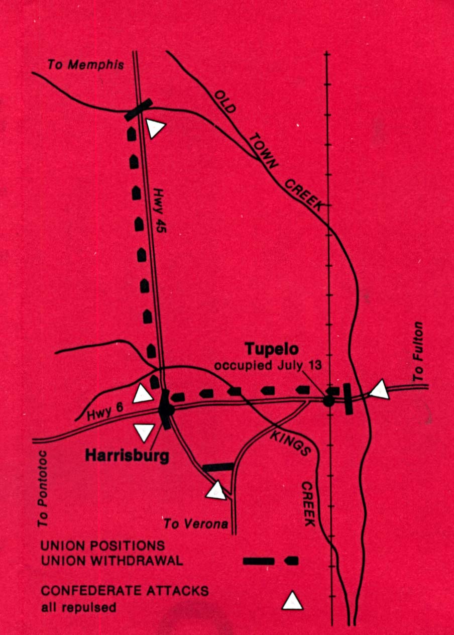
Tupelo National Battlefield (Battle Map) 1995 (126K)
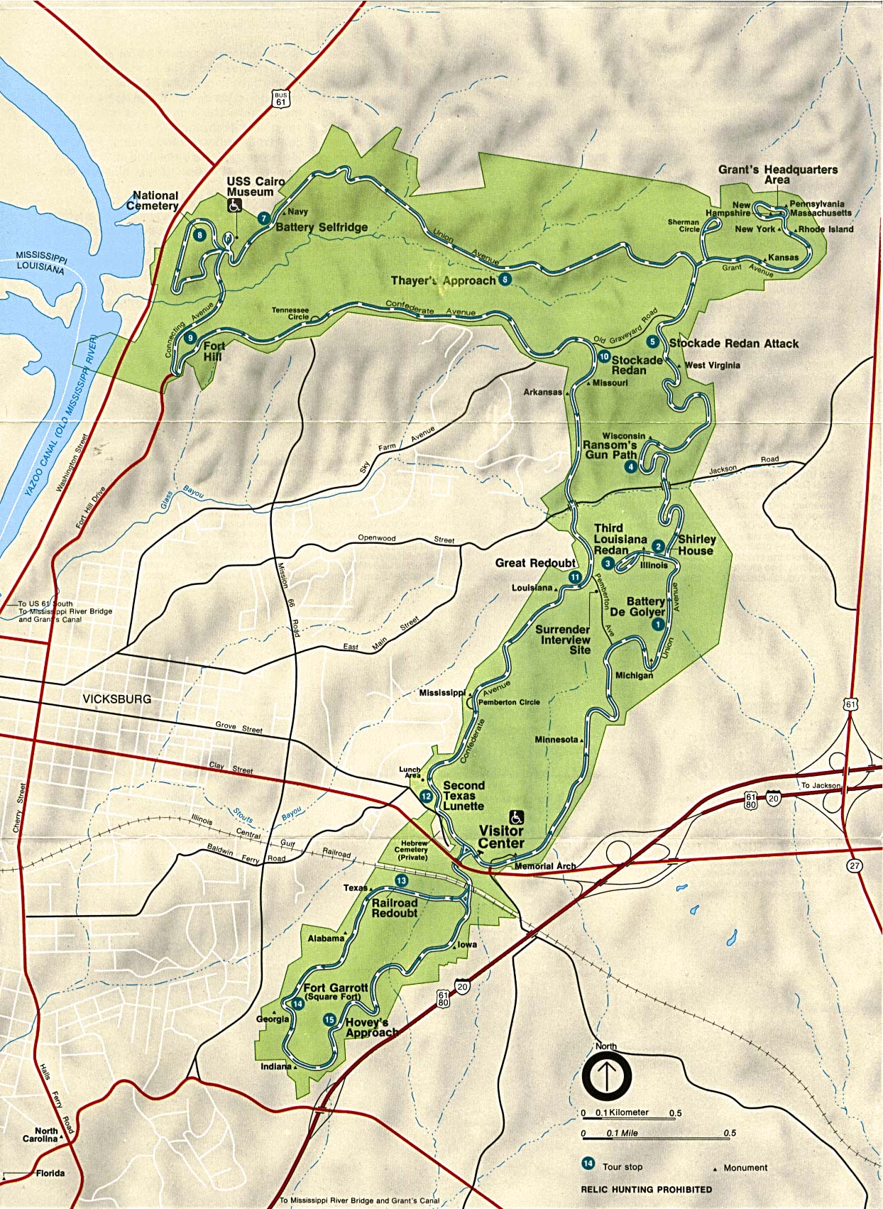
Vicksburg National Military Park (Area Map) 1994 (507K)
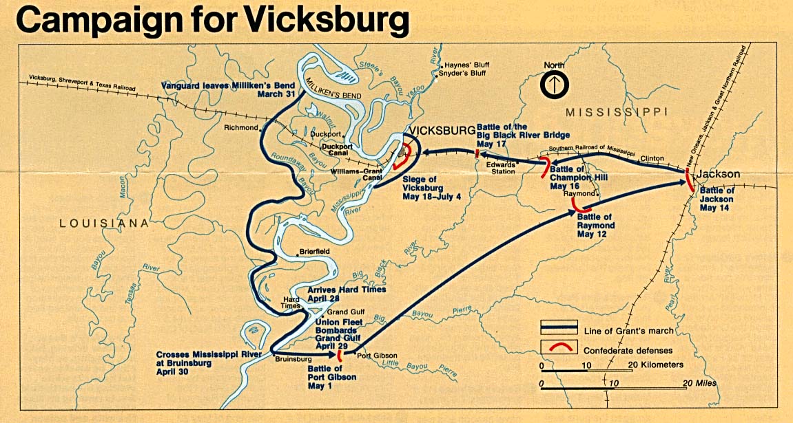
Vicksburg National Military Park (Campaign Map) 1994 (195K)
Vicksburg National Military Park (Campaign Map) 1999 (65K) (PDF Format)
Vicksburg National Military Park (Touring the Battlefield Map) 1999 (194K) (PDF Format)
Sources: Many of these maps were provided by the University of Texas Library and/or the U.S. Central Intelligence Agency (CIA).
Maps on other websites
Mississippi - County Names (Census Bureau)
Mississippi - County Road Maps (MDot) [PDF format]
Mississippi - Downloadable Maps (MARIS)
Mississippi - GIS Data and Maps (MARIS)
Mississippi - Maps (Geology.com)
Mississippi - Maps (MARIS)
Mississippi - Maps (Mississippi Dept. of Transportation)
Mississippi - Online Map Viewer (MARIS)
Mississippi - Road Map (MDoT) [PDF format]
Mississippi - Road Map (World Sites Atlas)
Mississippi - Satellite Image (Geology.com)
Mississippi - Topographic Maps (Libre Map Project)
See Also:
Topographic Maps
ArcGIS Shapefile Map Layers
<-- Free Maps
<-- Free U.S. State Maps
<-- Free World Country Maps
Didn't find what you are looking for? We've been online since 1996 and have created 1000's of pages. Search below and you may find just what you are looking for.
Michael R. Meuser
Data Research & GIS Specialist
MapCruzin.com is an independent firm
specializing in GIS project development and data research.
We created the first U.S. based
interactive toxic chemical facility
maps on the internet in 1996 and we
have been online ever since. Learn more about us and our services.
Have a project in mind? If you have data, GIS project or custom shapefile needs contact Mike.
Contact Us
Report Broken Links
Subscribe for Updates
Sponsors
| 


![[Biloxi, Mississippi to Dauphin Island, Alabama]](/free-state-maps/states/mississippi/biloxi_1982.jpg)
![[New Orleans, Louisiana to Gulfport, Mississippi]](/free-state-maps/states/mississippi/gulfport_1982.jpg)
![Gulf of Mexico [Mississippi / Alabama / Florida]](/free-state-maps/states/mississippi/gulf94.jpg)
![Natchez Trace Parkway National Scenic Trail [Mississippi, Alabama, and Tennessee]](/free-state-maps/states/mississippi/traceparkway4_97.jpg)
![Natchez Trace Parkway National Scenic Trail [Mississippi, Alabama, and Tennessee]](/free-state-maps/states/mississippi/traceparkway3_97.jpg)
![Natchez Trace Parkway National Scenic Trail [Mississippi, Alabama, and Tennessee]](/free-state-maps/states/mississippi/traceparkway2_97.jpg)
![Natchez Trace Parkway National Scenic Trail [Mississippi, Alabama, and Tennessee]](/free-state-maps/states/mississippi/traceparkway1_97.jpg)