Renewable Energy Atlas of the West: A Guide to the Region's Resource Potential
<-- Free Shapefiles
<-- Renewable Energy Maps & Shapefiles
More Articles - Related Reading
Excellent resource for alternative and renewable green energy research.
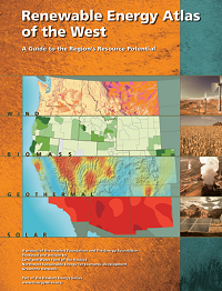 | Renewable Energy Atlas of the West: A Guide to the Region's Resource Potential |
View or Download (52MB PDF)
Introduction
The Renewable Energy Atlas of the West is designed as a resource for policy makers, advocates,
landowners, developers and others interested in furthering the production of electricity from
renewable wind, solar, geothermal and biomass energy resources.
Utilizing state-of-the-art GIS technology.
The
Atlas brings together the best existing renewable
resource maps and data into a single comprehensive,
publicly available document and interactive
Web site. It does not provide a new regional
assessment of renewable resources, but rather
shows the current understanding of these
resources throughout the West and highlights the
issues affecting their development. In addition, it
identifies areas where new data are needed in
order to more accurately represent the region�s
renewable energy resources.
While the maps contained in this Atlas do not
eliminate the need for on-site resource measurement,
they can help developers gain a better
understanding of where the best renewable
resource areas are found and screen out the less
promising areas. This can significantly minimize
the cost and time involved in prospecting. Landowners
can use the information for a first-cut
feasibility analysis of using renewable resources
to supply electrical power to their homes, farms,
ranches and businesses, while policymakers will
find it a useful tool for broader planning purposes.
Summary
The Atlas begins with an overview of regional
maps of the wind, solar, biomass and geothermal
resources. The second section describes the
current status of renewable energy development,
including a summary of the region�s current
electricity supply mix and a map of the locations
and installed capacity of existing renewable
energy facilities. A regional map shows state-level
policies, including tax incentives, system benefits
charges and portfolio standards, which have been
implemented in several states to stimulate the
development of renewable energy. The final
section in the overview addresses important issues
to consider in developing new renewable energy
projects, including transmission capacity, load
growth, land use and environmental impacts.
The Atlas continues with individual sections
for each of the eleven Western states: Arizona,
California, Colorado, Idaho, Montana, Nevada,
New Mexico, Oregon, Utah, Washington and
Wyoming. Each state section features success
stories of renewable energy development, statelevel
maps of wind, solar, biomass and geothermal
resources and summaries of existing policies, installed
renewable energy facilities and the current
electricity supply mix. The final sections of the
Atlas include a glossary, a technical notes section,
and a list of resources for further information.
View or Download (52MB PDF)
Related Articles and Reports
Renewable Energy Potential Maps of the United States
Oil and Gas Field, Renewable Energy Potential and Residential Energy Consumption Maps in ArcGIS Shapefile and PDF Formats.
Residential Energy Consumption Maps by U.S. Census Divisions.
Renewable Energy Atlas of the West.
<-- Free Shapefiles
<-- Green Energy Maps & Shapefiles
Didn't find what you are looking for? We've been online since 1996 and have created 1000's of pages. Search below and you may find just what you are looking for.
Michael R. Meuser
Data Research & GIS Specialist
MapCruzin.com is an independent firm
specializing in GIS project development and data research.
We created the first U.S. based
interactive toxic chemical facility
maps on the internet in 1996 and we
have been online ever since. Learn more about us and our services.
Have a project in mind? If you have data, GIS project or custom shapefile needs contact Mike.
Contact Us
Report Broken Links
Subscribe for Updates


