reimagining relationships
Store   Free GIS   Education   Free Shapefiles   Census   Weather   Energy   Climate Change   News   Maps   TOPO   Aerial   GPS   Learn GIS

DOWNLOAD SHAPEFILES: Canada FSA Postal - Zip Code - U.S. Waterbodies & Wetlands - Geographic Names - School Districts - Indian Federal Lands
Zip Code/Demographics - Climate Change - U.S. Streams, Rivers & Waterways - Tornadoes - Nuclear Facilities - Dams & Risk - 2013 Toxic Release Inventory TRI

ANWR Arctic National Wildlife Refuge; What is at stake; removed USFWS website; photos, maps, descriptions

tools for survival plans Maps Food Water Health Gardening Energy Housing Security Communications Livelihood

Money Making Tips Work from Home Make Money Used Lumber & Building Materal Beginner's Guide Buy/Sell Gold Electronics & Computer

GIS Shapefile Store - for Beginners & Experienced GIS Users Alike. Geographic Names Information System, Nuclear Facilities, Zip Code Boundaries, School Districts, Indian & Federal Lands, Climate Change, Tornadoes, Dams - Create digital GIS maps in minutes.

Toxic Release Inventory TRI Shapefiles

Canada FSA Postal Code Shapefile

GNIS Shapefiles 2,000,000+ Points

Nuclear Energy Facilities in the U.S.

Download Zip Code with Demographics Shapefiles

Download U.S. Streams & Rivers Shapefiles

Download Water Body & Wetland Shapefiles

Download Zip Code Boundary Shapefiles

Download School District Shapefiles

Download Indian & Federal Land Shapefiles

Download Climate Change Shapefiles

Download Tornado Shapefiles

Download Dams & Risks Shapefiles

Follow Mapcruzin.com on Twitter Follow on Twitter

Didn't find what you are looking for? Email me and I'll find it for you.

Progressive Links

Federation of American Scientists

Physicians for Social Responsibility

Public Employees for Environmental Responsibility

Union of Concerned Scientists

Alternet

Reader Supported News

Common Dreams

Truthout

Huffington Post

Media Matters

Think Progress

Grist Environmental News

Climate Shift Blog

MapCruzin Consulting
Data Research and GIS Specialists.

GIS Tutorials

GIS Basics

GIS Terminology

Of Interest

Arctic National Wildlife Refuge Maps

Climate Shift - The effects of climate shift on the future of planet earth and its inhabitants.

Right to Know or Left to Wonder?

Hazardscapes - Toxic and Nuclear Risks in your backyard.

War & Environment

Worst Case Scenarios: Terrorism & industrial chemicals.

Free GIS Shapefiles, Software, Resources and Geography Maps

We have hundreds of free GIS shapefiles that you can download for free and use for any purpose. Recently we have added many countries to our world shapefiles and will keep on adding until we've got the world covered. On the world shapefile page you can make requests for countries to be added.


Welcome - We've been online since 1996 providing free and open source GIS software applications and programs, city, state and national level maps, geospatial data and shapefiles, GIS tutorials, GPS programs and tools, Satellite - aerial - remote sensing programs and maps, TOPO maps, and other resources for students, educators, home schoolers, cartographers, geographers, GIS professionals, GIS beginners, Community GIS participants, neogeographers and neocartographers.

We also create custom GIS shapefiles, GIS and web based mapping projects to your specifications. Check here for more information and examples.

We post news, additions and updates on the MapCruzin Blog. You may want to subscribe to our feeds and occasional newsletters by entering your email address in the box at the top of the left column. You can also subscribe to our RSS feed. and, we invite you to follow us on twitter.

Thank you so much for visiting. We depend on your input to help us make this a better resource. If you have suggestions, please feel free to contact me (see contact info at bottom of each page).

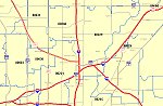
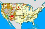
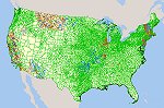
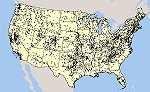
Here are some of our featured shapefiles:

Census 2010 Zip Code (ZCTA5) Boundaries


Climate Change - Temperature and Precipitation to 2099


Indian and Federal Lands Shapefiles


U.S. Elementary, Secondary and Unified School Districts


U.S. Dams and Associated Risks


Tornado Touchdown Points and Severity in the U.S.

Go to: About Mapcruzin - Services - Issues - Right-To-Know-More

About Mapcruzin

MapCruzin is an independent firm specializing in innovative Geographic Information System (GIS) projects, environmental and sociodemographic research, website development and hosting. In 1996 we created the first U.S. based interactive toxic chemical facility maps on the internet and we have been online ever since.

Our lives and those of all living things on this earth are at a turning point. We believe that to plan for an equitable and just future, we must analyze present inequalitites through an historical lense to assure that they are never repeated again.

Our specific focus is on environmental justice and equality especially as it pertains to pollution, climate change, peak oil, energy, water, housing, food and technology. We look forward to working with groups as we look towards reinventing our economies, cultures and societies in an equitable and just manner.

Our hope is that our efforts will help speed you on your journey of re-imagining our relationships with each other and the earth.

Click here for our mission statement.

Services:

(Click on links for examples)

Custom ArcGIS shapefiles.
Census demographic research and shapefile creation.
Community or regional based GIS toxic inventories. Our TRI explorer is a simple example based on Google Maps. A more robust examle is our ToxicRisk.com. An earlier, but more detailed version is our SVTC EcoMaps.
Website development, hosting, domain names, content development and management, optimization and monetization. Check MichaelMeuser.com for some of the websites we have created and host.
Fast! In most cases we can obtain a domain name, setup email, and create and host a simple website for you in a matter of hours.
Custom GIS projects using free software that non-GIS people can easily use to view geospatial data of your choice.
Environmental justice research and mapping.
Google Earth and Google Maps project development.
Check here for our full line of services and contact me to talk about your needs.

Issues

Check the right column of each page for issue specific content.

Thanks and Best Regards,

Mike
Right-To-Know MORE!

Didn't find what you are looking for? We've been online since 1996 and have created 1000's of pages. Search below and you may find just what you are looking for.


Michael R. Meuser
Data Research & GIS Specialist

MapCruzin.com is an independent firm specializing in GIS project development and data research. We created the first U.S. based interactive toxic chemical facility maps on the internet in 1996 and we have been online ever since. Learn more about us and our services.

Have a project in mind? If you have data, GIS project or custom shapefile needs contact Mike.

Contact Us

Report Broken Links

Subscribe for Updates

Follow on Facebook
News & Updates

Find: Maps, Shapefiles, GIS Software & More

MapCruzin Blog for updates, questions and answers
Blog Updates

More Blog Updates

Downloads

Google Earth Toxic Release Inventory (TRI) Maps
Lester Brown's Plan B 3.0
State GIS Shapefiles, Maps & Resources
GIS Shapefiles & Maps
GIS Programs, Tools & Resources
Free World Country & Regional Maps
GIS / GPS Careers and Job Positions
Disease Outbreak Maps
TOPO Maps
Extreme Weather & Disaster Maps
Free World Maps from the CIA Factbook
Arctic National Wildlife Refuge ANWR Maps
Oil and Gas Maps
Africanized Honey Bees
Renewable Energy Potential Maps of the United States
Terrorism Maps
War Maps
Google Maps
Weather Maps
GPS Resources
Historical Maps of the World
Google Earth
Library of Congress American Memory Map Downloads
Toxic Chemical Pollution Maps
Climate Change Maps
Toxic Release Inventory (TRI) Maps
Census Shapefiles
World Maps

Issues

Environmental Justice
Data Sources
Greenwash & JunkScience
Statistical Resources
Wireless Dangers
Surviving Climate Change
Global Right-To-Know
Creating Living Economies
Books of Note
Toxic Klamath River
Federal Lands Maps
TRI Analysis
TRI Webmaps
EnviroRisk Map Network
Community-Based Research
Right-To-Know or Left to Wonder?
Chemical Industry Archives
21st Century Warfare
Biotechnology
Nanotechnology
Globalization/Democracy
National Parks and Public Lands
Trade Secrets/Toxic Deception
GIS Books
Our Projects
Other Projects
1999 Archive Environews
Environmental Books
Environmental Links
Redwood Coast Information
Recycle, Salvage, Reuse

Resources
Shapefile Store
Free GIS Software
Free Map Downloads
Free Shapefiles
Free Remote Sensing
Free Topo Maps
Free GIS Tutorial
Free GPS
ToxicRisk.com
ClimateShift.com
Maptivist.com

About MapCruzin - Cookies, Privacy, Fair Use and Disclaimer - Advertise on MapCruzin.com