USDA Forest Service Announces New Strategy for Improving Forest Conditions
Sponsors
<-- Free Geography Maps
<-- Free GIS Shapefiles
<-- Fire Weather and Wildfire Potential, Risk and Incident Maps
USDA Forest Service Announces New Strategy for Improving Forest Conditions
Release & Contact Info
Press Release
Release No. 0165.18
Contact: USDA Press
Email: [email protected]
(Washington, D.C., August 16, 2018) - The U.S. Department of Agriculture (USDA) Forest Service (USFS) announced today a new strategy for managing catastrophic wildfires and the impacts of invasive species, drought, and insect and disease epidemics.
Specifically, a new report titled Toward Shared Stewardship across Landscapes: An Outcome-based investment Strategy (PDF, 3.7 MB) outlines the USFS's plans to work more closely with states to identify landscape-scale priorities for targeted treatments in areas with the highest payoffs.
"On my trip to California this week, I saw the devastation that these unprecedented wildfires are having on our neighbors, friends and families," said U.S. Secretary of Agriculture Sonny Perdue. “We commit to work more closely with the states to reduce the frequency and severity of wildfires. We commit to strengthening the stewardship of public and private lands. This report outlines our strategy and intent to help one another prevent wildfire from reaching this level."
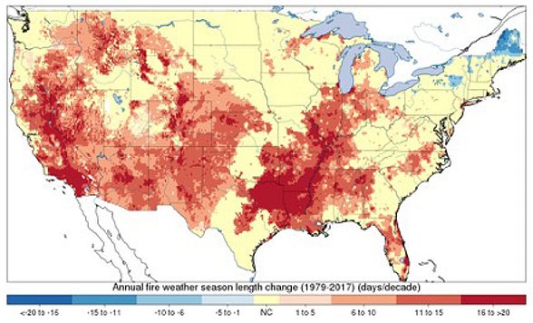
Both federal and private managers of forest land face a range of urgent challenges, among them catastrophic wildfires, invasive species, degraded watersheds, and epidemics of forest insects and disease. The conditions fueling these circumstances are not improving. Of particular concern are longer fire seasons, the rising size and severity of wildfires, and the expanding risk to communities, natural resources, and firefighters.
"The challenges before us require a new approach," said Interim USFS Chief Vicki Christiansen. "This year Congress has given us new opportunities to stand shoulder-to-shoulder with state leaders to identify land management priorities that include mitigating wildfire risks. We will use all the tools available to us to reduce hazardous fuels, including mechanical treatments, prescribed fire, and unplanned fire in the right place at the right time."
A key component of the new strategy is to prioritize investment decisions on forest treatments in direct coordination with states using the most advanced science tools. This allows the USFS to increase the scope and scale of critical forest treatments that protect communities and create resilient forests.
The USFS will also build upon the authorities created by the 2018 Omnibus Bill, including new categorical exclusions for land treatments to improve forest conditions, new road maintenance authorities, and longer stewardship contracting in strategic areas. The agency will continue streamlining its internal processes to make environmental analysis more efficient and timber sale contracts more flexible.
The Omnibus Bill also includes a long-term "fire funding fix," starting in FY 2020, that will stop the rise of the 10-year average cost of fighting wildland fire and reduce the likelihood of the disruptive practice of transferring funds from Forest Service non-fire programs to cover firefighting costs. The product of more than a decade of hard work, this bipartisan solution will ultimately stabilize the agency's operating environment.
Sponsors
Finally, because rising rates of firefighter fatalities in recent decades have shifted the USFS's approach to fire response, the report emphasizes the agency's commitment to a risk-based response to wildfire.
The complete strategy is available at toward-shared-stewardship.pdf (PDF, 3.7 MB).
The mission of the USFS, an agency of the USDA, is to sustain the health, diversity and productivity of the nation's forests and grasslands to meet the needs of present and future generations.
National Fire Weather Maps -
A key component to the new national fire weather page is its interactive map that allows you to examine critical fire weather information at the national level initially, but quickly provide you access to local and regional fire weather data as well.
The Wildland Fire Assessment System was developed by the Fire Behavior unit at the Fire Sciences Laboratory in Missoula, Montana.
<-- Free Geography Maps
<-- Free GIS Shapefiles
<-- Fire Weather and Wildfire Potential, Risk and Incident Maps
Didn't find what you are looking for? We've been online since 1996 and have created 1000's of pages. Search below and you may find just what you are looking for.
Michael R. Meuser
Data Research & GIS Specialist
MapCruzin.com is an independent firm
specializing in GIS project development and data research.
We created the first U.S. based
interactive toxic chemical facility
maps on the internet in 1996 and we
have been online ever since. Learn more about us and our services.
Have a project in mind? If you have data, GIS project or custom shapefile needs contact Mike.
Contact Us
Report Broken Links
Subscribe for Updates
| 


